9:34PM: Isaias came and went. Two deaths were attributed to his wrath, but a Category 2 hurricane is otherwise light work for local residents. He’s going to continue to harangue the East Coast for a couple of days, and will probably get his name retired, even though it’s not going to go down as a storm that everyone remembers.
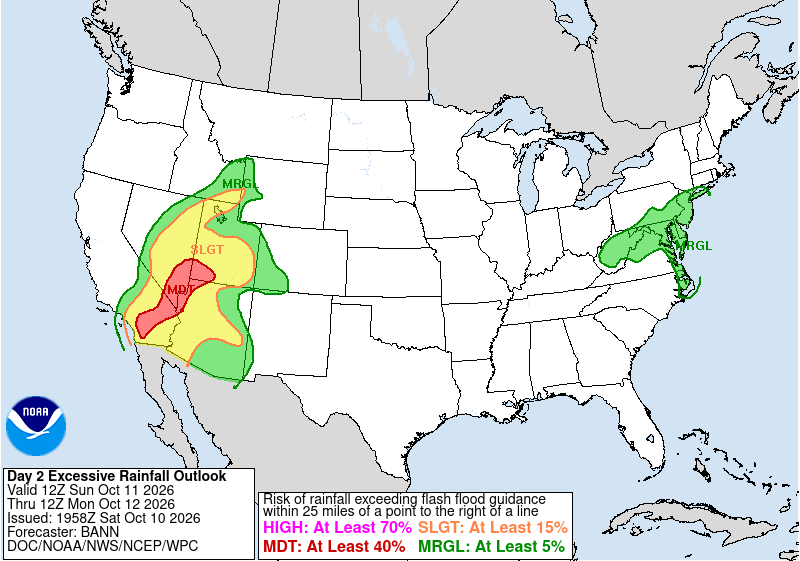
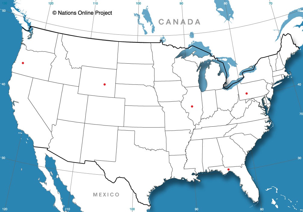
1059PM: Obviously Isaias was the big show in town this weekend, but we should also take note of the potential for flash flooding almost immediately thereafter in the Las Vegas area.
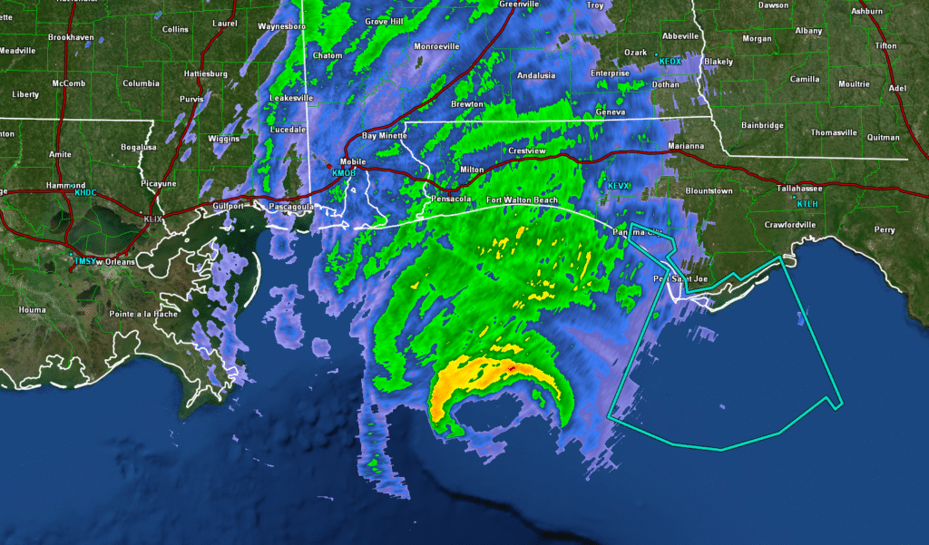
Well, it’s here. Hurricane Isaias is on the doorstep of the Florida Panhandle, and will make landfall this afternoon to early evening.
Presently, Isaias is a Category 3 hurricane, which is what I anticipated, but it is also taking a bit deeper channel in towards landfall, which at this point appears to be just east of Fort Walton Beach.
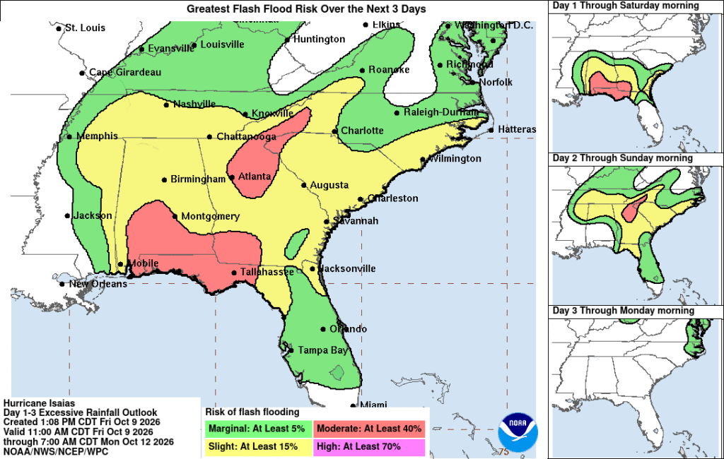
While surge is going to be an immediate problem along the coast, within the next few hours, the threat for high wind and a few tornadoes will be pronounced in places like Panama City and Tallahassee. Fortunately, Isaias is moving steadily, and while there is a threat for flash flooding, it is not as severe as we have seen with storms in recent years.
Isaias will march through Alabama tomorrow, which has brought some speculation about the viability of the college football game in Tuscaloosa. It should start drying out fairly early, and football is important at the University of Alabama, so expect it will be a miserable game on.
Isaias is major hurricane and will certainly cause problems in the Panhandle, but it is not as strong as Matthew, the most recent strong hurricane to hit the area, and is not going to dawdle in the high terrain, like Helene. Any landfalling hurricane is notable, and it is particularly notable this year, as it is the first hurricane of any kind in the Atlantic. It only takes one!
12:21AM: Late night update, but Isaias is presently a major hurricane. He will begin to wane as he approaches the coast through the day Friday, but surge, rain and a few tornadoes are going to be expected in southern Alabama, southern Georgia and the Florida Panhandle this weekend.
Late September in Salinas is apparently perfect. Our forecast featured sunshine, highs in the low 70s and crisp mornings in the upper 50s. Forecasts along the coast are always a bit topsy turvy, so even with good weather, the forecasts weren’t extraordinary. The Weather Channel did earn victory. Actuals: September 24th, High 73, Low 58 September 25th, High 73, Low 54
1:31PM: For those who missed it, we finally have our first hurricane of the year. Isaias is officially a hurricane in the Gulf, headed for landfall around Mobile and Pensacola if current guidance holds.
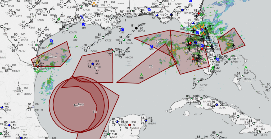
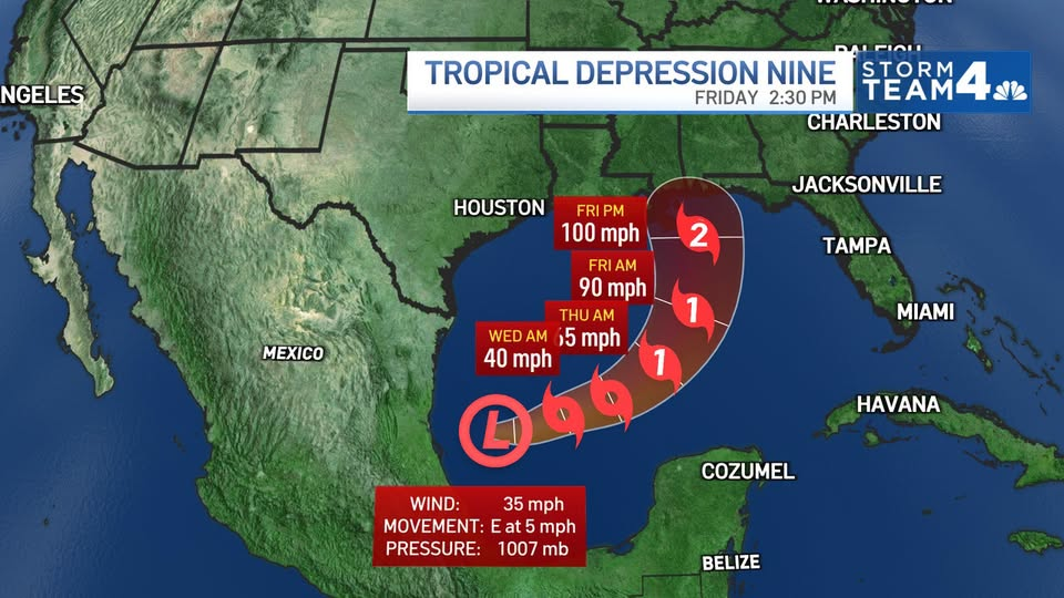
10:33AM: Isaias has formed in the Gulf, and you can see the wind barbs drawing towards and around the center of his circulation off the Mexican coast. There are ample showers and storms tied to a slow moving boundary in the Florida Peninsula, and the air is dry along the Gulf Coast. That said, the storm is in very rich air, and now appears primed to develop into the year’s first hurricane. Steering flow will keep him over the Gulf, getting stronger, for a couple of days. Right now the guidance has him making landfall around Pensacola. If it misses, I will guess it goes further to the east, towards Panama City. Still a lot of the week left to go, with a projected land fall coming late Friday.
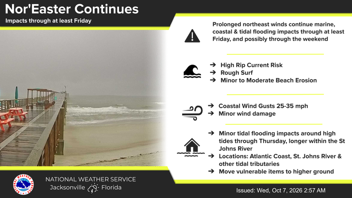
11:41AM: The rain currently in Florida shouldn’t be discounted. It has brought historic rain to the northern part of the state over the beginning of October, and is related to several perturbations along the coast. Jacksonville isn’t far from where Isaias will end up, and they don’t even touch on it in their daily highlights.
12:08PM Guidance right now pretty consistently calls for at least a Cat 1 storm out of Isaias. Thi is a strange year, but I’ve learned recently that storm intensity isn’t often anticipated well. Don’t be surprised if he ultimately caps as a Cat 2 or even low grade Cat 3.
10:13PM: After ending September with tons and tons of rain, it has now been pretty warm in Minnesota this week. My lawn hasn’t looked this good all summer.
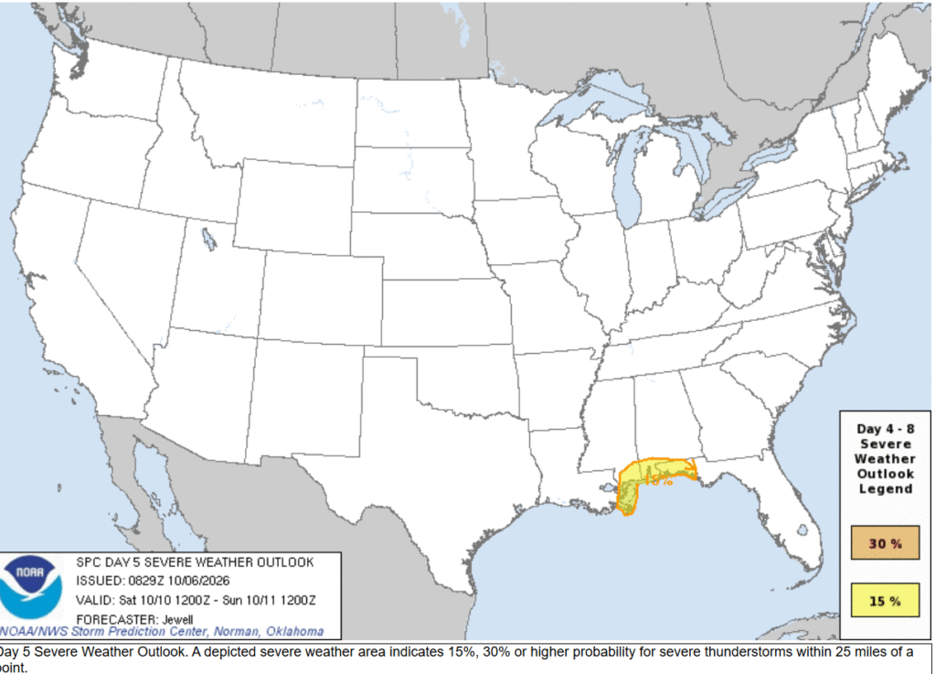
7:22PM There is a little bit of tropical development in the Gulf. Might it be a hurricane? It might, eventually. It will probably spin up a few landspouts in the highlighted area on Saturday.
11:39PM Our first forecast next week is for Tallahassee. Obviously, that looks like our most interesting forecast for the coming week as well. Hurricane season is finally here.
Eastern Pennsylvania tonight, with a forecast for the Lehigh Valley.
At 1151PM, ET, Allentown was reporting clear skies and a temperature of 52. High pressure dominated New England, however a fairly deep trough over the Great Lakes, producing a weak feature presently centered over the Upper Peninsula. A band of showers over the Mid Atlantic and lifting northward was tied to this feature as well. The upper level trough in the Great Lakes will continue to track o the east, and tap more effectively into the Gulf Stream,, while taking the traditional comma shape of a large area of low pressure. Cold air won’t really trickle into Allentown until Monday afternoon, when the original cold front arrives. Meanwhile, the moisture will have a tough time getting into the Lehigh VAlley either, rising from the south to meet the broader feature. Still, a chance for showers with overcast Sunday afternoon, and a clearer day on Monday, if trending cooler by nightfall. Tomorrow – Passing clouds, especially in the afternoon with a sprinkle, High 60, Low 50 Monday – Mostly sunny, High 70, Low 48
TWC: Tomorrow – Cloudy skies with a few showers later in the day High 61, Low 52 Monday – Some clouds in the morning will give way to mainly sunny skies for the afternoon. High 68, Low 53
AW: Tomorrow – Cloudy and cooler; occasional rain this afternoon High 61, Low 53 Monday – Mostly sunny and breezy at times; the start of an extended stretch of dry weather High 70, Low 53
NWS: Tomorrow – A chance of showers, mainly after 2pm. Cloudy, High 63, Low 52 Monday – Partly sunny, HIgh 68, Low 52
WB: Tomorrow – Mostly cloudy. A chance of showers in the afternoon. High 64, Low 57 Monday – Sunny High 60, Low 44
WN: Tomorrow – Mostly cloudy with showers, High 63, Low 53 Monday – Mostly sunny, High 68, Low 57
CLI: Tomorrow – Light rain showes, High 61, Low 52 Monday – Sunny High 67, Low 53
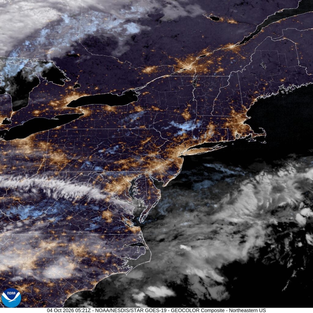
Satellite will continue to show a busy pattern in the northeast, but just like to night, it looks like a lot of that activity will steer clear of the Allentown area.