
10:01PM Happy Saturday! I think a lot of people label August as the dog days of summer, but it is pretty similar right now. Hot, humid, not much of a break for a lot of the country. This was a good time of year, when I was still in operational meteorology, to do some training or read. There is some down time.
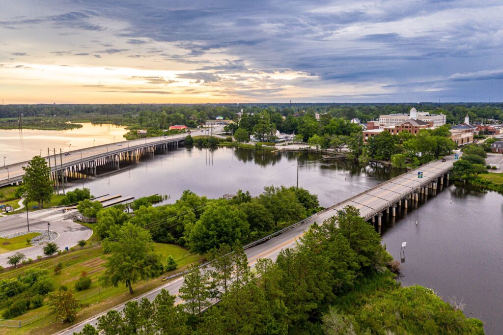
Jacksonville, North Carolina to Ithaca, New York
We are taking a long day’s drive through the East Coast, covering 665 miles over 5 states and a district. Despite being solidly along the coast, the route will be fairly forgiving, cutting through Raleigh, Richmond, DC and then… Harrisburg? There is enough urban driving, and then the drive into the Poconos to account for, so our speed will only be about 62.5mph on average. Still, 5 states in a day? Not bad.
It’s just that time of year. A low in the Gulf Stream is tailing a boundary into the Carolinas. It’s enough that there is widespread shower activity in the Appalachians tonight, and it’s liable to be a foggy morning as far north as DC. There will likely be showers embedded within the low clouds throughout Virginia as we make our way northward as well. I’ve been in Virginia only a couple of times, and it has rained every time. Is that a thing? Crossing the Potomac, and then heading north into Pennsylvania will be a bit nicer of a time. We will arrive in the Finger Lakes with mostly cloudy skies and a muggy atmosphere. The next boundary will be sliding out of Canada, making sure we don’t have TOO much fun in Ithaca.
Updates 7/7
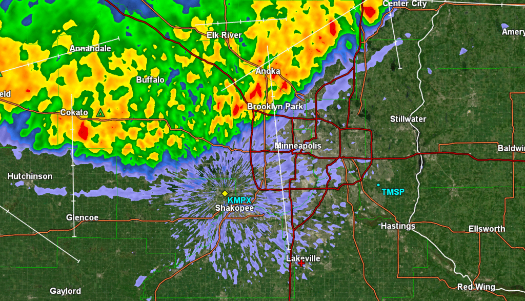
12:03AM: Much coffee will be enjoyed in Minneapolis this morning. Radar just after midnight from the Twin Cities
Winning a home game
Minneapolis is presently just outside of the heat dome that has cooked so much of the southeastern US. The heat hadn’t really even started to build back on the 24th and 25th of June, when we put together a forecast for the home metropolitan area of Victoria-Weather, and temperatures didn’t get out of the 70s. It led to some misty mornings, but the rain had already shipped out of town, and we saw a rare low in the 50s on the 25th. Brr? As you may have suspected, Victoria-Weather was the top outlet, and ended up winning the forecast.
Actuals: June 24th, High: 78, Low 61
June 25th: High 72, Low 51
Grade: B
Updates 7/2
10:21PM: It’s extremely warm in the southeast, and there is a ring of fire, with thunderstorms in the Plains and the Great Lakes, but right now, the world’s eyes are on Vancouver, where Switzerland is playing Algeria in the World Cup. It’s currently 57 degrees in Vancouver. Perfect soccer weather, if they were outdoors. Instead, fans can enjoy a chill when they step out.
Certainly feeling like summer
As we sit on the final day of June, awaiting the beginning of July, the pattern has certainly taken a turn for summer. The spring season is marked by strong cyclones and supercells that bring tornadoes to the southern Plains and Dixie Alley. It rightfully gets a lot of attention for the destruction and disruption it can bring.
Spring storms are brought by the changing airmasses, from cool and dry winter to hot and humid summer. Eventually, summer takes hold and it just gets incredibly hot and humid in the South. There are a few afternoon thunderstorms, essentially every day, but they are fueled directly off of one air mass, and not a clash. That’s where we are now, it’s overwhelmingly hot, especially in the southeast.
This is also the time of year where fuel for thunderstorms is the greatest, so whenever flow is from the west, and we get low pressure in the lee of the Rockies, we can get strong to severe thunderstorms in the Plains. This isn’t necessarily colder air, just drier air, but this burst of energy can ripple through the atmosphere, and the weakest of boundaries offer as firing lines for thunderstorms to ride along.
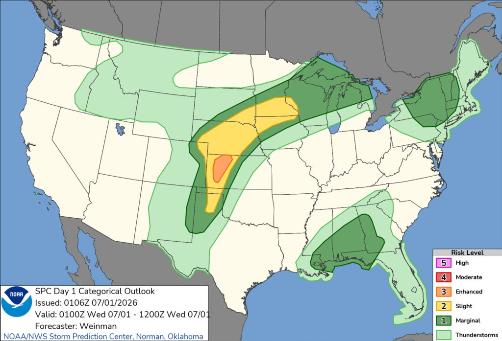
Tonight’s outlook shows exactly what a typical summer time severe set up should look like. There is the origin of the storms in western Kansas, where they may get a bit twisty, with tornadoes more likely. From Nebraska to Minnesota, one of those ripples in the air mass will act as a guide for a batch of storms with howling straight line winds – a true derecho. It’s almost midnight, and it is producing nearly 80mph winds in central Nebraska.
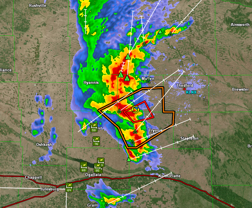
Often times, there are embedded tornadoes within squalls like this, but really, a tornado warning might just be what it takes to pay attention to a storm that will mess things up pretty well on its own.
Given the copious amounts of fuel on hot humid days, long track derechos are more likely. Even if they are derechos, lines of thunderstorms occur more frequently than the cellular storms of spring. Even in New York a line of storms is moving through upstate New York, feasting on the atmospheric moisture, rather than conflicting airmasses.
Storms like our Nebraska storm, above are also called mesoscale convective complexes. Our air mass storms in the southeast erupt when surface heating reaches a point that causes the moist air to become buoyant, rising, condensing and forming cumulonimbus clouds and eventually, thunderstorms. Those are the same mechanics for our storm in the Plains to initiate, but there is a different mechanism for its sustenance.
As I hope you have learned by now, warm or moist air rises. Typically, this is the surface warming up, but overnight, especially with the elevated thunderstorms we are seeing, cooling from the top down after nightfall is what draws those parcels of air upward. They continue to track along whatever phantom boundary, or wave or ripple exists, and they tend to roll on until that boundary tapers away.
Our Nebraska storms show no signs of dying out quite yet. Look for a loud wake up in Sioux City Iowa and Rochester, Minnesota.