
We’re continuing a recent trend of forecasting in the western Great Lakes with a trip to the Quad Cities.
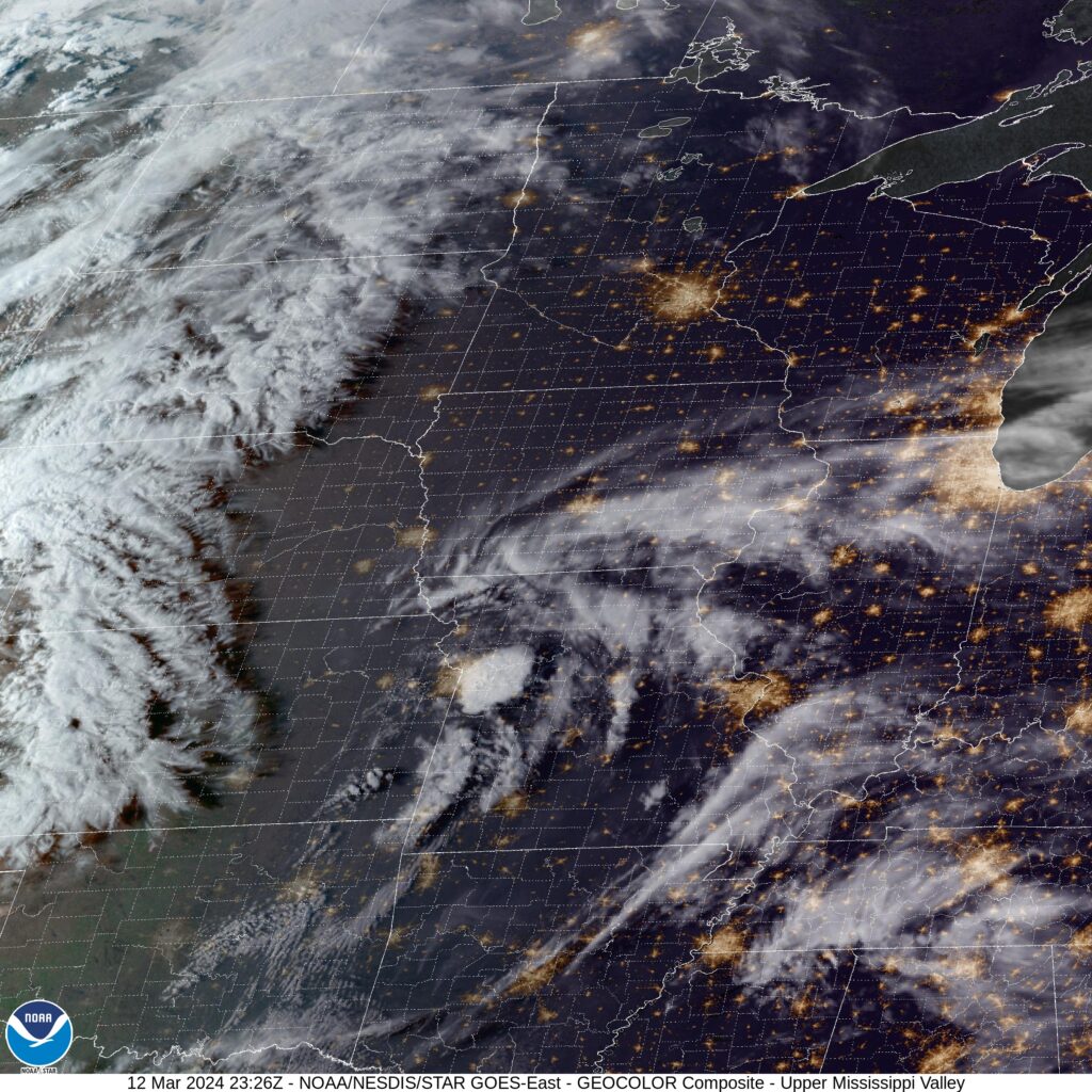
At 252PM, CT, Davenport was reporting a temperature of 71 degrees with a brisk south wind and clear skies, There appeared to be a vorticity maximum near St. Joseph, Missouri, and a whorl of clouds over the center of the United States was bringing a few of the clouds north to eastern Iowa, but the the real threat for deteriorating conditions is further to the southwest, where low pressure is going to continue developing over the next couple of days.
By tomorrow evening, areas near an emerging warm front will start to feature show rain and thunderstorms across southeastern Iowa. The center of low pressure will start to shift northeastward, and what had been convective in nature at the beginning of the day will become cooler and more stratiform rain showers, ultimately giving way to cool cloudy skies in the evening.
Tomorrow – Increasing clouds, late thunder possible, High 67, Low 47
Thursday – Rain with embedded thunderstorms. Ending late, then cooler, High 58, Low 43(Non standard)
TWC: Tomorrow – Partly cloudy skies during the morning hours will become overcast in the afternoon. High 72, Low 45
Thursday – Showers and thunderstorms. High 60, Low 48
AW: Tomorrow – Cloudy and warm with a shower in the area High 67, Low 47
Thursday – A thick cloud cover, breezy and mild with a couple of showers and a heavy thunderstorm; thunderstorms could bring damaging winds, flash flooding and hail High 63, Low 46
NWS: Tomorrow – Partly sunny, (late rain) High 70, Low 48
Thursday – Rain and possibly a thunderstorm. High 63, Low 47
WB: Tomorrow – Partly sunny, High 68, Low 51
Thursday – Rain with thunderstorms, High 55, Low 42
WN: Tomorrow – Partly cloudy, High 68, Low 50
Thursday – Mostly cloudy with showers and scattered storms, High 58, Low 51
CLI: Tomorrow – Light rain showers, High 68, Low 48
Thursday – Drizzle, High 63, Low 45
This forecast was interrupted quite a few times while I tried to put it together. That vort max I mentioned at the beginning actually produced a couple severe storms east of Kansas City. Still not too bad in Davenport tonight, but it will deteriorate through the week. We’ll see at what pace.
Comment (1)