This is going to be a 1 day trip that will touch 8 states! Sure, it will be a long 1 day, but that is still pretty incredible, considering we will be covering just 570 miles. Driving through the urban landscape of New England and the Mid-Atlantic, we’ll also only be slugging along at a 57mph pace. Plenty of time to take in all the sites.
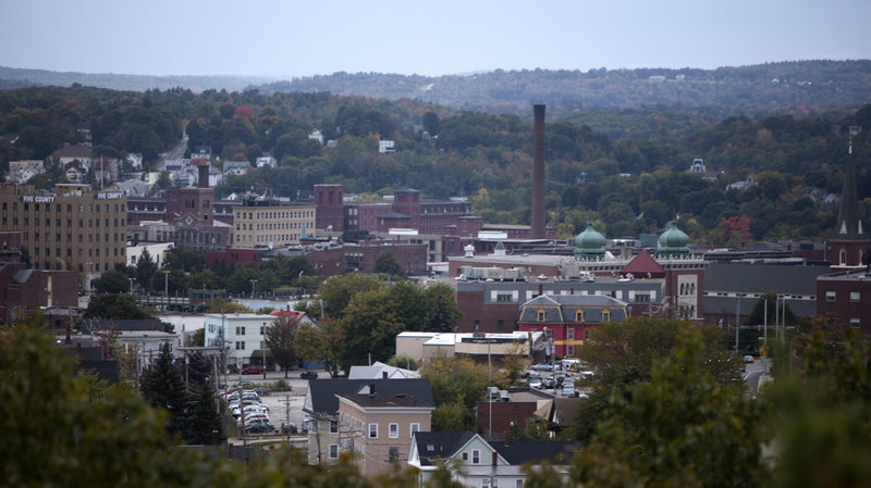
Lewiston, Maine
Low pressure is looming as we approach mid-December. Winter has been slow in coming to the country, but a taste of it is going to be wrapping around on the northwestern side of this system. That does not include any part of our route through the East Coast’s largest cities. There appears to be a closure on the GW Bridge which might affect our route, but for the weather, this would just mean the southerly wind would be on our left rather than a headwind. Heck it might be warm enough in Salisbury to take a quick trip to the beach after we arrive, but before thar rain eventually gets there.
Many lamented the loss of Forecast.io across the internet, and perhaps in honor of their impending retirement, Forecast.io did better than normal. That is to say, they finished in a tie for 4th. Lewiston withstood a Pacific storm that brought precipitation to the Cascades and Northern Rockies, and eventually to the middle of the country. Lewiston only had about an eighth of an inch of rain between the two days of our forecast period at the end of the year, and temperatures lingered just below 50 degrees. All told, it wasn’t nearly the story seen outside of the region between the Ranges. The Weather Channel rang in the new year with a victory. Actuals: December 30th, .04 inches of rain High 50, Low 37 December 31st, .09 inches of rain, High 46, Low 36
This forecast is coming out too late to factor into our standings or anything like that, but it will serve as a send off to the newly retiring Forecast.io. Starting on January 1st, we will be using Clime. I would love to use Fox Weather, but they still haven’t managed to produce a website with local forecasting.
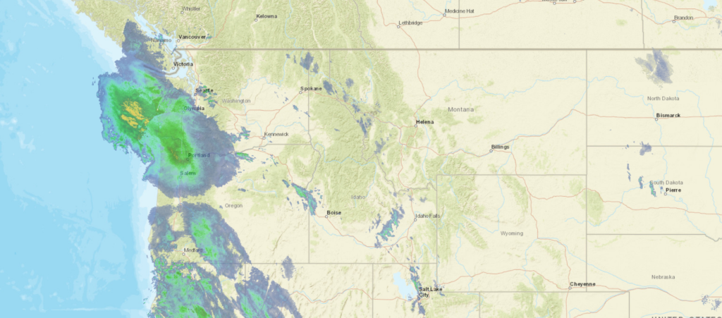
At 956PM, MT, Lewiston was reporting cloudy skies with a temperature of 42 degrees. While the west didn’t experiences the frigid temperatures seen in the eastern 2/3 of the country over Christmas, a deep trough has set up over the Rockies, with a strong jet, a so called atmospheric river, pumping moisture into the Pacific Northwest. Winter Weather advisories have been issued just to the north of Lewiston, with more to the south. It remains quite likely that snow is on it’s way in Lewiston as well. The next round of wet weather is already Pressing ashore in western Washington and Oregon, bringing steady precipitation to the Cascades. Lewiston’s presence between the Cascades and the Rockies of western Montana will spare some of the more significant snows, as will temperatures that will flirt with freezing. Additionally, a prominent surface feature is forecast to organize in the Great Basin, south of Idaho through the next two days, sapping Lewiston’s moisture and ultimately bringing colder temperatures as the snow ends. Nevertheless, snow with a bit of light rain mixed in are possible from mid morning tomorrow and onward for about 24 hours before clearing arrives. Tomorrow – Light snow with a bit of light rain, High 47, Low 37 Saturday- Early precipitation, generally falling as rain, High 41, Low 32
TWC: Tomorrow – A mix of clouds and sun early, then becoming cloudy later in the day (rain/snow late). High 48, Low 36 Saturday – Considerable cloudiness (Early mixed precip). High 45, Low 35
AW: Tomorrow – A couple of showers of rain or snow in the morning; otherwise, mostly cloudy High 51, Low 37 Saturday – Mostly cloudy High 46, Low 37
NWS: Tomorrow – Rain, mainly before 7am. High 50, Low 37 Saturday – Mostly cloudy, High 45, Low 36
WB: Tomorrow – Mostly cloudy with rain or snow in the morning then mostly sunny in the afternoon. High 47, Low 36 Saturday- Partly sunny, High 45, Low 37
WN: Tomorrow – Partly cloudy with isolated showers, High 49, Low 39 Saturday – Partly cloudy, High 42, Low 34
FIO: Tomorrow – Light rain throughout the day. High 47, Low 37 Saturday – Mostly cloudy throughout the day. HIgh 44, Low 34
Clouds and the amount of precipitation in Lewiston will all play a factor. I think there is a huge bust potential overall with this dynamic system in the mountains. I am banking on it skewing colder. Look at all the rain coming for the Cascades at this hour!
Road tripping is sort of en vogue right now, given the potential of coronavirus transmission with air travel, so why not see the country in a week long transnational road trip? It will take us 6 days to get from coast to coast, covering 3200 miles. We’ll average 68mph and nearly 545 miles a day. Right through the center of the country!
DAY ONE (Friday)
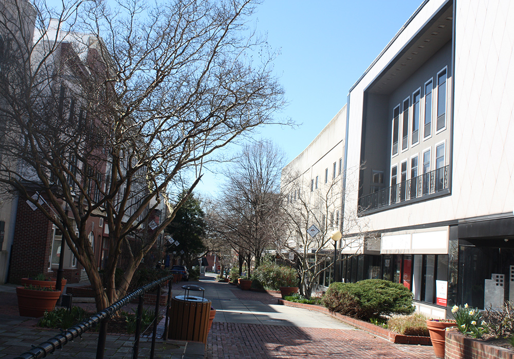
Lewiston, Maine
Isaias has long departed the Eastern Seaboard, but the remainder of a weak surface trough still lingers in the mid-Atlantic,and is continuing to threaten the area with showers and storms from Long Island to Florida. Inland, those storms are filtering towards the mountains, beginning to rise up with the elevation and raining out at higher terrain. For our purposes, that means a threat of rain as we approach the Catskills. The threat for isolated rain and thunder will linger until about Oneida, with clearing skies returning until we arrive at Batavia, between Buffalo and Rochester, and our destination for the day.
DAY TWO (Saturday) On the other side of the Appalachians, life is good. High pressure has taken care of the Great Lakes and is doing a good job of suppressing Gulf moisture and shunting systems from the Plains to the north. Not a bad day to drive through Ohio. We’ll end in Hammond, Indiana, in the Chicago region.
DAY THREE (Sunday) As we move west, the ridge will shift east, opening the Mississippi Valley up to the Gulf’s moisture. The Sunday drive will be soupy. Scattered spots of drizzle might be possible with the rising warm air in Illinois, but it should clear out through Iowa. Unfortunately, the sunny skies and humidity will only be priming the region for strong thunderstorms, of which a few might arrive in eastern Nebraska just as we are passing through Omaha and Lincoln. Severe weather is a strong possibility as we pull off the highway in Milford, just west of Lincoln.
DAY FOUR (Monday) After a stormy evening in Nebraska, it should improve dramatically as we cross the windswept prairie of Nebraska and enter the windswept hills of Wyoming. Some monsoon thunderstorms may be seen on the horizon over the peaks in Colorado, but our route should be dry. We will end near Walcott, but most of southern Wyoming is all the same, so who knows!
DAY FIVE (Tuesday) There isn’t going to be too much difference on Tuesday. Generally, the drive will be just fine, but in slopes, there could be a stray thunderstorm associated with the seasonal monsoon. It shouldn’t be an enormous concern, with the largest issue being dust from downdrafts in dry storms west of Salt Lake City. Our day will conclude in Elko, which, yes, does have some casinos. No, you probably shouldn’t go, what with the pandemic and all.
DAY SIX (Wednesday) The monsoon doesn’t really reach as far west as the Sierras, and we should get on the road before we have to deal with the afternoon storms around Elko. Smooth sailing into Napa, then. Heck, we even get to approach from Sacramento, which is a heck of a lot easier than coming from San Francisco.
As the Northern Plains get pummeled by a historic early-season blizzard, we’re going to take a look at a locale that would probably bring visions of snow and crisp air to the mind, Lewiston, Maine! Surely they’re doing better than our neighbors in the Dakotas, right?
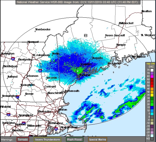
At 1056pm EDT, the temperature at Lewiston, ME was 51 degrees under fair skies. While a potent winter storm hits the Central US, a nor’easter is busy spinning its’ wheels off the Eastern Seaboard. It’s been pushing plenty of rain into Southern New England over the last 24 hours along with persistent northeasterly winds, causing coastal flooding in areas. While some shower activity may get close to the coast during the day Friday, we’re expecting the Lewiston area to remain dry. As the low finally gets moving towards Nova Scotia, some light shower activity may affect the area early Saturday morning before drying out for the rest of the day. It may not be a washout, but overall, not a great start to the weekend weather-wise.
Friday: Overcast. High 58, Low 43.
Saturday: Cooler with scattered morning showers. High 54, Low 43.
NWS: Friday: Overcast. High 57, Low 44.
Saturday: Showers expected. High 53, Low 46.
AW: Friday: Rather cloudy. High 57, Low 43.
Saturday: Rain and drizzle in the morning. High 51, Low 44.
NWS: Friday: Mostly cloudy, couple of late showers. High 58, Low 43.
Saturday: Scattered showers. High 53, Low 43.
WB: Friday: Mostly cloudy. High 55, Low 44.
Saturday: Scattered showers in morning. High 53, Low 46.
WN: Friday: Mostly cloudy, showers late. High 58, Low 43.
Saturday: Mostly cloudy with scattered showers. High 53, Low 43.
FIO: Friday: Mostly cloudy throughout the day. High 61, Low 45.
Saturday: Possible drizzle in the morning. High 55, Low 48.
The Lewiston area is dry currently, but those rain showers sitting offshore will slowly rotate their way inland during the weekend.