I will admit, that I haven’t done a heck of a lot of driving in the southeastern US, so I don’t have a terribly good concept of just how big the spaces are down there. I am a little surprised, I guess is what I am saying, that Deltona and Hattiesburg are only 610 miles apart, and the drive can be done in just one day. The pace will be a brisk 70mph, owing the fact, I guess, that the only major towns we will bypass are Tallahassee and Mobile, which I guess aren’t beset by traffic.
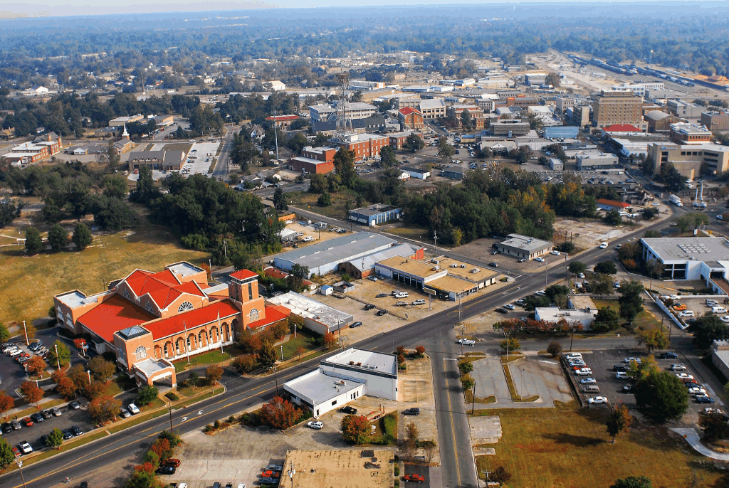
Deltona, Florida
The weather in Deltona today is quite nice, and there really isn’t anything on its way that suggests that will change for the next 24 hours or so. TYhe start of our drive, therefore, looks pretty great, pretty swift and incident free. Unfrotunately, an area of low pressure developing over Ontario, of all places, is draping a cold front south along the Mississippi River, and it will be inching into the Tennessee Valley as we get going on Monday. Now, the cold front will not reach the coast or I-10 at any point, but the flow feeding the boundary will lead to some afternoon showers and storms from the Florida Peninsula west to Hattiesburg. The shower activity is most possible beyond Tallahassee, but doesn’t become likely until we reach Mobile. The rain won’t last all night, so Hattiesburg should dry up by nightfall. Of course if we want to spend any more time in Hattiesburg than just one night, we might need to make sure our plans are of the “indoor” variety.
There was a nasty storm system that battered the country late last week and into the weekend. This verification isn’t about that system. It’s about the weaker wave that moved through just as 2020 came into being. We were looking at Deltona, Florida for our first forecast of the year. A cold front was forecast to sweep into the region, though it wasn’t expected to carry a lot of rain or severe weather with it, if you were to judge by what the models suggested. When cold fronts move through Florida, they have ready access to a healthy supply of moisture, and as the cold air blows in, it is enencumbered by frictional drag, and winds can howl, even in weaker systems. They are a real pain in the butt. This time, when the front moved through, the Deltona area saw 45mph gusts around lunch on the 4th, and nearly half an inch of rain. Victoria-Weather, which has a lot of recent experience with the Sunshine State, started 2020 off with a victory. Actuals: January 3rd – High 83, Low 63 january 4th – .41 inches of rain, High 79, Low 59
All right, guys! My sabbatical is over, and the new year is beginning in the same state we left off in — Florida!
At 253PM, ET, Deltona was reporting a temperature of 78 degrees and sunny skies. An area of low pressure in the Tennessee Valley was producing a vast cloud field in the southeastern US, sparing most of the Florida Peninsula but drawing a warm flow across the region. Deltona, as noted, was in the upper 70s, but the 80s were seen widely around the area as well. The storm is going to advance to the northeast, along the exit arm of the parent jet trough. The center of the system will get distended as it tracks through the Appalachians, but the associated cold front will arrive early on Saturday morning. This will be good news, as cold fronts tend to be fairly active and dangerous for Florida in the day time, where there is often a great deal of available instability. The showers and storms that move through will be through by the early afternoon, which will ensure a fairly pleasant afternoon, and the avoidance of any truly nasty weather this weekend. Tomorrow – Mostly sunny, increasing clouds, High 84, Low 63 Saturday – Early rain with isolated thunderstorms, then sunny and cooler, High 75, Low 58
TWC: Tomorrow – Partly cloudy skies. High 84, Low 65 Saturday – A steady rain in the morning. Showers continuing in the afternoon High 76, Low 62
AW: Tomorrow – A steady rain in the morning. Showers continuing in the afternoon – High 84, Low 66 Saturday – Mostly cloudy and not as warm with a couple of showers and a thunderstorm; breezy in the afternoon High 75, Low 58
NWS: Tomorrow – Partly sunny, High 84, Low 63 Saturday – Showers likely and possibly a thunderstorm before 1pm, then a slight chance of showers. Mostly cloudy, High 75, Low 57
WB: Tomorrow – Partly sunny, patchy fog, High 83, Low 68 Saturday – Mostly cloudy. A chance of showers with a slight chance of thunderstorms in the morning then a slight chance of showers and thunderstorms in the afternoon, High 77, Low 60
WN: Tomorrow – PArtly cloudy, High 83, Low 65 Saturday – Mostly cloudy with showers likely, High 75, Low 65
FIO: Tomorrow – Mostly cloudy throughout the day. High 86, Low 65 Saturday – Light rain in the morning and afternoon. High 74, Low 54
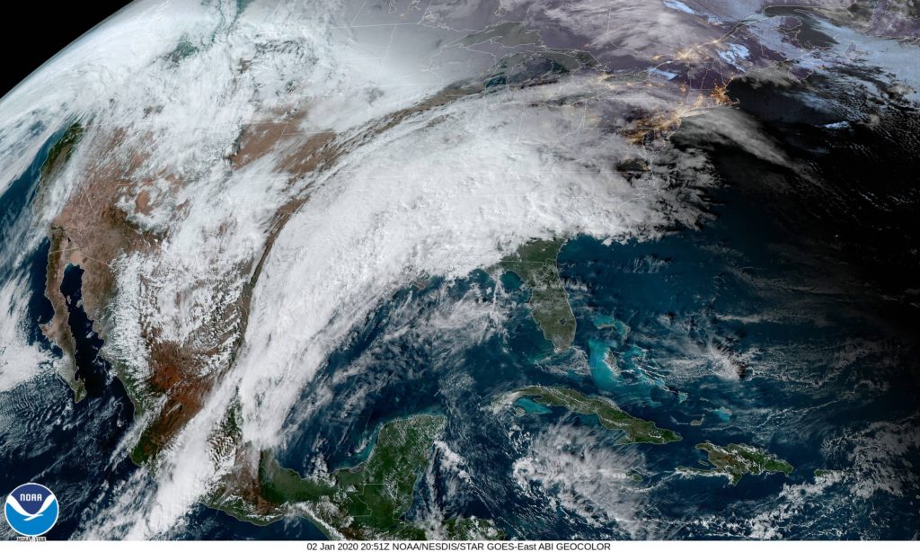
Here is the satellite imagery, giving you a sense for the scale of the feature in the southeastern US. IT’s going to look markedly weaker by the time it arrives in central Florida.
That’s generally the rule of thumb for forecasting in Florida, especially in the summer months. Last weekend was our valid time for our forecast for Deltona, and there were a handful of outlets that unconscionably left rain out of the forecast one one or both days. Mistake. Because we stuck to our mantra, we won the forecast despite some pedestrian temperature forecasting. Actuals: Friday – .36″ of rain in thunderstorms, High 95, low 75 Saturday – High 93, Low 75
With all the focus on the 50th anniversary of the Moon Landing, I think that a trip to the Space Coast and a rapidly developing town near Cape Canaveral is very appropriate.
At 336PM, ET, Deltona was reporting a temperature of 88 degrees, and thunderstorms in the vicinity. In fact, they were reporting lightning from all quadrants. It paints a more aggressive picture than what radar indicates. but there is a band of storms south and east of town that is the most robust. It’s that time of year for Florida, in which the dynamics are very small scale, reliant on the temperature profiles of see and land as opposed to any broad scale waves. Indeed, Deltona is going to be answerable only to the day time seabreezes as opposed to any broad scale flow pattern. Expect carbon copies of the next two days, with thunderstorms fairly likely, thanks to Deltona’s position set inland. Tomorrow – Scattered PM thunderstorms, High 95, low 77 Saturday – Scattered PM Thunderstorms, High 95, Low 77
TWC: Tomorrow – Partly cloudy in the morning followed by scattered thunderstorms in the afternoon high 92, Low 75 Saturday – Partly cloudy with afternoon showers or thunderstorms. High 93, Low 75
AW: Tomorrow – Sunshine and some clouds High 92, Low 75 Saturday – Partly sunny, a shower or thunderstorm around in the afternoon High 93, Low 75
NWS: Tomorrow – Mostly sunny and hot, High 95, Low 77 Saturday – A 30 percent chance of showers and thunderstorms after 2pm. Sunny and hot, High 96, Low 77
WB: Tomorrow – Partly cloudy. A chance of showers and thunderstorms in the late morning and afternoon, High 91, Low 78 Saturday – Partly cloudy. A chance of showers and thunderstorms in the late morning and afternoon, High 90, low 78
WN: Tomorrow – Partly cloudy with scattered storms, High 93, Low 76 Saturday – Partly cloudy with scattered storms, High 95, Low 75
FIO: Tomorrow – Humid and partly cloudy throughout the day. High 93, Low 76 Saturday – Humid and partly cloudy throughout the day. High 94, Low 75
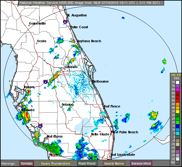
Hot and humid. Exactly what we want from Florida in July. Here is a look at the radar in central Florida.