If you talk to a lot of people in the eastern 2/3rds of the country, they lament the demise of spring. It goes from too cold to too hot in the span of a couple of days, never lingering on the “ideal” number. Of course, what is ideal is personal to every individual. Don’t talk to me until it is at least 80. Some people appreciate cooler numbers, like the highs in the low 60s in San Jose early this week. Too chilly for me. On the “pre-spring” side of things, frankly. The Weather Service and WeatherNation will have no problem saying that they were closest to the mark, spring or not, for our forecast there. Actuals: Monday, High 62, Low 46 Tuesday, High 62, Low 41
I was in Costa Rica just two months ago. The capital and largest city there is also called San Jose, though I suspect the forecasts to begin this week will be a hair different.
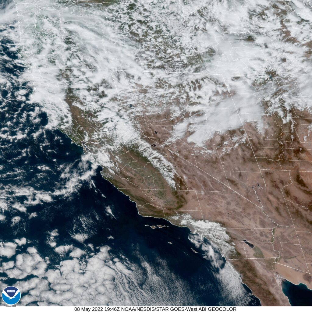
AT 753PM, PT, San Jose was reporting partly cloudy skies with a temperature of 54 degrees. Low pressure in the Pacific Northwest is extending a cold front being reflected at the surface approaching Victorville, while a band of clouds is streamed across the San Jose area. Brisk northwesterly winds give evidence that the boundary is through the region already. Heavy snow is expected in the higher terrain in Northern California as the upper level trough remains entrenched and moisture abundant. As ridging strengthens in the middle of the country, the upper level trough will contort and dig deeper across the Bay area. Precipitation will become less likely, as a deeply distended trough in the northwest has less access to moisture, but unseasonably cold temperatures will be on the order for Silicon Valley, accompanied by blustery winds. Tomorrow – Mostly cloudy, High 60, Low 45 Tuesday – Mostly cloudy, High 60, Low 45
TWC: Tomorrow – Mostly cloudy skies early will become partly cloudy later in the day. High 63, Low 46 Tuesday – Sunshine along with some cloudy intervals. High 63, Low 45
AW: Tomorrow – Cool with times of clouds and sun High 62, Low 47 Tuesday – Partly sunny and cool with a shower in places High 63, Low 45
NWS: Tomorrow – A 20 percent chance of showers after 11am. Mostly sunny, High 62, Low 42 Tuesday – A 20 percent chance of showers. High 63, Low 41
WB: Tomorrow – Partly cloudy. A slight chance of showers in the afternoon. High 61, Low 46 Tuesday – Partly cloudy. A slight chance of showers, High, 62, Low 46
WN: Tomorrow – Partly cloudy with light rain showers, High 63, Low 43 Tuesday – Partly cloudy with isolated showers, High 63, Low 41
FIO: Tomorrow – Partly cloudy throughout the day. High 61, Low 47 Tuesday – Clear throughout the day. High 64, Low 45
A wide array for you to choose form. Who will be right in the end? Satellite shows chaos to the north, and one defined boundary in California.
We needed to rely heavily on model guidance for our forecast in San Jose, thanks to tricky terrain and a dearth of information to the west. Some of it is still instinct, however, and many people shouldn’t have trusted theirs. On Monday, skies cleared a bit thanks to a brisk northwest wind, and temperatures popped into the 70s, but that was the only real forecast surprise for model adherents. Victoria-Weather and The Weather Channel collected the top spot, which is interesting, because the robot forecaster actually ended up last. Actuals: Monday – High 71, Low 48 Tuesday – High 69, low 45
Just a quick little trek today, as we head about 3 hours from the Central Valley to the Bay Area. Such a change in geography over only 191 miles. We’re going to cover the ground at a pace of 61.9mph. That’s not very fast, but these short trips aren’t known for their high rates of speed. Nor are California roads.
Visalia, California
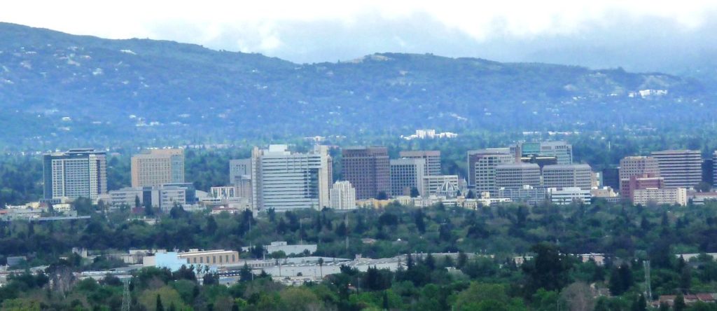
Fortunately for our quick drive on Monday morning, the pattern, already pretty good, is going to get even better on the West Coast. A ridge is setting up over California, which may lead to a bit of a breeze, but not much else. The big concern will be traffic, but we’ll get to San Jose around lunch time, so hopefully, it won’t be bad!
The Bay Area of northern California is a complicated weather scene thanks to the water, the changing terrain and the fact that there isn’t a heck of a lot of data immediately to the west of there. Fingers crossed, models don’t fail us now!
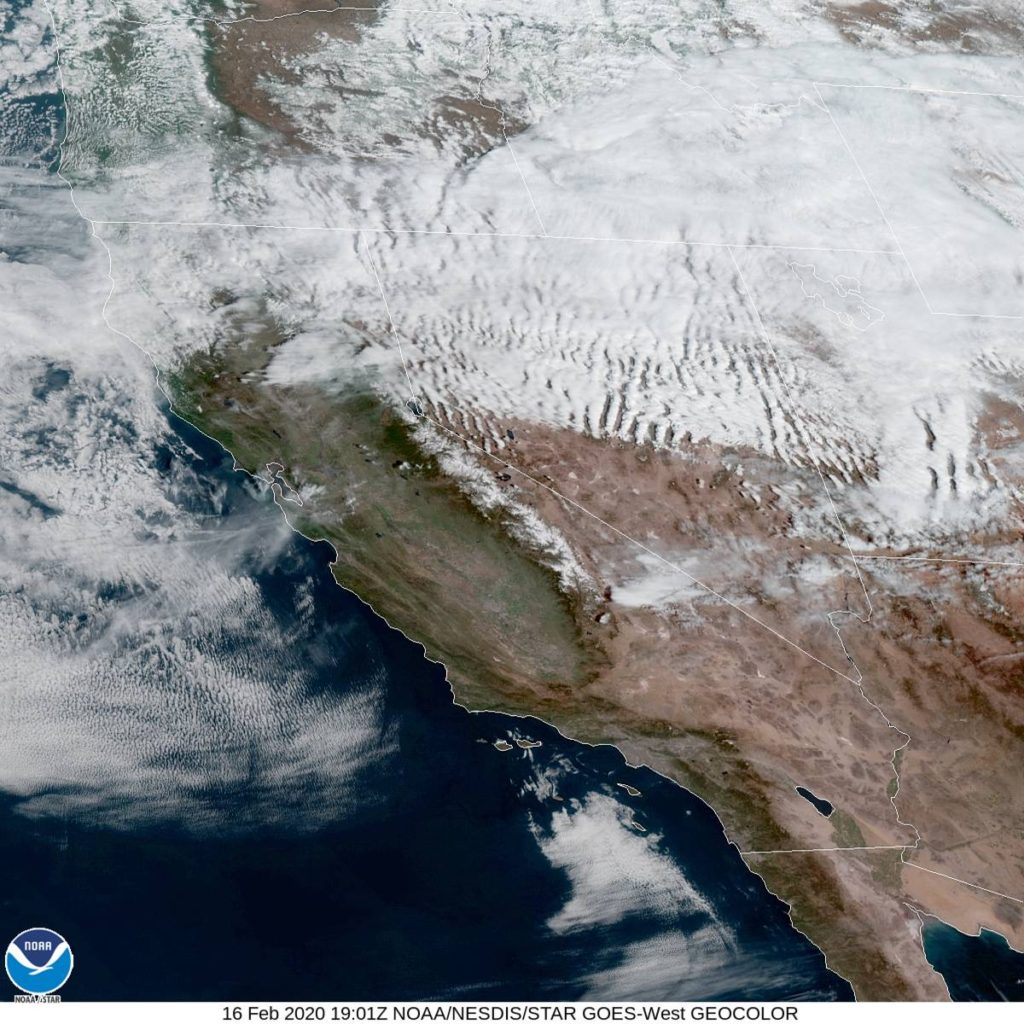
At 1053AM, PT, San Jose was reporting a temperature of 58 degrees with mostly cloudy skies. The regional satellite showed off the jet stream through northern California, with some striated clouds moving through Nevada and Utah after passing the Sierras. The southern Bay just had a few patches of clouds that don’t look to have much staying power. A surface ridge will build over the west coast over the next few days, further underscoring the stability in the region. The tail of a jet streak will press eastward, allowing a strong Pacific ridge to really put it’s mark on the area. Tomorrow – Sunny, High 68, Low 46 Tuesday – Mostly sunny, High 68, Low 45
TWC: Tomorrow – Partly cloudy, High 70, Low 46 Tuesday – Abundant sunshine. High 67, Low 44
AW: Tomorrow – Plenty of sunshine High 69, Low 46 Tuesday – Plenty of sunshine High 67, Low 42
NWS: Tomorrow – Cloudy through mid morning, then gradual clearing, High 69, Low 43 Tuesday – Sunny – High 68, Low 40
WB: Tomorrow – Partly cloudy in the morning, then becoming sunny, High 69, Low 45 Tuesday – Sunny, High 66, Low 43
WN: Tomorrow – Mostly sunny, High 69, Low 43 Tuesday – High 68, Low 40
FIO: Tomorrow – Mostly cloudy throughout the day. High 68, Low 43 Tuesday – Partly cloudy throughout the day. High 67, Low 41
Here is a look at that satellite I mentioned. Pretty cool how apparent the jet stream is, if you ask me, a local weather nerd.