
A two day severe weather marathon stretched from Kansas to Ohio with tornadoes starting near Topeka, and becoming increasingly more destructive, ultimately leaving lives turned upside down across Indiana and northwest Ohio in particular.
The system came into being in an almost textbook manner. There was a stationary boundary in the PLains that needed only be given the energy of an upper level trough to get moving. That was when the severe storms started in Wednesday, with discrete super cells cropping up in northeastern Kansas. In addition to the tornadoes around Topeka, there was very large hail seen in the Kansas City suburbs.
The system got more organized as Wednesday turned to Thursday, and the warm sector we look for in a severe weather outbreak showed up in the southern Great Lakes. Severe weather developed all the way southwest to near Dallas, with strong winds and large hail reported in many locations. It will be the tornadoes found in northeast Indiana and northwest Ohio that will be remembered, though.
Storms rotate the most near the center of an area of low pressure, as a general rule of thumb. There is enough built in vorticity that any storm specific helicity is just added to the mix, and can both make tornadoes and very large hail likely. The low tracked through the Great Lakes, and ultimately, destructive tornadoes followed.
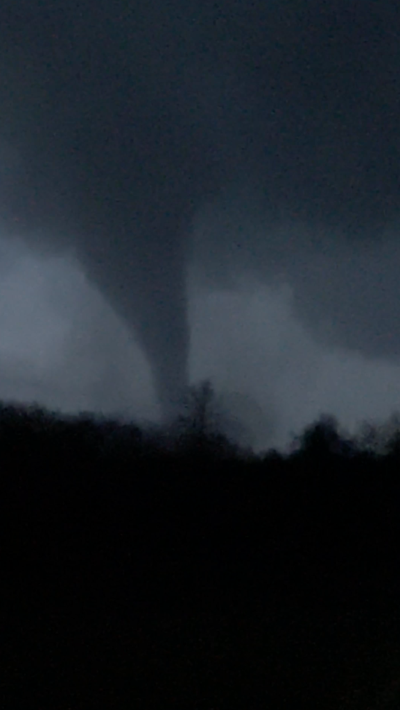
The two areas that were most directly impacted were Winchester, Indiana, where an estimated EF-3 tornado left a swath of destruction throughout the city, and in Logan County Ohio, north of Springfield, were three people were killed by a tornado.
This is the beginning of the severe weather season, lest we forget, and we have at least three more months of the particularly busy part of the year. Fortunately, we are coming off a quiet year for severe weather, and this part of the country is having a quiet spell to recover. Let’s hope this is as bad as it gets this year, but I fear it won’t be.
Comment (1)