I understand that it is only May, and a relatively tame one at that, but 90 degrees is still hot. That’s what was seen in Laredo last weekend, the verifying time of our recent forecast for the border town. Laredo was west of a broad, ambiguous area of low pressure, which meant that they were receiving a north wind, and were still over 90 by Sunday. This went about as well as planned for the meteorologists with a vested interest, and The Weather Channel and WeatherNation tied atop the leaderboard (because they had the same forecast). Actuals: Saturday High 87, Low 67 Sunday, High 90, Low 64
Way down south in Texas for our forecast, right along the Mexican border.
At 1056PM, Central Time, Laredo was reporting a temperature of 76 degrees with mostly cloudy skies. A broad cut off trough over the northern Gulf Coast is rotating flow throughout the area. The offshore, west Texas breezes were keeping places like Laredo fairly tolerable and pretty dry. The low and the trough fostering it are going to be slow to move out, but the good news for Laredo is that they are in a dry regime, on the back end of the low with dry northerly flow persisting in south Texas. Tomorrow – Mostly cloudy, High 86, Low 64 Sunday – A bit more sun, High 90, Low 62
TWC: Tomorrow – Sunshine and some clouds. High 88, Low 65 Sunday – Mainly sunny. Hight 94, Low 62
AW: Tomorrow – Pleasant with plenty of sun High 86, Low 64 Sunday – Plenty of sun High 90, Low 63
NWS: Tomorrow – Sunny, High 87, Low 66 Sunday – Sunny, High 91, Low 64
WB: Tomorrow – Sunny in the morning then becoming partly cloudy. High 85, Low 70 Sunday – Sunny. high 89, Low 67
WN: Tomorrow – Mostly sunny, High 87, Low 66 Sunday – Sunny, High 91, Low 64
CLI: Tomorrow – Light rain showers High 84, Low 65 Sunday – Sunny High 89, Low 63
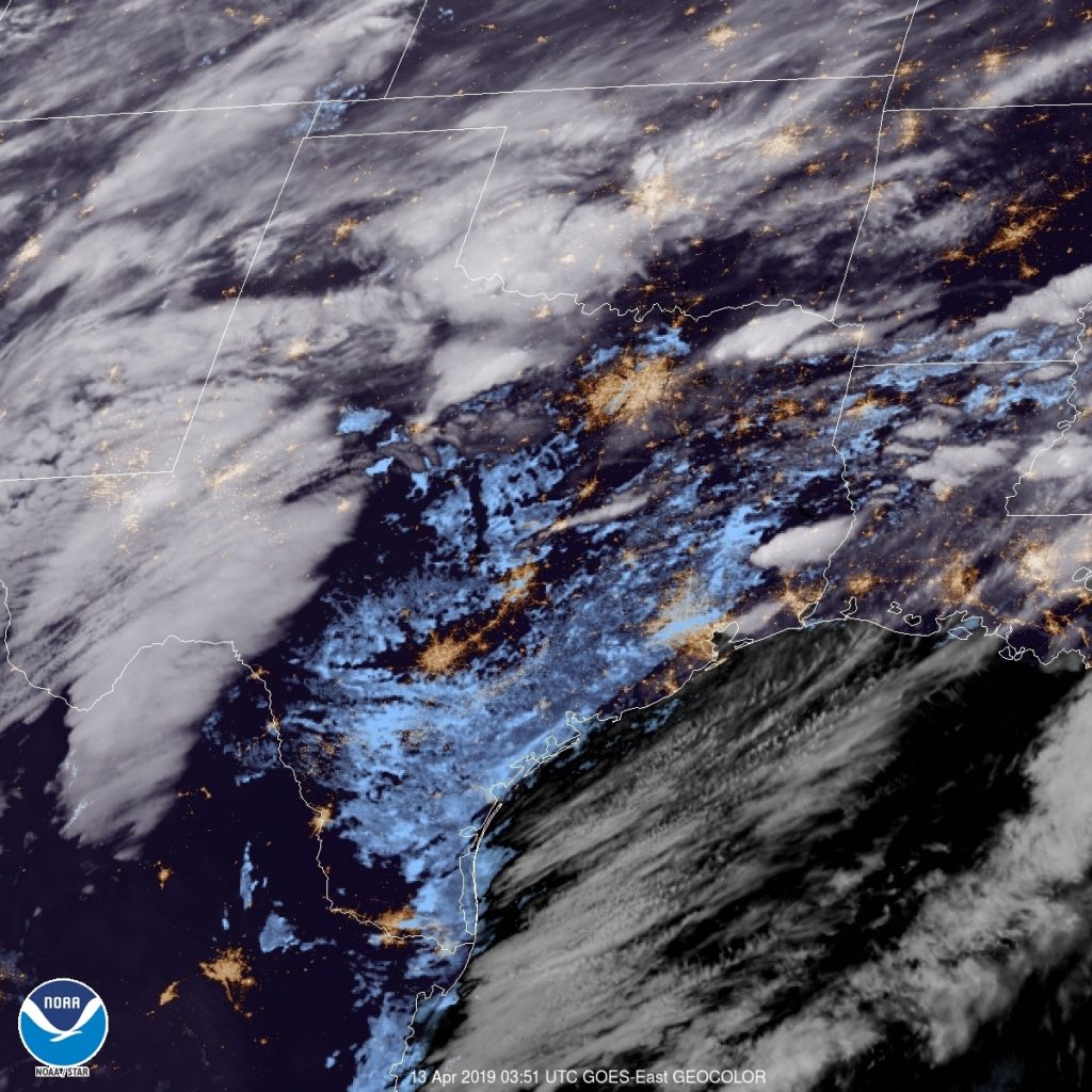
The rain that Clime has might be one of those hallucinating AI things you hear about. It’s pretty clear on satellite right now.
It’s a busy stretch of weather across almost the entire country, so obviously let’s just drive right through it. It’s going to take 3 1/2 days to cover the 1,965 miles between the two cities. Fortunately, we will have a lot of freeway time, which will mean a pace of 67.8mph, or 542 a day for those first three days.
DAY ONE (Friday)
Laredo is the county seat of Webb County, Texas, United States, on the north bank of the Rio Grande in South Texas, across from Nuevo Laredo, Tamaulipas, Mexico.
The most recent storm system to sweep through the country caused some nasty weather in the southeastern US last night, particularly with tornadoes in Alabama and Georgia. The feature is going to be bothering Labrador by the time we are hitting the road from Laredo, though, and we will have the benefit of relatively cool high pressure for the drive through the Lone Star State. Arrival in Louisiana will coincide with a return flow setting up, and the potential for some low level moisture, including mist and light rain from Lake Charles to our destination for Friday night, Cecilia. Don’t be surprise if this turns into some murky fog as we set out on Saturday morning.
DAY TWO (Saturday) That return flow from the Gulf is going to find a ripe environment in the Plains for development. As we get started, precipitation will already have exploded from the Great Lakes, where snow is possible, south through the Tennessee Valley. We will drive through the day in the warm sector of this new feature. By the end of the day, the pivot point for the surface low will be centered around Cincinnati, with a cold front to Shreveport and a warm front stretched towards Washington. With this positioning, Fog will be possible in the morning, through our northerly turn at Slidell, but the clouds may start filtering back in as we hit some terrain in northern Alabama, calling it a night in Hammondville, Alabama, which will come right before we pass into Georgia and then Chattanooga.
DAY THREE (Sunday) That rain, including some embedded thunderstorm activity is going to hit like a freight train overnight in northern Alabama. It will still be pouring as we start packing our things to hit the road on Sunday morning. The bulk of the severe activity will hit to the west and a little south of our stop in Hammondville, but flash flooding is severe weather too. Our drive through steep terrain for most of the day may be plagued by some lingering effects, as heavy precipitation will have moved through every section of our route. If there is good news, it is that precipitation will move too quickly to really add up. Still, bear in mind the slick roadways and embrace how much drier it is by the time we get to the eastern face of the Appalachians, where rain will cut off much sooner. The day will take us to Woodstock in northern Virginia, leaving a half day to Binghamton.
DAY FOUR (Monday) In the wake of the most recent round of significant weather coming this weekend, brisk west wind will trigger an active lake effect regime throughout the Eastern Great Lakes, Mostly clear skies should dominate our drive, with an exception as we approach Binghamton, when some of that Lake snow may filter through.
Last week, Texas was still wrapping up a surprisingly cool start to summer. It was hot everywhere in the country, except in the southeast, and when we looked at Laredo, another round of onshore showers and thunderstorms was just wrapping up for the far southern part of the state. Most outlets had thunderstorms in the forecast for last Thursday, but they never materialized. Nevertheless, it was still cloudy enough that temperatures stayed below 100 one last day. It’s been a scorcher ever since, however. Accuweather had the best forecast for the last gasp of tolerable weather for south Texas. Actuals: Thursday, July 22nd – High 93, Low 75 Friday – High 101, Low 76
It’s time for another road trip. This route takes us from one state to another that borders another, but we are going to cut through a third to get there. The drive covers about a day and a half, and is 762 miles long. There will be an ample amount of time spent on I-35, which will allow for a pace of 62.9mph. Not as fast as you expected? Well, that’s because of some off – interstate driving through Oklahoma. We’ll work out about 503 miles of driving on Tuesday, with the remainder on Wednesday.
DAY ONE (Wednesday)
Laredo, Texas (via Britannica.comdn
Our day will start from the Mexican border, and take us north through Texas on 35. We will abandon 35 as we head through the Dallas Metroplex and head for the Red River. There is a tail of a weak boundary sagging south through Texas that will trigger an isolated shower or thunderstorm generally north of the Austin area. Nothing severe or long lasting, but just enough to dampen the pavement from time to time. Just before we arrive at the Red River crossing, we will stop for the night in Denison.
DAY TWO (Thursday) As the tail of that boundary drifts further south, it will clear the air in Oklahoma and western Arkansas. Well, not clear it, so much as bottle up the shower and thunderstorm threat to the south of our route. Be prepared, it’s going to be hot and miserable in Fayetteville when we arrive. Find air conditioning.
We’re heading down to the banks of the Rio Grande for our forecast this evening. Typically this time of the year, we can expect some high heat and a little bit of humidity. Is that the case today as well?
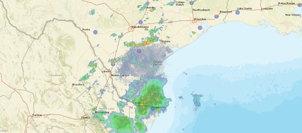
At 656PM, CT, Laredo was reporting a brisk 30mph gust with fair skies and a temperature of 84 degrees. Dew points were near 70, and the moisture rich environment provided an atmosphere that was active with precipitation. A line of thunderstorms ran from north of Victoria to north of Laredo. The storms nearest Laredo on the American side of the border are beginning to diminish, because they are driven less by any synoptic feature, but mostly on the diurnal interaction with onshore flow. A remnant frontal boundary north of the Gulf Coast is leaching some moisture away from south Texas, but is more importantly allowing the space for high pressure to develop over the western Gulf. Scattered showers and thunderstorms will still be possible in Laredo tomorrow, owing less to the onshore flow, and more to the monsoon flowing through Mexico and north towards the dry line and the Front Range. As high pressure builds, it will interrupt the flow of instability into Laredo, and the end of the week projects to be dry, but much warmer. Tomorrow – Isolated thunderstorms, High 97, Low 75 Friday – Sunny and hot, High 102, Low 78
TWC: Variable clouds with scattered thunderstorms. High 94, Low 75 Friday – Some clouds in the morning will give way to mainly sunny skies for the afternoon. High 101, Low 78
AW: Tomorrow – Humid with times of clouds and sun High 93, Low 75 Friday – Breezy and less humid with times of sun and clouds High 99, Low 77
NWS: Tomorrow – A 30 percent chance of showers and thunderstorms, mainly after 1pm. Mostly sunny High 96, Low 77 Friday – Sunny and hot, (early AM rain) High 100, Low 78
WB: Tomorrow – Mostly cloudy in the morning then becoming partly cloudy. A 30 percent chance of showers and thunderstorms, High 93, Low 77 Friday – Partly cloudy in the morning, then becoming sunny,, High 100, Low 78
WN: Tomorrow – Partly cloudy with chance of storms, High 95, Low 77 Friday – Mostly sunny, High 100, Low 78
FIO: Tomorrow – Humid and mostly cloudy throughout the day. High 94, Low 75 Friday – Humid and partly cloudy throughout the day. High 98, Low 77
The radar picture below is probably going to be a little less noisy tomorrow, and more so on Friday.
Well, the weather hasn’t been too great up here in the Upper Midwest last couple of days. Constant periods of snow and sleet and strong winds have made for an unpleasant week. While our weekend looks to be dry but cold, let’s go see what it’s like in the Southern US. Like WAY far south. Laredo in fact! Any further south and you’d need a passport.
At 856pm CDT, the temperature at Laredo, TX was 77 degrees under fair skies. Tail end of a stationary front is lingering over the TX Gulf Coast, but is expected to retreat northward during the day tomorrow. An area of low pressure is expected to intensify over West TX from morning throughout the day as it shifts eastward. By midday, the low will be centered near Dallas while the accompanying cold front will have swept eastward through the state into LA, kicking off strong to severe weather over LA into AR. As far as the Laredo area is concerned, precip should stay off to the north as clouds are expected in the morning, but clears out by midday as strong winds from the west. Clear skies then expected throughout the rest of the weekend but with temperatures coming down a bit on Sunday in the wake of tomorrow’s system.
Saturday: Cloudy early, then clearing. High 86, Low 67.Sunday: Clear, slightly cooler. High 81, Low 55.
TWC: Saturday: Partly cloudy, windy. High 88, Low 69.Sunday: Sunny. High 81, Low 52.
AW: Saturday: Windy in the afternoon. High 91, Low 68.Sunday: Mostly sunny: not as warm. High 80, Low 54.
NWS: Saturday: Sunny and breezy. High 90, Low 68.Sunday: Sunny. High 78, Low 55.
WB: Saturday: Windy. High 91, Low 70.Sunday: Sunny. High 80, Low 52.
WN: Saturday: Mostly sunny. High 90, Low 68.Sunday: Sunny. High 79, Low 56.
FIO: Saturday: Partly cloudy in morning and breezy in afternoon. High 89, Low 69.Sunday: Clear throughout the day. high 81, Low 53.
We see the storm system getting revved up over Western TX, while eastern TX is already seeing some low clouds cover the region