
We are approaching the end of August, and the peak of hurricane season is a little more than two weeks away, and we haven’t had a named feature since Tropical Storm Colin graced the Georgia coast at the beginning of July. The way it looks, we will make it until at least September until we have our “D” storm, given the current NHC outlook.
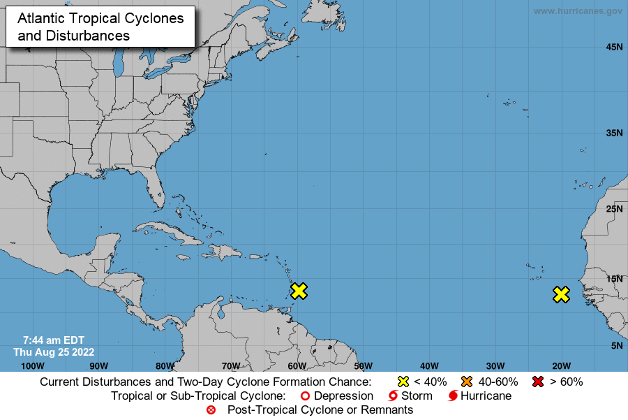
Each of those two yellow x’s represent a wave that ultimately could become a named tropical feature, but the NHC outlook suspects that formation chance is merely 20% through the next 5 days, which takes us to the end of the month with a day to spare. If these storms fail to materialize, and nothing else crops up in the intervening days, it would be the first time since 1997 that we went through August without a named storm in the Atlantic basin, and only the 2nd time since 1961. The fact that one of those x’s lies off the coast of Africa suggests that there is little time for another feature to arrive behind it, and a surprise is even less likely than usual.
The long range GFS model is pretty consistent with a tropical feature showing up at the beginning of September, and that wouldn’t really be a surprise. There is no causation of a quiet September simply because there is a quiet August. Colorado State hasn’t revised their predictions for the season yet. A quiet season in 1992 didn’t have a named storm until August — Hurricane Andrew. That 1961 season didn’t have any August storms, but did have two Category 5 hurricanes later in the season.
I haven’t found a season that hadn’t had a hurricane by September, though, and that would certainly be unusual, if not historic. We’ve also had the first season in 8 years without a named storm before the hurricane season officially starts on June 1st. It’s been a slow start, and it continues to remain slow for the coming days. We should appreciate that while it lasts.