11:15PM: The somewhat tepid looking June is living up to the forecast we discussed yesterday. The SPC is looking at isolated severe weather in the Northern Plains for the next few days, but nothing like a major outbreak. The Southeast looks dry. Not much is changing, but there isn’t anything overwhelming ongoing either
Updates 6/2
7:47PM: There are severe storms in the Dakotas this evening, but a bunch of dry air ahead of them. Fire danger is high in the Northwoods of Minnesota and into Wisconsin. It sure would be nice for the weather to reach this area (the rain, not the severe stuff), but it is not to be.
11:51PM: As I noted earlier this week, El Nino should render the Atlantic hurricane season a bit milder. But it’s going to be busier in the Pacific, starting…. now.
Updates 6/1
9:01: Happy meteorological summer, everyone! 6/1 is the beginning of meteorological summer, and probably closer to the beginning of what the lay person calls summer. Astronomical summer, of course, begins on June 21st. That’s a sad day, though, as days start getting shorter then. Hooray daylight! Hooray Pennsylvania, without a cloud in the sky! Well, too late, I guess. It is 10 there now.
Updates 4/12
12:33AM: We’re looking at a busy week of storms. High pressure hangs over the mid-Atlantic, with warm air pumping into the Plains. Storms are a consistent threat in the middle of the country for the next few days.
4:55PM With the gusty winds found posrt frontally, and it being as dry as it is regionwide, expect an elevated fire risk for the Plains all week. Red flag warnings are out for many spots
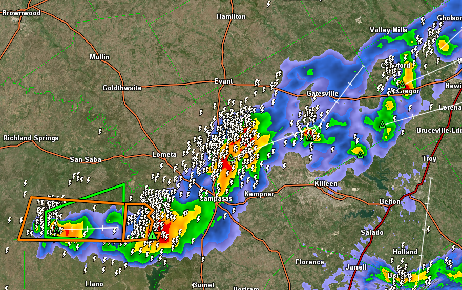
10:53PM Storms are dying out in Texas this evening, but good luck getting sleep. Look at all this lightning
Updates 4/9
10:35PM: The burden for above normal warmth has shifted to the southeastern US for the time being. Instead of heat out west, there is a chance for mountain snow early next week in the northern Rockies.
Updates 4/8
7:35PM: There is a “minor heat risk” for the Central Valley in California. At least it’s minor. But what’s this? There is also a winter weather advisory in the Sierras. California contains multitudes.
Updates 4/6
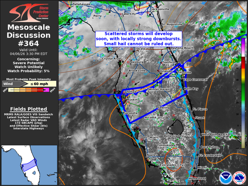
1:50PM: The map is pretty quiet today. The closest thing to action is this area, being watched by the SPC in Florida. The area could use the rain, so as long as the activity isn’t severe, this might qualify as good news.
Updates 4/5
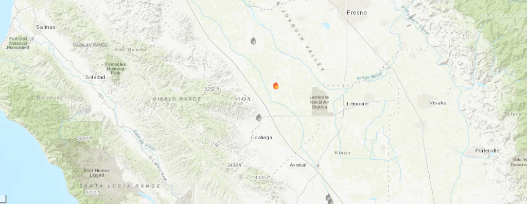
7:10PM Happy Easter! One thing to appreciate on this day is that, despite fires developing in California, they have been well contained and remain small. We forecast for Visalia last night, and today, west of town, this little fire, the Lake fire popped up.Not a major concern, but worth noting.
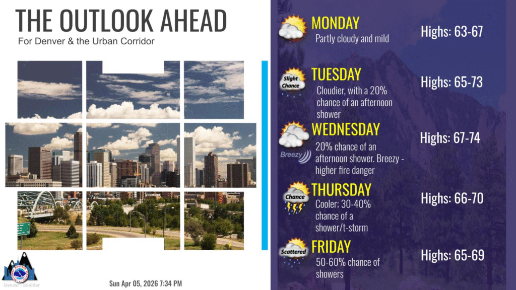
9:11PM High pressure and a slow moving pattern is the story in the west. The forecast from Denver tells the story.
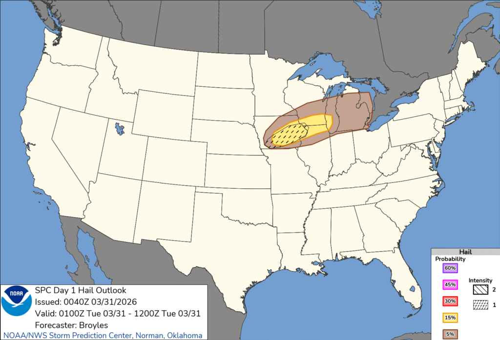
Updates 3/31
12:30AM: Cold Front!
Updates 3/30
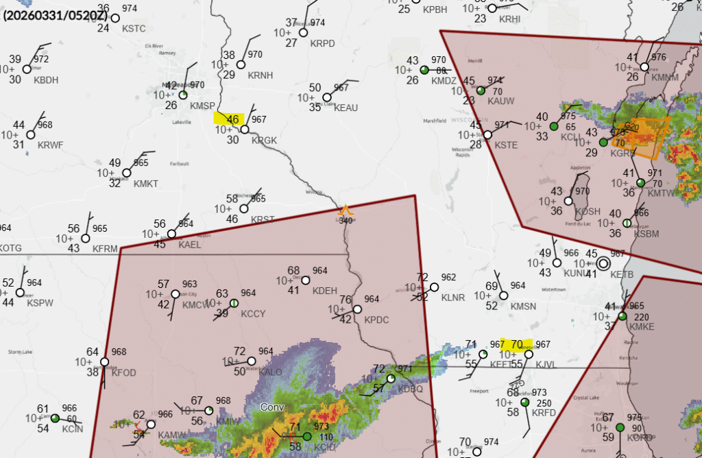
10:34PM: The SPC does have a hatched area on this evening’s outlook. Here is the hail forecast for you to see the new graphics in action.