Every time I think of San Antonio, I find it is in a much further south location than I remember. It’s a big city that is totally different than any of the other big Texas towns.
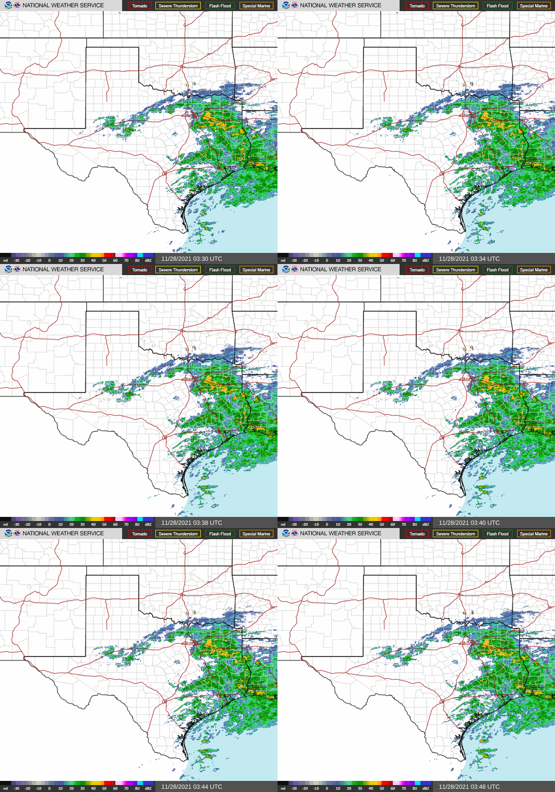
At 951PM, CT, San Antonio was reporting overcast skies with a temperature of 51 degrees. Dew points were nearly 50 degrees across the region as well, and some early fog was settling into the region. Low pressure had become established just offshore from Texas, and was helping to generate heavy rain in East Texas, with something resembling a feeder band arcing around towards Amarillo and Lubbock. The low was developed near the right entrance of a jet streak, and at the tail of a surface trough, and is not tropical in nature.
As the jet shifts away, the low will disintegrate into the Gulf, while high pressure develops in the southern US. The surface pressure ridge will be transient, though upper level support will remain in place. Westerly flow across the southern Rockies will allow some additional warmth to spread across the region to begin the work week.
Tomorrow – Morning clouds and fog, followed by a nice afternoon, High 68, Low 48
Monday – Sunny, High 73, Low 44
TWC: Tomorrow – Sunshine and clouds mixed High 71, Low 46
Monday – Sunny skies. High 72, Low 44
AW: Tomorrow – Warmer with times of clouds and sun; ideal weather for one of the busiest travel days of the year High 70, Low 46
Monday – Comfortable with plenty of sunshine High 72, Low 43
NWS: Tomorrow – Mostly sunny, High 68, low 47
Monday – Sunny High 70, Low 44
WB: Tomorrow – Not as cool, Partly cloudy, High 67, low 46
Monday – Sunny, High 70, Low 43
WN: Tomorrow – Partly cloudy, High 68, Low 47
Monday – Mostly sunny, High 70, Low 44
FIO: Tomorrow – Partly cloudy throughout the day. High 69, Low 46
Monday – Clear throughout the day. High 72, Low 43
Quite a bit of rain is showing up on radar, but none of it looms for San Antonio.


Comment (1)