
In the past several years, some long standing meteorological terms have filtered out into the masses, and have exploded as buzz phrases, and often help to drive ratings and induce a mild hysteria. Think of how often you now hear the terms “polar vortex” or “bomb cyclone” for example. Right now, many meteorologists are talking about an “Omega block,” which is definitely much more innocuous than it sounds.
For those that are familiar with the Greek alphabet, you may know that the letter Omega is the last letter. This lends the Omega block terminology a bit of gravitas. Is it some sort of apocalyptical signal? Is it the end? No, assuredly not. The name is actually a reference to the shape of the Omega: Ω. The upper level jet features a ridge, bracketed by two sharp, potentially cut off areas of low pressure. This is the case today, and will be for a while.
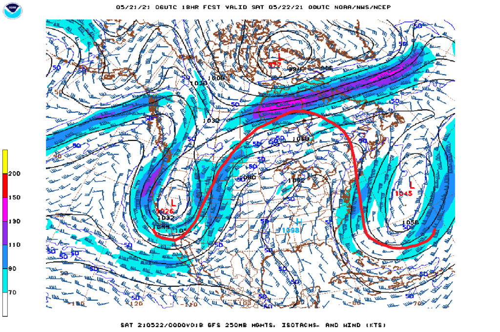
Ridges in general are tough to dislodge, and having a immobile trough, as is the case off shore, in front of it, and even undercutting it, slows things down even more. This is why it is called a “block”. For a while, the upper level pattern is going to be unable to progress.
There isn’t a lot of danger in the pattern, especially at it’s current location. A little further east or west, the coasts could be in for a fairly rainy week, or the Plains could be in line for a major severe weather stretch, with low pressure unable to move our of the region. Instead, it will be dry from the Mississippi Valley to the East Coast, with just a few showers riding the western side of the ridge, a persistent but not terribly worrisome threat (despite a few tornadoes dipping down over southern Minnesota earlier in the week. )
This Omega will be in place through the weekend before it slowly starts to shuffle off to the Atlantic.