
I used to live in the northern part of Indiana (I went to school there) but I’ve never made it down to Evansville. One of my best meteorology friends is from Evansville, though, so maybe this forecast will get a cosmic boost because of that.
At 1154PM, CT, Evansville was reporting few clouds with a temperature of 57 degrees. The regime was mostly southerly, thanks to a warm front emerging on the Wisconsin/Illinois border. While the southerly flow is impacting Evansville now, the continued development of this feature will mean more significant weather later in the week. Notably, after a daylong warm up tomorrow, the cold front, materializing through the day on Tuesday, will arrive late in the evening. Rain and thunderstorms, some of which could contain hail or strong winds, will be possible.
After the front passes, the parent low will begin to occlude and meander through the Great Lakes as it takes a left turn towards eastern Canada. Rain will continue to wrap around the circulation, even as the cold front presses to the east. A positive benefit is that temperatures won’t dip too far on Wednesday, thanks to the cloud cover, but the steady light rain will make the day too gloomy to see that silver lining.
Tomorrow -Warm and mostly sunny, with strong thunderstorms possible late, High 76, Low 55
Wednesday – Heavy early rain, then mostly cloudy with rain possible through the day, High 62, Low 48
TWC: Tomorrow – Cloudy skies early will become partly cloudy later in the day (Late thunderstorms). High 76, Low 56
Wednesday – A steady rain in the morning. Showers continuing in the afternoon. Thunder possible High 64, Low 51
AW: Tomorrow – Mostly cloudy and breezy (dangerous thunderstorms late) High 73, Low 56
Wednesday – Cloudy, breezy and cooler with showers High 62, Low 52
NWS: Tomorrow – A 20 percent chance of showers before 1pm. Mostly cloudy, (storms late) High 74, Low 55
Wednesday – Showers, with thunderstorms also possible after 1pm. High 66, Low 52
WB: Tomorrow – Partly sunny (late storms), High 73, Low 57
Wednesday – Showers in the morning then showers and a slight chance of thunderstorms in the afternoon, High 64, Low 52
WN: Tomorrow – Partly cloudy with isolated showers, High 74, Low 56
Wednesday – Mostly cloudy iwth light showers, High 66, Low 57
FIO: Tomorrow – Partly cloudy throughout the day. High 77, Low 55
Wednesday – Rain throughout the day. High 66, Low 50
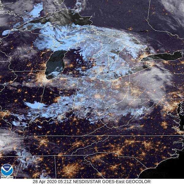
FIO’s timing is slower and I fear that may do them in this forecast, but I always appreciate their temperature forecasts on non-standard days (which is what will happen on Wednesday). 24 hour highs and lows. A look at the satellite shows the remnant of an unmentioned area of low pressure. The real focus is the next one for Evansville.
Comment (1)