A short wave rippled through the northern tier, bringing cooler air to a lot of the country late last week. We felt it here in the Upper Midwest, it eventually arrived as far as New England, but it sure didn’t show up during our verification for Evansville. The boundary was supposed to arrive in Evansville on Friday evening, bringing some cooling temperatures and brisk winds. The rain never came, and the temperatures stayed in the 90s instead. Victoria-Weather played down the rain chances, but the Weather Service and Clime had strong temperature forecasts, and anticipated a slow arrival to the cold front. Actuals: Thursday, High 92, Low 65 Friday – High 90, Low 67
We aren’t going to travel too far from our previous forecast spot – St. Louis – but depending on your route, we are still two, maybe three states away.
At 154PM, CT, Evansville was reporting a temperature of 84 with clear skies. There was a trough extending at the lower levels from the western Gulf of Mexico, pressing into western Tennessee, which had resulted in some clouds streaming through Kentucky, and occasionally over Evansville. This feature was penetrating a strong ridge in the eastern US, so the trough figured to get snuffed out before it can do anything interesting, particularly around Evansville. The instability in the Gulf, however, is expect to spread into the southeastern US as high pressure begins to recede away from the mid-Atlantic. A weak trough running along the Canadian border will drape a cold front into the Plains that will be approaching the lower Ohio Valley on Friday. The cold front will pass through southern Indiana late in the day, however the instability rising out of the Gulf will prevent much moisture for reaching the Evansville city streets. While there is a small chance for rain, there is a better chance for increasing winds and an initial dose of autumnal air. Tomorrow – Partly cloudy, High 92, Low 66 Friday – Increasing clouds and wind with a spot of rain, High 85, Low 68
TWC: Tomorrow – Sunny, along with a few afternoon clouds. High 91, Low 63 Friday – Partly cloudy. A stray shower or thunderstorm is possible. High 86, Low 67
AW: Tomorrow – Partly sunny and hot; caution advised if doing strenuous activities outside High 93, Low 64 Friday – Times of clouds and sun with a thunderstorm in one or two spots; not as hot High 86, Low 65
NWS: Tomorrow – Sunny, High 91, Low 65 Friday – A 20 percent chance of showers and thunderstorms after 1pm. Mostly sunny, High 89, Low 67
WB: Tomorrow – Sunny, High 86, Low 68 Friday – Mostly sunny, High 86, Low 70
WN: Tomorrow – Mostly sunny, High 89, low 66 Friday – Partly cloudy with scattered showers and isolated storms, High 86, Low 68
CLI: Tomorrow – Sunny, High 92, Low 66 Friday – Thunderstorm, High 89, low 67
Forecasts for Friday are an interesting study in “when do you think the front will arrive?” Later arrival suggests warmer highs on Friday. The satellite for the region shows a band of clouds spiraling all the way north from the Gulf.
It had been a minute since we had composed a forecast before we put one together for Evansville. I mused that I hoped we remembered how to do it. Our forecast was fine, but it was difficult to improve on the near perfection of The Weather Channel and Accuweather. They had the same forecast, which paid dividends, because aside from the high temperature being 1 degree too cool on Saturday, the forecast was spot on. Granted, accuracy should be at its best with sunny weather forecasts like we saw in southern Indiana, the forecasts were nevertheless commendable. Actuals: Saturday – High 64, Low 45 Sunday – High 67, Low 40
Hey, look, it’s a forecast! After a lengthy time away from the site forecasts, let’s see if we still remember how to do this.
At 1154AM, CT, Evansville was reporting clear skies with a temperature of 72 degrees. The region was in some clear, dry air in the wake of a rainy cold front that moved through yesterday afternoon. Low pressure continued to spiral over Michigan, and it will be pressed northward as Tropical Storm Philippe heads towards New England. The thermal trough will swing south today and overnight, with tomorrow morning landing as the chilliest morning of the season, with Sunday being even chillier. Philippe will merge with the Great Lakes low and start to occlude and retrograde. The persistent northwest winds will keep temperatures down, and the moisture continuing to wrap between the two features and slowly into Indiana. This will lead to some overcast throughout the weekend, and temperatures closer to autumnal. Tomorrow – Mostly sunny, High 63, Low 44 Sunday – Mostly cloudy, High 64, Low 42
TWC: Tomorrow – Sunny. High 63, Low 45 Sunday – Sunshine and clouds mixed. High 66, Low 41
AW: Tomorrow – Partly sunny and cooler High 63, Low 45 Sunday – Plenty of sunshine High 67, Low 40
NWS: Tomorrow – Sunny, High 62, Low 44 Sunday – Mostly sunny, High 65, Low 40
WB: Tomorrow – Sunny, High 60, Low 45 Sunday – Mostly sunny, High 64, Low 44
WN: Tomorrow – Mostly sunny, High 62, Low 44 Sunday – Mostly sunny, High 66, Low 40
CLI: Tomorrow – Sunny, High 63, Low 45 Sunday – Partly cloudy, High 66, Low 43
This is what I believe many in the US would call football weather. There is a nice swath of sunny skies over southern Indiana today.
We looked at Evansville early last week, when bundle of low pressure moving through the Great Lakes promised to disrupt some outdoor plans. Indeed, it did, but fortunately for everyone working at home, the rain came only on Wednesday the 29th of April, so Tuesday was pretty nice. Ahead of the low, warm air surged into Indiana to make it even nicer. Forecast.io came through with the victory, so I’m sure they thought it was especially nice. Actuals: Tuesday April 28th, High 76, Low 57 Wednesday, April 29th, .2 inches of rain, High 67, Low 49
I used to live in the northern part of Indiana (I went to school there) but I’ve never made it down to Evansville. One of my best meteorology friends is from Evansville, though, so maybe this forecast will get a cosmic boost because of that.
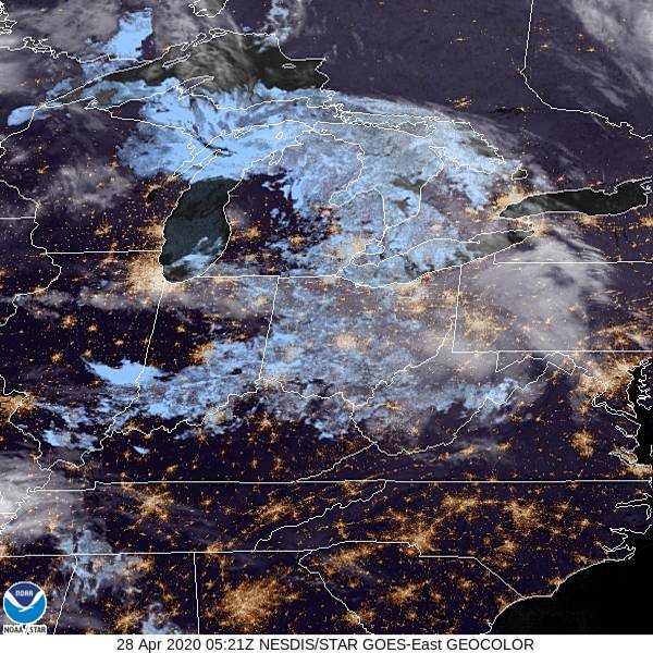
At 1154PM, CT, Evansville was reporting few clouds with a temperature of 57 degrees. The regime was mostly southerly, thanks to a warm front emerging on the Wisconsin/Illinois border. While the southerly flow is impacting Evansville now, the continued development of this feature will mean more significant weather later in the week. Notably, after a daylong warm up tomorrow, the cold front, materializing through the day on Tuesday, will arrive late in the evening. Rain and thunderstorms, some of which could contain hail or strong winds, will be possible. After the front passes, the parent low will begin to occlude and meander through the Great Lakes as it takes a left turn towards eastern Canada. Rain will continue to wrap around the circulation, even as the cold front presses to the east. A positive benefit is that temperatures won’t dip too far on Wednesday, thanks to the cloud cover, but the steady light rain will make the day too gloomy to see that silver lining. Tomorrow -Warm and mostly sunny, with strong thunderstorms possible late, High 76, Low 55 Wednesday – Heavy early rain, then mostly cloudy with rain possible through the day, High 62, Low 48
TWC: Tomorrow – Cloudy skies early will become partly cloudy later in the day (Late thunderstorms). High 76, Low 56 Wednesday – A steady rain in the morning. Showers continuing in the afternoon. Thunder possible High 64, Low 51
AW: Tomorrow – Mostly cloudy and breezy (dangerous thunderstorms late) High 73, Low 56 Wednesday – Cloudy, breezy and cooler with showers High 62, Low 52
NWS: Tomorrow – A 20 percent chance of showers before 1pm. Mostly cloudy, (storms late) High 74, Low 55 Wednesday – Showers, with thunderstorms also possible after 1pm. High 66, Low 52
WB: Tomorrow – Partly sunny (late storms), High 73, Low 57 Wednesday – Showers in the morning then showers and a slight chance of thunderstorms in the afternoon, High 64, Low 52
WN: Tomorrow – Partly cloudy with isolated showers, High 74, Low 56 Wednesday – Mostly cloudy iwth light showers, High 66, Low 57
FIO: Tomorrow – Partly cloudy throughout the day. High 77, Low 55 Wednesday – Rain throughout the day. High 66, Low 50
FIO’s timing is slower and I fear that may do them in this forecast, but I always appreciate their temperature forecasts on non-standard days (which is what will happen on Wednesday). 24 hour highs and lows. A look at the satellite shows the remnant of an unmentioned area of low pressure. The real focus is the next one for Evansville.