California in flames again

another autumn, another raging inferno in California. The drought ravaged state is once again in the crosshairs — Hold on, what’s that? California isn’t classified as being in a drought any longer?
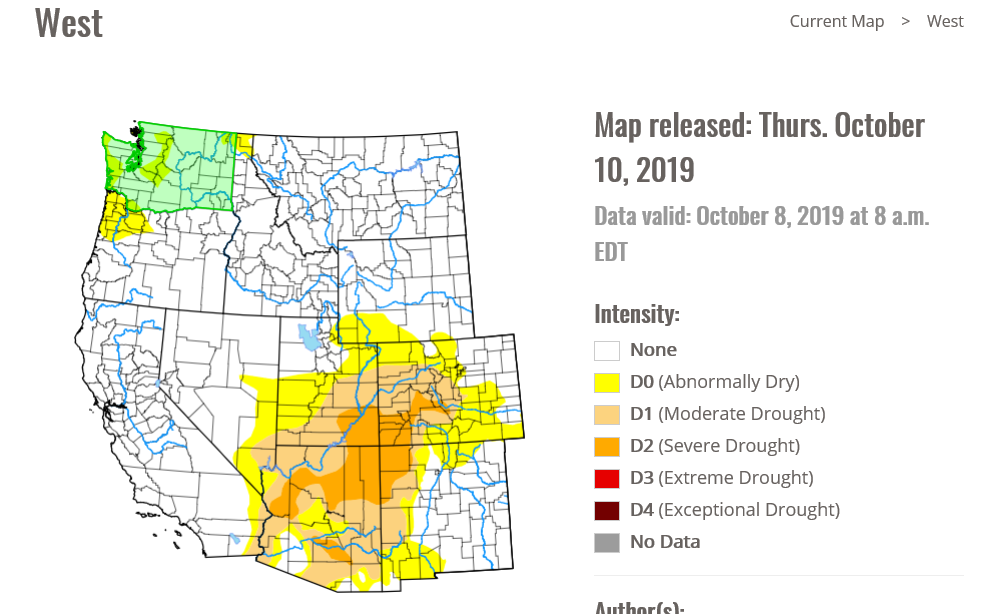
The Saddle Ridge Fire is burning on the northern edge of the San Fernando Valley, safely ensconced in the “None” range of the drought monitory, as of October 10th. I assure you, a drought didn’t develop in the last few days, either. California had a very wet spring, which has allayed the drought in the area, including the San Fernando Valley.

Wildfires are a natural part of the rebirth of the southern California wilderness. It’s a very dry climate, and even if they are receiving the typical amount of precipitation, and this time of year usually features a few fires, aided by hot, brisk winds out of the Mojave, the so called Santa Ana’s. The Saddle Ridge Fre is dangerous, but it is not atypical.

This is making headlines simply because of the location. With populations growing, particularly on the west coast, these regular occurrences suddenly take on an even more menacing turn, as they start near populated areas with greater frequency, and ravage those same areas that may have been many miles away just a decade or two ago.

California is home to a host of potential disasters, and as the population continues to grow and sprawl, they become more and more likely to become catastrophes.
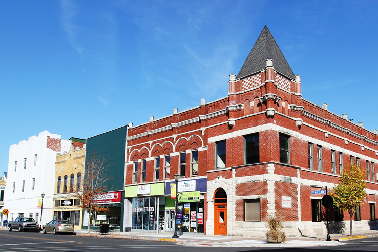
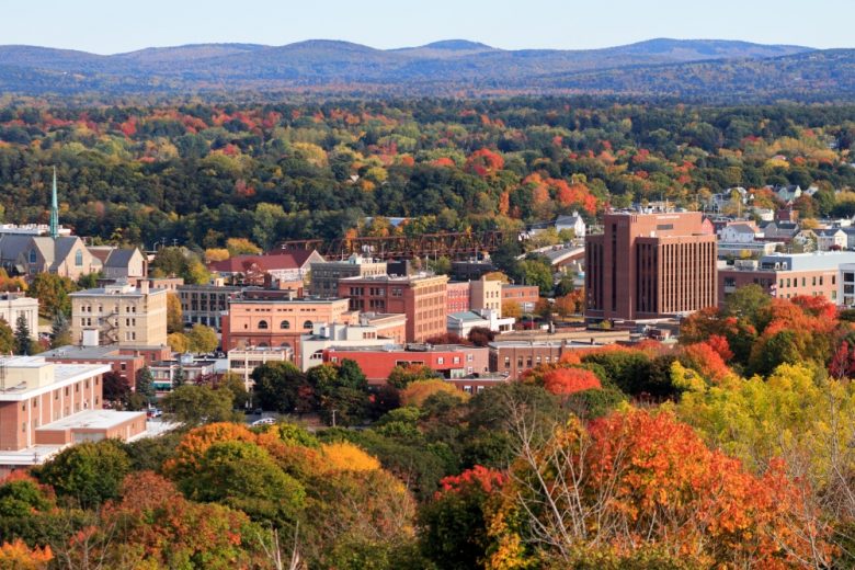
Boston, Massachusetts

Happy weekend, everyone! We’re going to stop in Beantown to see how life is now that we’ve finished with a nasty early season storm.

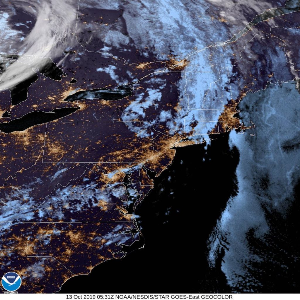
At 1254AM, ET, Boston was reporting clear skies and a temperature of 55 degrees. Some fog and clouds were settling in in the Berkshires and across Providence and South Boston, however it will be a race between clouds over the Cape and that fog, as temperatures should level off overnight if cloud cover encroaches. There is clear air over southern New England and in the Mid Atlantic, so if Boston is skirted by the clouds to the south, a foggy Sunday morning seems likely.
The dominant feature in the eastern US is a deep area of low pressure in Ontario, with an occluded front through New England and a cold front stretching to the Carolinas. Independent circulation at the occlusion will shift off shore through tomorrow morning, and will deepen into a mostly independent feature, strengthened via good jet support. The amplification looks to be underestimated by the models at this point, but is also going to remain well east of Boston, bringing perhaps some low clouds and a little bit of wind on Monday.
Tomorrow – Mostly sunny, High 66. Low 53
Monday – Mostly cloudy, High 65, Low 51

TWC: Tomorrow – Partly cloudy. High 68, Low 52
Monday – Sunshine and clouds mixed. High 67, Low 51

AW: Tomorrow – Clouds and breaks of sun High 68, Low 54
Monday – Clouds and breaks of sun, High 67, Low 52

NWS: Tomorrow – Mostly sunny, HIgh 66, Low 49
Monday – A chance of showers between 9am and noon. Partly sunny HIgh 66, Low 50

WB: Tomorrow – Mostly sunny, High 65, Low 50
Monday – Partly sunny with a 30% chance of showers, High 64, Low 51

WN: Tomorrow – Partly cloudy, HIgh 66, Low 50
Monday – Partly cloudy with scattered showers, High 66, Low 50

FIO: Tomorrow – Mostly cloudy throughout the day. High 65, Low 51
Monday – Partly cloudy throughout the day. High 63, Low 49

The NWS and friends are going for the shower potential, but it isn’t a popular forecast elsewhere. 60s seem pretty tolerable for October. Here is the satellite, with clear skies ready to move north.

Kokomo, Indiana to Bangor, Maine

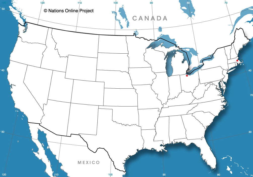
Let’s go for a drive. And while we’re at it, let’s go for a drive in the fall before the Lake Effect machine gets going. It takes two days to get from northern Indiana to Maine, though the second day might be an hour longer. The distance is 1,151 miles, which we will navigate at a speed of 65.5mph, pinning us somewhere in New York to conclude day one, with the left to spare on day two.

DAY ONE (Tuesday)

By Cameronloyd03 – Own work, CC BY-SA 4.0, https://commons.wikimedia.org/w/index.php?curid=61605902

Fall is coming to the northern part of the country, and it s coming in the form of a cold front sweeping into New England as we speak. Cool high pressure is pressing into the Great Lakes, and as we leave Kokomo, we will be headed right into this high pressure. We’ll make our way through northern Ohio and drive the southern shore of Lake Erie, all with barely a cloud, and make it to Le Roy, New York, south of Rochester as we take our sole pause on the journey.

DAY TWO (Wednesday)
As that cold front gets off shore, it will phase with an upper level trough, and start development into an early season nor’easter. Terrific! Most of the drive in the Empire State will be dry, but east of Albany, the rain will start. It will be persistent and accompanied by stiff gales all the way through Massachusetts. Leaves are still on trees, so watch out for branches and debris on the roads, but as we pass through Haverhill and into New Hampshire, we will be in the clear, back into that cool, perhaps cloudy high pressure, into Bangor.

Bangor, Maine

Coming Soon…

As we saw with our monthly review earlier today, we haven’t been terribly active with our forecasts lately and, well, that doesn’t seem to be likely to change in the near future. We’ll still try to make sure to that everyone has a good look at everything that’s going on out there.

Boston, Massachusetts

Toledo, Ohio

September Forecaster of the Month

We didn’t really do a lot of forecasting this month, as most of our attention was tied to the dangerous and persistent tropical season. Dorian and Imelda took a lot of our attention, but when we were, albeit briefly, focused on the Mainland, it was WeatherNation who snuck in for a victory.

OutletMonth wins
Weatherbug1
Victoria-Weather0.2
WeatherNation0.2
National Weather Service0.2
Forecast.io0.2
Accuweather0.2
The Weather Channel

Outlet
Month winsyear wins
Victoria-Weather0.213.15
The Weather Channel11.7
Weatherbug110.58
WeatherNation0.27.81
National Weather Service0.27.48
Forecast.io0.26.95
Accuweather0.26.81

Monroe, Louisiana to Fresno, California

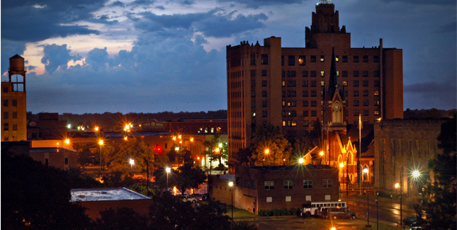
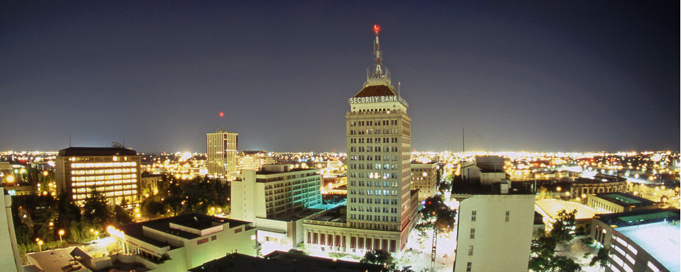
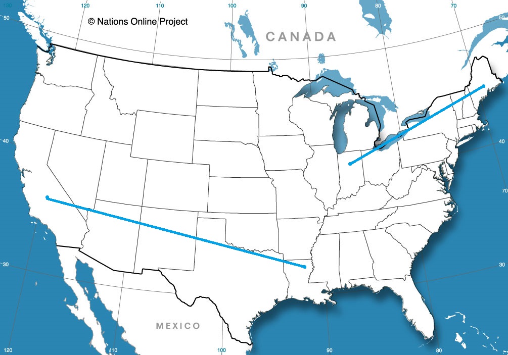
Just to provide some context for just how big these United States are, we will be staying entirely west of the Mississippi and remain in states that border either the Gulf of Mexico or the nation of Mexico, and we will still be traveling 1,842 miles and taking 3 long days to get where we are going. We’ll even take interstates, so we’ll cover 68mph, and 546 miles per those first two days, and we’ll STILL have a lengthy 11 hour day to finish with.

Monroe, Louisiana

DAY ONE (Wednesday)
There is a stout ridge of high pressure in the southeastern United States, and most of the precipitation for the next couple of days will be ridge riding on the north side of this dome, meaning very hot, dry and mostly sunny weather in the southeast, including in Louisiana and east Texas. The western edge of this dome will be in west Texas, but we will stop in Childress, before we run into the associated showers and thunderstorms. Hopefully, the AC works in the hotel.

DAY TWO (Thursday)
As is the nature of shower activity on the backside of high pressure, it won’t be moving anywhere, but it’s coverage will probably expand through the day on Thursday. Expect some showers and storms through Amarillo, and as we cross into New Mexico, rain will lighten, but persist. In fact we may see rain persist right up to Tijeras, butting up against the foothills of the mountains surrounding Albuquerque. We’ll be in the clear, however, by the time we reach New Mexico’s biggest town, and will drive in sun to Manuelito, just before the Arizona line.

DAY THREE (Friday)
High elevation rain showers may encroach the hills east of Manuelito, but that will be the only threat for this long finishing day of our trek. Strong low pressure is going to develop in the Rockies, kicking up a Santa Ana wind that may necessitate a firm grasp of the steering wheel. particularly as the day reaches it’s final stages, and we turn north into the San Joaquin Valley. Fresno will be mild and could be fairly breezy.

Fresno, California

Storms will blossom very quickly in the Upper Midwest

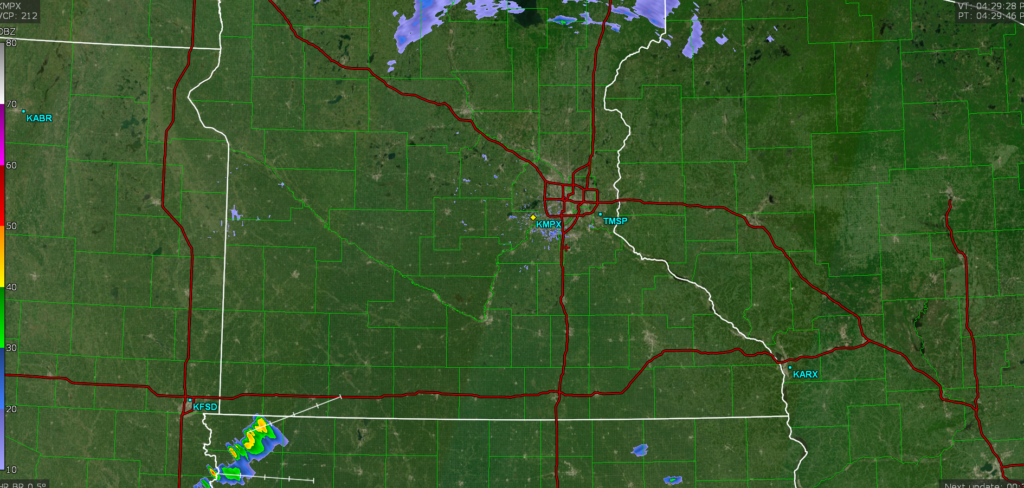
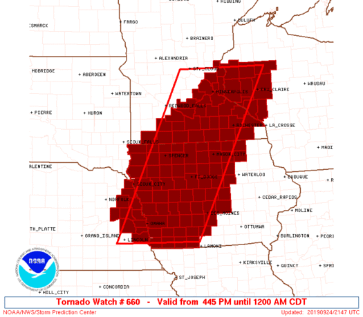
There is an enhanced risk for severe weather today in Minnesota, though at present, the radar is pretty sparse, save for a few showers in northern Minnesota and the first severe storm in northwest Iowa.

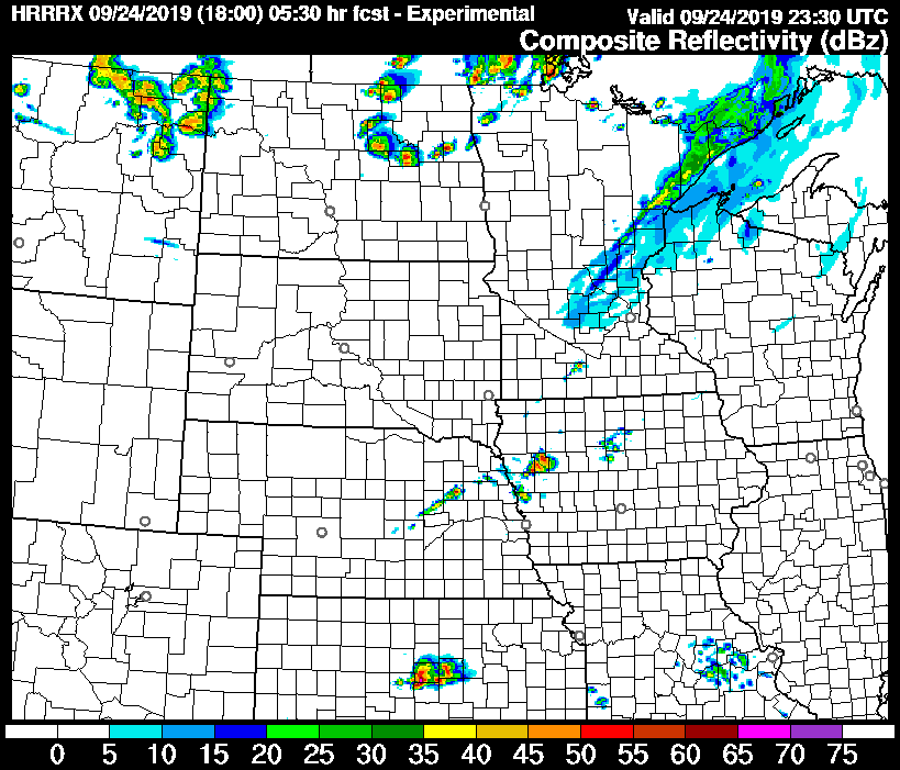
This radar imagery is from about 4:15. Here is a look at the HRRR forecast radar for about 630 this evening.

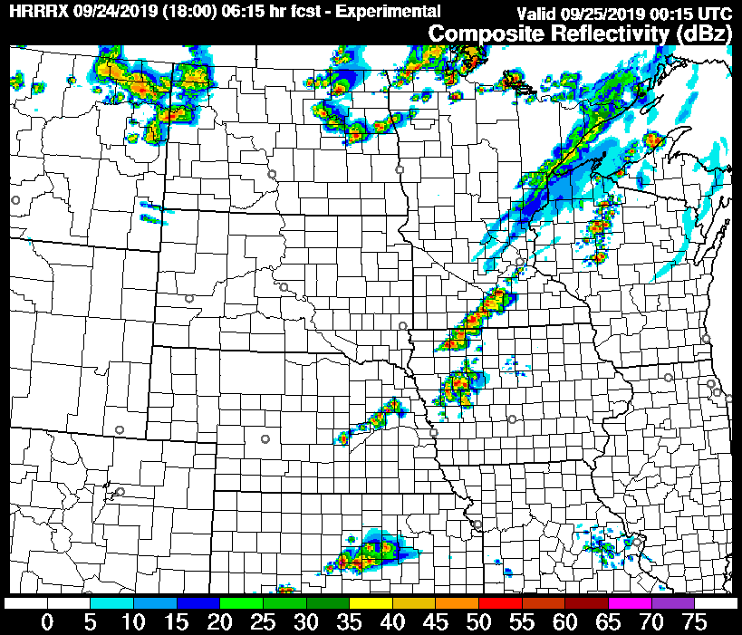
It looks as though the guidance is a little behind schedule, but the most important thing to note, will be how fast this line develops. This is the forecast radar 45 minutes later, or 715.

This looks like a strong line from Mankato to Storm Lake. Note the distinct blobs within the line. The threat for tornadoes and large hail is real tonight, and it is evidenced by the depiction of discrete cells within this line.

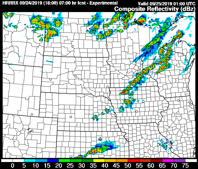
Eventually, and only within another 45 minutes, the storm will metastasize into a line. It will still be strong, and straight line winds will be added to the mix of threats.

This is the epitome of the “pay attention to the skies” days in southeast Minnesota and northern Iowa. Strong, dangerous storms are likely tonight, and they are likely to develop rapidly. It is possible that strong storms can develop and produce tornadoes even between radar scans with rapid development such as this.

Stay alert, heed local warnings, and listen to your gut. If it seems dangerous, take shelter, even if a warning has not yet been issued.

*Even as I was writing this, a tornado watch was issued for the region*

Imelda stalks where Harvey still haunts

Meteorologists everywhere feel a twinge of guilt and pain every time severe weather targets life and property. We all love the weather, but when it turns ugly, it hurts a little differently, like we have somehow been betrayed. It’s worse when the bad weather is somewhat unanticipated.

Imelda was never anticipated to be a strong storm, in terms of central pressure, or wind speed, and it wasn’t anticipated, originally, to linger very long. Eventually, the storm did slow down and tracked over the same tract of land for about 48 hours. The result is images that resemble those from Hurricane Harvey, particularly between Houston and Beaumont.

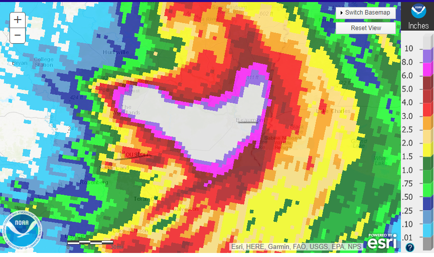
Here is a look at the heaviest rain of the past 24 hours. There is a swath from the Woodlands in the east Houston metro to Beaumont that saw 10+ inches of rain today. Over the course of the storm, that same area saw close to 2 feet.

I’ve underlined Houston and Beaumont on the map which should show you something else from a couple of different perspectives. Either you will see this map, depending on your perspective. Either you will note that the is a lot of rain for a very large area, or you will note that this is actually a lot less rain than the area saw with Harvey. Both conclusions are true, and should be telling.

Even though there is quantitatively less rain from Imelda, there was a lot of rain for a very large area IT was disruptive, deadly, destructive and evocative of the all time crisis that Harvey brought. This should underscore just what a nightmare Harvey was, but also sound an alarm about the eminent threat of any tropical feature. Just because Imelda’s torrential rain affected a smaller footprint doesn’t mean it wasn’t a major catastrophe. Imelda didn’t bring 5 feet o rain, but 2 is still pretty overwhelming.

The Appalachians and the heat

Usually, when you think of mountains, you think of snow capped peaks and chilly air. In Greensboro last week, they were directly responsible for temperatures not cooling off as quickly as it could have. cold air was rushing south from the Great Lakes, but got hung up in the mountains. Southerly flow with humid air produced clouds and a bit of rain that certainly allowed for a cooldown, but not quite on the order forecast by our model guidance for Friday. Weatherbug had a blend of a good temperature forecast, and were one of only three that had rain in the forecast on Thursday.
Actuals: Thursday – .01 inches of rain, High 95, Low 72
Friday – .01 inches of rain, High 82, Low 72

Grade: A-C