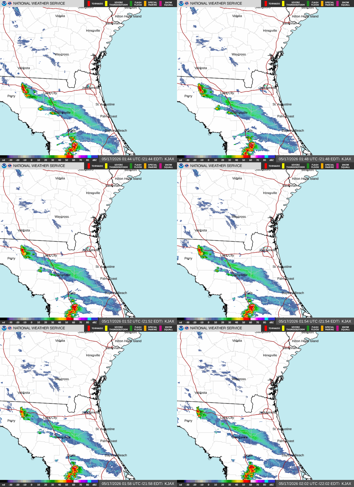
11:15PM: The somewhat tepid looking June is living up to the forecast we discussed yesterday. The SPC is looking at isolated severe weather in the Northern Plains for the next few days, but nothing like a major outbreak. The Southeast looks dry. Not much is changing, but there isn’t anything overwhelming ongoing either
Updates 6/2
7:47PM: There are severe storms in the Dakotas this evening, but a bunch of dry air ahead of them. Fire danger is high in the Northwoods of Minnesota and into Wisconsin. It sure would be nice for the weather to reach this area (the rain, not the severe stuff), but it is not to be.
11:51PM: As I noted earlier this week, El Nino should render the Atlantic hurricane season a bit milder. But it’s going to be busier in the Pacific, starting…. now.
The outlook at the head of summer
June 1 is an inflection point on the meteorological calendar. It is the beginning of hurricane season, and the beginning of the meteorological summer season. Meteorological summer is marked by very warm temperatures in the south, along with dry conditions in the west and a steady diet of thunderstorms in the southeast. Also, the onus for severe weather shifts to the north. June itself is the most active severe period for the northern Plain and western Great Lakes.
How will this summer fit with the standard summer?
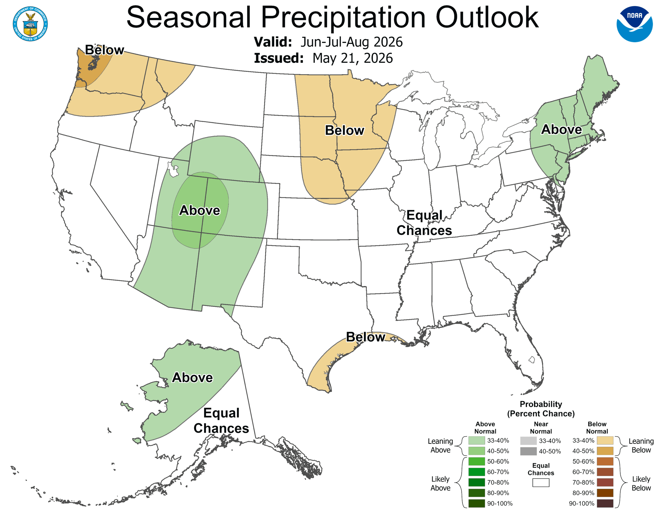
Precipitation has several areas that are expected to be outside of the normal ranges, but they are generally small, and could go either way. The only stand out is the Rockies, where it looks like the monsoon should be particularly active this summer.
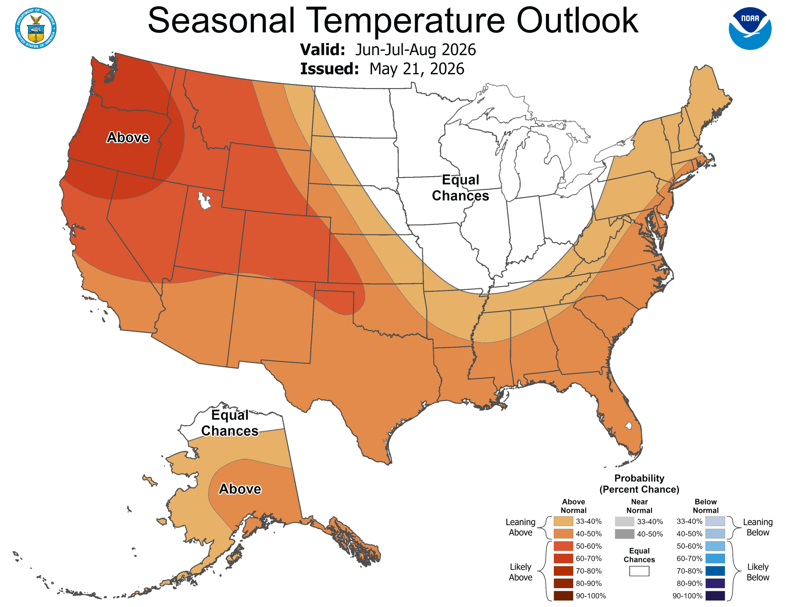
The temperatures offer a different tale. The west in particular will be warmer than normal, with the south also expected to be above normal. The hot get hotter.
Enjoy the heat, stay hydrated, and have a good summer.
Updates 6/1
9:01: Happy meteorological summer, everyone! 6/1 is the beginning of meteorological summer, and probably closer to the beginning of what the lay person calls summer. Astronomical summer, of course, begins on June 21st. That’s a sad day, though, as days start getting shorter then. Hooray daylight! Hooray Pennsylvania, without a cloud in the sky! Well, too late, I guess. It is 10 there now.

Some hopeful news for the Atlantic
As has been the case recently, the trade winds over the Atlantic basin, as well as ocean temperatures are elevated. Both of these traits are consistent with active hurricane seasons, which we have certainly been privy to for the last decade or so. Also this summer, El Niño is forecast to intensify, and generally, El Niño is an inhibitor to tropical development. Which of those factors will win out?
The National Hurricane Center officially says that they believe it will be El Niño that wins the summer, and has officially forecast a below normal hurricane season because of it.
The NHC takes care to point out the importance of maintaining your hurricane vigilance even as the outlook is more favorable than it has been in a while. Part of the reason is the factors working against a quiet year hurricane season (water temperature, weak trades). Another, larger part of the suggestion for continued concern is that in the end, it doesn’t matter if the season is quiet or not if one of the few larger storm strikes your home. In 1992, there were only 7 named storms. One of those storms was Hurricane Andrew.
The outlook is promising on a holistic level, however the consistent warning when it comes to the hurricane season remains the same. It only takes one bad storm to set the impression of an entire season.
Happy to be off
We put together a forecast for Jacksonville early in May, and a couple of sources, including Victoria-Weather, thought the shower and storm activity in the area might indicate that there would be a recurrence the next day. This didn’t happen. Ultimately, that wasn’t the thing that turned the tide for anyone, but I think most in Duval County were happy for a rain free couple of days before it gets too hot. The Weathers Channel and Service drew level with good temperature forecasts, but the consensus was best of all
Actuals: May 17th, High 86, Low 75
May 18th, High 84, Low 70
Grade: A
Coming Soon…
We are spreading around to all corners of the country as summer looms. Especially that northwest corner.
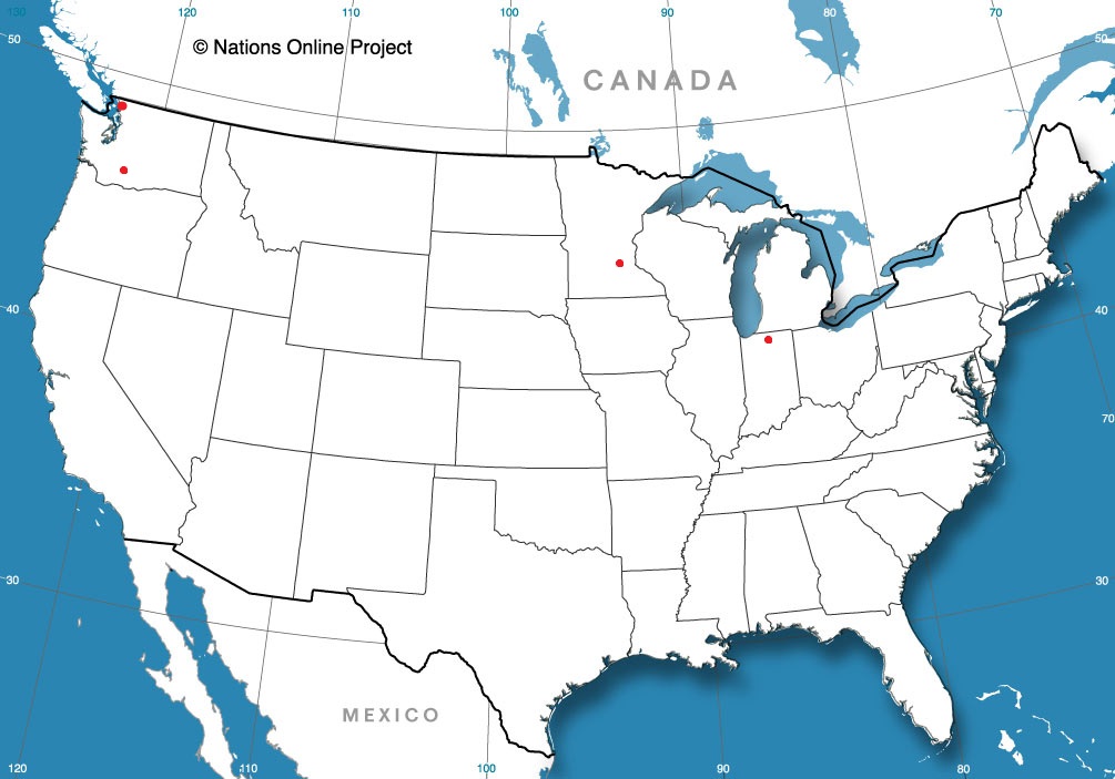
South Bend, Washington
Longview, Washington
Minneapolis, Minnesota
Bremerton, Washington
Houston, Texas
I hope everyone is planning a wonderful time outside for Memorial Day Weekend. It’s the beginning of the warmth up north, and probably the last time it won’t be too hot down south.
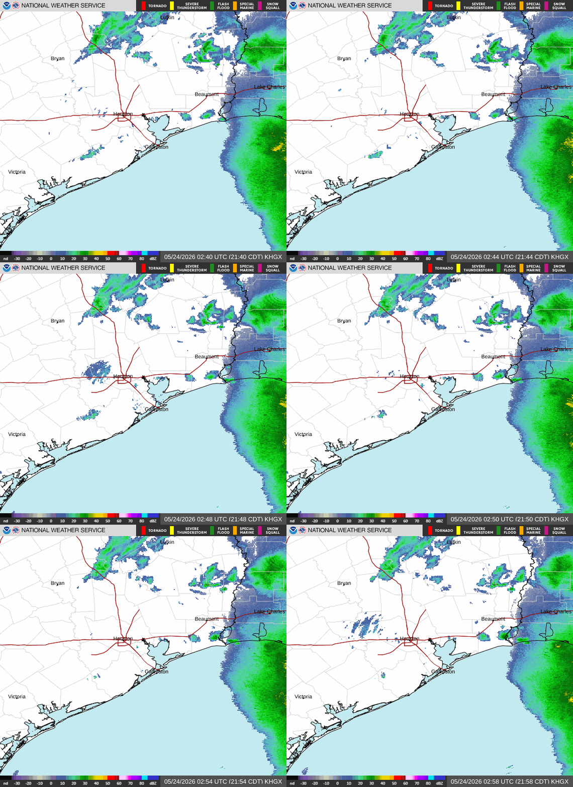
At 853PM, CT, Houston was reporting a temperature of 72 degrees. Moisture in the atmosphere was high, after rain this afternoon. There will likely be some fog and low clouds overnight. The bulk of the rainfall has shifted towards the Mississippi Delta, however a weak upper level trough remains over east Texas, which means that there won’t be any real clearing tomorrow.
With the trough hanging out in eastern Texas will continue to generate cyclonic flow in the western Gulf. Showers with some embedded thunderstorms will be more frequent and wider in coverage over Louisiana, on the east side of the circulation, but lingering moisture and scattered showers will remain a possibility throughout the remainder of the holiday weekend, with precipitation more likely Sunday than Monday.
Tomorrow – Mostly cloudy with a chance for showers and fog early, High 85, Low 69
Memorial Day – Partly cloudy with AM fog and afternoon showers, High 88, low 71
TWC: Tomorrow – Sunshine and clouds mixed. High 88, Low 68
Memorial Day – Partly cloudy skies High 89, Low 70
AW: Tomorrow – Mostly cloudy with a couple of showers and a heavy thunderstorm; watch for flash flooding High 83, Low 71
Memorial Day – Variable cloudiness with a thunderstorm High 88, Low 71
NWS: Tomorrow – A 20 percent chance of showers and thunderstorms after 10am. Partly sunny High 82, Low 70
Memorial Day – A 30 percent chance of showers and thunderstorms after 1pm. Mostly sunny, High 85, Low 71
WB: Tomorrow – thunderstorms in the afternoon. Some thunderstorms may produce heavy rainfall in the afternoon High 83, Low 69
Memorial Day – Mostly sunny. High 87, Low 72
WN: Tomorrow – Partly cloudy with showers and isolated storms, High 82, Low 70
Memorial Day – Partly cloudy with showers and a chance of storm, High 85, Low 71
CLI: Tomorrow – Light rain showers, High 84, Low 68
Memorial Day – Sunny, High 85, low 71
There is close correlation between precipitation and temperature forecasts the next couple of days. There will be some wild differences in our verification scores! Precipitation has moved all the way over the Louisiana.
Do you know where you are?
Do you know what county you are in? You probably know what county you live in. but do you know what county you work in? Let’s say you do know that information: Do you know the name of the county just to you west? Or in any other direction?
Compounding that even further, do you travel? For work or for pleasure. If so, can you find where you are, generally, on a map? GPS is great for getting us places, but for some people, it has made map reading extremely difficult, as for most, it isn’t a muscle that often needs to be flexed.
There is one area that counties and geolocation are important. The NWS still issues watches and warnings based on counties. Radar only shows the largest locations, and even then, the scale isn’t always perfect. Or if you are traveling, say, to the Dallas area, would you realize as you are in Grapevine that you are north of Fort Worth?
This is the current radar from West Texas, simply because it is the only site with severe weather tonight.
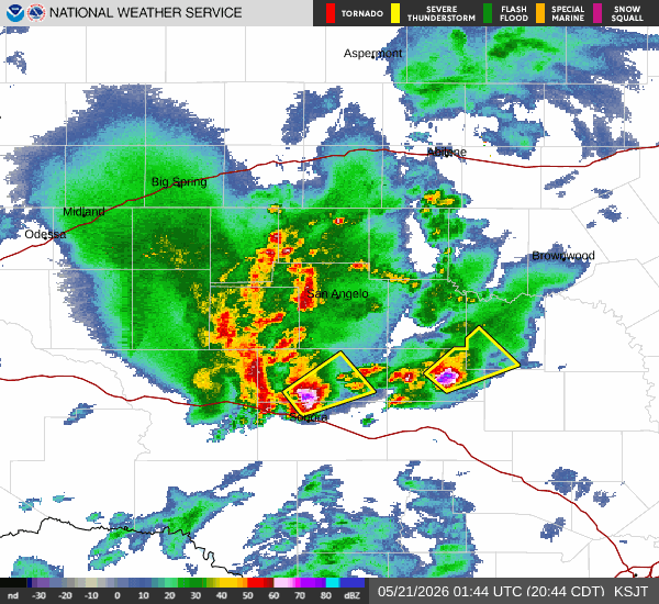
The yellow boxes represent severe thunderstorm warnings. Here is the text on one of those warnings:
...A SEVERE THUNDERSTORM WARNING REMAINS IN EFFECT UNTIL 1015 PM CDT
FOR SOUTHWESTERN MCCULLOCH...NORTHEASTERN MENARD AND NORTHWESTERN
MASON COUNTIES...

At 922 PM CDT, a severe thunderstorm was located over Us-
190 Near The Menard-
Mcculloch County Line, or near Calf Creek, moving northeast at 20
mph.

HAZARD...60 mph wind gusts and half dollar size hail.

SOURCE...Radar indicated.

IMPACT...Hail damage to vehicles is expected. Expect wind damage to
         roofs, siding, and trees.

This severe storm will be near...
  Calf Creek around 930 PM CDT.

Other locations impacted by this severe thunderstorm include The
Intersection Of Us-190 And Ranch Road 1311 and Us-
190 Near The Menard-Mcculloch County Line.

PRECAUTIONARY/PREPAREDNESS ACTIONS...

For your protection move to an interior room on the lowest floor of a
building.
You, I assume, are like me, and wouldn’t know which warning that was for, had I not just clicked on it. It wouldn’t mean much to me if I was in West Texas. In this scenario, let’s say I had heard of Calf Creek, because I was nearby in Eden. Would I know, based on the polygon that the storm was coming for me? Of if I was in Junction, would I know that it wasn’t?
One thing that meteorologists always tell you when there are forecasts for severe weather is to be prepared. Especially when you are away from home, take the time to figure out where you are on the map. If the forecast looks dicey, learn what county you are in, and even what part of the county, if you can. Victoria, for example, is in Carver County, Minnesota, and on the east side, near the border with Hennepin County. To the west, northwest and southwest are McLeod, Wright and Sibley Counties. Even when not eyeballing the radar myself, if I heard on the radio or saw an alert on TV for one of those counties, I should start to pay closer attention.
I’m a map nerd, certainly, and a lot of this comes to me naturally. That said, the weather warning apparatus necessarily makes assumptions about YOUR ability to read a map and know where you are. Take the time to hone those skills.
Jacksonville, Florida
The forecast wheel spun and took us back to the southeast. We are off to Duval County tonight.
At 856PM, ET, Jacksonville was reporting a temperature of 79 degrees and mostly cloudy skies. Isolated storms have emerged over the center of the state, but they were dying with darkness. There is a bit of a jet streak over the Northern Gulf that is presently leading to some of the activity, however there is broad trade activity developing in the region.
Deep low pressure in the Plains is also contributing to moisture transport across the Florida Peninsula. The region will be cloudy at the very least tomorrow, with a considerable threat for a pop up shower or storm, particularly in the afternoon. As the surface pressure reorganizes in the southern US on Monday, activity will diminish in the Jacksonville area.
Tomorrow – Scattered showers and storms, High 87, Low 64
Monday – Sunny, High 86, Low 72
TWC: Tomorrow – Sunshine and clouds mixed. High 87, Low 74
Monday – Sun and a few passing clouds High 86, Low 71
AW: Tomorrow – Partly sunny; a thundershower in spots in the morning followed by a couple of thunderstorms in the afternoon High 87, Low 73
Monday – Times of clouds and sun High 87, Low 68
NWS: Tomorrow – Mostly sunny, High 87, Low 73
Monday – Mostly sunny High 85, Low 71
WB: Tomorrow – Mostly sunny. High 85, Low 76
Monday – Sunny. High 82, Low 73
WN: Tomorrow – Partly Cloudy, High 87, Low 73
Monday – Mostly Sunny, High 86, Low 71
CLI: Tomorrow – Thunderstorm High 86, Low 70
Monday – Partly cloudy High 85, Low 66
Varying opinions on storms tomorrow. Makes sense, I think they will be isolated. But alas, it’s Florida. It storms. Such as it is tonight.