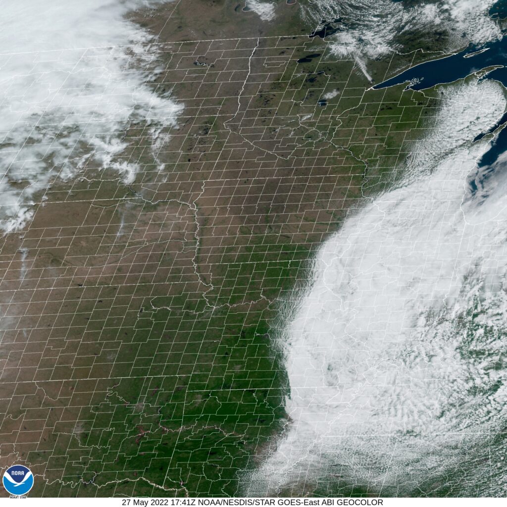
Napa, California to Johnstown, Pennsylvania

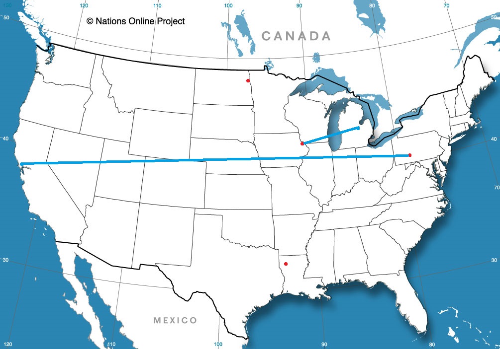
Cross country road tripping is the name of the game today, as we start on a 5 day journey. It is a 2,607 mile voyage which we will cover at a pace of 68.6mph, which is indicative of all the freeway time we are spending. That means a 549 mile a day pace for days 1-4, with a shorter drive to finish things off thanks to our blistering pace.

DAY ONE (Friday)

Napa, California

Low pressure over the Gulf of Alaska is pretty much just hanging out in place, and a cold front is becoming mostly stationary in the Pacific Northwest. This is all good news for people chugging along I-80, as we will be on Friday. It will make it hard to leave Napa, though, but driving through Sacramento and Reno will be a bit easier. Our drive will take us to Death Star Valley. Ope, sorry, Star Wars fan. That should be the Deeth/Starr Valley exit in northeastern Nevada.

DAY TWO (Saturday)
The drive through the west will take its typical winding path through Salt Lake City then continue on into Wyoming. There isn’t a lot going on… BUT WAIT! There is a hint that the monsoon might be getting organized by this weekend. If that happens, there is an extremely remote chance at an isolated storm popping up over south central Wyoming by the end of the day. We’ll end the day at Cooper Cove, north of Laramie for our Saturday night stop.

DAY THREE (Sunday)
Lee troughing is going to be fast in developing over central Nebraska, ready to turn towards the Upper Midwest, but it won’t tap into much moisture until it is closer to the Great Lakes. Surface high pressure will be in rapid pursuit, with some convergence and resultant thunderstorms over the Panhandle late in the day. We will already be in Ashland, about 30 miles before Omaha, when the day is through.

DAY FOUR (Monday)
The next big storm is going to be brewing in the northern High Plains by the beginning of next week. A warm front may be expressed with a few spotty showers from Omaha to Cedar Rapids, but it certainly won’t be a cumbersome delay or terribly heavy precipitation. Dry air — well, rain free air — will be the name of the game for the rest of the drive to the Granger/Mishawaka area on the east side of South Bend, Indiana. It’s going to be hot and humid, so finding a place with a pool, or at least functioning air conditioning, will be a priority.

DAY FIVE (Tuesday)
Expect to finish strong, especially through Ohio, where it should be mostly cloudless. There will be a line pretty near the border with Pennsylvania where clouds will become more likely. Pittsburgh and Johnstown look to be in a bit of a damming situation, which means temperatures are going to be noticeably cooler than those that we will arrive from.

Johnstown, Pennsylvania

Johnstown, Pennsylvania

I feel like it’s been a while since we swung through the Mid-Atlantic, and I don’t think Johnstown is a town I’ve forecast for in the past, or at least recently. Very exciting!

At 949AM, ET, Johnstown was reporting a temperature of 55 degrees with light rain showers. There were only a few showers leftover from a stormy overnight, which brought hail south of down through the night. The lingering area of low pressure is presently centered over western Pennsylvania, but is expected to shift to the northeast. Even as the low transitions northeast through New England, overcast and light rain are possible in Johnstown.
As Friday arrives and the low shifts into the Canadian Maritimes, real clearing is expected to take hold. Expect a pleasant end to the work week. The next impulse rippling along the jet stream is going to find a supportive environment for development in the southeastern US. Don’t expect much precipitation to come out of it in Pennsylvania, but the northerly flow off the Lakes rushing towards low pressure in the Carolinas will lead to an environment conducive to mid to low overcast and a few shots of drizzle. All told, Saturday looks to be a hair on the cool side.
Tomorrow – Partly cloudy, High 72, Low 54
Saturday – Mostly cloudy with some light afternoon showers possible, High 65, Low 55

TWC: Tomorrow – Intervals of clouds and sunshine High 73, Low 54
Saturday – Considerable cloudiness with occasional rain showers. High 69, Low 55

AW: Tomorrow – Some sun, then turning cloudy and warmer High 72, Low 52
Saturday – Mostly cloudy with a shower in the afternoon High 72, Low 55

NWS: Tomorrow – Sunny (late rain), High 79, Low 55
Saturday – Rain, mainly between 8am and 2pm, then a chance of showers and thunderstorms after 2pm High 71, Low 59

WB: Tomorrow – Mostly sunny (late rain), high 70, Low 53
Saturday – Rain likely, High 66, Low 56

WN: Tomorrow – Partly cloudy, High 72, Low 51
Saturday – Mostly cloudy with light rain and isolated storms, High 71, Low 53

FIO: Tomorrow – Partly cloudy throughout the day. High 74, Low 52
Saturday – Light rain until afternoon. High 68, Low 56

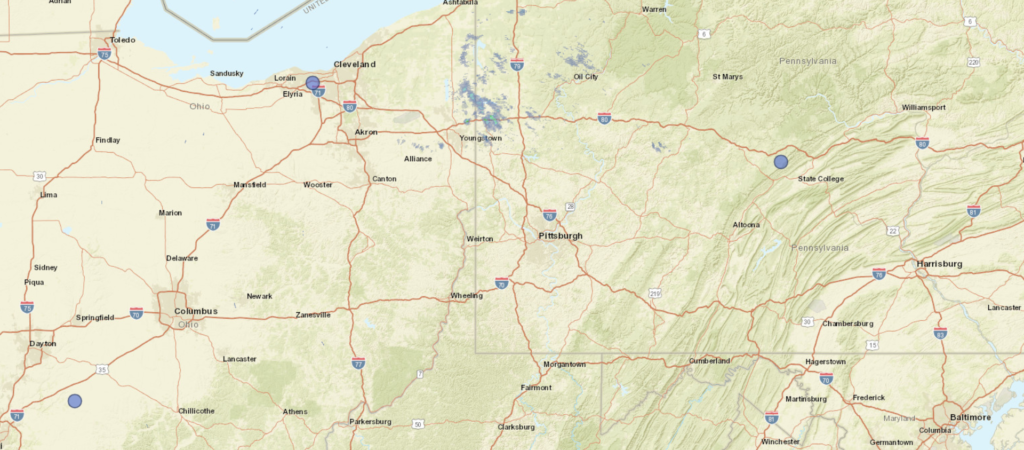
The start of the rain, and the persistence of the overcast to start the weekend are going to tell the tail of this forecast . A look at the current radar doesn’t really show a whole lot at the moment.

Napa, California

It’s below normal right now in the Upper Midwest, but also, surprisingly, the weather is cooler than average in the northwest, as far south as the Napa Valley. Finally, North Dakota and the North Bay have something in common.

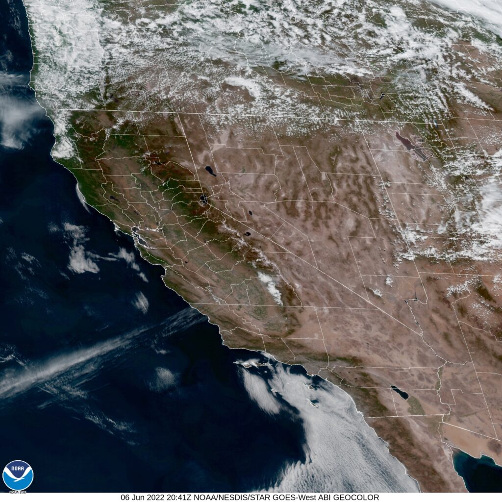
At 1254PM, PT, Napa was reporting a temperature of 78 degrees with clear skies. Temperatures were warm despite a fresh breeze of the San Pablo Bay. After a stretch of time with a broad trough positioned over the northwestern US, a short waved ridge is pressing inland over the west coast, helping to establish the sunny skies.
The next wave is already positioning in the Gulf of Alaska, with a mature area of low pressure marching towards the coast. The associated occluded and cold front will impact British Columbia and the American Pacific Northwest late on Tuesday, with some mid to high overcast streaking across Napa later in the day on Wednesday, but precipitation is unlikely.
Tomorrow – Mostly sunny, High 83, Low 50
Wednesday – increasing clouds, High 84, Low 55

TWC: Tomorrow – Partly cloudy skies. High 85, Low 51
Wednesday – Partly cloudy. High 87, Low 56

AW: Tomorrow – Mostly sunny and warm High 84, Low 51
Wednesday – Mostly sunny and warm High 86, Low 56

NWS: Tomorrow – Areas of fog before 8am. Otherwise, sunny High 85, Low 51
Wednesday – Mostly sunny, High 86, low 55

WB: Tomorrow – Sunny, High 81, Low 51
Wednesday – Partly cloudy, High 83, Low 56

WN: Tomorrow – Mostly sunny, High 85, Low 51
Wednesday – Mostly sunny, High 86, Low 55

FIO: Tomorrow – Partly cloudy throughout the day. High 81, Low 52
Wednesday – Mostly cloudy throughout the day. High 84, Low 59

A beautiful day for northern California, and the middle of the week seems delightful as well.

Coming Soon…

We’ve made it to June, and my favorite stretch of the year. We will feature quite a few forecasts coming up, so that is how I am spending summer vacation.

Johnstown, Pennsylvania
Road Trip from Napa, California to Johnstown, Pennsylvania

Shreveport, Louisiana

Grand Forks, North Dakota

Dubuque, Iowa
Road Trip from Saginaw, Michigan to Dubuque, Iowa

May forecaster of the Month

May was one of the busier months we have had in quite some time, so there were a lot of data points when trying to identify the top forecaster. Most of the really rough weather this year ended up falling in the north central US, which is definitely atypical, and we had some very bumpy forecasts along the way. One thing that is not entirely unheard of is a solid month of May from The Weather Channel, who alway seem to shine during the transitional seasons, and those times of year with the busiest weather. Congrats, TWC!

OutletForecast Wins (year)
National Weather Service4
Accuweather3.83
The Weather Channel3.83
Weatherbug3.33
Victoria-Weather2.66
WeatherNation2
Forecast.io0.33

Downplaying

Never sell the SPC short, I will stay that. In our forecast for Sioux Falls, there were only a couple of mentions of severe weather in the forecast last weekend, from ourselves and Accuweather. Meanwhile, Sioux Falls was included in the severe outlook both Saturday and Sunday, and it verified, or did awfully close to town. Saturday had hail, 2 inches in diameter just outside of town. No rain was actually reported in Sioux Falls, however, reflecting the isolated nature of the storms. Sunday was a soaker, with hail (though not as large) and strong winds around town. The low temperature forecasts were volatile, and the rain on Sunday ensured a colder day than expected, so the forecast didn’t turn out great for anyone. Weathernation sneaked in by accurately avoiding rain on Saturday and having a cool low on Sunday.
Actuals: Saturday – 92, Low 67
Sunday – .61 inches of rain, High 80, Low 61

Grade: C-D

Above average Atlantic, Below Average Pacific

Welcome to hurricane season, everyone! For the first time in quite a while, the Atlantic has managed to avoid having a named storm crop up before the season started, though nevertheless, a busier than normal season is expected this year.

Even as this post is written, the remnants of Tropical Storm Agatha are being monitored for redevelopment in the southern Gulf of Mexico. It would be an interesting way to kick off the season, but the more traditional means of tropical development are, as now, pretty quiet across the Atlantic.

That portends to activity picking up later in the season. Even though this is the beginning of the tropical season, historically the most active period in the Atlantic comes at the end of summer, when the oceans are at there warmest. If the season waits to start and gets busier as it goes on, that will lead to a rough August and September.

Despite Agatha’s emergence in the eastern Pacific, the NHC projects a quieter than average season in the central Pacific. This is particularly important for both Hawai’i and surfers who come looking for big swells around the islands. There aren’t many other land masses that stand to be impacted by tropical features in the middle of the ocean, and even in busy years, Hawai’i isn’t impacted with much frequency.

Of course, with any season, what we remember is the storms that make landfall. Most residents of the Caribbean would agree that the Atlantic can be as busy as it wants to be, just so long as the storms stay out to sea and leave their islands alone. A quiet season in the central Pacific means nothing if one rogue cyclone nails Honolulu.

One last note. The beginning of hurricane season is also the dawning of meteorological summer. We made it, everyone. Happy summer!

Can’t beat the heat

Nothing is quite like the Texas sun beating down on you. Our forecasts didn’t quite anticipate how hot that sun could get when we forecast for Tyler, a town that looked like it was going to be in the aftermath of a cold front for a couple of days. Warming was anticipated, though not quite to the degree it was actually seen. Temperatures topped 90 on Friday, which is just a little too warm for sane people, and several degrees higher than what forecasts called for. The Weather Channel nabbed the top spot for the day, staying warm throughout their forecast period.
Actuals: Thursday, High 88, Low 58
Friday – High 91, Low 62

Grade: C

Slow moving Agatha threatens Mexico.

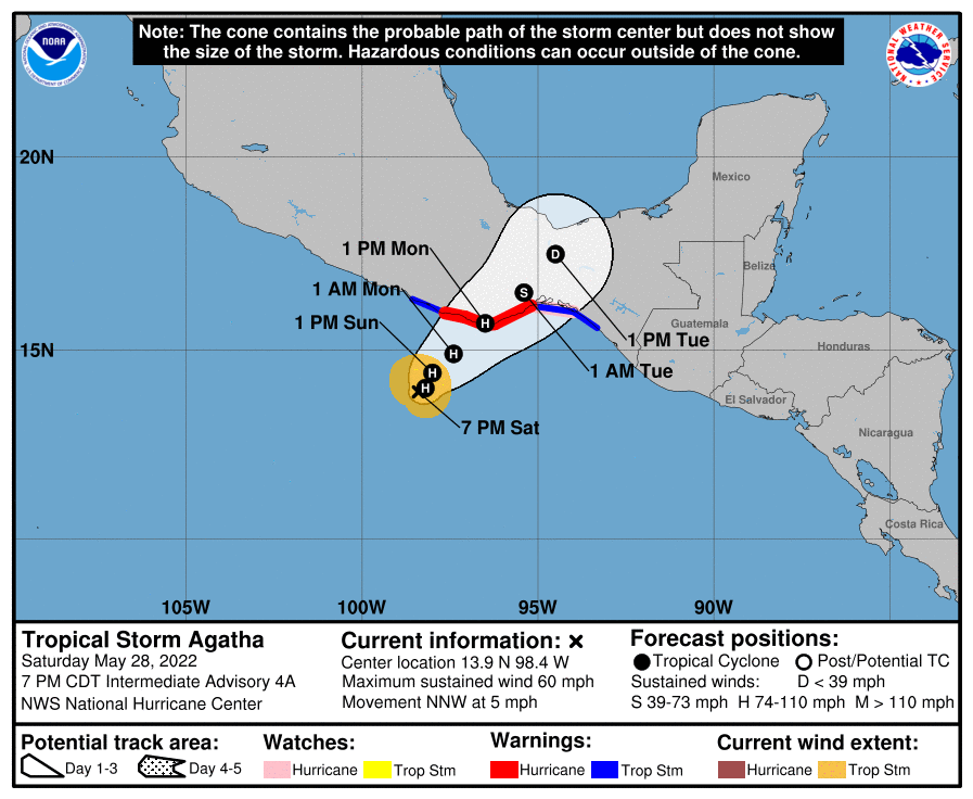
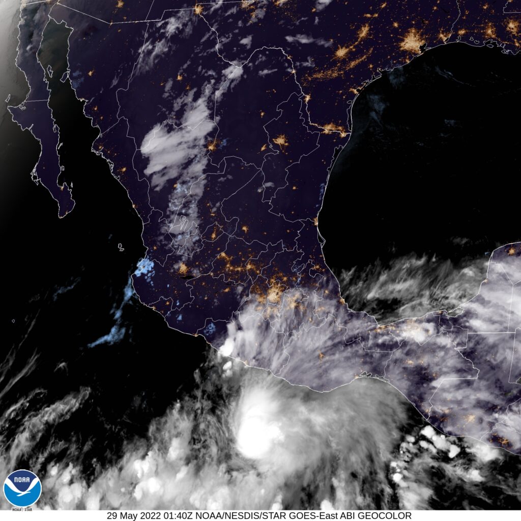
The Pacific hurricane season gets an earlier start than the Atlantic, historically, thanks to abeing a vast body of water that doesn’t see the same changes in temperatures the Atlantic can undergo. It’s not terribly surprising to see Tropical Storm Agatha lurking off the coast of Mexico, but what is surprising is that this feature is expected to back up into the Mexican coast.

Pacific storms tend to start in this area, but the tropical wave they gear up from tend to maintain some momentum, allowing them to shift off to sea. Agatha is nearly stationary, and looks as though she will begin to move poleward earlier than is typical in the Pacific, and back up into Oaxaca.

If there is any good news, it is that Agatha isn’t a large storm. She is expected to become a hurricane before making land fall, which means the wind will be stronger along the beaches of southern Mexico, but the breadth of territory affected by the associated heavy rain should be mitigated. Additionally, that Agatha has backed up and moved northeast fairly recently suggests that storm surge will not be a primary concern either.

Even so, it looks like the storm won’t landfall until Monday, and changes are always possible. Notably, a storm over warm waters always possess the ability to get stronger, though of course, we hope that doesn’t happen.

Sioux Falls, South Dakota

Sioux Falls was in the news most recently and on these pages for a massive dust storm that swept the city. Storms may be on the way, but perhaps not as vigorous as the ones seen earlier this month!

At 1256PM, CT, Sioux Falls was seeing clear skies and a temperature of 76 degrees. Warm temperatures were finally filtering back into the Upper Midwest after a cooler stretch to finish May. A broad but transient ridge was sliding through the region, but a similarly broad trough was moving into the Pacific Northwest, leading to cyclogenesis and clouds seen in the western Dakotas.
A rippling warm front will pass through the region overnight tonight, developing a few showers and thunderstorms in the area. A warm, muggier day is expected tomorrow, setting the stage for a few afternoon thunderstorms. The system will stall over the High Plains, with another round of wet weather tomorrow night, this time providing a threat of severe weather. The feature will begin to reorganize in the Colorado Plains, and will revitalize the system in the Dakotas. A connective cold front will light up in the evening on Sunday evening, setting a stage for the potential for straight line wind damage. Tonight, tomorrow and Sunday will have a threat of severe weather, with each of the three days featuring stronger weather with more precipitation likely.
Tomorrow – Isolated showers early, thunderstorms late, High 88, Low 64
Sunday – Strong storms possible late after a hot partly cloudy day, High 88, Low 67

TWC: Tomorrow – Sunny along with a few clouds. (Late storms) High 91, Low 62
Sunday -Overcast. A stray shower or thunderstorm is possible. High 86, Low 67

AW: Tomorrow – Partial sunshine; breezy in the morning, then becoming humid (late storms) High 90, Low 62
Sunday – Breezy with some sun returning; a severe afternoon t-storm; storms can bring downpours, large hail, damaging winds, and a tornado High 87, Low 67

NWS: Tomorrow – Mostly sunny (early rain, late storms), High 89, Low 62
Sunday – A slight chance of showers and thunderstorms before 7am, then a slight chance of showers and thunderstorms after 1pm. Mostly cloudy,  High 88, Low 66

WB: Tomorrow – Sunny (late storms) High 89, Low 63
Sunday – Mostly cloudy in the morning, then partly sunny with a slight chance of showers and thunderstorms in the afternoon, High 89, Low 68

WN: Tomorrow – Mostly sunny, High 89, Low 62
Sunday – Partly cloudy with light rain showers, High 87, Low 63

FIO: Tomorrow – Windy overnight. High 87, Low 61
Sunday – Overcast throughout the day. High 83, Low 68

The paucity of rain forecasts, despite an SPC outlook with a slight or enhanced risk tells you how isolated storms will be. Hopefully, everyone can get out and enjoy the long holiday weekend!