It’s been a cool stretch of rain soaked weather for a lot of the interior part of the country, from the Great Lakes to the Plains. Ah, but how we forget how warm it got at the end of last week. Kokomo saw temperatures that nearly hit 90 on Friday. In a bit of good news, forecasts were fairly competent across the board, leading to a three way tie between Victoria-Weather, Weatherbug and Forecast.io. WeatherNation would have been in good shape, had they not fat fingered the low forecast for Friday. Actuals: Thursday – High 81, Low 61 Friday – High 88, Low 66
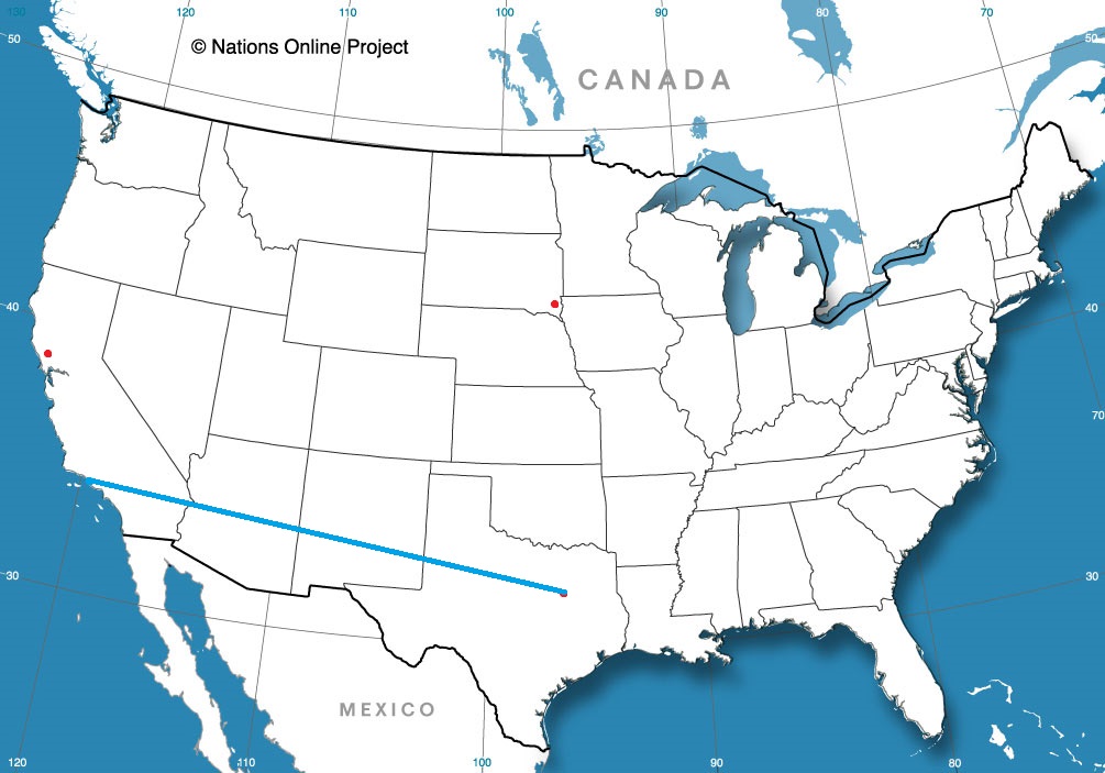
It seems as though any trip through California usually takes a full week, so I am delighted that our trip this weekend is only a 3 day trek across the desert southwest. The pace of the 1,597 mile journey will be about 68mph, owing in large part to I-10. This will give us almost 544 miles a day, with a slightly shorter day to end things on Sunday. Memorial Weekend is a good time for a road trip.
DAY ONE (Friday)
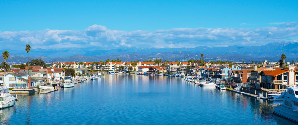
Oxnard, California
It’s fire season already in southern California. Despite copious snow and fairly persistent rain patterns through the winter, it wasn’t enough to break the drought that has plagued the southwest for a long time now. While there is a fire near Laguna Beach, the route through southern California will be free of fire, though pollution is a bit high in the LA Basin. The better threat for new fires under the dry high pressure will be in northern Arizona towards the 4 Corners. Despite the drought, day 1 looks good to Tucson.
DAY TWO (Saturday) Low pressure will start to develop in the High Plains of Colorado this weekend, which will likely fan the flames of the Black Fire in New Mexico, which will make the route from Deming, New Mexico to Pecos, Texas a little hazy. The fire may advance towards our route on Saturday, though it won’t come anywhere near it. The prevailing winds will only make life grayer, however. We will make it past Pecos to Pyote for the day.
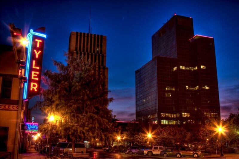
DAY THREE (Sunday) Low pressure is going to track to the northeast after developing in the Colorado prairies. It’s not going to be able to pull any moisture north, at least not enough that the atmosphere will destabilize in Texas, even as a weak cold front tries to move through. Eventually, it will turn into an inactive dry line west of Dallas-Fort Worth. This will pen any smoke from filtering eastward, but showers and storms are not in the forecast for the rest of the way to Tyler.
I am a man of science, which means that I am in constant search of evidence to support or challenge explanations of the way the world works. Study after study has shown that gun ownership merely provides the illusion of safety, but the presence actually puts households at greater risk. Empirically, guns are dangerous, and the tragedy in Uvalde yesterday underscores that again, but everyday, dozens of people die or are injured by guns, accidentally, purposefully or in self inflicted acts. Places where gun casualties do not occur are places where guns are not available. That is the only variable.
Now, to another part of Texas for the forecast.
At 1153AM, PM, Tyler was reporting cloudy skies with a temperature of 73 degrees. An active cold front brought severe weather to the Lone Star State yesterday, and was now east of the Mississippi. In the wake of the boundary, cooler temperatures and a brisk west wind prevail. A cut off low over the south central United States is responsible for the wet weather, so the clouds my linger, but the cold air will struggle to gain traction. Cooler air will continue to wrap into the Tyler region through tomorrow morning, leaving some overcast in the morning, but flow will level off on Friday, and early summer heat will build back into east Texas. The front that moved through yesterday will maintain a presence in the Gulf and along the east coast as the cut off low gets folded into the mean jet flow, and this will prevent humidity and storm chances from taking hold, even as heat returns. Tomorrow – Mostly cloudy, High 84, Low 55 Friday – Sunny and warmer, High 88, Low 59
TWC: Tomorrow – Mainly sunny. High 85, Low 58 Friday – Sunny skies. High 87, Low 57
AW: Tomorrow – Pleasant with plenty of sunshine High 84, Low 57 Friday – Pleasant with plenty of sunshine High 84, Low 58
NWS: Tomorrow – Sunny, High 84, Low 57 Friday – Sunny, High 84, Low 59
WB: Tomorrow – Mostly sunny, High 82, Low 57 Friday – Sunny, High 84, Low 58
WN: Tomorrow – Mostly sunny, High 84, Low 57 Friday – Sunny, High 84, Low 59
FIO: Tomorrow – Clear throughout the day. High 83, Low 55 Friday – Clear throughout the day. High 85, Low 58
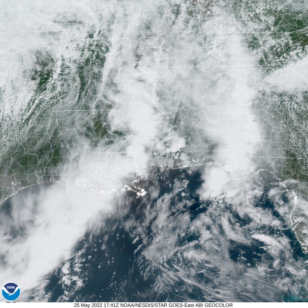
Here we see clouds most aggressively in the lower Mississippi Valley with that trailing band of overcast.
Strong storms and rain made for a pretty eventful week last week in the north central United States. If eventful doesn’t work for you, then perhaps Duluth is the right town for you. With forecasts in the low 70s on the 13th and showers and storms in the forecast, Lake Superior guffawed and sent low level moisture, fog and clouds into the city. Temperatures didn’t even get out of the 40s. As a result, the warm nights were not seen either, and the low temperature on the 14th, which ultimately did see sun and a return to the 70s, dipped to the 30s when low 50s were expected. It was a completely busted forecast, but Accuweather was the least terrible of a rotten forecast. Actuals: May 13th – .24 inches of rain, high 48, Low 41 May 14th – High 73, Low 39
Last week, a two day storm event brought rough weather first to the Twin Cities on Wednesday, followed by this howling, apocalyptic dust storm to Sioux Falls. There were tornadoes in Minnesota, South Dakota, Nebraska and Iowa, but the real show were a couple of bowing lines of thunderstorms that rolled through each town.
There was more severe weather on Thursday in the Upper Midwest and into the Great Lakes. Severe watches were out from Missouri to Kentucky, and also popped up from Minnesota into Wisconsin and Iowa. There was a particularly different feel to these storms than the ones last week, though, and much of it has to do with the orientation of the upper level pattern.
Last week, the upper level pattern featured a brisk south to north jet streak butting against a stout ridge in the east and situated on the eastern flank of the trough that was allowing the storm system to develop. One of the results was a very narrow opportunity for a warm sector of any consequence, but a lingering “warm front” boundary was the perfect environment for bowing lines and derechos, which is what we got, twice, last week.
This week, the system brought a wider warm sector, and was able to advance cold air. Initially, on Thursday, it lead to some significant hail, such as what I saw in downtown St. Paul Thursday afternoon.
As the storm moved on, the progressive low with access to warm moist air was a ripe environment for tornadoes, of which one struck Gaylord, Michigan. This storm was an EF-3 tornado, which is quite strong in general, but in particular for northern Michigan.
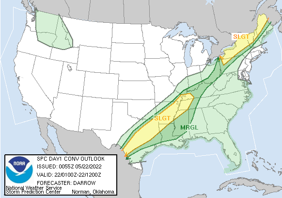
The wave, which again, because it was more open than the one from last week, has continued it’s course, and has allowed the parent area of low pressure into Canada. But again, because it is advancing, has brought cold air in on the back side. Even tonight, there is an ongoing threat of some severe weather thanks to a ranging cold front from the eastern Great Lakes to Texas.
Clashing air masses and strong jet streams are good environments for severe weather. Differing patterns and flows might lead to different results, but as the last couple of weeks have shown, they can all be dangerous.
Before I got the map for this trip, I wondered if it would take us through the Twin Cities or the Upper Peninsula, and it turns out, it was neither. It’s going to be a one day trip that takes us 627 miles and right through Chicago. The route through rural Wisconsin, followed by the decidedly not rural Chicago will slow us down to a 61mph pace, but that’s ok because we are getting it all done in one day.
Duluth, Minnesota
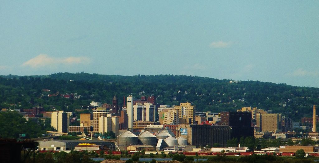
I found what might be the least attractive angle of Duluth I could, just because the intent is to leave this fine city for Indiana. We will be between systems as we set forth tomorrow, which makes for a much easier drive. A warm front lifting north ahead of the next feature coming eastward will touch off some late showers or convention (probably convection, frankly) in northern Wisconsin. We will likely steer clear of the wet weather before it initiates, and will only deal with a hot, stuffy traffic jam late in the afternoon in Chicago, before we trundle on in to Kokomo.
All right gang, we’re ready to head to another forecast destination. After a forecast in my current home state, how about one in my former residence?
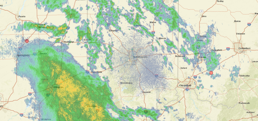
At 856AM, ET, Kokomo was reporting overcast skies with a temperature of 59 degrees. A deeply occluded system in the Upper Midwest was recentered over Iowa, and the slowly being digested warm front was shifting north through Indiana. The warm sector and copious rain was found in Illinois, but scattered showers were prevalent in the Hoosier State as well. The bundle of low pressure at the end of the occluded boundary will shift from Iowa through Indiana as the day progresses, eventually giving way to a quiet night. The passage of the system today will allow Kokomo a much more pleasant and significantly drier day on Thursday. A broad upper level trough moving into the northwestern US will give rise to a vast, vibrant area of low pressure in the northern High Plains late Thursday into Friday. Some rain showers are possibly as warm air surges northward on Friday morning, but more significant will be the line of thunderstorms expected to light up across northern Indiana on Friday night. The heaviest weather will be north and west of town, but some late, noisy, windy storms are expected before midnight. Tomorrow – Mostly cloudy, High 81, Low 58 Friday – Transient clouds, with chances for a bit of rain early and especially late. Humid. High 86, Low 65
TWC: Tomorrow – Partly cloudy skies. High 85, Low 58 Friday – Windy with a few clouds from time to time. High 88, Low 69
AW: Tomorrow – Warmer with times of sun and clouds High 82, Low 57 Friday – Breezy, very warm and humid with partial sunshine High 88, Low 70
NWS: Tomorrow – Mostly sunny, High 82, Low 56 Friday – A slight chance of showers and thunderstorms before 8am, then a slight chance of showers and thunderstorms after 2pm. Mostly sunny, High 87, Low 67
WB: Tomorrow – Warmer, Mostly sunny. High 81, Low 59 Friday – Breezy, Partly cloudy. A 20 percent chance of showers and thunderstorms in the afternoon. High 87, Low 69
WN: Tomorrow – Mostly sunny, High 82, Low 59 Friday 0 Partly cloudy with isolated thunderstorms, High 87, Low 56
FIO: Tomorrow – Partly cloudy throughout the day. High 84, Low 59 Friday – Windy in the morning. High 88, Low 69
Oh my, it seems as though someone at Weathernation slipped on the keyboard when assigning the Friday morning low. It really is 56 on their site. Now I don’t feel so bad going on the low side for my forecast! Look at all this rain coming for southern Indiana. The Ohio is going to be running pretty quickly!
I was shocked that after a long, healthy run, WeatherNation was on the fritz when we forecast for Spokane. I was even more shocked when I went to verify the forecast, and saw that I had left the Weather Service’s forecast off the post. Third, when verifying, I saw that our verification site uses a downtown site — as it should — rather than Spokane International Airport, which is to the west of town. Victoria-Weather would have at least secured a better forecast showing. Instead, it was The Weather Channel who locked up a victory of all sites that showed up. Actuals: Tuesday – High 59, Low 39 Friday – High 61, Low 37
Duluth is one of the most underrated cities out there, in terms of culture, activity and overall beauty. It’s a real treasure on Lake Superior, and frankly feels a little out of place in Minnesota.
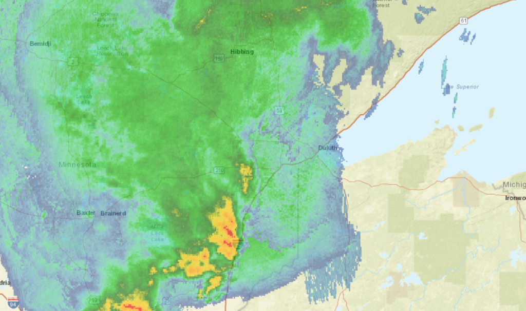
At 1155AM, CT, Duluth was reporting overcast skies with a temperature of 52 degrees, and rain. Much of northern Minnesota was caked in rainfall, thoruhg a line of thunderstorms from Moose Lake to St. Cloud was also progressing to the east. A perturbation along a rising warm front was more active, it seemed, than expected, but a warm up to the south and west of Duluth promised another ominous day of convection in Minnesota and the Dakotas. Short range models indicate a clearing later this afternoon, which would provide for a warmer afternoon. Additional strong thunderstorms will emerge in the Red River Valley in the early evening, but whatever comes from those will not reach Duluth until close to midnight. There is a threat for some gusts with these storms, but the real danger is on the other side of the state. The jet is north to south and will direct the parent low that direction. As a result, behind the front will be substantially warmer than a typical May cold front. This will lead to a bit more instability, and clouds are likely Friday, and a post frontal trough could bring a bit more rain on Saturday. Tomorrow – Partly to mostly cloudy. Rain and thunder before dawn, High 73, low 49 Saturday – Partly cloudy, chance of some afternoon rain, especially away from the Lake, High 71, low 50
TWC: Tomorrow – Intervals of clouds and sunshine (Early storms), High 65, low 45 Saturday – Sunshine and some clouds. A stray shower or thunderstorm is possible High 69, Low 51
AW: Tomorrow – Mild with clouds followed by a brightening sky (early storms)High 67, low 44 Saturday – Mostly sunny High 69, Low 51
NWS: Tomorrow – Mostly cloudy, then gradually becoming sunny (early storms) High 70, Low 49 Saturday – Sunny, High 70, Low 52
WB: Tomorrow – Mostly sunny (early storms(, High 70, low 47 Saturday – Sunny. A 20 percent chance of rain showers in the afternoon, High 69, low 52
WN: Tomorrow – Partly cloudy with light rain showers, high 70, low 49 Saturday – Mostly sunny, High 70, Low 51
FIO: Tomorrow – Foggy overnight and in the morning. High 73, low 45 Saturday – Partly cloudy throughout the day. High 69, Low 54
This is a lot of rain. Good news for fans of Gooseberry Falls, at least.