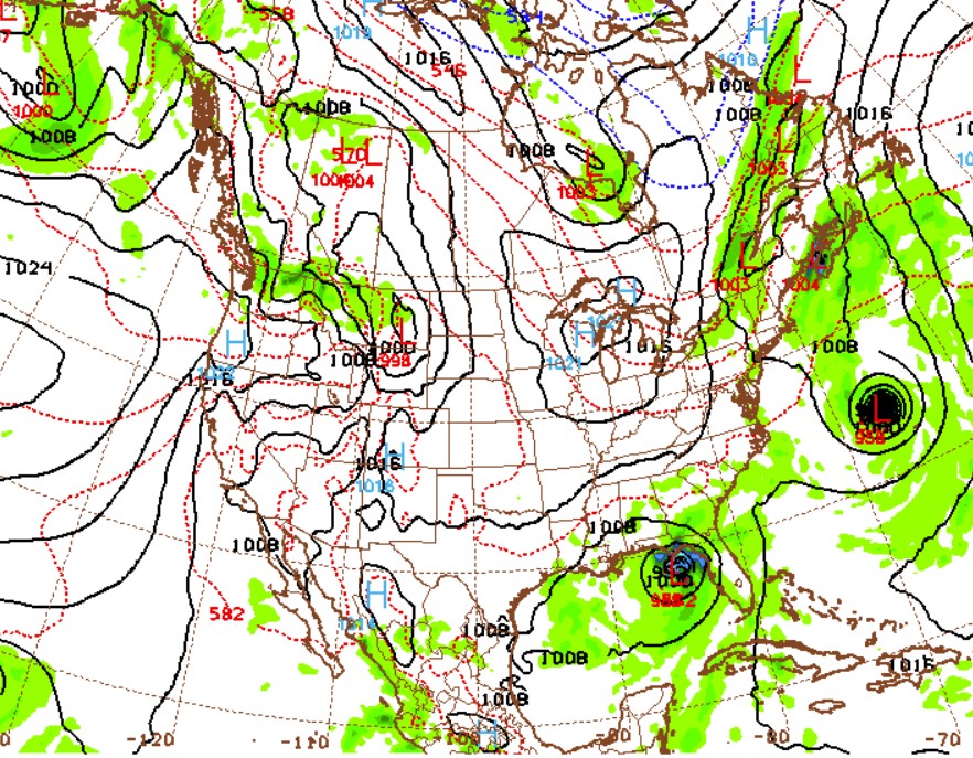
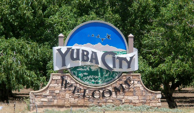
I famously am constantly in need of an editor, someone to review my spelling, and in some cases, such as two weeks ago when I put together a forecast for Yuba City, California, to make sure I made any sense. I suggested that diurnal convection might feel “left out” and bring shade to the town, and said that it is “night” that we are seeing clouds instead of smoke on the satellite this summer in California. I even spelled night correctly. I published the forecast after midnight, Victoria-Weather time, which was a big part of the problem, but despite all that, we managed to have the best numbers for Yuba City, tied with The Weather Channel. High pressure in the area provided the clear skies (and left those clouds out) needed to bump temperatures right on up to 106 on the 15th. Maybe I just need to start writing more in the middle of the night? Actuals: Monday, August 14th, High 100, Low 74 Tuesday, August 15th, High 106, Low 67
Danville is south of Chicago and snuggled up next to Indiana. The whole region is consumed by corn fields.
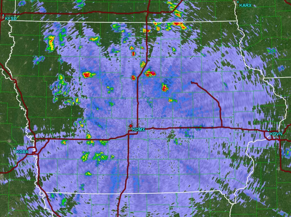
At 959PM, CT, Danville was reporting a temperature of 55 degrees with fair skies. Dew points were in the low 50s as well, and thanks to the looming harvest, the air around Danville was a bit moister, and will be prone to fog on clear nights such as today. High pressure is currently in place, while Idalia in the Carolinas had started to pull some cooler moisture from Canada towards the low, bringing some cooler air to Danville. Temperatures will remain a bit suppressed while a wave moves just north of the Canadian border. Even though the system is bringing severe weather to the northern High Plains tonight, it will leave northern Illinois dry. After this feature shifts on, temperatures in Danville will really start to climb, just in time for the holiday weekend. Tomorrow – Mostly sunny, High 79, Low 50 Friday – Sunny and warmer, High 85, Low 50
TWC: Tomorrow – Mainly sunny High 77, Low 49 Friday – Sunny skies High 83, Low 52
AW: Tomorrow – Plenty of sunshine; a nice end to August High 78, Low 49 Friday – Nice with plenty of sunshine High 85, Low 51
NWS: Tomorrow – Sunny High 78, Low 49 Friday – Sunny High 83, Low 51
WB: Tomorrow – Sunny High 76, Low 50 Friday – Sunny High 83, Low 53
WN: Tomorrow – Sunny High 78, Low 49 Friday – Sunny High 83, Low 52
CLI: Tomorrow – Clear, High 77, Low 50 Friday – Sunny, High 82, Low 52
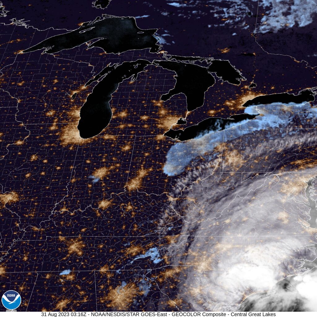
The GFS was much warmer than all other models for Danville, and nearly every outlett abandoned that guidance. The warmth is coming, just a matter of when. Here is the satellite, with Idalia in the southeast corner.
Idalia looks like she will make landfall tomorrow at about the spot that was expected before it even had a name. Initial model guidance wasn’t as aggressive on the storm’s intensification as the NHC was, so credit as always to the meteorologists, but here is the good news:
The Big Bend are of Florida is fairly sparsely populated. Storm surge, thanks to the geography of the region, will be quite high for Cedar Key north and westward, but there aren’t a lot of beachfront communities in the area. Not to say there aren’t any, but the most costly part of this storm will not be the surge, even though it will be impressive.
Instead, my biggest concern is the flash flooding that may come to places like Live Oak, Valdosta and Wenatchee. Sporadic tornadoes are also a big concern, as they usually are with landfalling hurricanes.
Idalia is a healthy storm, and will be memorable for those it impacts. The only reason this storm isn’t more fearsome is because it found the part of the Florida Coast that hasn’t been fully developed.
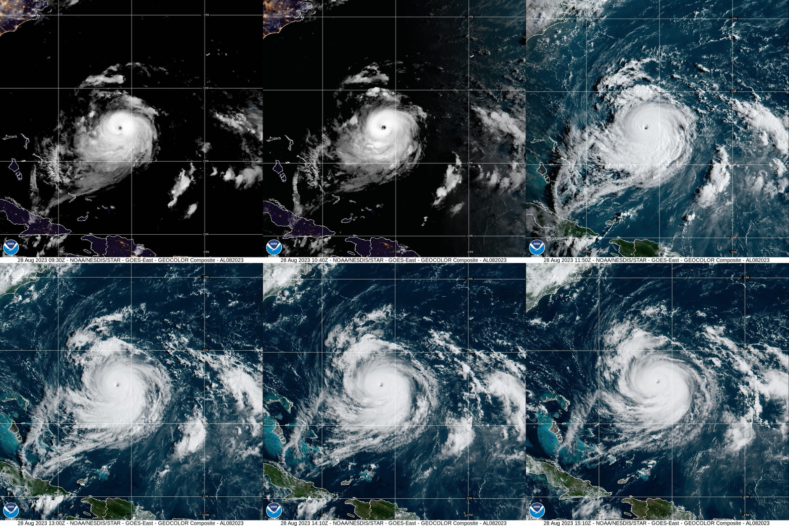
Franklin is a big beautiful storm, with a well developed eye that is mercifully spinning well away from most major interests, save for the air and sea interests of the North Atlantic. He is not getting much attention, because he isn’t going to make landfall anywhere, and will merely work to reroute aircraft and ships.
All that said, he is causing a trough in the mid-Atlantic to slow down, and the rain showers in the Virginias over the weekend dumped enough rain to cause some flash flooding over both states. As Franklin keeps moving, ultimately so will these showers. With luck, Idalia will also steer clear of the region.
Idalia has formed off the Yucatan. There aren’t any major changes vs. what we were looking at yesterday, save for a little bit of acceleration. Expect the storm to landfall on Wednesday south of Tallahassee as a strong tropical storm.
UPDATE 9pm – The latest forecast from the NHC has Idalia landfalling at a Category 2 level. That seems a little high to me, but ultimately, what is most important is that the storms projected landfall is at a pretty low density part of the state. Let’s hope that’s how it ends up.
UPDATE 1115PM – No big changes to Idalia, but the threat for for tropical weather will cut off the inflow to the Midwest. Things should be drier mid to late week in the Mississippi Valley
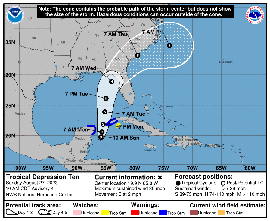
The first two tropical features to impact the US this year, Hilary and Howard, were well handled. Tropical Depression 10, which is presently hanging out on the coast of the Yucatan, near Cancun and Cozumel, is expected to organize and move slowly to the northeast. The time spent over the Gulf will allow the storm to become a low end hurricane before it moves into Apallachee Bay in the middle of next week,
Much remains to be seen. Fortunately, this isn’t expected to be a major hurricane, but any tropical storm presents it’s own problems.
Update, Sunday 1230 AM – One important factor for TD10’s impact on the States is that it is not forecast to move off shore fully intact, which means it won’t reemerge after the initial landfall. Heavy rain and isolated tornadoes are still going to be a possibility into the Carolinas through the end of next week.
When I plugged this trip into Google Maps, it defaulted to buses and trains. If you don’t want to partake in a 5 day cross country journey, then I guess I can’t blame you. That’s what Google wants too. We’ll cover 2806 miles at a pace of 68.4mph, with an 8 hour daily goal of 547 miles. It’s a good old fashioned road trip, an we can make good time, but only if we leave now.
DAY ONE (Thursday)
Yuba City, California
It’s pretty wild to think about it, but our drive on Thursday will take us from Yuba City to Wendover, Utah, through the wasteland of northern Nevada, and the region is presently between two tropical storms. Hilary was swept north of the region last week, and now the remnants of Tropical Storm Howard are moving into the 4 Corners. I wouldn’t be entirely surprised to see some clouds on the eastern and southern horizon when we reach Wendover and the home of the Bonneville Raceway, but the drive will stay dry.
DAY TWO (Friday) Howard is going to get hung up in the Rockies and lose his self among the seasonal monsoon. Wyoming will be rainier than one might expect, and we’ll dodge a few showers, maybe a rumble of thunder, as we trek through Wyoming on I-80. I would expect the heaviest rain will be west of Laramie, but we won’t get much further than the home of the University of Laramie, stopping west of Cheyenne at exit 348 as our day concludes.
DAY THREE (Saturday) High pressure in Canada is going to start sinking south, squashing out any life that Howard had. This will mean any lingering moisture will spread west to east along a cold front that is going to mostly be stationary through Saturday. Rain will be most likely early in the day, but there will be a chance for clouds and some isolated showers throughout the day as we make it to Avoca, Iowa, which is East of Omaha. As is all of Iowa, but this is pretty close to Omaha.
DAY FOUR (Sunday) All good things on Sunday! We’re going to finally start encountering some populated locations, including Chicago, but we’ll do it on the weekend, and one with good weather conditions at that. We’ll see a lot of sun, maybe a little bit of smoke in the atmosphere from the Canadian wildfires, but other than that, hakuna matata. We’ll reach Howe, Indiana for our destination for the day.
DAY FIVE (Monday) By the time Monday rolls around, all weather eyes will likely be out to see, where Franklin will be spinning between Bermuda and the Carolinas. The tail of the cold front we have been talking about will be working to kick Franklin to the sea, but for our own selfish purposes, it will be allowing dry conditions to enter Ohio and Pennsylvania as were traverse those two states to get to New Jersey.
The intrigue right now is out west, where many are still contending with the issues brought out by a landfalling tropical storm over a desert. As is Victoria-Weather custom, we will end up forecasting on the other side of the country.
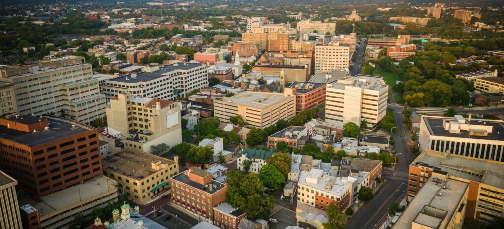
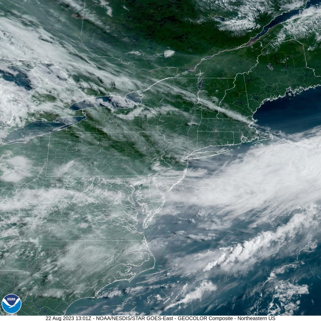
At 853AM, ET, Trenton was reporting clear skies and a temperature of 77 degrees. Fog was lifting in the valleys of eastern Pennsylvania, with clouds still lingering through the region, remnants of the moisture leading to the fog. High clouds indicated the jet running northwest to southeast through southern New England, with the moisture and heat in the Mid-Atlantic rising northeastward as a ridge builds from the Midwest. Because the jet is so strong, the burgeoning heat and humidity in the Plains will not be able to build northeast towards the Mid-Atlantic. Instead, as the jet begins to break down, expect a little bit more air mass mixing, with cooler temperatures aloft merging with the soupy air in the south, bringing an increase of clouds for Trenton with some cooler temps by Thursday. Tomorrow – Partly cloudy and warm, High 82, Low 60 Thursday – Mostly cloudy, High 78, Low 65
TWC: Tomorrow – Sunshine and clouds mixed. High 80, Low 60 Thursday – Showers in the morning, then cloudy in the afternoon. High 74, Low 64
AW: Tomorrow – Sunny to partly cloudy High 81, Low 59 Thursday – Mostly cloudy and cooler with a couple of showers High 74, Low 65
NWS: Tomorrow – Mostly sunny High 81, Low 58 Thursday – A chance of showers, with thunderstorms also possible after 5pm. Cloudy, High 77, Low 63
WB: Tomorrow – Mostly sunny, High 77, Low 62 Thursday – Cloudy with a 40 percent chance of showers, High 73, Low 67
WN: Tomorrow – Partly cloudy, High 81, Low 58 Thursday – Mostly cloudy with scattered showers, High 77, Low 63
CLI: Tomorrow – Partly cloudy, High 78, Low 60 Thursday – Overcast, High 74, Low 63
The satellite image has a smattering of clouds, but the real question is how much rain is really going to come with the breakdown of our ridge. I think most of it will remain in higher terrain, but clearly, I am in the minority.