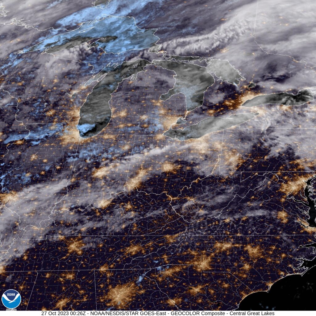
Temperatures in the early afternoon in Logan are in the upper 40s, should probably settle into the low 50s, just as we all suspected. But that wasn’t where the questions came up. We’ll see what the lows are like tomorrow morning. Dew points are in the mid 20s, which might affect how old it can get over night.
Logan, Utah
Winter is fast approaching, which is great news for members of the skiing and snowboarding community. The Wasatch are certainly poplar spots for that winter weather activity, but are we there yet?
At 951PM, MT, Logan was reporting a temperature of 29 degrees with clear skies and a light northwest wind behind a weak cool front that passed by earlier this morning. Clear skies prevailed across the Beehive State, with a ridge of high pressure nosing into the area from the west.
The jet structure is going to bubble around the Intermountain West, with a southern jet beginning to trough and engender some development in the Mexican Desert, while a ridge will only strengthen in the northern Plains. This will lead to some sustained stability, and late season warmth in Logan.
Tomorrow – Mostly sunny, High 51, Low 23
Sunday – Sunny, High 55, Low 20
TWC: Tomorrow – Sunshine and clouds mixed. High 51, Low 26
Sunday – Except for a few afternoon clouds, mainly sunny. High 56, Low 26
AW: Tomorrow – Mostly sunny High 49, Low 24
Sunday – Brilliant sunshine High 55, Low 21
NWS: Tomorrow – Sunny High 51, Low 26
Sunday – Sunny High 57, Low 29
WB: Tomorrow – Sunny, High 40, Low 29
Sunday – Sunny, High 48, Low 32
WN: Tomorrow – Mostly sunny, High 51, Low 27
Sunday – Mostly Sunny, High 57, Low 27
CLI: Tomorrow – Partly Cloudy, High 50, Low 25
Sunday – Partly Cloudy, High 54, Low 25
All right, here is my guess: The top three outlets and Clime updated their forecasts with the new model guidance already, and the NWS just hasn’t. Guidance clearly is showing a chilly Sunday morning, and it’s already busted on the warm side, so trending colder makes more sense. With this confusion, let’s check with a local perspective, from KSL in Salt Lake City.
A pattern is established
Back before Halloween, we issued a forecast in Cincinnati, in which we were ahead of a fairly active time. A failing cold front was on its way through town, and it did bring a bit of light rain. At the end of the period, we anticipated a warm front climbing to the northeast back into the Cincinnati area, which didn’t come to pass before the period was over. Well, don’t look now, but a warm front is rising through the Ohio Valley again. At least back in November, the clouds and rain will more sparse, allowing for a greater drop in temperature, which won’t be the same this time around. This lead to Victoria-Weather, forecasting cooler, winning the day.
Actuals: October 27th, .02 inches of rain, High 75, Low 62
October 28th, .-03 inches of rain, High 68, Low 54
Grade: B – C
Sherman, Texas
Our forecast takes us to the Red River Valley, northeast of the MetroPlex. The Thanksgiving Holiday is soon approaching, so I have to believe more of us are looking at the weather in even more places.
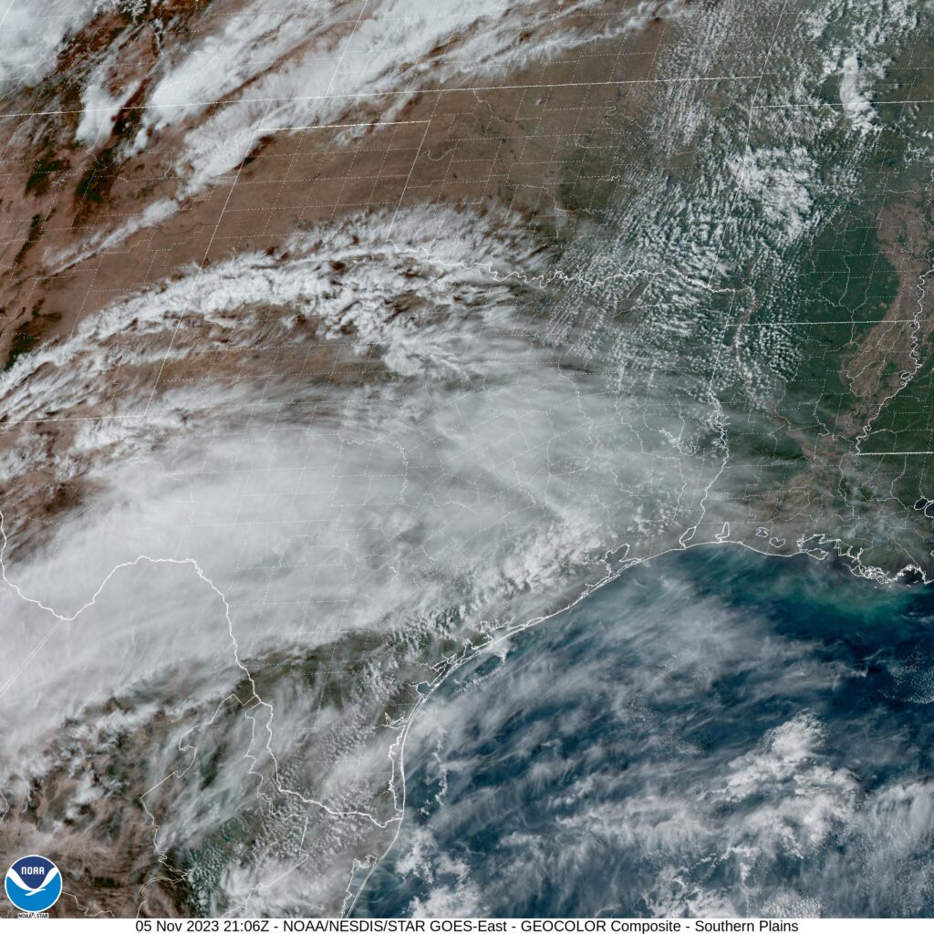
At 250pm, CT, Sherman was reporting a temperature of 81 degrees with clear skies. While there was a weak jet streak bringing high clouds to central Texas, the strongest flow aloft was well to the north. There was a strong wave of low pressure preparing to develop in the northern High Plains, which will act t draw flow from the south.
The strong jet to the north will usher the surface feature along while forming into a long waved, low amplitude ridge. This will provide stability to the region, and lead to some warmer air and sunny skies.
Tomorrow – Breezy partly cloudy, High 82, Low 61
Tuesday – Sunny, High 85, Low 62
TWC: Tomorrow – A mainly sunny sky, High 82, Low 61
Tuesday – A mainly sunny sky. High 82, Low 62
AW: Tomorrow – Mostly sunny, breezy and very warm; great day to be outside High 82, Low 61
Tuesday – Breezy and very warm with plenty of sunshine; dry weather for getting out to vote High 83, Low 62
NWS: Tomorrow – Sunny, High 79, Low 61
Tuesday – Sunny, High 82, Low 62
WB: Tomorrow – Mostly sunny, High 78, Low 62
Tuesday – Sunny, High 79, Low 63
WN: Tomorrow – Mostly sunny, High 79, Low 61
Tuesday – Mostly sunny, High 82, Low 62
CLI: Tomorrow – Sunny, High 82, Low 60
Tuesday – Sunny High 84, Low 62
A look at the satellite shows that jet streak I mentioned earlier. A look at Accuweather’s forecast shows a bit of editorial commentary suggesting that they had too much free time for this forecast.
Cold air damming in effect

Cold air damming is something that happens when warm air tries to build from the southwest, but it doesn’t spill east over the Appalachians (usually). This is why you are seeing temperatures in the mid to upper 50s through Kentucky, and it is only in the mid 40s in Charlotte and Greenville.
Ski season coming for the Cascades and Northern Rockies
There is an area of low pressure hanging out in the Gulf of Alaska that is sending successive rounds of moisture into the Pacific Northwest. It isn’t a strong system and is really only notable because of the time of year it is arriving. It is the first real snow storm for the northern Rockies and Cascades, and will be persistent and cold enough to bring lasting snow.

An odd observation
We all know about the urban heat island. Typically, city center or airport observation points are the warmest local point in an area. Not Cincinnati! The airport in Covington (KCVG) is the low point around southeast Ohio.

Cincinnati, Ohio to Hickory, North Carolina
We’re off on a fairly short trip, that somehow still covers 4 states. It will take 6 1/2 days to cover 439 miles, which equates to a pace of about 67.4mph, which is impressive, given the mountainous terrain we will cover through much of our journey. Thanks, freeways.

There is a mess of instability in the north Atlantic, and it is extending a few memories into the eastern US. By tomorrow morning, we will see a trough in the Great Lakes and a band on the Atlantic side of the Appalachians, from Virginia to South Carolina. The trough in the Great Lakes is going to leave us alone, though it will be breezy for most of our drive, until about Knoxville. A tropical wave near the Bahamas is going to leak to the north and inflame that rain in the coastal plains. It often seems like it is raining between Knoxville and Asheville. Lean more towards the Asheville side this time, and anticipate a shower or two in Hickory when we role in.

Bring a coat!
Temperatures were expected to be on cool side in the afternoon in Olympia, thanks to a couple of waves pumping through the Pacific Northwest. The biggest surprise of the whole deal was that temperatures last Sunday started to plummet on the evening. Temperatures were significantly cooler than expected on Sunday, which really made scores look worse than they may actually have been. WeatherNation was able to sneak in for a victory, but scores were all pretty close.
Actuals: Sunday, .01 inches of rain, High 59, Low 44
Monday – High 55, Low 45
Grade: C
Cincinnati, Ohio
There are a lot of quirks about Cincinnati. First, the airport is actually across the Ohio River in Kentucky. Next, the radar terminal for the area is actually to the north, in Wilmington, because the WFO there services Columbus, Dayton and Springfield, as well. It begs the question: what exactly IS Cincinnati?
At 352PM, ET, Cincinnati was reporting a temperature of 74 degrees with mostly cloudy skies. The clouds were patchy or much of the tri-state region, with clearer skies at other nearby sites. Low pressure over the northern Plains is entangled with some tropical energy from the south and drenching the western Great Lakes. The two bits of energy are also attached to parallel jet streaks, which are boosting the energy but hampering the mobility of the feature.
The leading band of rain is diminishing over Indiana and northwest Ohio tonight, and will wear itself out
through the morning hours tomorrow. The trailing cold front will be dragged into the region later in the day Friday, arriving in the predawn on Saturday. By this point, low pressure will be developing over the central Rockies, with a warm front rising towards the Ohio Valley by the late evening, bringing a chance for steadier rain to the region after a cooler day beforehand.
Tomorrow – Cloudy with scattered showers, High 74, Low 63
Saturday – Overcast with light rain early, cooler, and more rain late, High 67, Low 57 (Non standard)
TWC: Tomorrow – Showers in the morning, then cloudy in the afternoon. High 76, Low 64
Saturday – Cloudy. Periods of rain early. High 66, Low 60
AW: Tomorrow – Breezy and warm with periods of clouds and sunshine High 76, Low 64
Saturday – Variably cloudy with a thunderstorm High 68, Low 59
NWS: Tomorrow – A chance of rain before 2pm, then a chance of rain and thunderstorms between 2pm and 5pm, then a chance of rain after 5pm. Partly sunny High 77, Low 65
Saturday – A chance of rain. Cloudy High 67, Low 60
WB: Mostly cloudy with a chance of rain, High 72, Low 66
Saturday – Cloudy with a chance of rain, High 65, Low 59
WN: Tomorrow – Partly cloudy with scattered showers and isolated thunderstorms, High 77, Low 65
Saturday – Mostly cloudy with isolated storms, High 67, Low 60
CLI: Tomorrow – Rain showers, High 76, Low 61
Saturday – Thunderstorm, High 66, Low 58
It will be particularly interesting to keep an eye on the temperature trendline for Saturday. Post cold front to overcast to warm front, it could go a lot of different directions.