A large area of low pressure moving through your area is usually a recipe for a botched forecast. That wasn’t the case at the beginning of last week in Hickory, where as we issued the forecast, the western North Carolina town was at the beginning of what would be 7/10ths of an inch of rain. Despite that, forecasts for the two days were collectively very good. Maybe because the rain was over well before noon on Monday. Accuweather and the Weather Service tied for the top forecast. Actuals: Monday – .7 inches of rain, High 68, Low 49 Tuesday – High 73, Low 45
At 854PM, CT, Des Moines was reporting a temperature of 58 degrees with clear skies. There was certainly a warm front just to the west, as even at this hour, Lincoln, Nebraska was sitting in the low 70s. Low pressure further to the south was intercepting any moisture, so the warm air will lift into Des Moines overnight without much impact. The southern low will shift eastward and remain south of of the Hawkeye State. Some moisture folded into the feature will wrap back to the north during the day tomorrow and lead to overcast skies at times with some light drizzle. The feature will shift further east overnight Wednesday into Thursday, with dryer air building in for a sunny day on Thursday, though late in the day, another trough will begin to drift in from the west. This will be weaker, but with better access to moisture for the Des Moines area than the two features previously, and some late rain or thunder are possible Thursday night. Tomorrow – Mostly cloudy to overcast, with a chance for drizzle. High 76, Low 48 Thursday – Very early and very late rain possible, but sunny during the day, High 68, Low 50
TWC: Tomorrow – Partly cloudy with afternoon showers or thunderstorms High 76, Low 51 Thursday – A few passing clouds, otherwise generally sunny High 70, Low 48
AW: Tomorrow – Some sun, then turning cloudy, breezy and warmer (Late rain) High 74, Low 50 Thursday – Some sun, then turning cloudy, breezy and warmer High 70, Low 50
NWS: Tomorrow – A 40 percent chance of showers and thunderstorms, mainly after 3pm. Partly sunny, High 76, Low 49 Thursday – Mostly sunny (Late rain) High 70, Low 49
WB: Tomorrow – Partly sunny with a 40 percent chance of thunderstorms. Warmer. High 71, Low 50 Thursday – Mostly sunny (thunderstorms early and late) High 69, Low 51
WN: Tomorrow – Partly cloudy with scattered storms, High 76, Low 49 Thursday – Partly cloudy, High 70, Low 49
FIO: Tomorrow – Partly cloudy throughout the day. High 76, Low 51 Thursday – Partly cloudy throughout the day. High 73, Low 51
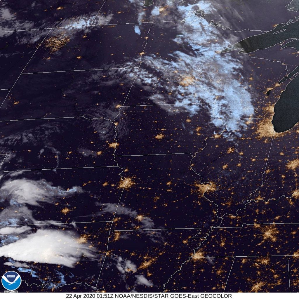
Here is the night’s satellite, showing Iowa to be nice and clear tonight.
In the coming days, our forecast trajectory will take us into the mid-Atlantic and southern New England. We will also be sure to take care to discuss the ongoing spring severe season, which we will be reminded of, undoubtedly, in the next few weeks.
Barnstable, Massachusetts Road Trip from Washington, DC to Barnstable
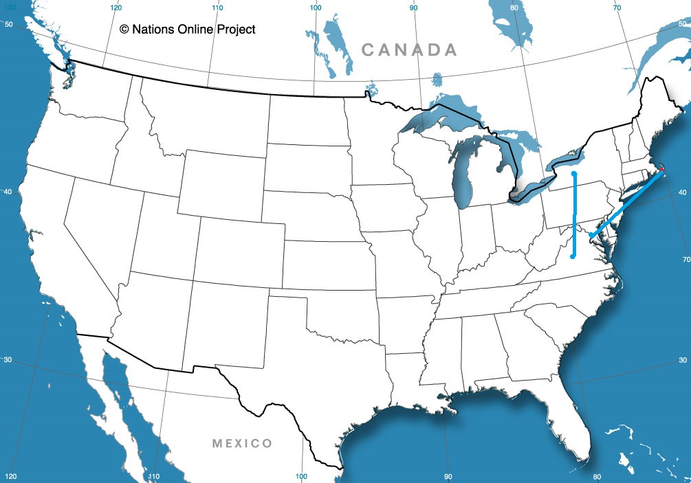
Road Trip from Rochester, New York to Charlottesville, Virginia
I-40 runs all the way from North Carolina to California, and yet we will spend the first part of this trip getting up to I-80. The drive will be a 5 day excursion that covers 2,635 miles. Our 5 days will be evenly spaced at 527 miles a day. or rather just short of 66mph. We have some ground to cover, so we should probably get a move on.
Hickory, North Carolina
DAY ONE (Tuesday) A weak tail of a cold front will be sweeping through the Appalachians overnight tonight. Could there be a little bit of mountain snow in the Appalachians. It will probably be only rain along our route through the mountains, as it will likely only be possible on the west side of the hills. Rain might be a possibility all the way to Crossville, but expect cool and dry air to move in by the late afternoon as we touch two more states, Kentucky and Illinois, where we will stop in Vienna, in far southern Illinois.
DAY TWO (Wednesday) A little bullet of low pressure is going to arise in the southern Plains and move through the central US. The warm front will be a traditional stratiform rain maker, just like we want to see in the spring and summer months. That is to say, no severe weather and no snow. We’ll be in the rain for most of the time spent in Missouri. Rain will lighten north of about St. Joseph but there will certainly be some lingering sprinkle activity north to Nebraska City, along the Iowa/Nebrasla state line.
DAY THREE (Thursday) The weather will become more congested as we head west. Nebraska looks like it will be pretty OK as we move along I-80, but don’t be surprised if an emerging feature brings some light ran to our drive after we pass into Wyoming. We’ll make it to Turtle Rock in the midst of a National Forest between Cheyenne and Laramie.
DAY FOUR (Friday) Some atmospheric troughing will continue over the Wyoming Rockies, and a splash of rain with maybe *MAYBE* some snow in the peaks will accompany our trip along I-80 in Wyoming. Utah will be a different story as the Great Basin will be bathed in sunlight. It will work out just so that our day will end in West Wendover, Nevada, right along the UTah border.
DAY FIVE (Saturday) What better way to finish a long week of driving than with a bright, sunny drive without the threat for inclement weather. Truckee and Lake Tahoe can be a bear when the weather is active, especially this time of year, and we just won’t have anything to really worry about. Sunscreen, maybe, if you want to go out while you are in town.
We’ve been worried so much about what has been going on in the southeast lately, we haven’t even looked out west for a while. What is, exactly, going on in the West Coast?
At 1053AM, PT, Sacramento was reporting overcast skies and a temperature of 58 degrees. A weak perturbation in the upper atmosphere is generating clouds over California, including some precipitation in he higher terrain, but there isn’t much support coming behind this feature. Clouds may take time clearing out, but a significant cool down and precipitation are not expected. More concerted ridging will move into the area by midday tomorrow, rendering Tuesday a clearer and warmer day for the Capitol. There should still be some ambient cloud cover through the area on Wednesday, as a north to south jet will continue weakly along the Nevada-Utah border, and will likely provide, at the very least, some clouds on the eastern horizon for Sacramento Tomorrow – Mostly cloudy but clearing High 75, Low 47 Wednesday – Partly cloudy, High 80, Low 49
TWC: Tomorrow – Mainly sunny. High 78, Low 47 Wednesday – Partly cloudy. High 82, Low 78
AW: Tomorrow – Partly sunny, pleasant and warmer High 77, Low 46 Wednesday – Beautiful with a blend of sun and clouds High 82, Low 49
NWS: Tomorrow – Sunny High 78, Low 47 Wednesday – Mostly sunny, High 83, Low 51
WB: Tomorrow – Mostly sunny, High 78, Low 47 Wednesday – Mostly sunny in the morning then becoming partly cloudy, High 81, Low 51
WN: Tomorrow – Mostly sunny, High 78, Low 47 Wednesday – Partly cloudy, High 83, Low 51
FIO: Tomorrow – Clear throughout the day. High 78, Low 48 Wednesday – Clear throughout the day. High 84, Low 53
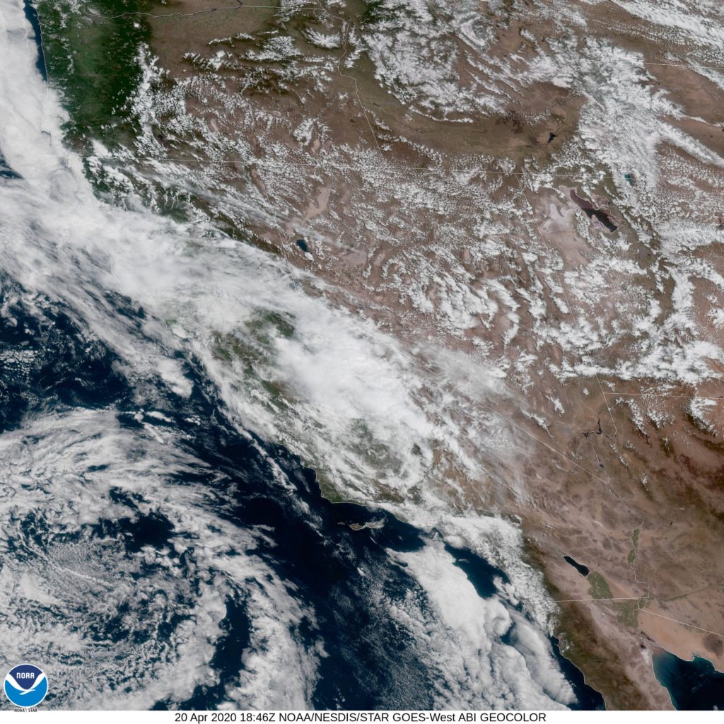
V-W is a bigger believer in the threat for cloud cover. Below, take a look at how robust it is this morning. You can’t even make out the coast yet today.
A day after a tornado struck Monroe, Louisiana, and a few days before another round of severe weather swept through northern Louisiana, there was a respite. Temperatures were cool for this part of the world, especially in the spring, with highs never pulling out of the mid-70s and lows even dipping below 40 on Thursday morning. Forecasts were generally pretty good, but this was a fairly simple forecast. A benign forecast for benign weather when that is just what everyone needed. The Weather Channel and Accuweather had the top marks. Actuals: Wednesday, High 64, Low 40 Thursday – High 74, Low 39
It’s interesting that Hickory, NC is clearly the largest Hickory in the world, but the most famous is one in Indiana that doesn’t even exist.
At 1153PM, ET, Hickory was reporting a temperature of 55 degrees with overcast skies. There were a few sprinkles around town, which was simply a the leading edge of what will be a rainy overnight. The heaviest rain still resided in South Carolina, but it was moving into the Tar Heel State. A strong area of low pressure has brought another day of heavy weather to the southeastern US, but will be pressed east and offshore before any of the worst of the weather can reach Hickory. The center of low pressure is going to move towards the Carolina coast on its trek northeastward, with moist air advecting back to the west on the back and north end of the low. This will likely enhance the threat for precipitation through Monday morning, at least. The jet stream is running in parallel right now, and a trailing, still strong but less active system is traversing the Canadian Prairies. After Monday dries out, the second system will swing a cold front through the area that will help make things breezy, with a bit of a cool down Tuesday evening. Tomorrow – Rain through the morning, then improving, High 68, Low 51 Tuesday – Partly cloudy, with increasing clouds late, High 71, Low 48
TWC: Tomorrow – Rain early. Decreasing clouds with mostly sunny skies by afternoon. High 70, Low 49 Tuesday – Sunny. High 70, Low 46
AW: Tomorrow – Periods of rain in the morning, then clouds giving way to some sun in the afternoon High 69, Low 50 Tuesday – Sunny to partly cloudy, breezy and pleasant High 72, Low 45
NWS: Tomorrow – Occasional showers, mainly before 11am. Patchy fog before 10am. High 68, Low 49 Tuesday – Sunny,High 71, Low 46
WB: Tomorrow – Patchy fog in the morning. Cloudy with showers in the morning then mostly sunny with a chance of showers in the afternoon, High 68, Low 51 Tuesday – Sunny breezy with highs in the lower 70s, High 69, Low 48
WN: Tomorrow – Partly cloudy with showers, High 68, Low 50 Tuesday – Mostly sunny, High 71, Low 46
FIO: Tomorrow – Light rain overnight and in the morning. High 69, Low 48 Tuesday – Clear throughout the day. High 70, Low 45
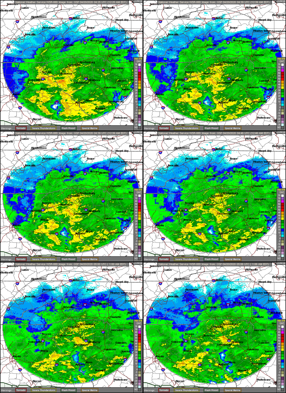
There wasn’t rain before we started this forecast, but there is now, in Hickory. Looking at the radar, though, I think you can see that it was inevitable.
Last Monday, we issued a forecast for Jacksonville, that took us through the middle of the week. Some other stuff has happened weatherwise since then. In Jacksonville, an aggressive surge of warm air indicated just what was available for the severe weather that was to come a few days later. Temperatures were, as a result, a bit warmer than most had on their forecast board. Weatherbug had two perfect forecasts, and hung tough thanks to their low temperature forecasts, and snagged the top forecast before all the weather went to hell not far from there. Actuals: Tuesday – High 85, Low 68 Wednesday – .11 inches of rain, High 89, Low 68
We have a short, less than 6 hour drive today, covering 368 miles at a pace of about 63 miles. Even though this is a narrow stretch of the road, it is also exactly the most ravaged part of the south from the Easter tornado outbreaks. We will pass through Collins, which was just north of the 2 mile wide, long track twister that struck Bassfield, and clipped by another mile wide twister on the north side of town. It was a bruising day, that the Jackson WFO is still assessing.
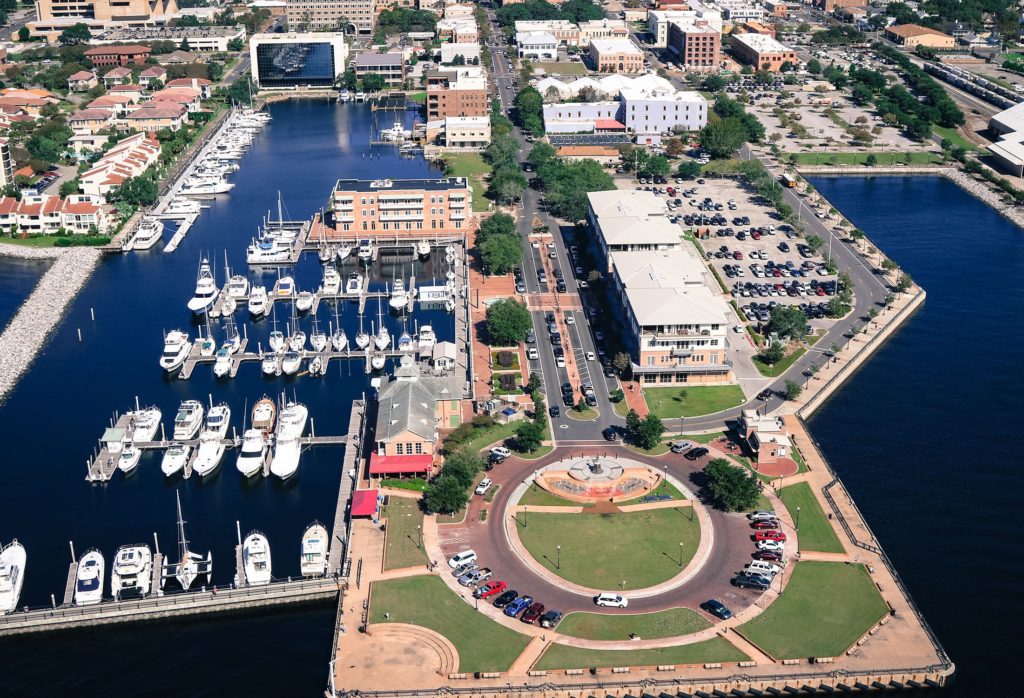
Pensacola, Florida
The southeast currently finds itself in a pretty good respite, as the severe weather from Sunday is now a few days behind us, and dry weather has invaded. It’s warm and comfortably dry, though on Friday during the drive, expect the Lower Mississippi Valley to get increasingly humid as a weak cold front sinks southward and draws Gulf moisture north. This will mean increasing cloud cover as well, ahead of some rain that might enter the picture over the weekend in Monroe.
Monroe was one of the first places impacted by the Easter Sunday tornado outbreak in the southern US. Monroe saw damage at the airport, and hundreds of homes and buildings in the area. Fortunately, it looks like we will be getting some more tolerable weather through the middle of the week. Let’s see if I can prove that.
At 1253PM, CT, Monroe was reporting a temperature of 59 degrees with a north wind and mostly sunny skies. There were a few stray clouds to the west, from El Dorado, Arkansas to Ruston and Shreveport, but Monroe was in a sunny streak of the atmosphere. The north wind trailed a still active cold front that stretched from north Florida to the Gulf of Mexico, while the band of clouds atop northern Louisiana was associated with a much weaker trough wrapping into the same area of low pressure as the front. That low was heading towards Ellesmere Island, which should give an indication of how strong it’s influence is. The parent jet trough is winterlike in it’s strength. The trough is broad and encompassing, but its momentum is carrying it eastward at a pace that doesn’t reflect how weak the flow is behind it, especially given how broad the trough is. With cold air pressing eastward, there doesn’t seem to be much poleward motion, and Monroe looks to be ensconced in cool dry air for the middle of the week. Tomorrow – Partly cloudy, High 65, Low 37 Thursday – Mostly sunny, High 70, Low 40
TWC: Tomorrow – Sunny skies, High 65, Low 40 Thursday – Mainly sunny, High 73, Low 41
AW: Tomorrow – Mostly sunny, High 64, Low 38 Thursday – Mostly sunny and pleasant, High 72, Low 39
NWS: Tomorrow – Patchy frost before 8am. Otherwise, sunny, High 66, Low 37 Thursday – Sunny, High 73, Low 40
WB: Tomorrow – Areas of frost through mid-morning. Mostly sunny. High 63, low 40 Thursday – Sunny, High 70, Low 43
WN: Tomorrow – Partly cloudy with areas of frost, High 66, Low 37 Thursday – Sunny, High 73, Low 40
FIO: Tomorrow – Clear throughout the day. High 65, Low 37 Thursday – Clear throughout the day. High 72, Low 39
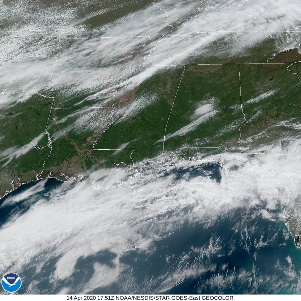
That should be very comfortable. Even if you are out of power in Monroe, first off, thank you for using your mobile device to check Victoria-Weather, and second, I am happy to hear that you will not have to contend with heat without air conditioning. See the banding of clouds over the southeast, below.