We have a short, less than 6 hour drive today, covering 368 miles at a pace of about 63 miles. Even though this is a narrow stretch of the road, it is also exactly the most ravaged part of the south from the Easter tornado outbreaks. We will pass through Collins, which was just north of the 2 mile wide, long track twister that struck Bassfield, and clipped by another mile wide twister on the north side of town. It was a bruising day, that the Jackson WFO is still assessing.
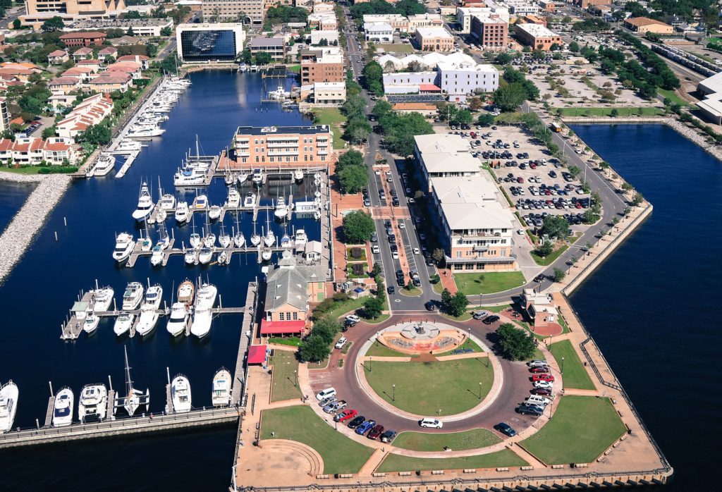
Pensacola, Florida
The southeast currently finds itself in a pretty good respite, as the severe weather from Sunday is now a few days behind us, and dry weather has invaded. It’s warm and comfortably dry, though on Friday during the drive, expect the Lower Mississippi Valley to get increasingly humid as a weak cold front sinks southward and draws Gulf moisture north. This will mean increasing cloud cover as well, ahead of some rain that might enter the picture over the weekend in Monroe.
Monroe was one of the first places impacted by the Easter Sunday tornado outbreak in the southern US. Monroe saw damage at the airport, and hundreds of homes and buildings in the area. Fortunately, it looks like we will be getting some more tolerable weather through the middle of the week. Let’s see if I can prove that.
At 1253PM, CT, Monroe was reporting a temperature of 59 degrees with a north wind and mostly sunny skies. There were a few stray clouds to the west, from El Dorado, Arkansas to Ruston and Shreveport, but Monroe was in a sunny streak of the atmosphere. The north wind trailed a still active cold front that stretched from north Florida to the Gulf of Mexico, while the band of clouds atop northern Louisiana was associated with a much weaker trough wrapping into the same area of low pressure as the front. That low was heading towards Ellesmere Island, which should give an indication of how strong it’s influence is. The parent jet trough is winterlike in it’s strength. The trough is broad and encompassing, but its momentum is carrying it eastward at a pace that doesn’t reflect how weak the flow is behind it, especially given how broad the trough is. With cold air pressing eastward, there doesn’t seem to be much poleward motion, and Monroe looks to be ensconced in cool dry air for the middle of the week. Tomorrow – Partly cloudy, High 65, Low 37 Thursday – Mostly sunny, High 70, Low 40
TWC: Tomorrow – Sunny skies, High 65, Low 40 Thursday – Mainly sunny, High 73, Low 41
AW: Tomorrow – Mostly sunny, High 64, Low 38 Thursday – Mostly sunny and pleasant, High 72, Low 39
NWS: Tomorrow – Patchy frost before 8am. Otherwise, sunny, High 66, Low 37 Thursday – Sunny, High 73, Low 40
WB: Tomorrow – Areas of frost through mid-morning. Mostly sunny. High 63, low 40 Thursday – Sunny, High 70, Low 43
WN: Tomorrow – Partly cloudy with areas of frost, High 66, Low 37 Thursday – Sunny, High 73, Low 40
FIO: Tomorrow – Clear throughout the day. High 65, Low 37 Thursday – Clear throughout the day. High 72, Low 39
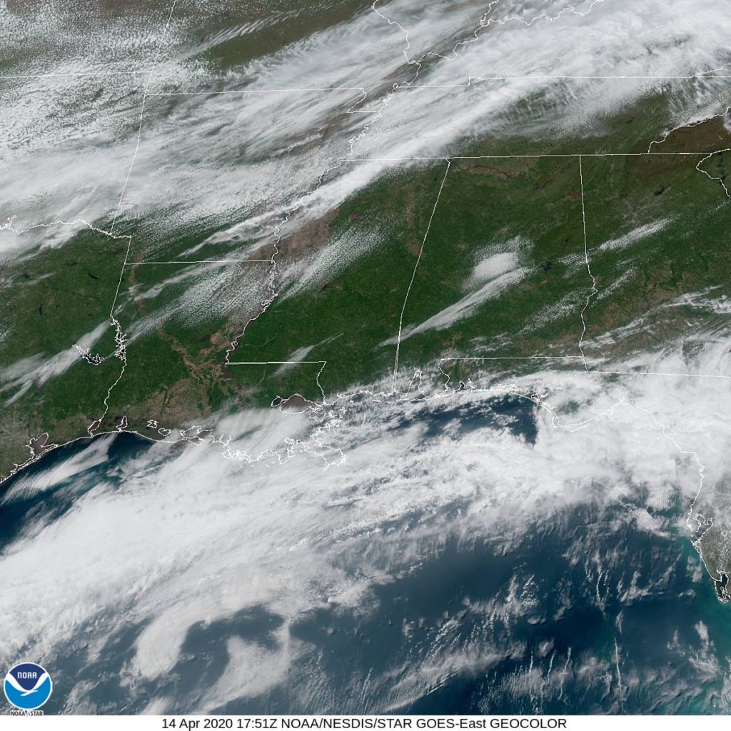
That should be very comfortable. Even if you are out of power in Monroe, first off, thank you for using your mobile device to check Victoria-Weather, and second, I am happy to hear that you will not have to contend with heat without air conditioning. See the banding of clouds over the southeast, below.
We looked at the Yakima Valley last week, and I warned that the forecast might be challenging. That was indeed what came to pass. The weather wasn’t really remarkable in Yakima, but it was several degrees warmer in the afternoons than most forecasts, but substantially cooler in the mornings. One outlet let their wings, and their forecast temperature deltas spread, and Accuweather took the top spot on a forecast several outlets would be happy to forget. Actuals: Monday – High 66, Low 28 Tuesday – High 72, Low 33
Happy Easter everyone! I have to, before we get started, tell you all that tomorrow looks like a very dangerous day along the Gulf Coast. This might be the storm system that 2020 is remembered for, as it bears a strong resemblance to storms that have lead to devastation in Alabama and Mississippi in the past. We’re all at home, so be sure to listen to your local weather persons for guidance as weather gets dangerous.
We didn’t have that many individual forecasts last month during the course of the month, but for those that we did, there was a clear winner: The Weather Channel. The Weather Channel parlayed their win in March to a comfortable lead for the year, a quarter of the way through.
Lets look at the total wins for the month, and for the year.
Guess what? It was my birthday last weekend (Sunday, to be specific) which fell over the verification period for Yuma. To be concise, there was absolutely no effort to facilitate a forecast victory for me this past weekend in Arizona. The low temperature decided to drop much lower than I had in the forecast last Saturday (though I will admit, it was well managed by our competitors) and other outlets, The Weather Channel in particular, went out and actually broadcast a good forecast. What I’m saying is, none of these reprobates could even manage to gift me a victory, and instead relegated Victoria-Weather to last place. I suppose I could have maybe not been so bullish on the cloud cover Saturday morning, and maybe take some responsibility myself, but you know what? No. It’s their fault I didn’t win. Actuals: Saturday, High 82, Low 54 Sunday – High 82, Low 58
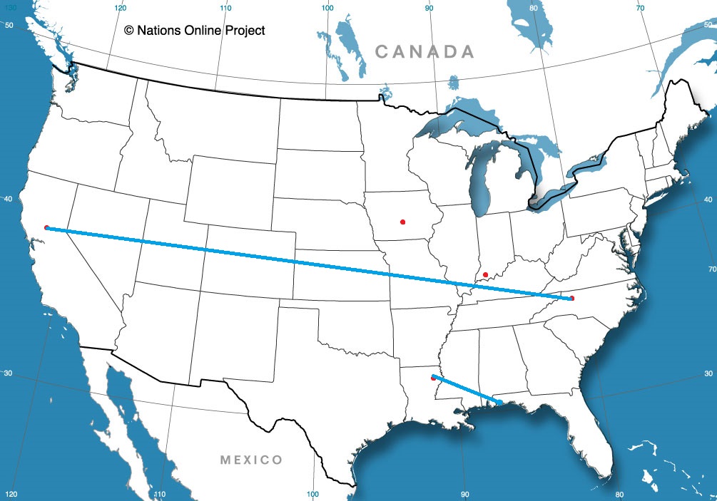
We have trekked out to Washington quite a bit recently (including a forecast for Yakima that didn’t quite get published until I noticed it hadn’t gone out right now) but now, we will be going exactly to the opposite side of the country.
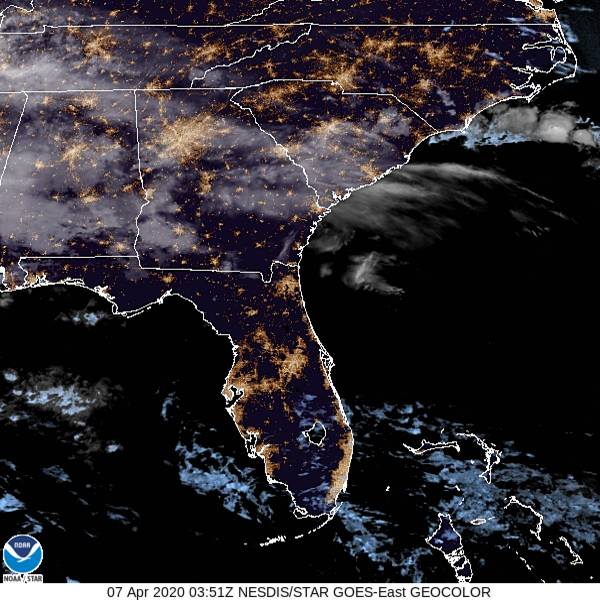
At 1156PM, ET, Jacksonville was reporting a temperature of 63 degrees with mostly cloudy skies. This is likely a bit of an aberration, as most sites across the region are cloud free, and the satellite imagery shows most of the sunshine state enjoying some moonshine tonight. The remnants of a boundary over the southeast lingers from Georgia to Mississippi in the form of some high clouds, though that is all that threatens tonight. High pressure centered northeast of the Bahamas will ensure Jacksonville will stay dry and mostly sunny on Tuesday. There is a weak low level disturbance over the Mississippi Delta that will continue to unravel as it shifts to the east, but Wednesday is going to look a little bit bleaker with a few more clouds and an isolated shot at a shower or thunderstorm. Tomorrow – Mostly sunny, High 85, Low 59 Wednesday – Mostly cloudy with a spot of rain, High 83, Low 67
TWC: Tomorrow – Partly cloudy skies. High 87, Low 63 Wednesday – Partly cloudy with afternoon showers or thunderstorms. High 86, Low 67
AW: Tomorrow – Times of clouds and sun High 85, Low 64 Wednesday – Mostly cloudy and very warm; a thunderstorm in spots in the afternoon High 86, Low 64
NWS: Tomorrow – Sunny High 86, Low 62 Wednesday – A slight chance of showers, then a chance of showers and thunderstorms after 2pm. Mostly sunny, High 88, Low 66
WB: Tomorrow – Mostly sunny in the morning then becoming partly cloudy, High 85, Low 64 Wednesday – Partly cloudy. Slight chance of showers in the morning then chance of showers and slight chance of thunderstorms in the afternoon, High 84, Low 68
WN: Tomorrow – Mostly sunny, High 86, Low 62 Wednesday – Partly cloudy with scattered showers, High 88, Low 66
FIO: Tomorrow – Clear throughout the day. High 86, Low 61 Wednesday – Partly cloudy throughout the day. High 87, Low 67
Here is the satellite graphic for the evening. Just a few clouds to the north, while Jacksonville can settle in for the night with no problems.
One day, I will stop trying to find cute names for these verifications, but today is not that day. Victoria’s Thursday was drab, with overcast keeping temperatures on the low end, while there was a little bit of light drizzle as low pressure in the northern US entrained flow from the Gulf of Mexico. Victoria-Weather had the best temperature forecast for the day, but we, along with the second best temperature forecaster (Forecast.io) missed on precipitation, and thus, V-W dropped into a 4-way tie with Accuweather, the Weather Service and WeatherNation. Congratulations to Accuweather, who finally had their first forecast win of the year, even if it was just a quarter share! Actuals: Wednesday – High 78, Low 51 Thursday – .01 inches of rain, High 78, Low 59
We’re taking another trip to Washington, this time to the south central part of the state. This could be a tough forecast, thanks to the position between some mountain ranges, an at the western reaches of our observation network. How will this go?
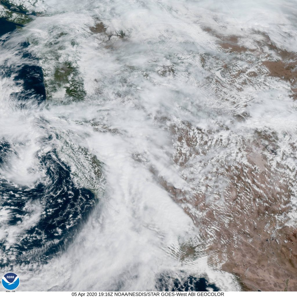
AT 1153AM, PT, Yakima was reporting a temperature of 53 degrees with overcast skies. A shark trough was stretching through the western US, with an area of low pressure centered off the coast of Eureka, California, but everywhere through the Pacific Northwest and the northern Rockies was congested with clouds and the threat of mountain snow and rain. The center of low pressure at the surface will sink further south, while the upper level trough will attempt to pivot east. High pressure will nose into western Washington and attempt to cut the low off over the central California Coast. This will bring some warmer, sunnier conditions to Washington, however there is certainly a chance for some lingering fog in the Yakima Valley, particularly in the mornings. Tomorrow – Mostly sunny by afternoon, some fog in the morning, High 64, Low 35 Tuesday – Sunny, High 66, Low 38
Last week, I described Weatherbug’s forecast for Anderson as “rogue” as they were a touch cooler than everyone else, and were the only outlet to introduce rain into the forecast. The temperatures were a few degrees warmer than Weatherbug’s forecast, however on Tuesday, as they rightly told us, there were a few light rain showers over the central Indiana community. Thanks to the penalty for missed precipitation forecasts, Weatherbug’s forecast surpassed several other outlets who foresaw clear conditions, and they won the day Actuals: Monday, High 53, Low 41 Tuesday – Trace of precipitation, High 41, Low 35