We’re taking another trip to Washington, this time to the south central part of the state. This could be a tough forecast, thanks to the position between some mountain ranges, an at the western reaches of our observation network. How will this go?
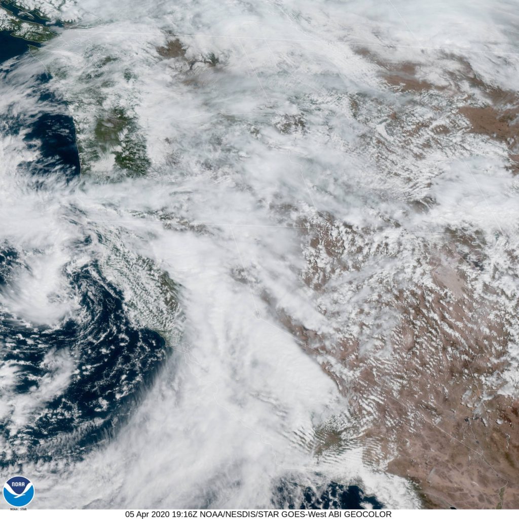
AT 1153AM, PT, Yakima was reporting a temperature of 53 degrees with overcast skies. A shark trough was stretching through the western US, with an area of low pressure centered off the coast of Eureka, California, but everywhere through the Pacific Northwest and the northern Rockies was congested with clouds and the threat of mountain snow and rain.
The center of low pressure at the surface will sink further south, while the upper level trough will attempt to pivot east. High pressure will nose into western Washington and attempt to cut the low off over the central California Coast. This will bring some warmer, sunnier conditions to Washington, however there is certainly a chance for some lingering fog in the Yakima Valley, particularly in the mornings.
Tomorrow – Mostly sunny by afternoon, some fog in the morning, High 64, Low 35
Tuesday – Sunny, High 66, Low 38
TWC: Tomorrow – Partly cloudy skies. High 68, Low 32
Tuesday – Partly cloudy skies.High 69, Low 37
AW: Tomorrow – Partly sunny High 67, Low 31
Tuesday – Mostly sunny and nice High 69, Low 34
NWS: Tomorrow – Mostly sunny, High 64, Low 34
Tuesday – Mostly sunny, High 65, Low 34
WB: Tomorrow – Mostly cloudy in the morning, then clearing, High 66, Low 32
Tuesday – Partly cloudy, High 68, Low 37
WN: Tomorrow – Partly cloudy, High 64, Low 34
Tuesday – Partly cloudy, High 65, Low 34
FIO: Tomorrow – Partly cloudy throughout the day. High 67, Low 32
Tuesday – Partly cloudy throughout the day. High 70, Low 35
Here is a look at the western US and the satellite. There is so much cloud cover it’s tough to discern the map.


Comment (1)