
Indiana was among the states in the firing line for strong thunderstorms last night. There were a few spots of severe weather damage, but mostly, it was a wake up call for the beginning of the severe season.
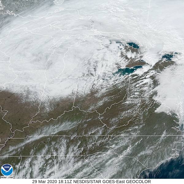
At 153ET, Anderson was seeing a temperature of 55 degrees with overcast skies. A large area of low pressure moving through the Great Lakes, and is now heavily occluded after bringing some widespread severe weather to the Mississippi and Ohio Valleys last night. The southern edge of the shield of clouds over the center of circulation stretched over central Indiana, leading to the overcast in the region, and depressing temperatures in northern Indiana.
The jet is mostly laminar, which means there will be a slow transition from feature to feature. Don’t be surprised if it takes a while for the clouds to fully pull out of town. Fortunately, the slow pace of translation of surface features also means that the next round of wet weather will take it’s time reaching town as well, and Tuesday should provide for a calm, mostly cloudy day, though more cool air will filter in.
Tomorrow – Cloudy, High 53, Low 40
Tuesday – A little more sun, but cooler, High 46, Low 34
TWC: Tomorrow – A mix of clouds and sun in the morning followed by cloudy skies during the afternoon. High 47, Low 39
Tuesday – Cloudy skies High 42, Low 32
AW: Tomorrow – Breezy in the morning; otherwise, periods of clouds and sun High 49, Low 40
Tuesday – Mostly cloudy and chilly High 43, Low 32
NWS: Tomorrow – Partly sunny, High 50, Low 41
Tuesday – Mostly cloudy High 45, Low 34
WB: Tomorrow – Mostly cloudy until midday then becoming partly cloudy, High 46, Low 38
Tuesday – Mostly cloudy, a 20% chance of rain showers in the afternoon High 40, Low 35
WN: Tomorrow – Partly cloudy, High 50. Low 43
Tuesday – Mostly cloudy, High 45, Low 34
FIO: Tomorrow – Partly cloudy throughout the day. High 51, Low 40
Tuesday – Overcast throughout the day. High 47, Low 31
Weatherbug with what can only be described as a rogue forecast on Tuesday. Looking pretty similar across the board otherwise. The low on Monday may be low standard when all is said and done. Here is satellite, showing a big disc of clouds.
Comment (1)