Just as summer turned to fall in Ohio, we forecast for Columbus. Wet weather was on it’s way into the Buckeye State, and was expected to bring a change to the pattern in central Ohio. Joke was on us, though, as that change came a day early. With rain and clouds, perhaps a bit thicker than expected, that change came a day early. Highs only reached 73 last Tuesday, thought they did get even cooler by mid week. All forecasters came through with a pretty workable forecast, with Weatherbug narrowly surpassing the rest. Actuals: Monday – .01 inches of light rain, High 81, Low 71 Tuesday – .24 inches of rain, High 73, Low 67
One source that I use pretty regularly here is the Climate Prediction Center. As the summer was winding to a conclusion, with many other weather news stories to cover, they quietly updated their forecast offerings. Now, it isn’t a massive change to their product offering, but it definitely is a fresh coat of paint.
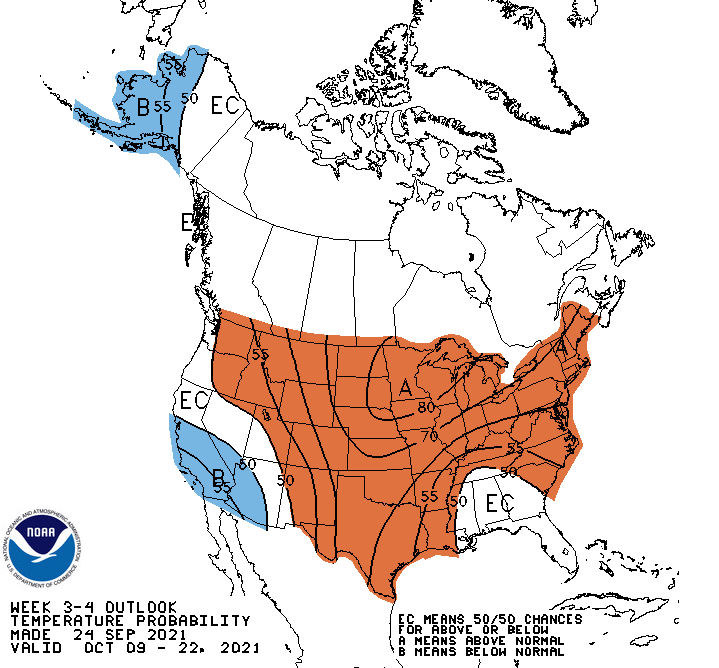
This is one of those paint jobs that really makes things look considerably better, though. The CPC graciously still has a 3-4 week outlook with the old graphics.
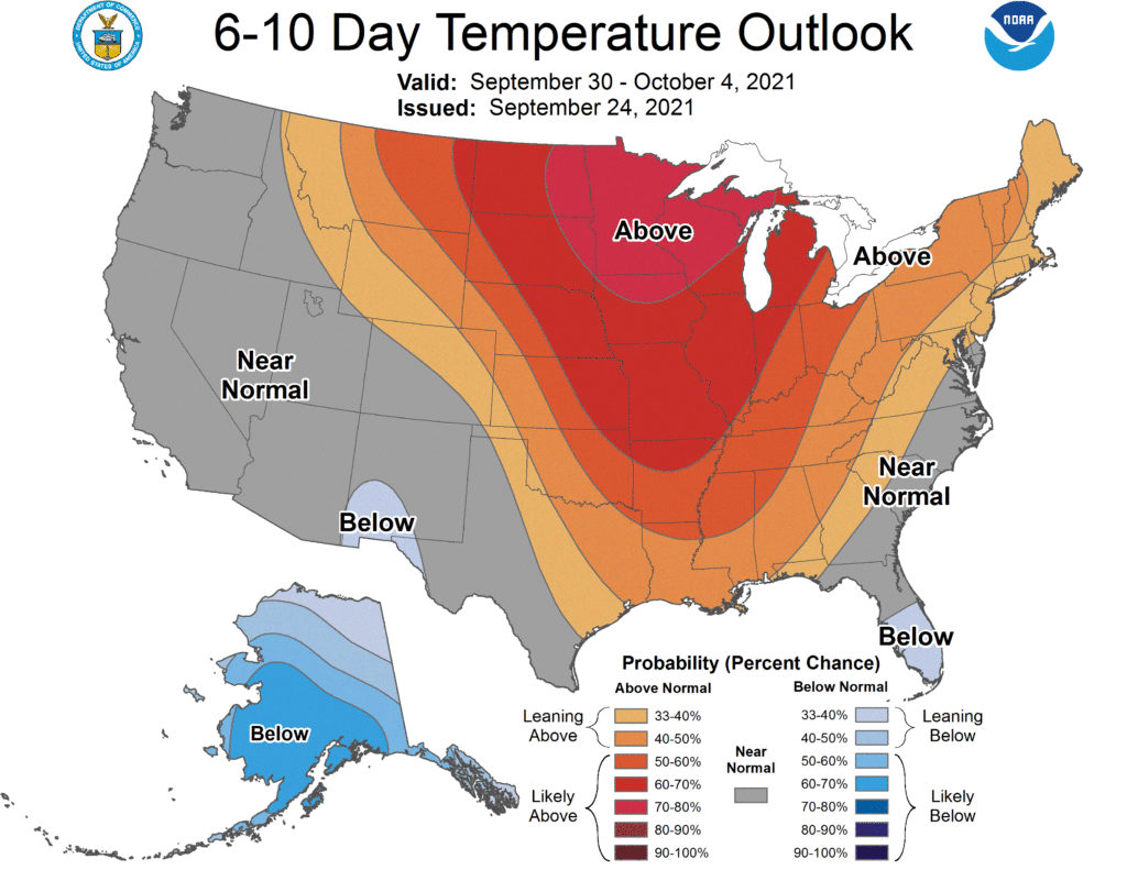
Looks fine, I guess. Also looks like the middle of October could be warm. That’s neither here nor there, though. Let’s look at the 2 week forecast which is issued with the new graphics.
Now there is a key in the bottom, which is pretty great, and a full word or phrase for each section. Again, it’s warm in the middle of the country, but here with the new version of the map, it’s much clearer.
So this is definitely an improvement. They not only look better, but the information is a lot more clearly displayed than before. It’s nice to have an upgrade that is actually an upgrade!
We’ve been following along with a front that moved steadily across the country, snapping the summer like start to September for a lot of the eastern two thirds of the country. We started looking at it when it was about to pass through St. Louis about a week ago. Temperatures ended up dropping by about 10 degrees from Tuesday to Wednesday. The low temperatures on Wednesday were actually the biggest discrepancy across the board, as they went all the way down to 60. The lowest low forecast for last Wednesday was from The Weather Channel, and as a result, they were the champion in St. Louis. Actuals: 9/14 – .22 inches of rain in thunderstorms, High 90, Low 69 9/15 – .02 inches of rain, High 82, Low 60
Autumn arrives tomorrow, but it always comes a little later to the southeast than the rest of the country. How summery will the end of September be?
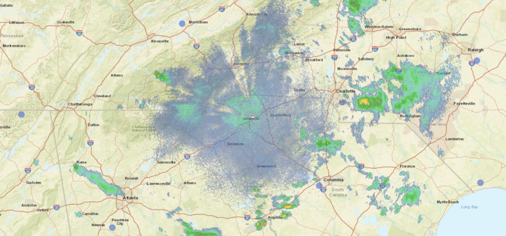
At 853PM, ET, Greenville was reporting a temperature of 70 degrees with overcast skies. In the ever unraveling saga of Nicholas, he is finally being dragged north towards the Eastern Great Lakes, but a plume of remnant moisture extends from western Pennsylvania to central North Carolina. Of more interest is a sharply digging upper level trough that is reaching into the Lower Mississippi Valley this evening. While the remnants of Nicholas are east of the Appalachians, cyclogenesis will be very autumnal thanks to the trough over the next couple of days. AS the trough rotates a bit and moves east, the latent moisture left by Nicholas will be expressed as widespread showers with some isolated embedded storms. The low generated by the trough is fully evolved, even dropping a cold front that will press through Greenville tomorrow evening. The air behind the front will be dry and refreshing after so many days with rain in the forecast. Tomorrow – Scattered showers, with thunderstorms more likely in the afternoon and evening. Cooling quickly. High 79, Low 63 Thursday – Sunny and nice, High 76, Low 56
TWC: Tomorrow – Thunderstorms. High 78, Low 64 Thursday – Sunny. Less humid. High 75, Low 54
AW: Tomorrow – Mostly cloudy with a couple of showers and a thunderstorm; much cooler than recent days High 80, Low 64 Thursday – Nice with plenty of sunshine High 75, Low 54
NWS: Tomorrow – A chance of showers and thunderstorms before noon, then showers likely and possibly a thunderstorm between noon and 4pm, then a chance of showers and thunderstorms after 4pm. Patchy fog before noon. Otherwise, cloudy, High 79, Low 62 Thursday – Sunny High 76, Low 52
WB: Tomorrow – Cloudy. Patchy fog in the morning. A chance of showers in the morning then showers likely with a chance of thunderstorms in the afternoon. High 78, Low 63 Thursday – Sunny, High 74, Low 56
WN: Tomorrow – Mostly cloudy with light showers and chance of storms, High 79, Low 62 Thursday – Sunny, High 76, Low 53
FIO: Tomorrow – Rain in the morning and afternoon. High 77, Low 63 Thursday – Clear throughout the day. High 77, Low 51
All those lows tomorrow are going to be midnight lows. The coming cold front is going to be pretty aggressive. Just this weak smattering across the area right now.
To conclude a long look at the drenching conditions brought about by Tropical Storm Nicholas, we took up a forecast for Jackson, Mississippi. The rain was slow in coming, but frankly, it has been even slower in leaving. Tere was a trace of rain last Monday, and a quarter inch on Tuesday, but then there has been rain in the area every day since. Nicholas has definitely been a bad house guest. The top forecast went to The National Weather Service and WeatherNation, as a tag team effort. Actuals: Monday – Trace of rain, High 85, Low 74 Tuesday – .25 inches of rain, High 80, Low 72
It’s time for a forecast in one of our oldest friends. Early in the site’s history we went to Columbus for our forecasts with stunning regularity. We should have a good handle on this, right?
At 851PM, ET, Columbus was reporting mostly cloudy skies with a temperature of 78 degrees. Much of the region is seeing clear skies, A strong, early autumn trough is rotating through the Upper Midwest, while the remnants of Nicholas bring quite a bit of rain to the southeast. Some of that rain fall and moisture is and will continue to be dragged north to the Ohio Valley. At present, there are a few scattered showers over Indiana and Eastern Kentucky, though nothing has filtered into Ohio yet. A strong ridge on the east coast will shift a bit eastward, helping to enhance the southerly flow towards Columbus, and making the threat of Nicholas related rainfall more likely on Monday. Fortunately, the storm and the attendant precipitation are weaker than they have been. The cold front will charge eastward and will arrive on Tuesday evening. Severe weather may not be the order of the day, but after the forecast period is through, expect a significant change to the weather when the front has passed by. Tomorrow – Scattered showers with isolated embedded storms, but mostly cloudy otherwise, High 83, Low 68 Tuesday – Rain, increasing late. cooler, High 78, Low 64
TWC: Tomorrow – Cloudy. A stray shower or thunderstorm is possible. High 84, Low 68 Tuesday -0 Rain showers in the morning with scattered thunderstorms arriving in the afternoon. high 78, Low 67
AW: Tomorrow – Mostly cloudy and warm; a thunderstorm in spots in the afternoon High 82, Low 67 Tuesday – Mostly cloudy with a stray thunderstorm in the afternoon High 77, Low 64
NWS: Tomorrow – A slight chance of showers before 10am, then a chance of showers after 1pm. Mostly cloudy, High 83, Low 68 Tuesday – Showers likely, then showers and possibly a thunderstorm after 2pm High 78, Low 68
WB: Tomorrow – Mostly cloudy, a slight chance of showers in the morning then a chance of showers in the afternoon, High 82, Low 70 Tuesday – Showers likely in the morning, then showers with a slight chance of thunderstorms in the afternoon, High 77, Low 69
WN: Tomorrow – Mostly cloudy with light rain showers, High 83, Low 68 Tuesday – Mostly cloudy with isolated showers and thunderstorms, High 78, Low 68
FIO: Tomorrow – Overcast throughout the day. High 84, Low 69 Tuesday – Light rain throughout the day. High 76, Low 66
I think wind is going to be a more significant issue than other outlets seem to, and it will be breezy every day. I think it will help force some gaps in the clouds, if nothing else. The clouds are coming already, though.
Rain and cooler temperatures moved into the Pacific Northwest this week, and the first bouts of wet weather had just passed Redding by when we stopped in for a forecast. Unfortunately, they never returned, with the jet trough planting itself north of the Oregon border. Redding stayed hot and smoky through the weekend last weekend. The scenario was well anticipated by our forecasters, and there was good clustering across the board, with The Weather Channel securing a solo victory. Actuals: Saturday, High 96, Low 67 Sunday, High 95, Low 61
At 1151PM, CT, St. Louis was reporting a temperature of 80 degrees with clear skies. St. Louis was between two major systems tonight, with Hurricane Nicholas sliding along the Texas Coast to the south, and a fall like area of low pressure moving through the western Great Lakes overnight tonight. High pressure will keep St. Louis dry at least through the morning. Nicholas will spiral eastward after landfalling, while the cold front from the northern feature will sink south. The boundary will pass through St. Louis late in the evening on Tuesday, with isolated thunderstorms continuing until after midnight. The full impact of this front will be blunted by Nicholas intercepting a lot of the moisture attempting to filter northward. Wednesday looks pretty OK after the morning showers clear out. Tomorrow – Isolated thunderstorms in the evening, High 90, Low 72 Wednesday – Morning rain, then clearing, High 81, Low 65
TWC: Tomorrow – Sunny in the morning then increasing clouds with some scattered thunderstorms later in the day. Storms may contain strong gusty winds. High 90, Low 70 Wednesday – Cloudy skies early will become partly cloudy later in the day. A stray shower or thunderstorm is possible. High 81, Low 64
AW: Tomorrow – Very warm and humid with times of clouds and sunshine; caution advised if doing strenuous activities outside (late storms) High 89, Low 71 Wednesday – Humid; cloudy in the morning, then intervals of clouds and sunshine in the afternoon (early storms) High 81, Low 66
NWS: Tomorrow – Sunny, (late storms) High 90, Low 71 Wednesday – A 40 percent chance of showers and thunderstorms. Partly sunny High 82, Low 66
WB: Tomorrow – Mostly sunny (Late storms), High 89, Low 71 Wednesday – Mostly sunny, High 80, Low 66
WN: Tomorrow – Partly cloudy with isolated storms, High 90, Low 71 Wednesday – Partly cloudy with chance of storms, High 83, Low 66
FIO: Tomorrow – Rain in the evening. High 91, Low 70 Wednesday – Rain overnight and in the morning. High 81, Low 65
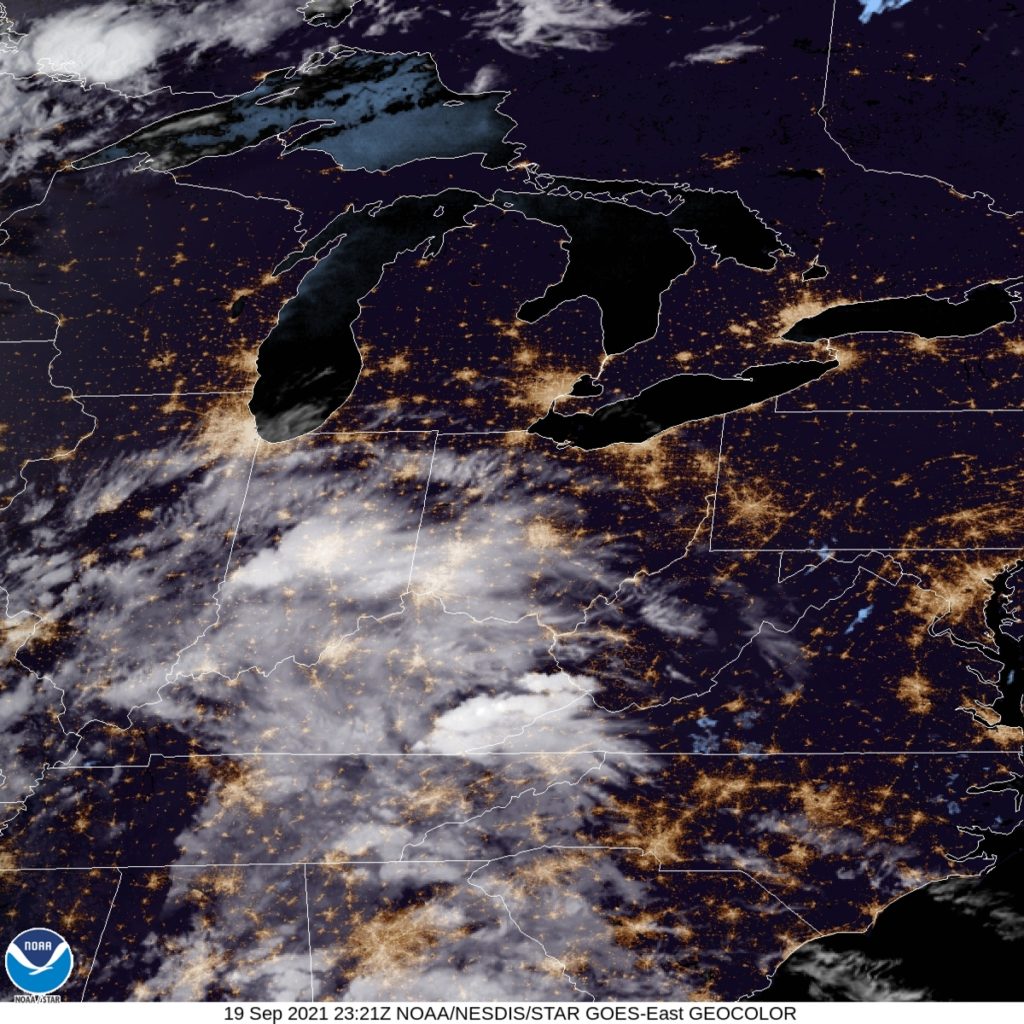
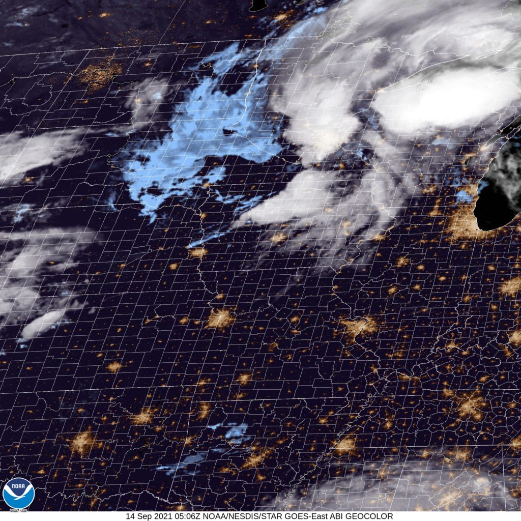
It will be interesting to see how ardently this front moves through. There is definitely a change to the airmass late in the week for St. Louis, but there might not be as much of a show to get there as one might typically expect. You can see the peripheries of both features on satellite.
After expecting Mindy to drift a bit further north than she actually did, a lot of outlets ended up looking foolish on our forecast for Columbia, 6 of the 7 thought that the storm would pass close enough to central South Carolina that the state capital would get a bit, perhaps a substantial bit, of rain. Judging by storm reports, was only ever really a problem down by Tybee Island in Georgia, and Columbia didn’t actually get any rain. None. So Forecast.io who had no precipitation in the forecast got a share of the victory, but so too did Victoria-Weather, who despite the whiff on Mindy, accurately forecast the high and low on Friday. Even though forecasters were disappointed by their inaccuracy, I’m sure Columbia residents were just fine. Actuals: Thursday – High 85, Low 67 Friday – High 84, Low 64