There is a continuing threat of wildfires in California, particularly in the northern part of the state, where despite a recent cool down for much of the country, hot weather, wind and dry conditions continued for California. Over the weekend of the 17th and 18th, temperatures in Santa Rosa spiked all the way to the 90s, even the upper 90s on that Saturday. Forecasters were anticipating some relief by the end of the forecast period, so everyone was a little low on their forecasts. The warmest outlet was Victoria-Weather, and we claimed victory on a miserable forecast for everyone — particularly residents of Santa Rosa. Actuals: October 17th, High 97, Low 48 October 18th, High 91, Low 48
All right, so this is definitely going to be a light stretch for forecasts, but given the rapid transition to winter time, there should be plenty to talk about!
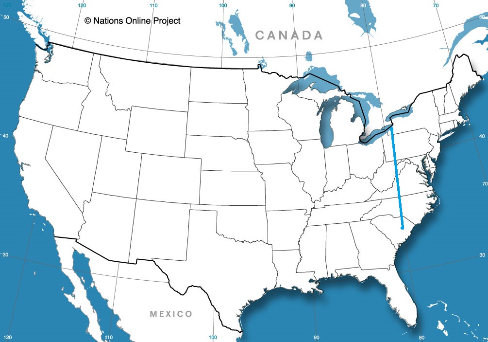
Road Trip from Buffalo New York to Florence, South Carolina
It’s not often we spent a road trip on the west coast, but that’s the plan for this journey. It will take a day and a half to get from the North Bay to western Washington. We’ll cover 798 miles at a pace of only 57.3mph, thanks to most of our drive being spent off of the main freeways, as well as through some rebuilding areas after this year’s wildfires. Enjoy the lackadaisical pace.
DAY ONE (Thursday)
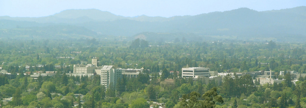
Santa Rosa, California
By JLankford – wikitravel, Public Domain, https://commons.wikimedia.org/w/index.php?curid=37654846
While you may not recognize it in northern California, where fires are still burning, particularly northeast of Santa Rosa, and further north in the Mendocino National Forest, but it is a time of rainy change in the Pacific Northwest. Northern California will be all too dry and haze tinged as we travel north along I-5, but north of Klamath Falls on US-97, we will start to see a change. First, some clouds will stream overhead, and then around Crater Lake, the northeast chilly wind will pick up. Models suggest a dry drive tomorrow afternoon, but make no mistake. We’re crossing a cold front in Oregon tomorrow. We will stop in the resort community of Sunriver, south of Bend, at the end of the day.
DAY TWO (Friday) The next round of wet weather to barrel into Washington is coming in the morning on Friday. It will particularly impact Puget Sound and eastern Washington near Spokane, mostly sparing the Yakima Valley. Don’t count on that lasting all day, though. Just because there won’t be as much rain or snow doesn’t mean there won’t be any. Precipitation will mostly be rain from Yakima northward, but some snow may mix in around Ellensburg, and again as we approach Wenatchee.
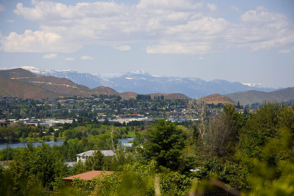
Western Washington is our destination for today’s forecast. Not Puget Sound though, but rather an entirely different climate on the east side of the Cascades.
At 1155AM, PT, Wenatchee was reporting fair skies with a temperature of 49 degrees. The jet was nearly directly overhead, and was bringing some striated high clouds to the Pacific Northwest in general, but specifically some fog and light precipitation at the higher terrain of the Cascades. This will dissipate, and aside from the continued high clouds, Wenatchee will remain in the clear through Thursday. The next feature out of the Gulf of Alaska will arrive early on Friday and bring a swift bout of showers to the region, some of which will likely snake its way to Wenatchee, even as most gets wasted in the Cascades. Expect a gloomy end to the week, thanks to the persistent clouds on Friday. Tomorrow – Mostly sunny, High 51, Low 31 Friday – Cloudy, chances of rain through the day, High 41, Low 32
TWC: Tomorrow – A few passing clouds, otherwise generally sunny. High 53, Low 33 Friday – Periods of rain and snow. High 40, Low 35
AW Tomorrow – Mostly sunny and chilly High 49, Low 31 Friday – Colder with snow beginning in the late morning, accumulating an inch or two, Low 33
NWS: Tomorrow – Widespread frost before 8am. Otherwise, sunny High 53, Low 33 Friday – A chance of snow before 8am, then rain and snow. Snow level 800 feet High 35, Low 33
WB: Tomorrow – Sunny, Widespread frost in the morning. High 51, Low 35 Friday – Snow. Moderate snow acumulations possible. Colder. High 38, Low 35
WN: Tomorrow – Partly cloudy with widespread frost, High 53, Low 32 Friday -Mostly cloudy with light wintry mix, High 36, Low 31
FIO: Tomorrow – Clear throughout the day. High 54, Low 31 Friday – Rain throughout the day. High 43, Low 33
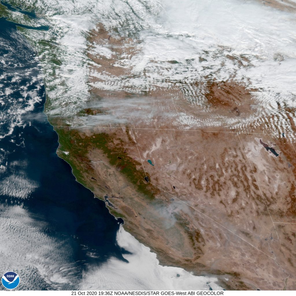
It looks like a pretty grim day on the eastern slope of the Cascades on Friday. Here is the satellite with clouds streaming across the PAcific Northwest associated with the jet.
The forecast for Kingston was spot on, at least for one outlet. Accuweather only missed by degree overall, going a little too cool on Thursday morning. This is what happens on a clear day on the east coast, I guess. Accuweather was clearly the best, but it was a good forecast for everyone. Actuals: Wednesday – High 69, Low 38 Thursday – High 74, Low 43
At 753PM, PT, Santa Rosa was still reporting a temperature of 80 degrees with clear skies. The west coast will continue to remain clear for the next couple of days, and unlike the eastern two thirds of the country, it will be hot. Santa Rosa is in a red flag warning, and a heat advisory. High pressure centered in the eastern Pacific is bolstered onshore by a thermal ridge. Little change can be anticipated in Santa Rosa, and the heat and fire danger will be in place, particularly with a broad static trough east of the Rockies. Tomorrow – Sunny, High 93, Low 53 Sunday – Sunny, High 87, Low 49
TWC: Tomorrow – Partly cloudy skies. High 92, Low 56 Sunday – Partly cloudy skies. High 85, Low 53
AW: Tomorrow – Hot with plenty of sunshine; caution advised if doing strenuous activities outside High 93, Low 56 Sunday – Plenty of sunshine High 85, Low 50
NWS: Tomorrow – Sunny, High 92, Low 61 Sunday – Sunny, High 86, Low 56
WB: Tomorrow – Sunny, High 91, Low 56 Sunday – Sunny, High 84, Low 54
WN: Tomorrow – Mostly sunny, High 93, Low 60 Sunday – Mostly sunny, High 85, Low 55
FIO: Tomorrow – Clear throughout the day. High 92, Low 58 Sunday – Clear throughout the day. High 85, Low 51
It’s like we were foreasting for different Santa Rosa’s, judging by some of those highs. I am not sold on as steep a drop in temperatures, clearly, as the others. Now, please enjoy the forecast from another viewpoint, KTVU in northern California.
The Hudson River is home to so many important cities, many of which are overshadowed by Albany and New York. There are plenty of good ones though, not the least of which is Kingston, which is just north of another good one, Poughkeepsie.
At 453PM, ET, it was 56 degrees and overcast near Kingston. The remnants of weak circulation associated with Delta are in Southern New England and are contributing to the cloudy skies in the area, though rain seems to have departed from Kingston for the rest of the day. Drier conditions are on the way tomorrow as a strong jet trough organizes a well developed extratropical cyclone in the Great Lakes. The low will shift to the north as the jet trough becomes more well developed. The jet trough development is indicative of cold air surging into the center of the country, and a cold front developing west of the Appalachians. Ahead of the developing cold front, warm southerly flow will make things unseasonably warm for at least a day in Kingston. Tomorrow – Partly cloudy, High 69, Low 41 Thursday – Partly cloudy, breeze, High 75, Low 43
TWC: Tomorrow – A mainly sunny sky, High 68, Low 40 Thursday – Abundant sunshine, High 74, Low 42
AW: Tomorrow – Mostly sunny, pleasant and warmer High 69, Low 38 Thursday – Sunny to partly cloudy and warm; breezy in the afternoon High 74, Low 42
NWS: Tomorrow – Sunny, High 68 , Low 41 Thursday – Sunny, High 73, Low 44
WB: Tomorrow – Patchy fog in the morning. Sunny. High 67, Low 41 Thursday – Sunny, High 72, Low 43
WN: Tomorrow – Mostly sunny, High 58, Low 41 Thursday – Mostly sunny, High 73, Low 41
FIO: Tomorrow – Clear throughout the day. High 69, Low 40 Thursday – Clear throughout the day. High 73, Low 44
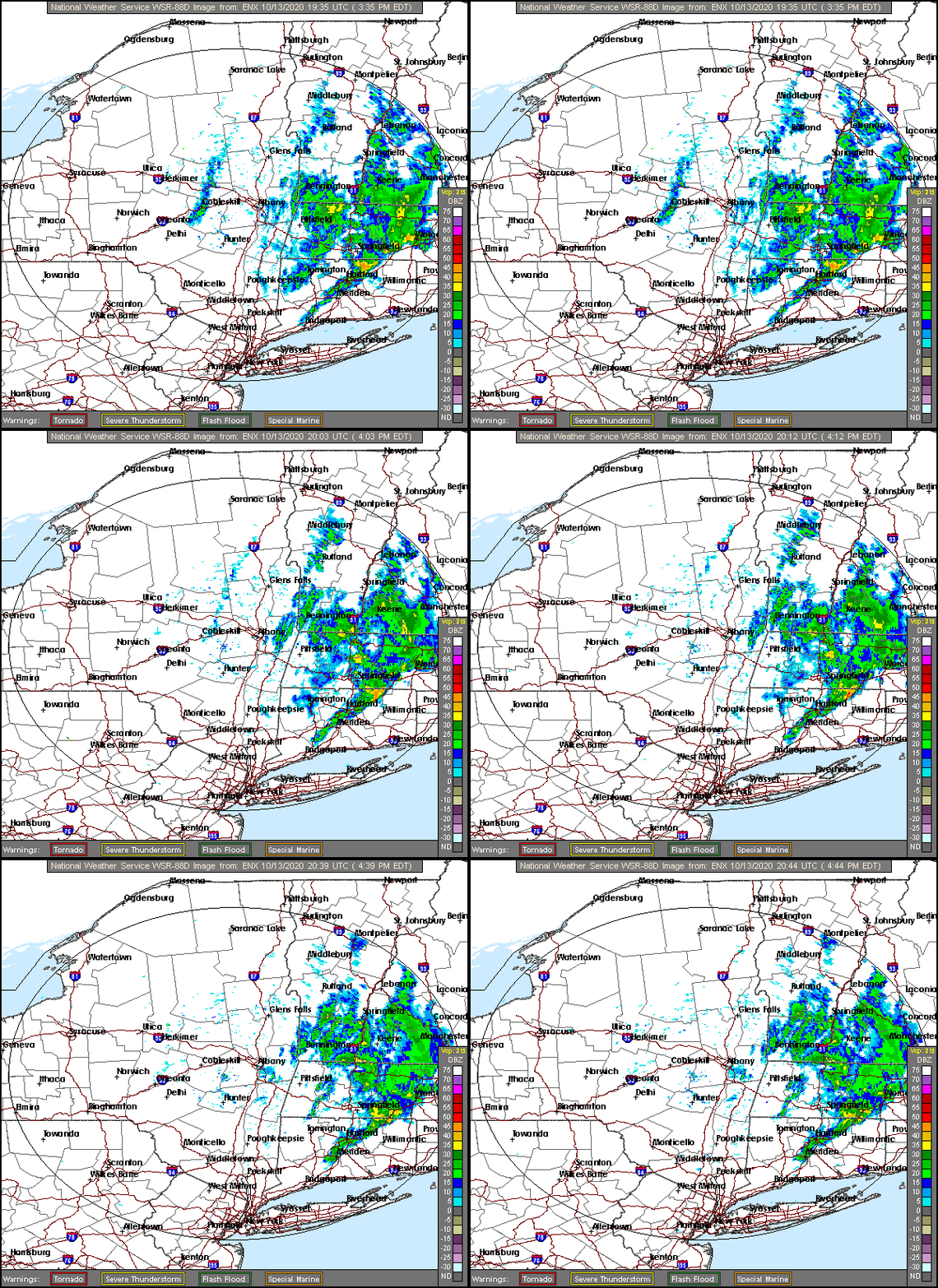
I’m on the warm end on Saturday. I believe in the power of sunny skies and south winds. Here is the radar, showing rain shifting out of town.
Two weekends ago, meteorologists were diligently watching the Gulf of Mexico in anticipation of the development of Tropical Storm Delta. Delta did develop into a hurricane and moved through the Mississippi Delta (no relation) and towards the Great Lakes. It was tough to think of the tropics before that in Atlanta, as the temperatures, particularly the morning lows around the 50 degree mark, were positively autumnal. The Weather Channel did earn victory on the forecast. They’ve been in Atlanta getting pumpkin spied lattes for a couple weeks now, and surely had some more intimate knowledge of the conditions. Actuals: October 5th, High 77, Low 50 October 6th, High 79, Low 51
Wow. What a wild month September was. Then again, September is the wildest of them all, almost every year. There are hurricanes, wild fires. every thing that can go wrong thanks to the stored heat of summer. No wonder, then, that it was Forecast.io, the robot army, that could keep the level head needed to secure this honor.
We will travel from one capital city to the other over the next week or so, headed from the bustling Atlanta to the more serene Olympia over the course of 5 days. The drive will cover 2718 miles at a pace of about 68mph, and with a goal of 544 miles on any given day. I think it’s time we pack our things. Will we see any other capital cities along the way?
DAY ONE (Saturday)
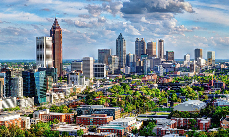
Atlanta, Georgia
For the beginning of our long, cross country drive, all eyes will be to our south, where we will need to monitor Hurricane Delta, which will be expiring in the Mississippi Valley. A dangerous feeder band of showers and storms angling into Delta from the Tennessee Valley. Most of these will be rain storms with little lightning and thunder, but even without lightning or thunder, rogue tornadoes are always a possibility. As Delta erodes and we head north, the rain threat will dissipate, about as we cross the Ohio into Illinois, but it will still be overcast at day’s end. Day’s end will be in Caseyville, a St. Louis suburb.
DAY TWO (Sunday) Low pressure developing in the plains will be robbed of moisture by the remnants of Delta, but the pressure squeeze of remnant hurricane, to ridge, to deepening area of low pressure will make for a very windy day as we head for the Plains. We will come very close to Kansas and Nebraska, but we will stay on the eastern side of the Missouri River before finally dipping across into far southeast South Dakota, and spending the night in North Sioux City.
DAY THREE (Monday) There will be a distinct chill to the air as we spend most of our day in South Dakota. A cold front will pass us in the evening on Sunday with little to no fanfare. The after effects will be notable, as temperatures may struggle to climb above freezing. Still, it will be dry, which is a pleasant bit of news. We will clip Wyoming and make it to the ghost town of Hammond in southeastern Montana to end the day.
DAY FOUR (Tuesday) This drive is looking very familiar. We have recently taken a drive across Montana for another long road trip, and our endpoints before we reached Bellingham, and that we stopped at before we reach Olympia are very similar. This time, we’re going to stop in Missoula after a pretty clear day. The back side of the system we saw in North Sioux City may leave a few whitecaps in western Montana, but it will be dry for our arrival.
DAY FIVE (Wednesday) A pretty good system will move into the Pacific Northwest from the Gulf of Alaska in the early to middle part of next week. As we get going Wednesday, be sure to drive those mountain curves with caution, as they may be rain slicked, with some snow again possible above our elevation. By the time we reach the Cascade rain shadow in central and Eastern Washington, it will e as though nothing happened. Thanks, geography! When we reach Puget Sound, the Gulf of Alaska storm will have departed, but low clouds, drizzle and fog will remain. It will be a little bit clearer in Olympia, but still a bit dismal. Oh, and to answer the question at the top, despite all this driving will account for but one other capital city.