Los Angeles, California to Sioux Falls, South Dakota

We are destined for a three day trek across the western US for our forecast today. This route includes forays along roads that we don’t often see, especially in Wyoming and South Dakota, so that is kind of fun. Also, the idea of an Angelino in South Dakota makes me chuckle. The mileage between the two towns is 1677 miles, and our travels along several highways with 80mph speed limits will allow for a pace of nearly 70mph overall, and 559 miles of ground covered every day. Pretty sweet for a long trip.

DAY ONE (Tuesday)

Los Angeles, California

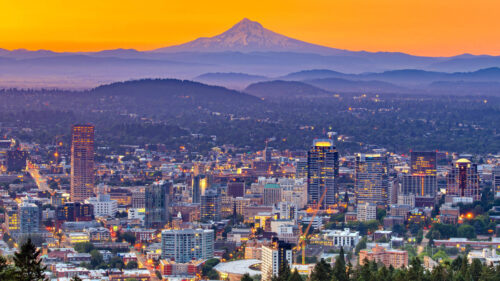
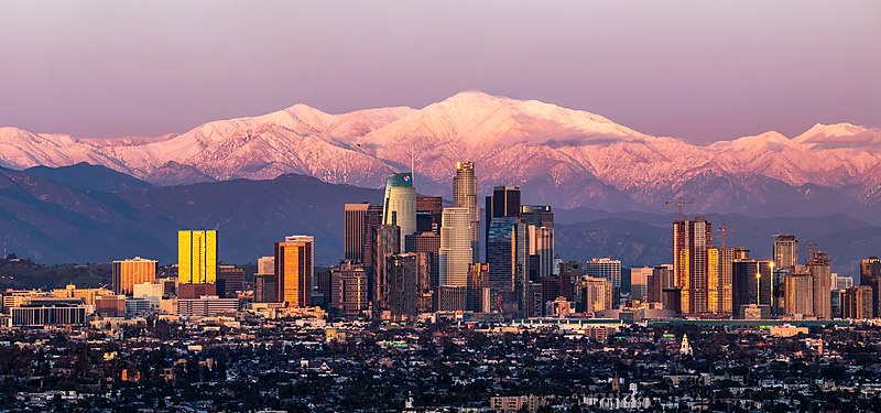
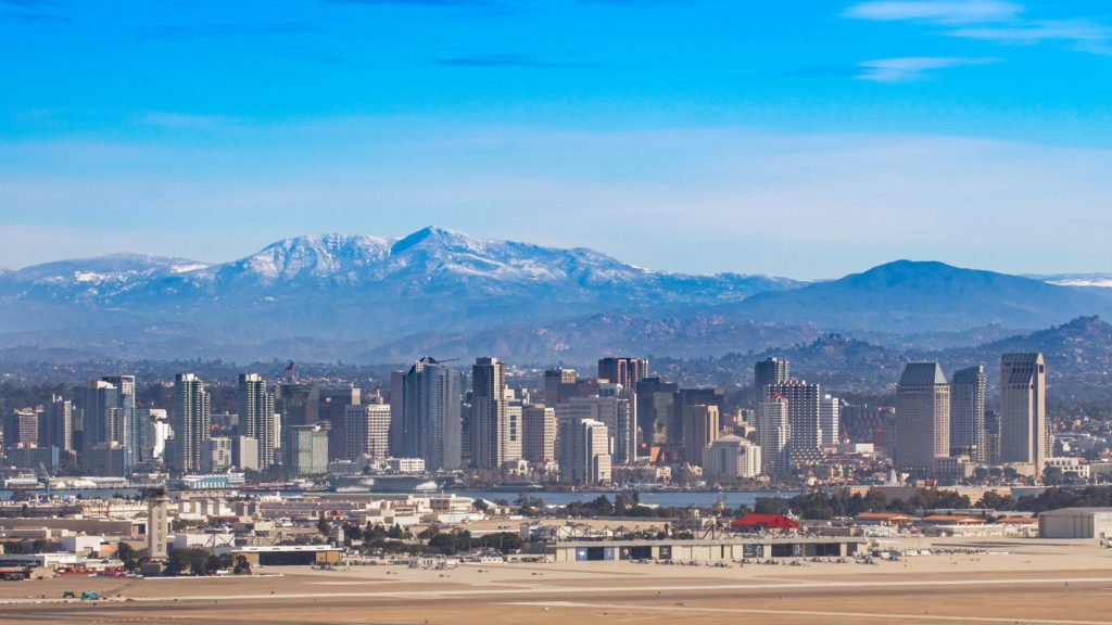
I’m not sure there is an actual location where you can take a picture of downtown Los Angeles with Mount Baldy looming in the background like this, but it’s what most pictures of downtown LA look like, so there must be something. The drive through California into the Lake Havasu area, where we will really start to turn to the north. A massive storm system is moving into the middle of the country and will bring more severe weather to the Plains, but also, significantly, will bring some snow to the Wasatch as we drive just to the east of them on I-15. We’ll stop in Holden, Utah, watching the peaks whiten overnight. Kind of like this picture of Mount Baldy.

DAY TWO (Wednesday)
The strong storm will barrel its way out of our route by the time we get moving on Wednesday, but bear in mind that this will be the first winter storm of the season, so even though we are on the interstates, the roads in the passes may still be a little slick. Nothing fresh will be falling through northern Utah or across the vast expanse of Wyoming that we will cover. We will end the day in the paper town of Savageton, which is about 2/3 of the way from Casper to Gillette.

DAY THREE (Thursday)
Moving through the Black Hills should be a bit easier than the Rockies and Wasatch were. They are lower, and probably won’t see as much snow, especially at the level I-90 passes through the region. Then, after Rapid City, South Dakota will feature boundless fields of pastureland, and a heck of a lot of sunshine and, most importantly, a speed limit of 80mph.

Sioux Falls, South Dakota

Columbia, South Carolina to Redding, California

It’s the weekend, baby! And our drive is going to cover a lot of country at what is really the right time of year to be taking such a journey. Temperatures are usually perfect for keeping the windows down, while you can stop and take in football games on the weekend, or baseball games in the week. This drive will take 5 days, so plenty of chances to stop, and will cover 2782 miles. It’s a hike, but we will break it up into 543 mile chunks at a pace of 67.8mph. Day 5 will be the longest, but it is also the stretch with the fewest roadside attractions.

DAY ONE (Saturday)

Columbia, South Carolina

The eastern US needs to dry itself out, and it will get the chance on Saturday. High pressure is going to build across the southeastern US, at least at the surface. It’s strength will help guide Larry and Mindy northward, while temporarily preventing the development of more tropical activity in the Gulf. It’s not permanent, but it is going to last long enough. Expect now weather related impairment as we head from Columbia to Kuttawa in western Kentucky. It’s kind of a resort-y area, so hotels will be plentiful.

DAY TWO (Sunday)
Low pressure is sliding through the Great Lakes toward eastern Canada, and a nearly stationary front will be left in it’s wake. It will try to bubble up some isolated showers and storms along the Minnesota-Iowa border on Sunday afternoon, but the ridge to the south is just going to be too much. Expect instead warmer than normal temperatures along our route, which will end in Dunbar, Nebraska, which is in the southeastern corrner of the state.

DAY THREE (Monday)
Driving across Nebraska, at least to me, is fun. It’s really easy to figure out where you are, as the farmland leads to regularly intervals between towns, and you can move pretty quick, especially on a quiet day like Monday. There will be a spot of shower and thunderstorm activity late in the day though, as we approach the Wyoming border. Isolated thunderstorms will pop up in the front range, or until we are over Sherman Summit approximately. We’ll be on the other side of the high range and through Laramie to the Bath exit about 20 miles west of Laramie.

DAY FOUR (Tuesday)
Storm activity will pick up in the Plains on Tuesday, so nice work getting out of there when we did. Some late showers and storms will pop up in southern Wyoming, but they should hold until we are into Utah. It looks pretty stormy in the Colorado Rockies too, but that is neither here nor there. In this case, “there” is outside of Wells, Nevada, where we will suspend our journey for the night.

DAY FIVE (Wednesday)
Hopefully, the rain that moved through the northwest today helped to quench some of the fires in Northern California and Oregon, but I don’t have high hopes. Temperatures will be dry, and the sky will almost certainly be tinged an unsettling color as we pass through Sierras into northern California and settle into the northernmost Central Valley, to park our butts in Redding.

Redding, California

Hinesville, Georgia to Madera, California

We’re ending the summer with a long trip across the country. It will take 4 and a half days, covering 2568 miles. That puts us on a brisk pace of 69.4mph, which won’t seem as great, since we will be on this pace for the better part of a week. The result of each day of driving will be 555 miles traveled. Not bad at all, actually, even if it will still take until Thursday to arrive.

DAY ONE (Sunday)

Hinesville, Georgia

Low pressure in the Great Lakes is demonstrating a nearly perfect comma shape, dangling a cold front from its eastern periphery southwestward towards the southern Plains. The front itself is in pretty rough shape, speaking of precipitation, and isn’t bringing a wintry onslaught, thanks to another system up in northern Canada., but it is going to dangle into our day one route. driving through Georgia and Alabama should mostly be ok, but some isolated showers and storms may pop up at the end of the day’s drive near the Alabama-Mississippi border. They shouldn’t be too obtrusive, but certainly possible. The day ends in Hickory Flat, Mississippi.

DAY TWO (Monday)

The front will be behind us as we leave on Labor Day morning, and while it will probably be cloudy until we hit Arkansas, it shouldn’t be rainy. The sun will be out not long after we reach Arkansas, and we will enjoy the sunshine all the way to Yukon, an Oklahoma City suburb.

DAY THREE (Tuesday)

Even a subsequent area of low pressure churning through the northern Plains and Great Lakes won’t be enough to pull up a return flow into west Texas. The drive from Oklahoma to New Mexico will be dusty and lonely. We’ll make it past Albuquerque, and the day will conclude in Highland Meadows, which is about 20 minutes west of Albuquerque.

DAY FOUR (Wednesday)

The drought continues in the west, and as if to confirm that for us, we will drive through Arizona, which is desertified at the best of times, and end our drive in the Mohave Natural Preserve about an hour into California. About 5 hours left for our Thursday in some blistering heat.

DAY FIVE (Thursday)

Make sure that AC is working. We’ll turn north at Barstow, and it will remain plenty toasty all the way up past Fresno and into Madera. Don’t be surprised if 110’s buckle roads for the last stretch of the drive. Some clouds my finally cool things down on our first full day in Madera, but it sure will be hot when we arrive.

Madera, California

Great Falls, Montana to Springfield, Missouri

I’m always interested in the more diagonal routes. They take us over terrain we don’t always get to see. Such is the case with this ride, which will take about 2 1/2 days through the Rockies and High Plains. We’ll cover 1457 miles at a pace of nearly 70mph. The drive will conclude at the end of the first two days after 555 miles of sincerely wide open terrain.

DAY ONE (Tuesday)

Great Falls Montana – By Montanabw – Own work, CC BY-SA 3.0, https://commons.wikimedia.org/w/index.php?curid=25249931

It’s extremely dry across so much of the country, and it has led to wildfires blanketing the country in smoke. Our route is affected by the smoke, even, with parts of US 212 closed because of the fires, requiring a trip through Wyoming on I-90. We’ll make it to Whitewood, South Dakota, in the Black Hills before the drive is over. A lobe of low pressure will swing into the Northern Rockies, and will bring rain to western Montana. We’ll stay dry in Whitewood, and throughout our drive.

DAY TWO (Wednesday)
Low pressure is going to deepen quickly in the High Plains east of the Rocky Mountains, but through the day in South Dakota and south into Iowa, the feature will only function to drive hot humid air north. Brisk, hot winds are expected, but the low isn’t going to move anywhere, so precipitation is not anticipated.

DAY THREE (Thursday)
The Gulf will be opened by the aggressive southerly flow, and showers with isolated thunderstorms are expected to start bubbling northward. Showers with a few rumbles of thunder are possible from Kansas City south to Springfield

Springfield, Missouri

Burlington, Vermont to Cleveland, Tennessee

This is sort of an Appalachian Trail route, but it will take only two days to cover the ground, rather than the months it takes to hike. Thanks, interstate highways! The two towns are 1060 miles apart, and our modern travel trappings will allow for a pace of 64.4mph, and no deer ticks.

DAY ONE (Tuesday)

Burlington, Vermont

All of the wet weather in the country is just skirting the East Coast. Sure, there are a few drips and drabs in other places, but there is a bona fide low moving up the Eastern Seaboard with rain and everything. To give an idea with how little of the country this rain is coming to, I will tell you that even on our route, we will see none of it. It will be nice and cool, though, for August. As the low slides into northern New England, we will be in upstate New York, and it may be a bit cloudy through Kingston, but then, south past the New York metro, into New Jersey and through Pennsylvania, we will be in great shape. The route takes through but a sliver of Maryland, but that’s the sliver we will stop in. Williamsport, right on the West Virginia border.

DAY TWO (Friday)
A trough moving in through the center of the country threatens to upset the balance of things (wherein the balance was no rain everywhere). Enough moisture will be drawn north out of the Gulf that showers and thunderstorms will dot the skies in Alabama and Georgia by the end of the day on Friday, and there may still be a rogue storm even in eastern Tennessee. It’s not extremely likely, and the threat would be confined to points south of Knoxville. It’s nicer than normal in the south. Enjoy it!

Cleveland, Tennessee

Laredo, Texas to Fayetteville, Arkansas

It’s time for another road trip. This route takes us from one state to another that borders another, but we are going to cut through a third to get there. The drive covers about a day and a half, and is 762 miles long. There will be an ample amount of time spent on I-35, which will allow for a pace of 62.9mph. Not as fast as you expected? Well, that’s because of some off – interstate driving through Oklahoma. We’ll work out about 503 miles of driving on Tuesday, with the remainder on Wednesday.

DAY ONE (Wednesday)

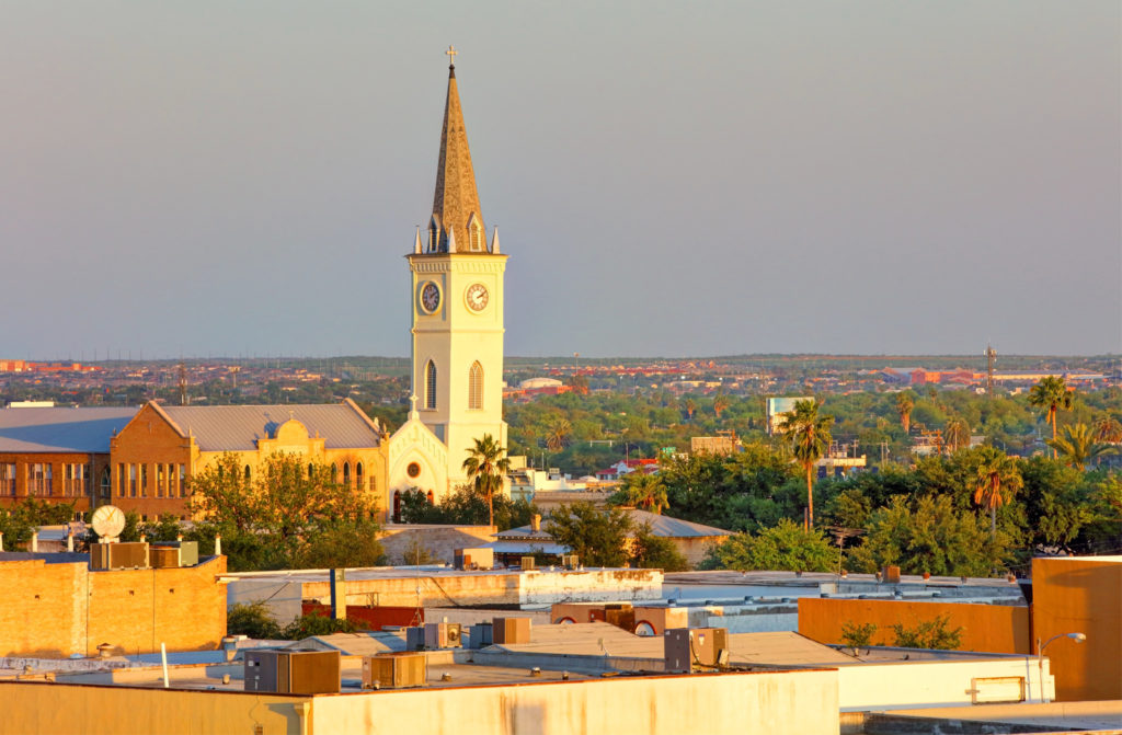
Laredo, Texas (via Britannica.comdn

Our day will start from the Mexican border, and take us north through Texas on 35. We will abandon 35 as we head through the Dallas Metroplex and head for the Red River. There is a tail of a weak boundary sagging south through Texas that will trigger an isolated shower or thunderstorm generally north of the Austin area. Nothing severe or long lasting, but just enough to dampen the pavement from time to time. Just before we arrive at the Red River crossing, we will stop for the night in Denison.

DAY TWO (Thursday)
As the tail of that boundary drifts further south, it will clear the air in Oklahoma and western Arkansas. Well, not clear it, so much as bottle up the shower and thunderstorm threat to the south of our route. Be prepared, it’s going to be hot and miserable in Fayetteville when we arrive. Find air conditioning.

Fayetteville, Arkansas

Prescott, Arizona to Bakersfield, California

For whatever reason, we don’t get a lot of trips that are spent entirely out west, like this one. It will last nearly a full, and will cover 481 miles at a pace of 63.2mph, thanks to the lower capacity roads through the desert. Looks like it’s time to get moving.

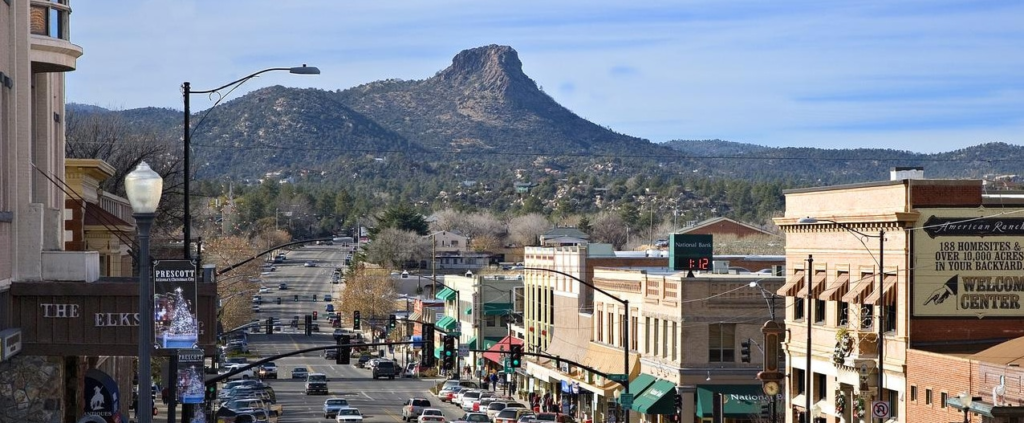
Prescott, Arizona

The afternoon monsoon looks to be full and robust tomorrow in the Four Corners region. That means very little for us, however. Prescott will have a slim chance for some afternoon showers and storms, but by that time, we will be deep into the Mohave, hoping our tires don’t melt to the road in the heat. Temperatures will easily reach the triple digits tomorrow in Bakersfield, and you have to imagine it will climb even warmer before we reach town in rural California.

Bakersfield, California

Tallahassee, Florida to San Diego, California

Hello, and happy weekend! In the dead heat of summer, a road trip across the southern US sounds like the last thing one might want to do, but frankly, most cars have functioning air conditioning, so why not? It will take us a surprisingly swift 4 days at a pace of 70+mph, which is pretty close to our top speed, maybe ever. This will allow us to cover the 2176 miles between the towns in 561 mile chunks (a little less, somehow, on Day 4). Let’s blow the doors off this thing, huh?

DAY ONE (Saturday)

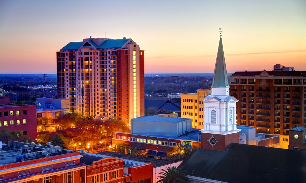
Tallahassee, Florida

Thunderstorms are raging in the Plains tonight, from Colorado and Nebraska southeast through Iowa and Illinois. They will continue to shift to the east southeast through the day. Bad news for the middle of the country but good news for drivers on the Gulf Coast. The showers and storms will be focused along this axis of instability, and will steer clear of the immediate Gulf Coast, leaving only a little bit of spotty activity between Mobile and New Orleans, but not much else. Our day will end on the east side of Lake Charles, still reeling from the last hurricane season. Thankfully, we’ve been quiet so far.

DAY TWO (Sunday)
That feature in the middle of the country is going to slow down and wind up over the weekend. A cold front will develop over north Texas and become evident by the evening in the Dallas area, but we aren’t driving through north Texas or Dallas. It will stay Texas hot and Texas dry in the southern part of the state. We’ll get just west of Ozona before we conclude our drive for Sunday.

DAY THREE (Monday)
The drive will continue through mostly pleasant conditions on Monday, but the seasonal monsoon is underway out west. The slightly elevated ground along the New Mexico – Arizona border could provide some fertile ground for scattered thunderstorms, and we might see a splash west of Lordstown, New Mexico. They will mostly be wrapped up, but still possible as we slide into Wilcox, east of Tucson.

DAY FOUR (Tuesday)
A similar pattern is expected for Tuesday. Importantly, this means that showers and storms will wait until late in the day to develop, and will generally be confined to the same spots on Tuesday as they were on Monday. That is to say, they will be most likely in the New Mexico/Arizona border region, which we will long be out of by the time thunderstorms develop. It’s just the hot, dry desert for us through Arizona and inland California, with the pearl at the end of the drive, beautiful San Diego.

San Diego, California

Valdosta, Georgia to Saginaw, Michigan

So many of our trips are west to east, but not enough follow the longitude more closely. Our drive will last for two days and cover 1025 well interstated miles. The pace will be a swift 67.4mph thanks to the busy roads we travel. Day one will be the longer of the two days, requiring us to cover 539.5 miles. Not much longer, but it still counts as longer.

DAY ONE (Wednesday)

Valdosta, Georgia

Summer is all different things to all different people, and this year, with the wide variety of weather hitting different neighborhoods, there is a little something for everyone. The southeast generally sees popcorn showers and thunderstorms every afternoon during the dog days. There will indeed be a few isolated showers and storms over Georgia, populating earlier than normal. There will be a hazy pause in eastern Tennessee, but a stalled surface trough, running perpendicular to our route, will be the source of showers and storms as we trek into Kentucky. The threat for rain will be highest for the last hour or so, as we pull into Pittsburg, near London, Kentucky.

DAY TWO (Thursday)
That surface trough is orphaned in the Ohio Valley, and will continue to be a source of precipitation on Thursday. As time progresses though, a perturbation will develop in this trough, and rain fall will organize and become heavier by the time we leave. The best threat for heavy rain with isolated thunderstorms for the entire trip will be from the beginning of our day on Thursday through about Sidney, Ohio. Dry air is likely in northwest Ohio, with a stray shower repopulating around Saginaw Bay, just at the very tail end of this soggy drive.

Saginaw, Michigan

Columbia, South Carolina to Fayetteville, Arkansas

There are certainly a few different Columbia to Fayetteville options out there, and this was the longest trip possible of any of those combinations. This particular iteration will result in a day and a half drive, covering 921 miles. The pace between these SEC college campuses will be a somewhat tame 61.9mph covering 495 mile on our first day of travel. Let’s just get going, then.

DAY ONE (Sunday)

Columbia, South Carolina

It’s certainly a nuisance for residence from the central Plains to the Great Lakes to have to endure several days of rain and thunderstorms, but as we drive from Columbia through northern Georgia, we will reap the benefits. The moisture being directed further to the north and west will allow the southeast to dry out a bit. A stream of moisture keeps showing up on the various model runs in the late evening over eastern Alabama, so don’t be surprised to see a little rain from the Georgia line to Birmingham. Mostly cloudy, warm and muggy conditions will continue west to Tupelo, Mississippi where we will round out the day.

DAY TWO (Monday)
The five plus hours through northern Mississippi, and across the state of Arkansas will be increasingly cloudy, and the higher terrain in northern Arkansas is likely to see spots of misty fog. Rain should stay clear of our route, but for the very end, when an isolated thunderstorm will certainly be possible along the hilly I-49 stretch, reaching into Fayetteville.

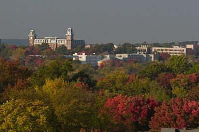
Fayetteville, Arkansas