Asheville is one of the more surprisingly attractive vacation destinations, thanks both to the setting in the Blue Ridge Mountains, and destinations like the Biltmore Mansion. Hopefully, the weather holds for any off season visitors.
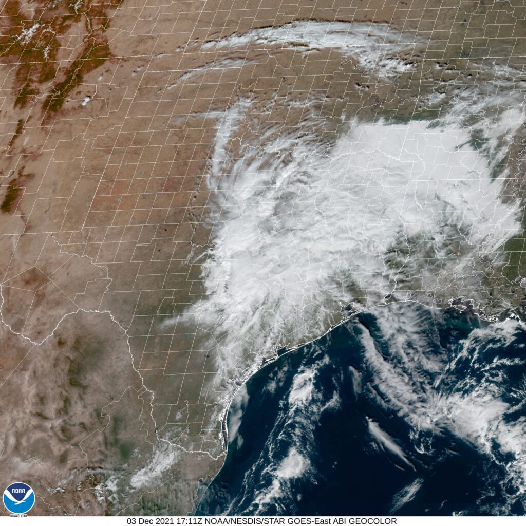
At 1154AM, ET, Ashville was reporting some haze, with clear skies and a temperature of 60 degrees. High pressure centered over the Great Lakes was the name of the game, but lingering moisture from the Gulf was interacting with a surface feature in Alabama, bringing about some clouds south and west of the southern Appalachians, which was generating western slope overcast and a large whorl south of Asheville, but no real concerns.
All eyes will be on a still developing trough and surface low in the northern High Plains. A cold front will be come well evident west of the Appalachians, from Lake Erie to Arkansas by tomorrow night, and the rotational energy with the system will eventually bring some warmer conditions and scattered clouds on Sunday and Monday as the boundary stages. As the parent low starts to track poleward and the front encounters the mountains, it will begin to deteriorate. Still, a little bit of rain is expected on Monday evening, with some cooling after the forecast period.
Tomorrow – Breezy and mostly cloudy, High 54, Low 46
Monday – Partly cloudy early, with increasing clouds and rain late, High 61, Low 44
TWC: Tomorrow – Intervals of clouds and sunshine High 55, Low 43
Monday – Overcast with rain showers at times. High 63, Low 47
AW: Tomorrow – Mostly cloudy and cooler High 55, Low 44
Monday – Mostly cloudy with a bit of rain in the afternoon High 66, Low 41
NWS: Tomorrow – Mostly sunny (late rain), High 56, Low 44
Monday – Showers likely, mainly between 11am and 4pm. Mostly cloudy, High 64, Low 39
WB: Tomorrow – Mostly sunny in the morning, then becoming partly cloudy (late rain) High 53, Low 46
Monday – Showers likely, High 63, Low 39
WN: Tomorrow – Partly cloudy, high 55, Low 43
Monday – Mostly cloudy with light showers likely, High 63, Low 47
FIO: Tomorrow – Partly cloudy throughout the day. High 56, Low 44
Monday – Overcast throughout the day. High 65, Low 35
Those lows on Monday are going to be non standard, and places like The Weather Channel will be hurt by not having hourly forecasts out that far. If the clouds don’t fill in ahead of the front tomorrow like we expect, there is some real bust potential. Today, the satellite imagery looks more interesting than it probably is.