
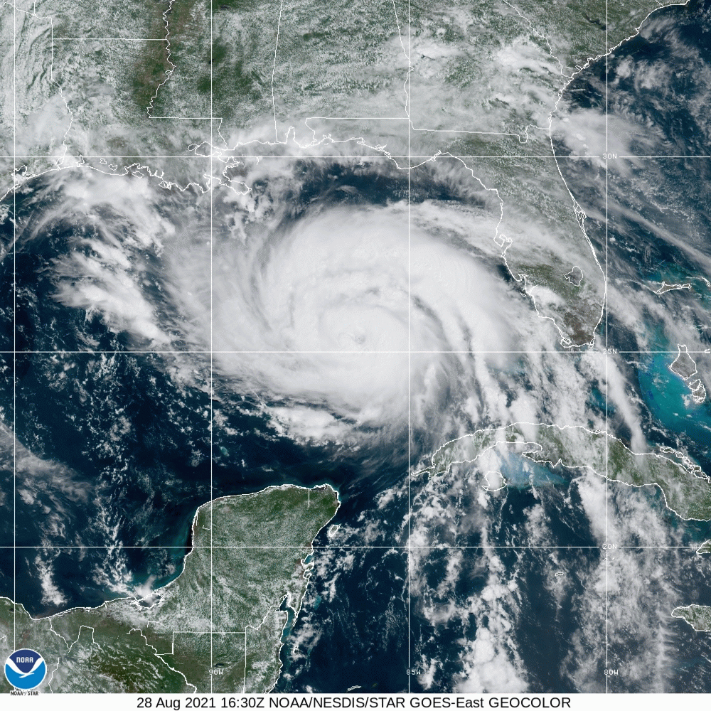
Hurricane Ida sits off the coast of Louisiana, and will descend upon the Bayou State tomorrow. Strong winds are already starting to pick up from Mobile to the Mississippi Delta. At this hour, Ida is a Category 2, but she is slowing down her momentum and is anticipated to strengthen rapidly. The NHC suggests that Ida will become a major hurricane, likely a Category 4 before she comes ashore.
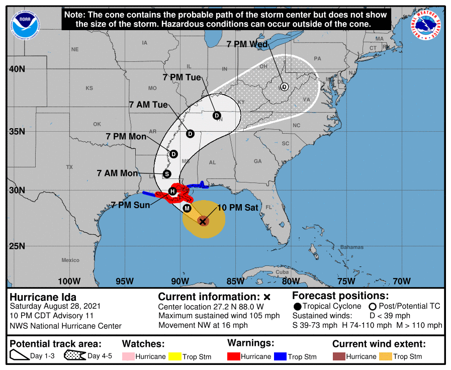
Ida’s swift momentum before this point brings good news, in the fact the storm surge will not be as terrible as it could be, given it’s status as a major hurricane. The rapid development before it makes landfall also limits the fetch and the subsequent coastal flooding. Additionally, if Ida closely follows the forecast track, she will landfall south of Houma, a bayou laden, sparsely populated (relatively) stretch of coastline. This is the good news.
The bad news is that a Category 4 storm is still strong. It will pass near enough to New Orleans to cause significant problems. There will also be a disruption to the platforms in the Gulf, and a hike to gas prices nationally as a result. Also, with Ida’s recent slowdown, heavy rain and flash flooding will become a concern. The gravest concern, and what makes Ida more dangerous than most, is that because she is expected to develop so quickly, mass evacuations were not issued. There are simply far more people in the line of fire than there would be typically when a major hurricane is bearing down.
Another bit of good fortune is that Ida is a compact storm, and as a result, will not impact even the entire state of Louisiana. Where she will impact though, will struggle to recuperate. Ida will landfall tomorrow evening, and will finally pull away from Louisiana on Monday evening.