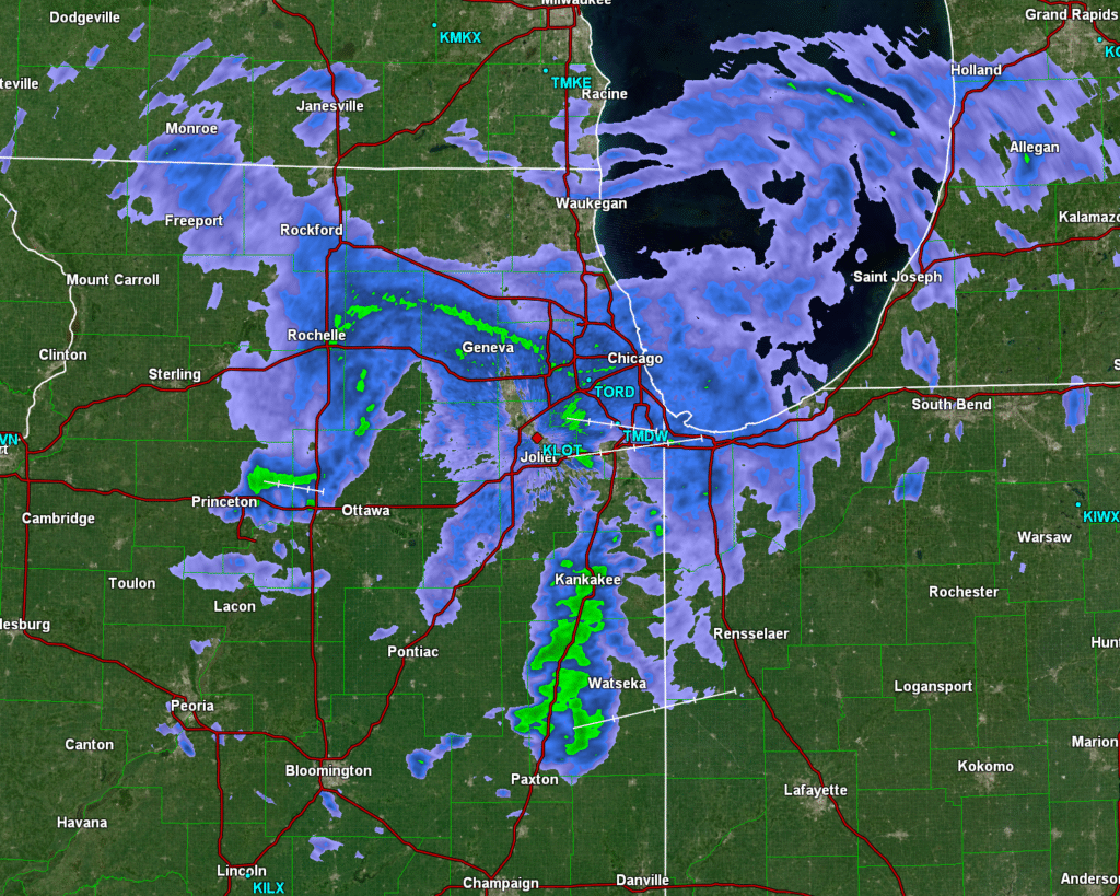
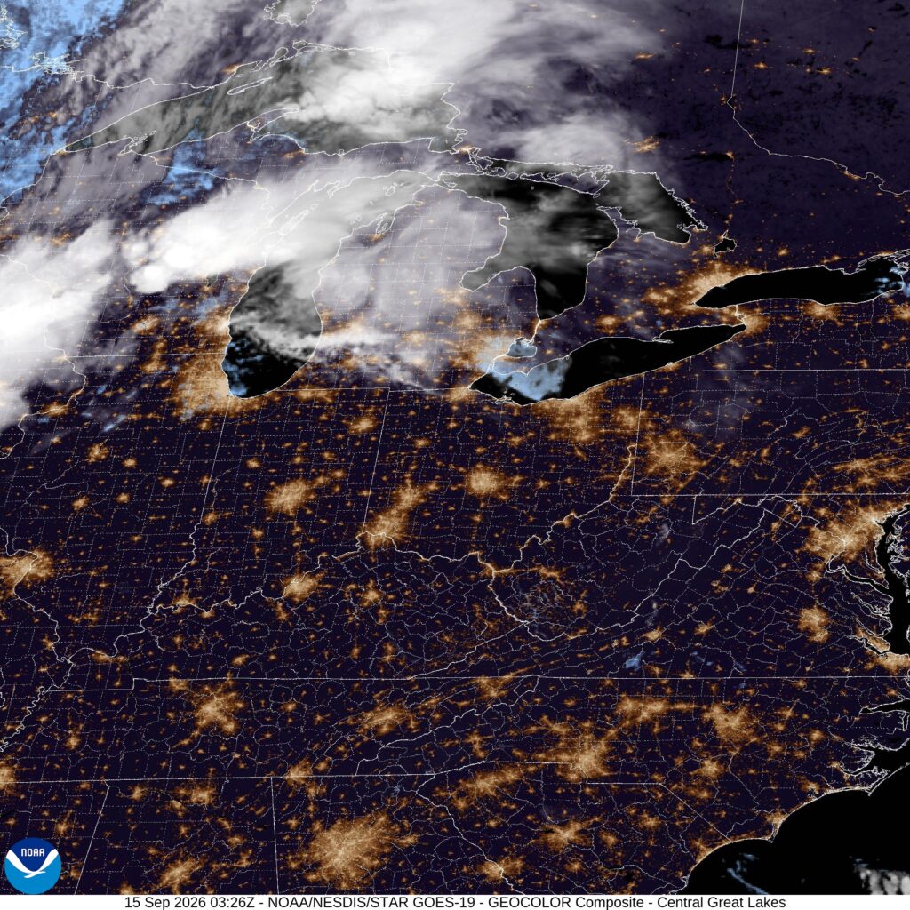
11:43AM: IF you are a football fan, you probably enjoy a good snowy battle. How do you feel about rainy and drizzle? The Vikings play the Bears at noon.
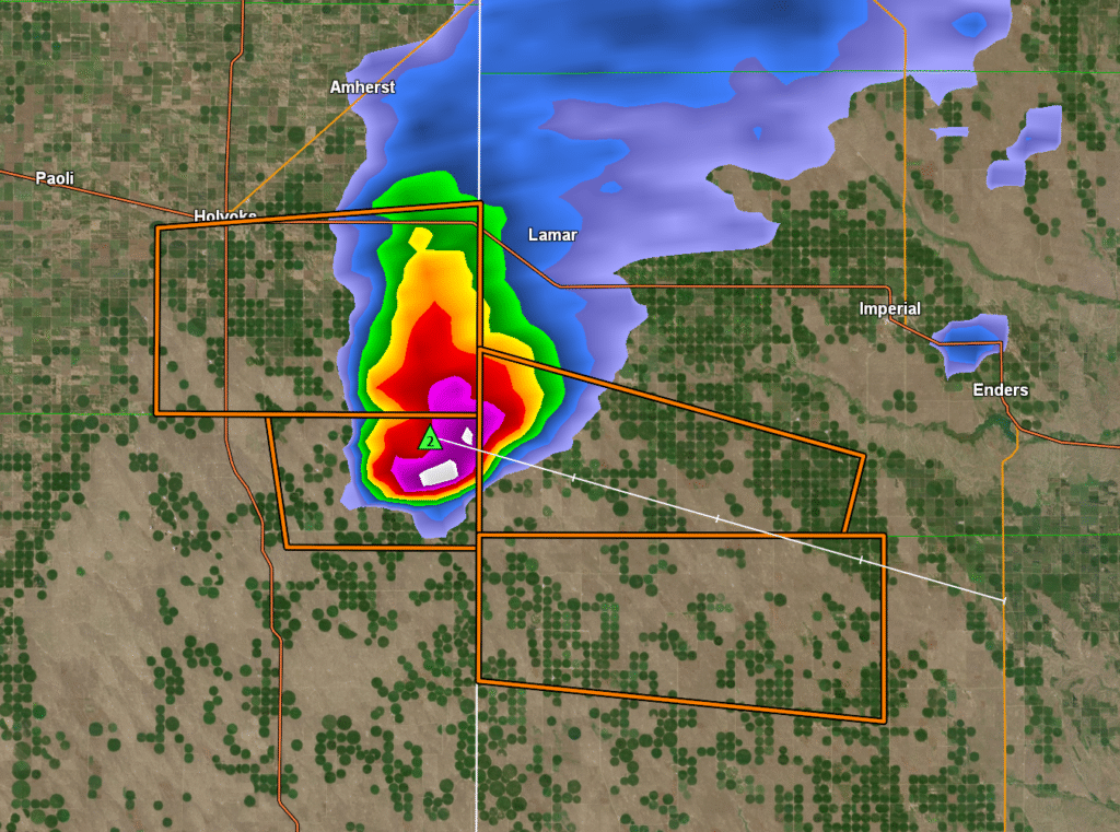
3:32PM: There is a big ol’ thunderstorm cell along the Colorado/Kansas border. It will be dropping some big hail, some outflow winds and a complicated array of severe thunderstorm warnings.
Rarely is there a day like this, where the weather in my location is going to be vastly different than the town I am forecasting for. That happens most typically when I am looking at the West Coast, but I Memphis isn’t so far from Minnesota that it should feel like an entirely different season!
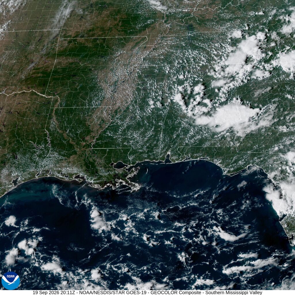
At 254PM, CT, Memphis was reporting clear skies and a temperature of 99 degrees. An area of low pressure over Canada dangled a slow moving boundary through the Great Lakes to Iowa. Typically, this position, especially with the heat in Memphis, would lead to scattered showers in the region, however a weak upper level gyre over the Florida Peninsula was redirecting flow back eastward, and away from Memphis. At the gyre drifts into the Gulfs Stream, it will strengthen and drift to join with the upper level trough. This won’t be directly impactful for Memphis, but it will allow the rich tropical air to move north and flood towards that boundary. There is a better chance for rain and storms to begin the work week, after a grueling hot weekend. Tomorrow – Hot, High 100, Low 77 Monday – Sunny, some clouds and a late storm, High 98, Low 77
TWC: Tomorrow – A few clouds early, otherwise mostly sunny. Hot High 100, Low 75 Monday – Partly cloudy. A stray shower or thunderstorm is possible. High 97, Low 75
AW: Tomorrow – Partly sunny and very hot with the temperature approaching the record high of 100 last reached in 2022; caution advised if outside for extended periods of time High 99, Low 74 Monday – Partly sunny and toasty conditions; an afternoon thunderstorm; caution advised if doing strenuous activities outside High 95, Low 74
NWS: Tomorrow – Mostly sunny and hot, High 100, Low 76 Monday – Mostly sunny and hot, High 98, Low 76
WB: Tomorrow – Mostly sunny in the afternoon High 94, Low 78 Monday – Mostly sunny. High 96, Low 79
WN: Tomorrow – Partly Cloudy, High 100, Low 76 Monday – Partly cloudy, High 98, Low 76
CLI: Tomorrow – Sunny, High 99, Low 77 Monday – Partly cloudy High 97, Low 75
It’s about 30 degrees warmer in Memphis than it is not far to the north. There is a circulation centered around Tampa, but again another one over Mississippi. Just churning away.
1:29PM: There are two stories this weekend on the weather front, and they are both part of the same story: There is a whole lot of rain in the middle of the country, and it is very warm in the Southeast. That rain is along a slow moving boundary, behind which lies early autumn.
North Central PA has the ability to be a tricky forecast, because it is squeezed between the Atlantic and Great Lakes, all while nestled in the folds of the Allegheny Mountains. Tricky!
At 954PM, ET, Williamsport was reporting a temperature of 55 degrees with clear skies. The cool temperatures, valley location and clear skies are all ingredients that will lead to overnight fog. A stout ridge lays over the Mid-Atlantic, despite a strong trough attempting to move in from the northern Plains. Eastern Pennsylvania will remain clear and fairly sunny through midweek while the boundary and trough dissipate and stall, respectively. Flow will become more southerly, however, leading to a warmer day on Wednesday in Williamsport. Tomorrow – Mostly sunny, High 73, Low 48 Wednesday – Mostly sunny and warmer. High 81, Low 54
TWC: Tomorrow – Partly cloudy skies. High 74, Low 46 Wednesday – A shower or two possible early with partly cloudy skies in the afternoon. High 81, Low 55
AW: Tomorrow – Mostly sunny in the morning followed by sun and areas of high clouds; pleasant with low humidity HIgh 74, Low 46 Wednesday – Sun through high clouds High 79, Low 53
NWS: Tomorrow – Patchy fog before 9am. Otherwise, sunny, High 74, Low 45 Wednesday – Areas of fog before 10am. Otherwise, mostly sunny, High 81, Low 52
WB: Tomorrow – Patchy fog in the morning. Sunny. High 73, Low 50 Wednesday – Patchy fog in the morning. Mostly sunny. High 80. Low 55
WN: Tomorrow – Mostly sunny, High 73, Low 45 Wednesday – Partly cloudy, High 80, Low 52
CLI: Tomorrow – Sunny, High 72, Low 47 Wednesday – Light rain showers, High 79, Low 55
Those smatterings of rain showers are particularly interesting to me. The radar and cloud cover are pretty empty tonight.
2:21PM: Here is an interesting dynamic. In eastern Washington, there are flood watches and advisories for the region, thanks to some steady shower activity. Meanwhile, in Oregon, there are forecasts and advisories counting for low water levels in the western part of the state. One hopes the water in eastern Washington will see water flow downstream towards the Oregon coast.
11:14PM: There was rain in the forecast from several outlets for Morristown, and it if happened, it’s gone now. Very dry tonight in Tennessee.
As we head into the weekend, how about a nice little drive through the mountains? Our drive will cover only 4 and a half hours and 276 miles. That’s a pace of 62 winding miles through the Appalachians and Smoky Mountains.
Burlington, North Carolina
This drive will take us north into Virginia so we can hitch a ride on I-81 and head into Morristown. There are going to be a pair of competing forces, including a weak area of low pressure in the Bight of Georgia, and a distant boundary in the Plains. They will have the same effect on either side of the mountain ridge: upslope winds, leading to scattered showers and storms. It will be showery for every leg of the drive on Saturday, but it won’t be a washout. It’s often rainy in this part of the world anyway, so we can’t complain a whole lot. The latter half of the weekend will be sunnier and warmer in Morristown.
It’s time to journey to the mountains of eastern Tennessee this afternoon. Technically, I think it’s also northern Tennessee, but who can even say? It’s in that little finger pointing at the Virginia/North Carolina border.
At 1215PM, ET, Morristown was reporting a temperature of 86 degrees with clear skies. The tail of a remnant boundary was lingering over the Carolinas, and the Gulf was open to the Ohio Valley. Showers and scattered storms will be possible through the afternoon across the region, though Morristown should remain dry, thanks to the position of the town north and west of the Smokeys, however eyes should stay on the next feature moving into the Northern Plains. As the boundary moves into the Upper Midwest, flow will redirect to become lightly southwesterly. The boundary itself will remain over the Great Lakes, but the moisture over the southeast will waft towards Morristown. There will be a chance of light showers on Saturday afternoon. As the feature shifts further east, the Gulf will close off, and clear skies will return to eastern Tennessee. Tomorrow – Mostly cloudy, chance of afternoon showers, High 80, Low 69 Sunday – Early cloudy, then sunny, High 86, Low 68
TWC: Tomorrow – Scattered thunderstorms in the morning, then mainly cloudy during the afternoon High 81, Low 69 Sunday – Partly cloudy. A stray shower or thunderstorm is possible High 88, Low 66
AW: Tomorrow – Times of clouds and sun with a couple of showers and a thunderstorm; humid; thunderstorms can bring gusty winds and ponding on roadways High 81, Low 69 Sunday – Times of clouds and sun with widely separated thunderstorms; humid High 85, Low 69
NWS: Tomorrow – A chance of showers and thunderstorms, then showers likely and possibly a thunderstorm after 2pm. Cloudy, then gradually becoming mostly sunny High 86, Low 69 Sunday – A 30 percent chance of showers, mainly before 8am. Mostly sunny, High 87, Low 67
WB: Tomorrow – Mostly cloudy with a chance of showers with a slight chance of thunderstorms in the morning, then showers with a chance of thunderstorms in the afternoon. High 81, Low 71 Sunday – Mostly sunny. A slight chance of showers in the morning. High 87, Low 70
WN: Tomorrow – Mostly cloudy with light showers and a chance of storms, High 86, Low 69 Sunday – Partly cloudy with scattered showers, High 87, Low 67
CLI: Tomorrow – Thunderstorm, High 82, Low 70 Sunday – Light rain showers, High 87, Low 69
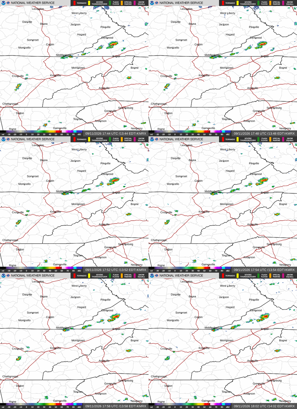
I’m surprised the other outlets are calling for rain on Sunday. It seems like it will be a bit of a challenge. Here is the radar, showing a couple of pop up storms in southern Kentucky.
11:19pm: The last whimpers of rain are winding down in the Appalachians. There will be some real storms, albeit briefly, in northern Minnesota tomorrow afternoon, in the event you are in the mood for radar watching.
I just posted about the unusually quiet Atlantic hurricane season. All good there, even a day later. We don’t often talk about the tropical season in the Pacific, because the gyre of the ocean usually keeps storms further to the south, and the general flow of the tropics is east to west, away from the North American mainland. There can be storms that veer poleward, striking the Mexican coast, but the Mexican Pacific is typically quieter than the Mexican Atlantic, particularly the Yucatan Peninsula.
There is one other territory out there, however. Hawai’i sits all by it’s geographic lonesome in the middle of the Pacific Ocean. Typically, hurricanes remain to the south of Hawaii, or never can sustain themselves far enough to the west to afflict the Aloha State. This year, the state has been impacted by two.
Hurricane Lala danced around the the southern coasts of the islands, causing it’s greatest impact to the Big Island, where 4 deaths were attributed to the storm. The greatest issue here was the heavy rain and flooding, though the high winds certainly caused issues of their own, including down power lines in Oahu. On the north side of Hawai’i (the island) one site reported 43″ of rain! While this site was on the north shore, LaLa passed on the south side of the the chain, which is the leeward side of the islands, and does not receive anywhere close to the rainfall seen on the windward side.
Lala was the first hurricane to impact the Big Island since 1871, if that give you an idea of how rare that is. So now that Hurricane Lowell is bearing down on Kauai, this hurricane season is truly remarkable in Hawai’i. Lowell, like Lala, won’t make landfall on the island, but it is forcing the National Weather Service to do something that I don’t know they have ever done: They issued a tornado watch for Kauai and the surrounding waters.
Lowell, as charted from the image pulled from his Wikipedia page, has taken a hard turn to the north towards the islands, and will likely be a hurricane when he makes his pass. Hurricanes often produce tornadoes, but Lala, for example, didn’t have the same rotation and pressure depth Lowell currently does. Given the threat of tornadoes from hurricanes, a watch absolutely makes sense, but Hawai’i’s place in the tropics, and it’s previous ability to avoid tropical storms makes this an incredible rarity.
Also, it’s a lesson for me, even. The Storm Prediction Center only covers the Continental US. Alaska has never had a tornado watch, and until now, neither has Hawai’i, and it was issued by the forecast office in Honolulu.
Lowell will continue to shift north and west. Tornadoes are scary, especially for a part of the world that doesn’t have basements or shelters, however the primary threat, like with Lala, will be rain and flash flooding. Hawai’i contains islands of volcanic origin, so they are filled with rugged terrain and narrow valleys. The leeward side will collect the brunt of the storm, and may sustain significant flood related damage. There will be some surge, but Hawai’i being isolated in the ocean means that water will have other places to go than inland.
Lowell will be off to bother the fish and birds by Tuesday afternoon, and subsequently weaken before hooking back to the east to batter Midway. This is an historic event for the Islands, and a real test for residents there.