Last weekend was a wet one in New England, and then, perhaps you heard, there was a ‘bomb’ cyclone later in this past week. As is often our luck, when we pulled the forecast for Boston, we found it between the two wet and windy spells. Temperatures were comfortable, especially without wind or rain. Speaking of comfortable, Victoria-Weather won this forecast… comfortably. Actuals: Sunday, High 67, Low 53 Monday – High 64, Low 52
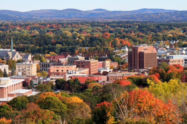
Fall colors are in full bloom across the Great Lakes. Are there any leaf peepers headed to northwest Ohio?
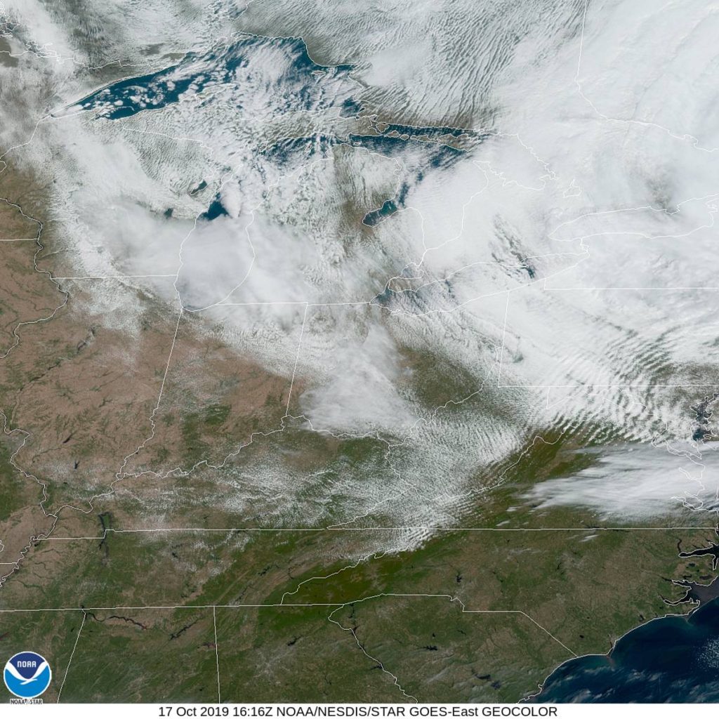
At 1152AM, ET, Toledo was reporting mostly cloudy skies with a temperature of 51 degrees. Toledo was on the back side of a strong system moving through New England, which resulted in a brisk northerly flow across the region. there was a tendril of clearer skies right over Toledo, but the back end of the clouds is over Wisconsin and Illinois. After some clear air gets to Toledo, the primary influencer will be a tropical disturbance developing now in the Gulf of Mexico, headed northeast across north Florida towards the Carolinas, which will sap moisture from a cold front advancing through the Upper Midwest. Ahead of the front, and on the back of the tropical feature, warmer air will filter into Toledo, with clouds likely across Lake Erie. Tomorrow – Partly cloudy, much less wind, High 56, low 35 Saturday – Partly cloudy and warmer, High 64, Low 36
TWC: Generally sunny despite a few afternoon clouds. high 56, low 36 Saturday – Generally sunny despite a few afternoon clouds., High 65, Low 38
AW: Tomorrow – Plenty of sunshine High 57, low 36 Saturday – Partly sunny and pleasant High 66, Low 38
NWS: Tomorrow – Sunny, High 55, Low 38 Saturday – Mostly sunny, High 65, Low 42
WB: Tomorrow – Areas of frost in the morning. Mostly sunny, High 56, Low 41 Saturday – Mostly sunny, High 65, Low 41
WN: Tomorrow – Mostly sunny, High 55, Low 38 Saturday – Mostly sunny, High 65, Low 42
FIO: Tomorrow – Partly cloudy throughout the day. High 57, Low 36 Saturday – Partly cloudy throughout the day. High 67, low 38
A look at the satellite shows that cloud cover at the western flank of the big storm on the east coast.
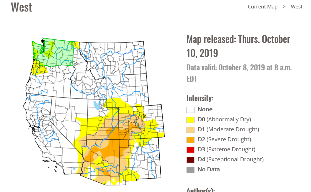
another autumn, another raging inferno in California. The drought ravaged state is once again in the crosshairs — Hold on, what’s that? California isn’t classified as being in a drought any longer?
The Saddle Ridge Fire is burning on the northern edge of the San Fernando Valley, safely ensconced in the “None” range of the drought monitory, as of October 10th. I assure you, a drought didn’t develop in the last few days, either. California had a very wet spring, which has allayed the drought in the area, including the San Fernando Valley.
Wildfires are a natural part of the rebirth of the southern California wilderness. It’s a very dry climate, and even if they are receiving the typical amount of precipitation, and this time of year usually features a few fires, aided by hot, brisk winds out of the Mojave, the so called Santa Ana’s. The Saddle Ridge Fre is dangerous, but it is not atypical.
This is making headlines simply because of the location. With populations growing, particularly on the west coast, these regular occurrences suddenly take on an even more menacing turn, as they start near populated areas with greater frequency, and ravage those same areas that may have been many miles away just a decade or two ago.
California is home to a host of potential disasters, and as the population continues to grow and sprawl, they become more and more likely to become catastrophes.
Happy weekend, everyone! We’re going to stop in Beantown to see how life is now that we’ve finished with a nasty early season storm.
At 1254AM, ET, Boston was reporting clear skies and a temperature of 55 degrees. Some fog and clouds were settling in in the Berkshires and across Providence and South Boston, however it will be a race between clouds over the Cape and that fog, as temperatures should level off overnight if cloud cover encroaches. There is clear air over southern New England and in the Mid Atlantic, so if Boston is skirted by the clouds to the south, a foggy Sunday morning seems likely. The dominant feature in the eastern US is a deep area of low pressure in Ontario, with an occluded front through New England and a cold front stretching to the Carolinas. Independent circulation at the occlusion will shift off shore through tomorrow morning, and will deepen into a mostly independent feature, strengthened via good jet support. The amplification looks to be underestimated by the models at this point, but is also going to remain well east of Boston, bringing perhaps some low clouds and a little bit of wind on Monday. Tomorrow – Mostly sunny, High 66. Low 53 Monday – Mostly cloudy, High 65, Low 51
TWC: Tomorrow – Partly cloudy. High 68, Low 52 Monday – Sunshine and clouds mixed. High 67, Low 51
AW: Tomorrow – Clouds and breaks of sun High 68, Low 54 Monday – Clouds and breaks of sun, High 67, Low 52
NWS: Tomorrow – Mostly sunny, HIgh 66, Low 49 Monday – A chance of showers between 9am and noon. Partly sunny HIgh 66, Low 50
WB: Tomorrow – Mostly sunny, High 65, Low 50 Monday – Partly sunny with a 30% chance of showers, High 64, Low 51
WN: Tomorrow – Partly cloudy, HIgh 66, Low 50 Monday – Partly cloudy with scattered showers, High 66, Low 50
FIO: Tomorrow – Mostly cloudy throughout the day. High 65, Low 51 Monday – Partly cloudy throughout the day. High 63, Low 49
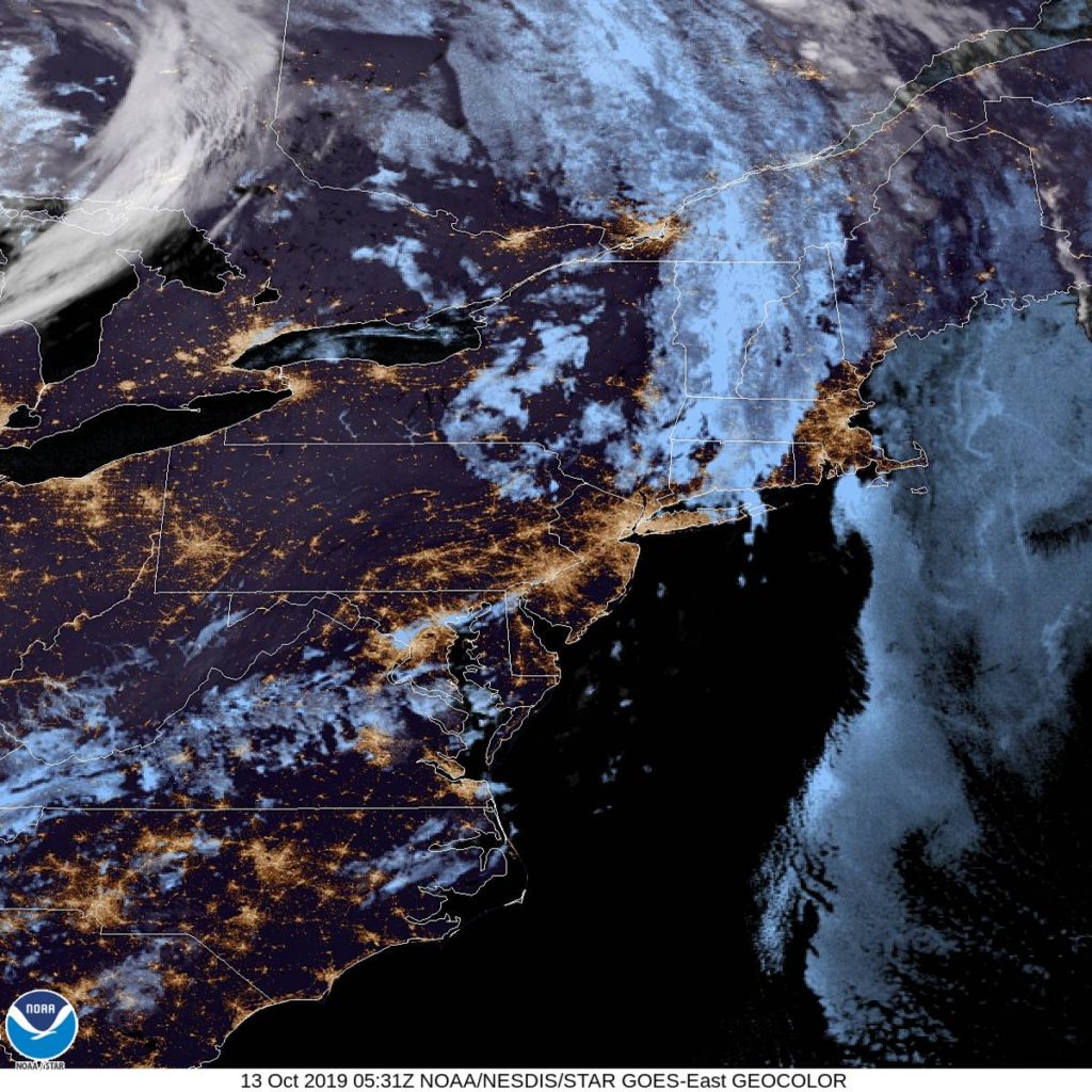
The NWS and friends are going for the shower potential, but it isn’t a popular forecast elsewhere. 60s seem pretty tolerable for October. Here is the satellite, with clear skies ready to move north.
As the Northern Plains get pummeled by a historic early-season blizzard, we’re going to take a look at a locale that would probably bring visions of snow and crisp air to the mind, Lewiston, Maine! Surely they’re doing better than our neighbors in the Dakotas, right?
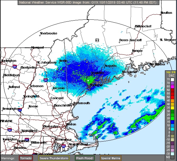
At 1056pm EDT, the temperature at Lewiston, ME was 51 degrees under fair skies. While a potent winter storm hits the Central US, a nor’easter is busy spinning its’ wheels off the Eastern Seaboard. It’s been pushing plenty of rain into Southern New England over the last 24 hours along with persistent northeasterly winds, causing coastal flooding in areas. While some shower activity may get close to the coast during the day Friday, we’re expecting the Lewiston area to remain dry. As the low finally gets moving towards Nova Scotia, some light shower activity may affect the area early Saturday morning before drying out for the rest of the day. It may not be a washout, but overall, not a great start to the weekend weather-wise.
Friday: Overcast. High 58, Low 43.
Saturday: Cooler with scattered morning showers. High 54, Low 43.
NWS: Friday: Overcast. High 57, Low 44.
Saturday: Showers expected. High 53, Low 46.
AW: Friday: Rather cloudy. High 57, Low 43.
Saturday: Rain and drizzle in the morning. High 51, Low 44.
NWS: Friday: Mostly cloudy, couple of late showers. High 58, Low 43.
Saturday: Scattered showers. High 53, Low 43.
WB: Friday: Mostly cloudy. High 55, Low 44.
Saturday: Scattered showers in morning. High 53, Low 46.
WN: Friday: Mostly cloudy, showers late. High 58, Low 43.
Saturday: Mostly cloudy with scattered showers. High 53, Low 43.
FIO: Friday: Mostly cloudy throughout the day. High 61, Low 45.
Saturday: Possible drizzle in the morning. High 55, Low 48.
The Lewiston area is dry currently, but those rain showers sitting offshore will slowly rotate their way inland during the weekend.
It’s a beautiful day here at VW HQ, temperatures in the low 70s, dew pts in the upper 30s, breeze is a bit stronger than I care to enjoy but I wont complain. Tomorrow looks to be just as enjoyable as well around here. This lovely weather should totally go on for the indefinite future as we head deeper into OctOH MY GOD… checks models
Currently there’s an area of low pressure off the East Coast and over the next couple of days, looks like it will sit just off southern New England and focus a ton of rain right at RI, CT, MA. Strong high pressure sits over Southeast Canada and extends through the Great Lakes all the way down to the TN Valley. What this is doing is causing a blocking pattern and as low pressure ejects out into the Plains late Wednesday into Thursday, it has nowhere to go but basically north-northeast, from eastern KS to MN/WI. Given the cold air that will work its way in on the backside of this system as well, it’s shaping up to possibly produce quite the snowfall from western Nebraska/eastern Wyoming northward through the Dakotas. While it’s a bit early to pin down where the highest snowfall will happen, the Central Dakotas have the highest chance of seeing 6-12″ of snow and combine with winds of 25-35mph. One interesting thing to note is that the top analog to the setup of this system is the Halloween Blizzard of 1991. I’m not going to insinuate that we’re going to have a similar epic snowstorm around here, it’s just something interesting to point out.
It’s been unseasonably warm through a good portion of the Eastern US, and the last few days over the Central US, but this system looks like it’s going to give at least a few states in the Northern US a rude awakening that Winter isn’t as far off as we’d like to think it is.
The weekend forecast for College Station, TX was pretty straightforward: Hot and dry. That’s pretty much how it panned out as well. The only hitch in the forecast’s giddy-up was that the overnight lows were just a smidge higher than some had expected. Oh well, I doubt too many people were complaining about it being 74 instead of 72. Weatherbug narrowly edged out NWS/WN for the victory.
Saturday: High 97, Low 74. Sunday: High 94, Low 74. Forecast Grade: A
Let’s go for a drive. And while we’re at it, let’s go for a drive in the fall before the Lake Effect machine gets going. It takes two days to get from northern Indiana to Maine, though the second day might be an hour longer. The distance is 1,151 miles, which we will navigate at a speed of 65.5mph, pinning us somewhere in New York to conclude day one, with the left to spare on day two.
DAY ONE (Tuesday)
By Cameronloyd03 – Own work, CC BY-SA 4.0, https://commons.wikimedia.org/w/index.php?curid=61605902
Fall is coming to the northern part of the country, and it s coming in the form of a cold front sweeping into New England as we speak. Cool high pressure is pressing into the Great Lakes, and as we leave Kokomo, we will be headed right into this high pressure. We’ll make our way through northern Ohio and drive the southern shore of Lake Erie, all with barely a cloud, and make it to Le Roy, New York, south of Rochester as we take our sole pause on the journey.
DAY TWO (Wednesday) As that cold front gets off shore, it will phase with an upper level trough, and start development into an early season nor’easter. Terrific! Most of the drive in the Empire State will be dry, but east of Albany, the rain will start. It will be persistent and accompanied by stiff gales all the way through Massachusetts. Leaves are still on trees, so watch out for branches and debris on the roads, but as we pass through Haverhill and into New Hampshire, we will be in the clear, back into that cool, perhaps cloudy high pressure, into Bangor.
As we saw with our monthly review earlier today, we haven’t been terribly active with our forecasts lately and, well, that doesn’t seem to be likely to change in the near future. We’ll still try to make sure to that everyone has a good look at everything that’s going on out there.
We didn’t really do a lot of forecasting this month, as most of our attention was tied to the dangerous and persistent tropical season. Dorian and Imelda took a lot of our attention, but when we were, albeit briefly, focused on the Mainland, it was WeatherNation who snuck in for a victory.