Supertyphoon Mawar is a monster, but catastrophe may be averted

Earlier this week, Supertyphoon Mawar swiftly intensified, then crashed through Guam as a Category 4 storm, the strongest in memory for the US dependency. Damage is extensive, power is out to the island and the recovery will be long and hard. Two men lost their lives, which is tragic, but also a lower figure than one might have anticipated. Mawar only strengthened after passing over the Mariana Islands, but if forecasts are accurate, Mawar will not go down as one of the typhoons of legend in the western Pacific.

There is some model consensus on Mawar’s future. An area of low pressure is expected to move out of eastern Mongolia and northeastern China, across the Korean Peninsula and into the north Pacific. It will drag a cold or stationary front westward and south through China. This will have an effect of bringing Mawar to a full stop, northwest of Luzon in the Phillippines and east of Taiwan, two major population centers.
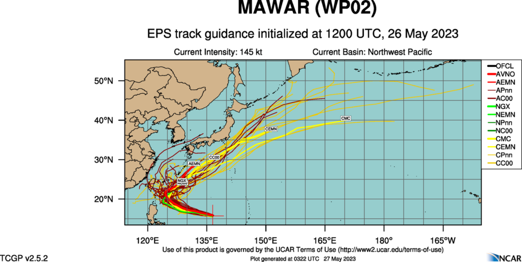
Mawar will still get close enough to both islands to bring high surf and the portential for a little storm surge, especially given the proximity suggested by some models to Taiwan, but we aren’t expecting a direct landfall of this strong storm on either. Then, as Mawar weakens, it will turn north towards, but ultimately southeast of the home islands of Japan, another crisis averted.

That certainly isn’t to say that Mawar will be totally unimpactful after Guam. The storm will move swiflty through the Bonin and Volcano Islands, the most famous of which for Americans is Iwo Jima, which is presently uninhabited. There are also important shipping channels that will be disrupted while the storm churns between all these commercial venues.

There is plenty of time for the tropical season to take a more sinister turn, but for now, we tentatively have had a stay.
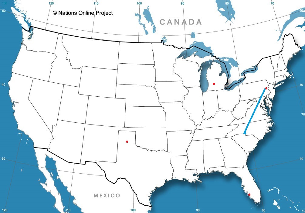
Prescott, Arizona

Arizona has a reputation as being a hot, nearly desolate place in the summer, outside of Phoenix, which is simply hot. Many population centers in Arizona though, have sought refuge in the cooler mountains in the rest of the state. Prescott is one of those towns!

At 1253PM, PT, Prescott was reporting clear skies and a temperature of 75 degrees. As if to illustrate the point of a chillier time in the mountains, the Sun Valley and Phoenix remained in the upper 90s. Temperatures were decided by elevation, and moisture was relatively low. The dry line straddling the Texas-New Mexico border was active, and keeping Prescott and the southwest out of the monsoon, which was already ongoing in the central Rockies.
Aiding the dry line was a weak area of low pressure that had found its way to an anchorage in the southwestern corner of the US. A blocking pattern in the center of the US was going to keep this regime in place for the next several days at least, with moisture kicked up and around the Grand Canyon State. The low pressure will help ensure temperatures in Prescott don’t match those found at lower elevations and to the south for the duration of the forecast period.
Tomorrow – Mostly sunny, High 72, Low 49
Saturday – Mostly sunny, high 76, Low 49

TWC: Tomorrow – Mainly sunny, High 73, Low 48
Saturday – Sunny, High 75, low 46

AW: Tomorrow – Plenty of sun; breezy in the afternoon High 77, Low 48
Saturday – Pleasant with plenty of sunshine High 77, Low 44

NWS: Tomorrow – Sunny, High 77, Low 47
Tomorrow – Sunny, High 79, Low 47

WB: Tomorrow – Breezy, Sunny, high 72, Low 42
Saturday – Sunny, high 74, Low 41

WN: Tomorrow – Sunny, High 72, Low 44
Saturday – Mostly sunny, High 78, Low 47

CLI: Tomorrow – Sunny, High 73, Low 48
Saturday – Sunny, high 75, Low 46

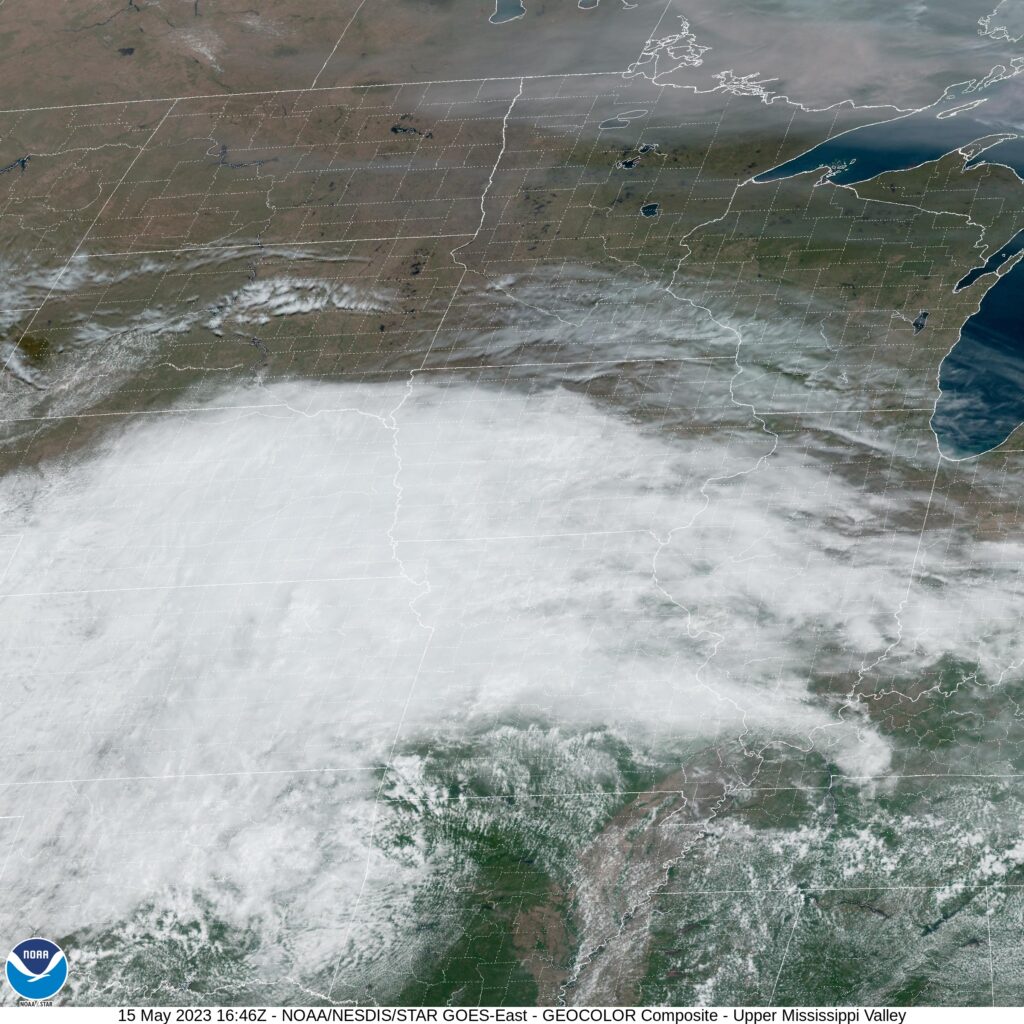
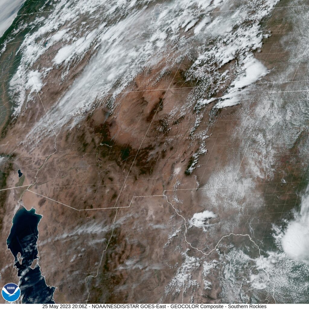
The low temperature guidance is completely divergent, and it appears as though many of our competitors are heeding the longer range, larger scope models. I’m wary, because it is the higher resolution models that are going warmer. I tend to trust them a little bit more when terrain is in play. And thus, I am on the higher end of those low forecasts. Here is the satellite centered over New Mexico, highlighting the flow up and around Arizona.

We are in late spring at this point, and have been undergoing a somewhat early season-ish spell, in which systems were charging through the southern US, leaving the northern US unaffected. As a local resident who was battered through the winter, I fairly appreciate that. It has made for a a chillier stretch through mid-May though, and that is what Iowa City was experiencing towards the beginning of last week. Without a feature moving through on Tuesday, temperatures soared into the 80s, however the next day, a system in the Tennessee Valley brought temperatures in Iowa City back down to the low 80s for a high. Forecasts were fine, though with mostly clear skies we would all like to have done better. The Weather Service and Accuweather drew level for this forecast.
Actuals: Tuesday, High 81, Low 57
Wednesday – High 73, Low 52

Grade: B-C

A reset spring

So many years in a row, we’ve been talking about premature tropical storms, or the ongoing western drought. This season, if there are any major stories, they are of the short lived, spring tornado variety. You know, the type of scenario you would expect if you’ve studied American climatology.

A robust snow season led to considerable concern for a massive flood season, especially in the Upper Midwest and further south through the Mississippi Valley. Fortunately, despite all the snow that the Dakotas and Minnesota saw this season, Iowa saw very little, and instead of aggregating, the threat for downstream flooding withered away. There was flooding in typical spots in the Upper Midwest, but nothing that was particularly overwhelming. Places that are often underwater were once again underwater for a couple of days.

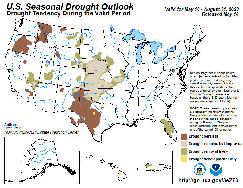
The heavy snow also afflicted the Sierras in California, and while the melting of the season did fill some reservoirs and watery spots that aren’t accustomed to be watery, the snow really served as a net positive, scuttling years of drought, and rescuing the local agricultural economy. In fact, there isn’t even a forecast for drought to return this season. Its part of a nationwide drought recovery forecast this summary, and surely the most notable part.

There is nothing to say that the tropical season won’t be just as active as the forecasts call for either, but that activity had stretched outside of the early bounds of the normal Atlantic hurricane season multiple times in the last decade or so. There are only 10 days until the North Atlantic Season starts, and we still await our first A storm, and will likely wait until the season begins.

There are still plenty of weather stories to continue to monitor and keep your eyes on, but this season is a full reset on a lot of the major weather stories that started the 2020s. For now, we are back to “normal”.

Iowa City, Iowa

Its forecast time, friends! It’s been stormy to begin May in Iowa, and the nearby town of Coralville was winged by a tornado not a month ago. I suspect we will enjoy a bit more tranquil weather this week.

At 1152AM, CT, Iowa City was reporting mostly cloudy skies and a temperature of 62 degrees. It was a bit cooler than might typically be expected in May in eastern Iowa, thanks to low pressure parked over eastern Kansas. In fact, Iowa City was a bit warmer than points westward, where a northerly flow was pressing into the region. Upper level flow is weak, so a look towards lower levels will help dictate the weather through the middle of the week.
As the low center moves nearly due eastward through the Ohio Valley, mostly cloudy to overcast conditions will remain in place through tomorrow morning. Finally, there will be a breakthrough in the afternoon, with sunnier skies and warmer temperatures. The tail of a cold front will slump southward through the Upper Midwest, drawing some southerly flow to the region, followed by a dip in temperatures as flow switches to northerly once again on Wednesday
Tomorrow – Mostly cloudy, High 76, Low 55
Wednesday – Mostly cloudy, High 72, Low 53

TWC: Tomorrow – Partly cloudy. High 80, Low 54
Wednesday – Partly cloudy. High 76, Low 51

AW: Tomorrow – Pleasant and warmer with times of clouds and sun High 81, Low 54
Wednesday – Mostly sunny and beautiful High 76, Low 52

NWS: Tomorrow – Mostly cloudy, then gradually becoming sunny, High 79, Low 53
Wednesday – Sunny, High 73, Low 52

WB: Tomorrow – Partly sunny in the morning then clearing. High 78, Low 53
Wednesday – Sunny, High 75, Low 53

WN: Tomorrow – Partly cloudy, High 79, Low 53
Wednesday – Mostly sunny, High 74, Low 52

CLI: Tomorrow – Partly cloudy, High 77, Low 52
Wednesday – Sunny, High 73, Low 52

Quite a bit of overcast for the state of Iowa this afternoon, but a warm up is on the way.

An unpleasant start to May

Now with forecasts of severe weather and a pending heat wave, it seems like a long time ago that we were talking about the chilly start to the month, as we were in Youngstown.. Well, I guess it was, not that it is already the 14th, but I digress. There was indeed some light snow mixed with rain on the 2nd, which is far too deep into the spring season for my taste. The forecast was a pretty neat affair, with little separating the top forecast from the bottom. The Weather Service and WeatherNation split honors, with a 4 way tie for second just behind them.
Actuals: Monday, May 1st, .31 inches of rain/snow, High 46, Low 38
Tuesday, May 2nd, .39 inches of rain and snow, High 43, Low 37

Grade. A-B

April forecaster of the Month

April was generally cooler than normal for a large swath of the country, and for a long stretch of the time. Lets try to remember the month fondly, though. There was at least one week where the temperatures were in the 80s here in Minneapolis! And Clime can remember things fondly as well, as they were hot in the month of April as well. They secured the top spot for the month.

OutletForecast Wins (year)
Victoria-Weather3
Clime2
National Weather Service2
Weatherbug1
The Weather Channel0.5
WeatherNation0.5
Accuweather

The best day of spring?

I think that there is fairly universal consensus that the best kind of weather is where highs are in the 60s – warm but not too hot- with plenty of sun. As it worked out, that is exactly the weather that Pine Bluff saw on April 24th. The 23rd was cooler with some rain, which made the 24th seem even better. It felt the best, perhaps, for the Weather Service and WeatherNation, who tied for the top forecast.
Actuals: April 23rd: .03 inches of rain, High 57, Low 46
April 24th, High 66, Low 43

Grade: A-D

Youngstown, Ohio

We are headed to northeastern Ohio for our month ending forecast. It should be getting warmer right? Right?

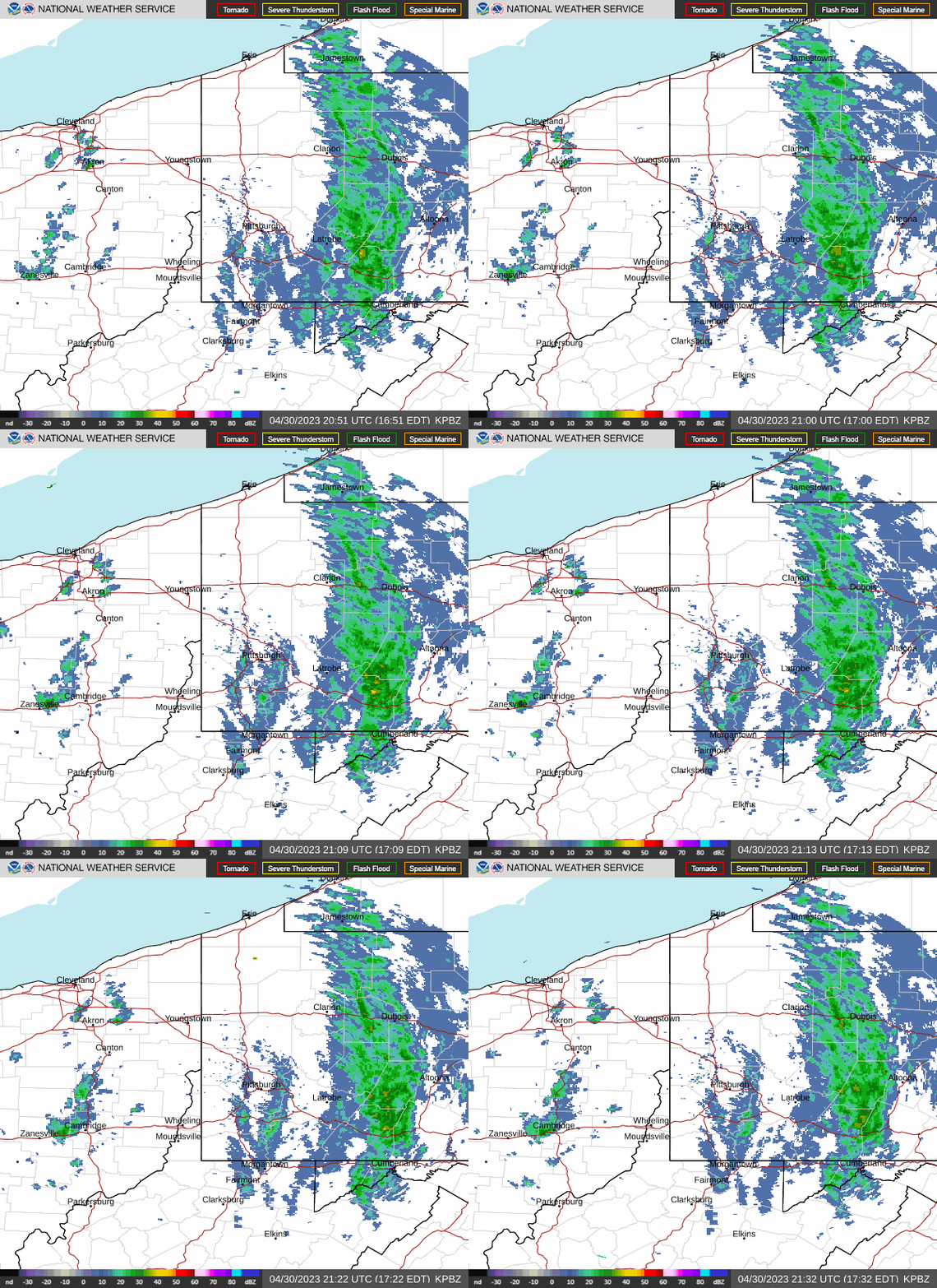
At 451PM, ET, Youngstown was reporting a temperature of 55 degrees with cloudy skies and a brisk west-northwest wind. Low pressure is parked over southern Ontario, and is bringing continuing bands of rain to the upper Ohio Valley. At present, the heaviest rain is falling over central Pennsylvania, while another band of lighter showers is evident on radar along I-77 between Canton and Cambridge.
The center of circulation isn’t going to be urged out of Ontario until after the entrance to a strong jet trough comes into being. That won’t be until Wednesday or Thursday of next week, which means reinforcing chilly flow will continue in Youngstown until then. The surface feature is going to continue occluding through the next couple of days, so clouds and rain will become lighter over time. Unfortunately, that makes it more likely for even chillier temperatures as time goes on. It will be quite breezy throughout the beginning of the week, making already cool temperatures feel even chillier.
Tomorrow – Scattered showers throughout the day, High 48, Low 38
Tuesday – Lighter showers with an isolated peek of sunshine, High 44, Low 34

TWC: Tomorrow – Showers early, becoming a steady rain later in the day.  High 47, Low 39
Tuesday – Rain and snow showers in the morning transitioning to light rain in the afternoon. High 41, Low 36

AW: Tomorrow – Cloudy, breezy and colder with a touch of rain High 45, Low 39
Tuesday- Breezy in the morning; cloudy and cold with a passing shower or two; there can be some wet snowflakes mixed in High 42, Low 35

NWS: Tomorrow – Showers, with thunderstorms also possible after 3pm High 48, Low 38
Tuesday – Rain and snow showers, becoming all rain after 9am.  High 44, Low 36

WB: Tomorrow – Showers. A slight chance of a thunderstorm in the afternoon, High 46, Low 40
Tuesday – Snow showers in the morning. Showers, High 41, Low 36

WN: Tomorrow – Cloudy with light showers and isolated thunderstorms, High 48, Low 38
Tuesday – Mostly cloudy with a light wintry mix, High 44, Low 36

CLI: Tomorrow – Rain showers, High 45, Low 37
Tuesday- Rain showers, High 42, Low 35

Frankly, I think any snow shower activity on Tuesday morning will be inconsequential. Like, a flake or two just to make people feel bad because it will be May 2nd. I don’t have the heart to include it in my forecast. Radar is fairly active, reflective of the larger storm centered to the north.