Harrisonburg, Virginia to Oklahoma City, Oklahoma

It’s time to take the first road trip in Victoria-Weather’s post Twitter era. Naturally, we should try to get to the center of the professional meteorology universe in Oklahoma City. We’ll take two days to cut through this tract of the country, which will cover 1212 miles. There is some mountaineering involved on this trip, but we’ll still manage a 68.3mph pace, which isn’t bad! We’re going to call it a night after 546 miles on day one, leaving a bit more work for day 2.

DAY ONE (Wednesday)

Harrisonburg, Virginia

High pressure has finally arrived to New England to help dry the area out a little bit. On the southern flank of this ridge, however, showers and storms were still active. That seems to be the trend for the day tomorrow as well. The threat for showers and maybe even an isolated embedded thunderstorm will be best in the morning, and in the terrain along the Virginia-Tennessee border. Things should stabilize later in the day, and we’ll make our way to the west side of Nashville to conclude out day.

DAY TWO (Thursday)
A weak area of low pressure will be moving through the Upper Midwest towards the Great Lakes Wednesday into Thursday, and will drag a sweeping cold front into the Tennessee Valley. There may be a lingering shower as we leave Nashville, but after that, we will be able to reap the pleasures that summer has to offer us. Driving through Arkansas is a much more scenic trip than you might expect, so appreciate that, and keep the AC on for our arrival in OKC.

Oklahoma City, Oklahoma

Odessa roasts

The headlines have been pretty unequivocal. It’s been hot in the southern US, particularly in the southwest. The average highs in Arizona are generally pretty warm, so the 100 streak doesn’t stand out as being as far from normal as the mid-100s do in west Texas, where in Odessa, at least, the average high is down in the 80s. Indeed, for our forecast period, Odessa was at a scorching 103 and 104 on the 9th and 10th. That is some tough work for any outdoor employees. If there is a silver lining, it was that Victoria-Weather crushed this forecast and earned a victory.
Actuals: Sunday, July 9th, High 103, Low 80
Monday, July 10th, High 104, Low 74

Grade: A-B

The Pueblo office as a map of high temperatures

The Pueblo office as a map of high temperatures that not only gives some good weather information, but also demonstrates Colorado’s topography pretty well. Of course, there is the lower temperature readings found in the mountains in the western 3/5ths of the state, but also, the break between 100s and lower temperatures is close to the Palmer Divide, which usually makes Denver a totally different weather scene than Pueblo or Colorado Springs.

Well, the heavy rain has moved on from Harrisonburg…

There was certainly some rain in the forecast with the next round of wet weather coming through, but there was a question of timing, and it always makes me wonder what the radar signatures will look like when it comes to pass. Well, the heavy rain has moved on from Harrisonburg, which is good news for those hoping for a dry Sunday. The rain has been quite steady too, especially in the lower terrain south of Harrisonburg through the center of the state.

Smoke before the heat

A system working it’s way through the country is temporarily bringing some more comfortable weather across the middle of the country. Of course, there is more smoke behind this system, and there is a lot of red skied sunsets across the northern Plains tonight. And of course, it’s going to roast again. Check out the next several day forecast out of Wichita.

Harrisonburg, Virginia

We’re heading to northern Virginia, and are going to be in for some sultry conditions headed into the weekend. Let’s see how stuffy we can get.

At 1215PM, ET, Harrisonburg was reporting a temperature of 82 degrees with clear skies and a steamy dew point of 71. There are a few clouds in nearby Staunton, and there is lingering moisture across the coastal Plain area from the Chesapeake south through the Carolinas which will continue to diminish through the day today. It is left over from the previous round of wet weather, and as the next system moves from the Great Lakes, expect Harrisonburg to scour out a bit, with clear skies coming in.
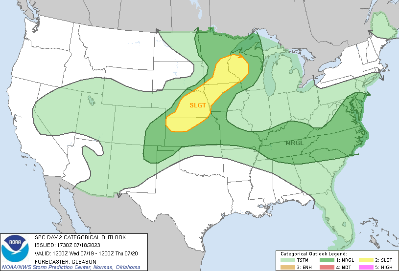
That next system will approach from the west by Saturday afternoon. The latent moisture in the region will mean there is a better chance for some rain and storms as the system climbs over the mountains than typically seen in eastward moving systems in Harrisonburg. There is a great deal of disagreement on the timing of this feature, with one model suggesting that the system won’t arrive until Sunday. As a result, rain and storms will be in both days’ forecast, but there is a better chance that the precipitation will be stormier on Saturday evening. There is some hope for clearing on Sunday afternoon, so the weekend won’t be a total loss.
Tomorrow – Partly cloudy with some late thunderstorms, High 89, Low 65
Sunday – Scattered showers, with some clearing potentially late. Less humid, High 88, low 68

TWC: Tomorrow – Intervals of clouds and sunshine in the morning with more clouds for later in the day. A stray shower or thunderstorm is possible. high 88, Low 64
Sunday – Partly cloudy skies. A stray shower or thunderstorm is possible. High 86, Low 69

AW: Tomorrow – Clouds and sunshine with a heavy thunderstorm around High 87, Low 64
Sunday – Mostly cloudy (early storms) High 87, Low 70

NWS: Tomorrow – A chance of showers and thunderstorms after 2pm. Patchy fog before 8am. Otherwise, partly sunny, High 89, Low 66
Sunday – A slight chance of showers, then a chance of showers and thunderstorms after 2pm. Mostly sunny, High 88, Low 69

WB: Tomorrow – Partly sunny, patchy fog in the morning. A chance of showers with a slight chance of thunderstorms in the afternoon, High 86, Low 67
Sunday – Mostly sunny. A chance of showers and thunderstorms in the afternoon. High 84, Low 68

WN: Tomorrow – Partly cloudy with scattered showers and a chance of storms, High 89, Low 67
Sunday – Partly cloudy (early storms), High 89, Low 69

CLI: Tomorrow – Mostly cloudy, High 88, Low 63
Sunday – Light rain showers, High 88, Low 68

As one might expect with models in conflict, there is disagreement on how to sort out this forecast. Have a glance at the local forecast from WSHV’s Ben Beddoes to get a little bit of clarity.

4 Minutes!

Thunderstorms moved into Amarillo after the 4th of July as the dry line finally shifted east and away from West Texas. on the 5th and 6th, as a system moving through the northern US dragged it into oblivion. As it usually does, it set off some nocturnal convection, which nearly everyone had in the forecast. I don’t feel bad for the outlets that left thunder out of the forecast for the 6th, as there were a solid 5 or 6 hours of stormy weather. Everyone who kept it dry on the 5th though, you were right, up until the 1156PM observation, when scattered storms were reported at KAMA. That’s tough. The Weather Service and WeatherNation had storms on both days of the forecast period, and WeatherNation narrowly edged the Weather Service to earn an Amarillo A+
Actuals: Wednesday, July 5th, Storms reported late, no accumulation, High 91, Low 69
Thursday, July 6th, .04″ of rain in thunderstorms, High 87, Low 63

Grade: A-C