In the Upper Midwest, the story of the winter has been the snow. Several rounds of accumulating snow have buffeted the Twin Cities, but temperatures have always rebounded, because the responsible storms are bringing moisture from the Gulf, rather than cold air from the north. That is changing with a series of Clippers that moved through last weekend.
Temperatures in Minnesota ahead of the cool down were in the 30s and seasonably pleasant, but they are going downhill, and the low temperatures will reach all the way to Chicago and the western Great Lakes by Tuesday morning. This was the forecast for Tuesday morning in the Upper Midwest.
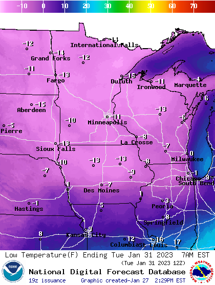
That cold has stuck around, and while it was chilly Tuesday, a reinforcing shot of the cold air came this morning, and it was as cold as -35 in International Falls, Minnesota. Unlike the initial rounds, this cold air is pressing further east, and while the Twin Cities and Minnesota are warming this weekend, it’s going to be dangerously cold in New England.
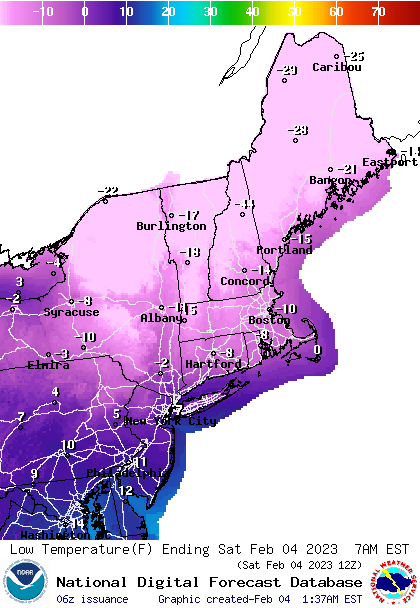
And unlike the cold in the Upper Midwest, there is a deep area of low pressure northeast of the Canadian Maritimes, bringing a brisk northeast wind, not only reinforcing the cold air, but introducing significant wind chill. Boston could see a wind chill of -30 in the early hours.
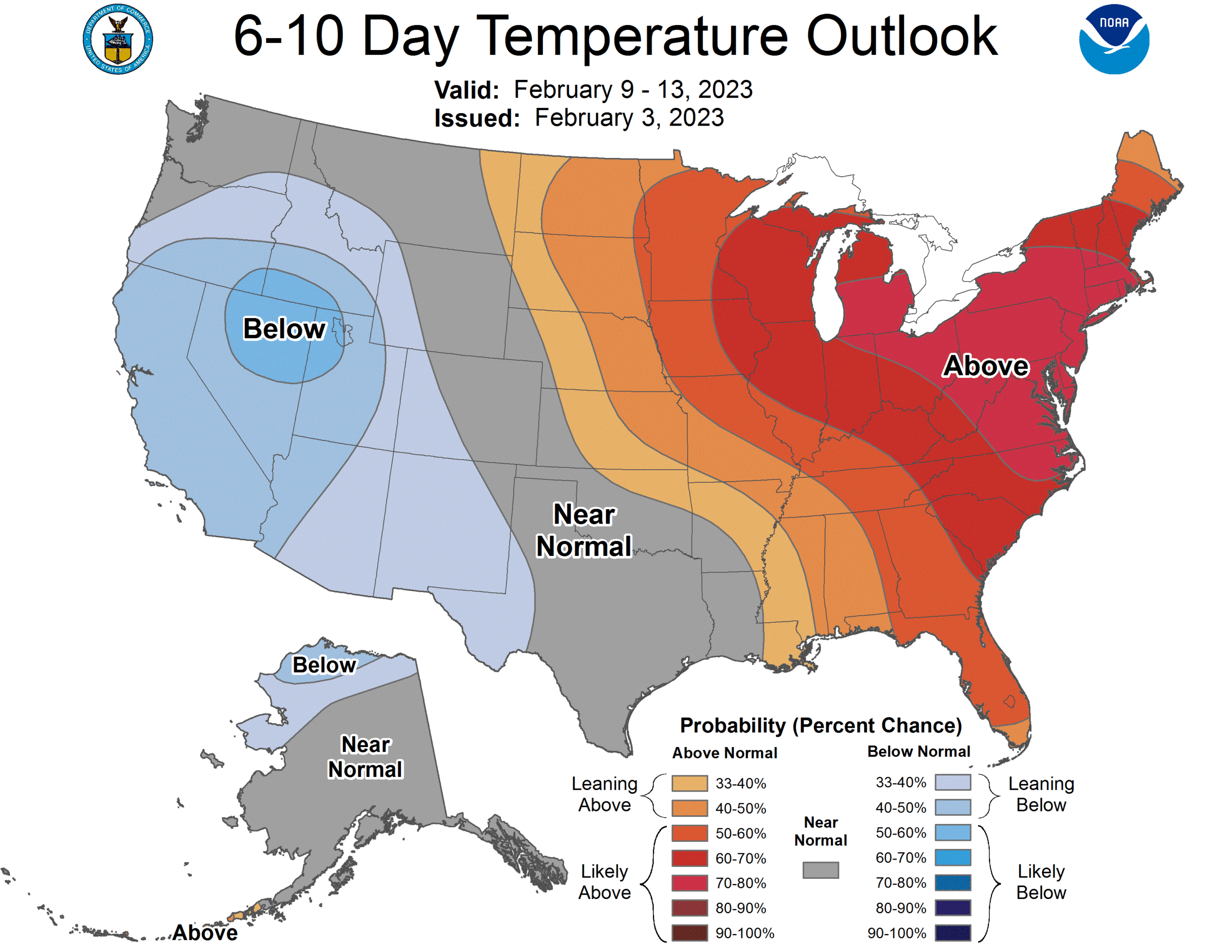
Great news, though. While this cold, the coldest shot of the winter in a lot of places, and in parts of New England the coldest in a decade, is brutal, it’s reign is at an end. Next week is forecast to be much warmer than normal for many locations in the chill this week.