
Areas of low pressure rotate counter-clockwise, dragging air around them in such a pattern. When all things are equal, in the Northern Hemisphere, warm air rises from the south on the eastern flank of a low, and cold air sinks south on the western flank. There are some undulations, notably with topography and the presence of large bodies of water that modify this scenario in some locations, but more or less, that is how it works.
The most nefarious of our weather comes as the cold air tries to intersect with that warm air, all while the atmosphere is trying to rotate. There are updrafts caused by the cold digging in, latent buoyancy of the warmer air, and the twistiness of the wind pattern. This can mean rain, thunderstorms or even heavy snow. This is why the northern Plains can get wicked blizzards, and the Southern Plains and increasingly the lower Mississippi Valley are prone to strong thunderstorms and tornadoes.
We’ve already seen a busy start to February, with severe weather afflicting the Lower Mississippi Valley, and copious snows falling from Kansas to Iowa, though the southern Great Lakes. Temperatures, as you might imagine, have been fairly warm in the eastern US, with an unusual chill out west. Before these past few days, the cold was aided in part by Pacific systems coming ashore, bringing clouds and rain. Now, it’s simply a colder air mass.
Knowing that it is the clash in air mass that fuels stronger weather, and particularly when the clash is between western cold and southeastern warmth, the long term out look suggests action to come.
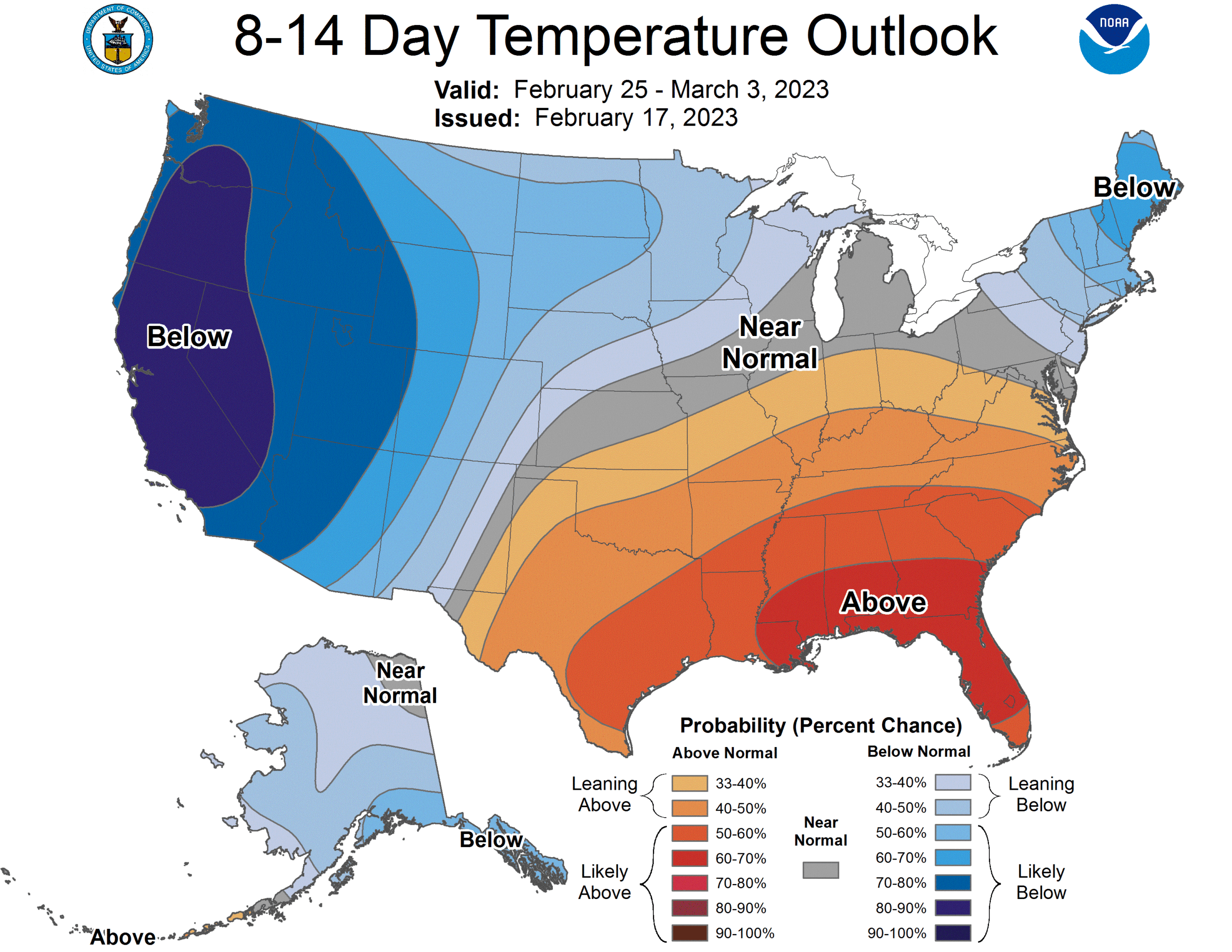
Whether in response to persistent lee troughing in the High Plains, or a result of a static jet pattern, this temperature trend for the end of the month and beginning of March indicates some busy times, both for tornado chasers centered in the middle of the country, and snow plows in the Upper Mississippi Valley.