12:04AM: Wind? Yes? Snow in the mid-Atlantic and New England? No.
from Victoria-Weather

12:04AM: Wind? Yes? Snow in the mid-Atlantic and New England? No.
5:13PM: An interesting feature of the ongoing storm activity in the Southeast for the second weeeekend in a row is the absence of precipitation in the northern Plains. It’s cold, but it’s cold on top of a half inch of snow in some places. No changes in the near future, either.
9:57PM: OK, I take it back a little bit. There might be an additional quarter to half inch in some places tonight, particularly in Minnesota. And, actually, it will ride a warm front, so temperatures might be livable tomorrow. Melt some ice.
My friends, I regret to inform you that, once again, in the Carolina Plains, it will be snowing again. That is the bad news. The good news is, there is a reason that I specifically called out this particular area.
The polar vortex is still parked over eastern Canada, which means a persistently active, and most importantly, a continually cold stretch of time for America east of the Rockies. Later this week, the upper level structure is going to rotate further to the south and a bit to the east, which is going to do two important things. One, it is going to get even colder for an unfortunate chunk of the country. Additionally, it is going to push the storm track south and a bit to the east.
The trough, in its motion, is going to have improved vorticity, and an increased capacity for cyclogenesis. What does that mean? It means low pressure is going to develop towards the southern base of the trough. As I said, this feature is going to be shifting further south and a bit to the east, which means the surface area of low pressure is going to develop south and a bit east of where the weekend storm went. Offshore.
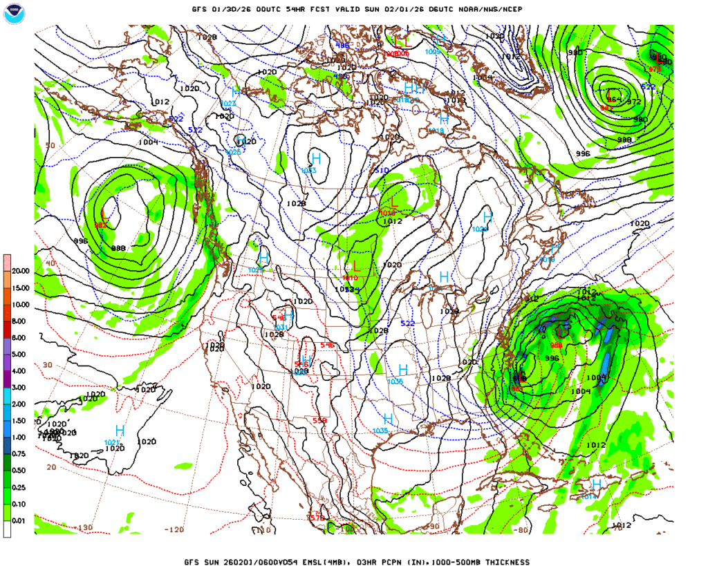
This does mean the storm going to be stronger, with a deeper central pressure. This means that despite less moisture, and a narrower focus for the precipitation,, the wind will drive most of the issues. There are blizzard watches out for the Piedmont, but there aren’t any snow accumulation forecasts for even double digits that I have seen. And absolutely no forecasts for ice.
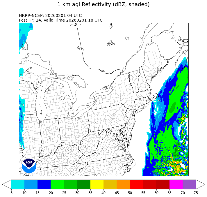
So even with the limited precipitation relative to last week, the nature of this storm is that it will be stronger at it’s heart, colder and windier. Snow that falls will be heaviest in the Carolinas and Virginia, but there may be a few flakes along the immediate coast from New Jersey through Massachusetts, but there too, the big threat is blustery wind.
The winter weather will pick up overnight tomorrow in the Carolinas and Virginia. The wind will peak Saturday night, and will be worst in the Outer Banks. The cold will move back in and continue to linger. The good news is, this storm i narrower geographically, and won’t have ice. But it will be windy. Stay safe, and tie down the lawn chairs.
6:00pm: The storm last weekend was such a good measuring stick for how we can be affected by weather depending on where you live. The East Coast is returning to normal: plows are clearing the roads fairly easily, and kids aren’t getting more days off of school. In places like Nashville, so much ice brought down branches and power lines, and recovery will be measured in months. Right now, it’s just going to be an :effort to stay warm.
8:42PM: The upper level trough is beginning to rotate into the southeastern US, bringing a pool of cold air with it, and also pushing a head some flurries, which are extending along a line from the western Dakotas, south to Nebraska and at a sharp eastward angle towards Cincinnati. Keep an eye on that crook and where it ends up. That will be the center of our problems this weekend.
As I noted in our discussion of the massive storm that came through last weekend, the region had aready been preconditioned, and was chilly, particularly for this part of the world. We saw that in the forecast for Rome, Georgia, which we issued the weekend before, and saw temperatures dive into the 20s, which is unusual in Georgia! Generally, though, there were a couple of times, the high temperature on Monday the 19th, and especially the low temperature on Tuesday the 20th, that were warmer than expected by a few degrees, Accuweather was the warmest forecaster on those two times, and came through with the win. Sidebar: I’m just now realizing our last two verifications were for Florence and Rome. How continental!
Actuals: January 19th, High 50, Low 27
January 20th, High 46, Low 27
Grade: C
2:05PM: We get to enjoy a bit of peace and quiet, albeit without power and buried under snow in a big chunk of the country, but at least the weather will be quiet! Of course, we have our next system moving into the Pacific Northwest right now, and there are signals at the end of the week that another storm could be brewing in the southeast. Can’t be as bad as the last one though, right?
Right?
7:59PM: The snow and whatnot is done (whatnot is doing some heavy lifting there), but the cold is not. Anyone who has gone through winter knows that when the snow is on the ground, the temperatures have a much tougher time warming up.
Brr.
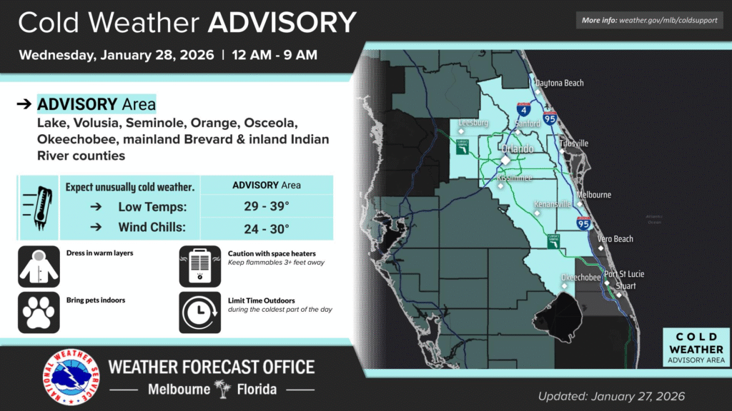
11:46: And now for something completely different: Freezing conditions extend deep into Florida tonight.
This weekend saw much of the country paralyzed, with millions losing power, thousands of flights canceled, and recovery an ongoing battle. The snow is still actively falling in parts of New England, but the thaw is not ready to move in yet. Everything that was frozen this weekend remains so.
A deep and strong trough has been ebbing and flowing across the eastern two thirds of the country for a couple of weeks now, and at long last, the surae organization matched with what was going on aloft. Low pressure developed in the Southern Plains and was able to tap into Gulf moisture, while at the same time drawing very cold air from the Canadian Prairies.
As we saw with our forecasts in Florence and Rome, several days before the storm set in, there was already cold air in place. The storm, therefore, wasn’t necessarily marked by the great conflict of air masses, but rather the incredible amount of moisture that was able to blanket the country.
The area covered by freshly fallen snow, mapped below with the heaviest totals coming from western Pennsylvania to Massachusetts, is an elongated southwest to northeast line, starting in southern New Mexico and running to New England. It tells the story of the track of the storm, starting in the southern Plains and ending up in the Canadian Maritimes. A “Texas Hooker” to be sure. Snow was measured over two feet in some of the terrain in Pennsylvania, and well over a foot throughout Massachusetts.
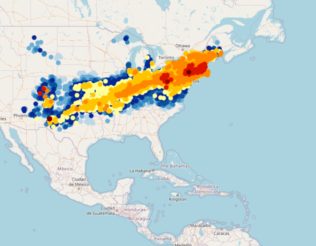
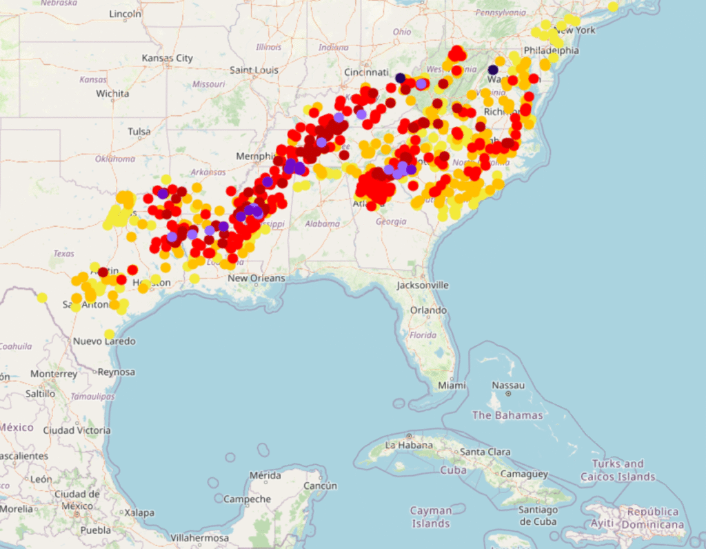
A broad area of accumulated ice, pictured below, is found on the southern fringes of this vast area of snow. This is where the most significant damage you have head about is showing up, from northern Mississippi, to Nashville and on to the Carolina Plains. I saw reports of up to 3″ of accumulated ice, which is devastating. Many places saw an inch, which is debilitating in itself.
The map of this storm tells us that much of the destruction was done by a stationary front, which became a weak, meandering warm front. The cold front associated with this rotating area of low pressure had little to do with what the storm wrought. There were several severe thunderstorm reports around the Florida Panhandle, but for all intents and purposes, this was purely a winter storm.
The cold air has of course eventually found it’s way in, and is keeping all these people buried under snow and ice in a deep freeze. For this particular occasion, the cold front has worked to exasperate an existing problem, rather than being the progenitor of the problems. Cold fronts generally have it easier when they want to raise a ruckus, and are pretty expert at it in the summer and spring, when they have warm air to work with. It takes a special blend of cool temperatures, and the right oscillating warm front to cause the havoc that this weekend’s storm did.
1:53PM: A broad area of baroclinicity, right along the transition zone of warm to cold air, leading to a vast area of precipitation, a lot of which was snow or ice. It’s tapered now, and the national radar is like nothing happened. Just make sure you stay warm out there.
The weather has been so bad that even in this of all weeks, it has broken through as a major headline in many markets. A week and a half ago, we looked at Florence, Alabama, which was preparing for a cold front that would ultimately be a pittance to what was received this weekend. There was a quick shot of rain on the 14th, after which temperatures started dropping, though not nearly as quickly as some believed. It only got down to 35 before the 15th rolled around The sun was out for Florence, but it wasn’t working, and the high never cleared 40. It was a good forecast over all, with The Weather Channel earning the top spot.
Actuals: January 14th, .08″ of rain, High 50, Low 35
January 15th, High 39, Low 23
Grade: B
We are looking ahead to a week that could bring the storm of the winter. The hallmark of a “storm of the year” is that it brings conditions that are extreme for the given area that those conditions arrive, and that means we are looking at snow, ice and cold in the south, stretching from Texas to the Carolinas. We will talk about it this week, as well as these specific forecasts.
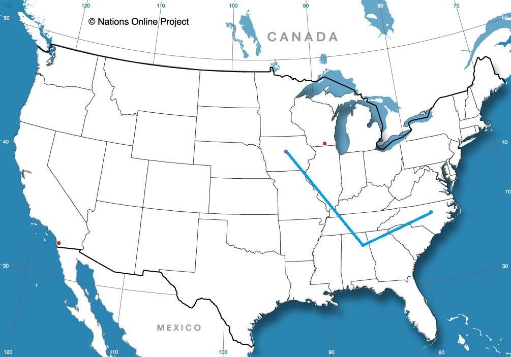
Road Trip from Raleigh, North Carolina to Gadsden, Alabama
Ames, Iowa
Road Trip from Gadsden to Ames
Janesville, Wisconsin
San Diego, California