I’m not happy. It’s about 40 degrees and windy, and generally, it’s colder than normal across the middle of the country. Matters were made worse when I spoke with someone in California who was talking about how warm it was today. Jokes on them, because this is the map for the 8-14 day outlook.
Take a breath
We’ve had a pretty noisy stretch over the last couple of days, with severe weather sweeping through the Plains over the last two days, and into the Mid Mississippi Valley today. High pressure is moving to the middle of the country tomorrow, and will stamp out much severe weather from then on, at least through the weekend, and perhaps through the beginning of the following week.
If you live in the center of the country, you were just experiencing some wet and stormy weather over the last couple of days, and through the end of the week, you will see temperatures that are well below normal. Great news, though, as the end of the month, nearly nationwide, is expected to be warmer than normal.
Among the places seeing warmer temperatures on the way is Phoenix. It’s not going to be crazy, but it will be a few degrees shy of 100 next week.

Coming Soon…
We’re not going to get further west than the Mississippi this week. In fact, we’re not going to get west of Lake Michigan.
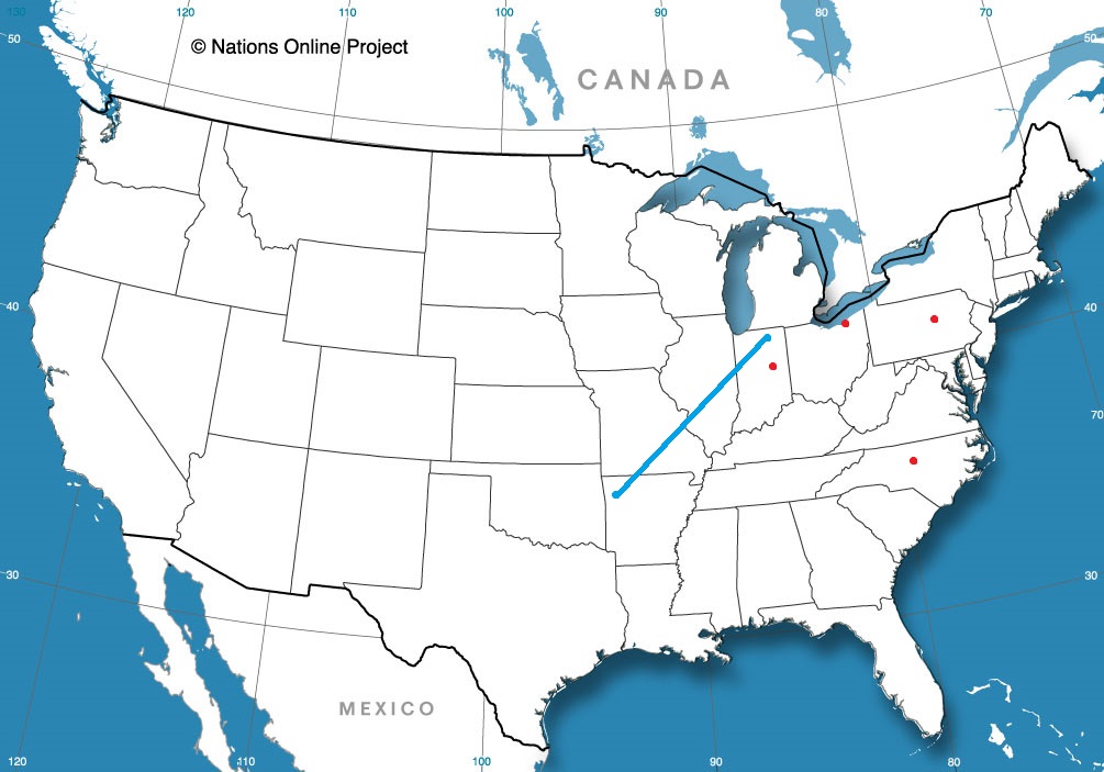
Road Trip from Elkhart, Indiana to Fayetteville
Muncie, Indiana
Goldsboro, North Carolina
State College, Pennsylvania
Cleveland, Ohio
Victoria, Texas to Chico, California
We’re headed westward on a three day trek out of Texas. Expect a pace of 66.8mph for our 3 1/2 days of travel. That means full days will cover about 534 miles, and we will see quite a bit of southwestern, desert and Spanish inspired sites. This is the time of year to travel through the area, as it won’t be too stormy, and it won’t be too hot. Yet.
DAY ONE (Wednesday)
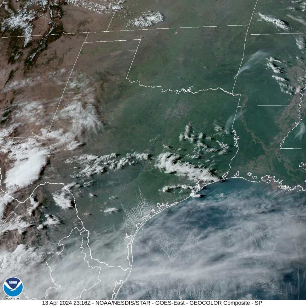
There is a large system moving through the center of the country today, and a cold front will sweep through east Texas without fanfare this afternoon. One might lead you to believe that will completely clear out the atmosphere behind it, but it will not. Another high Plains disturbance will start the wheels in motion almost immediately. This won’t do a lot to our drive tomorrow, but some more moisture being pulled into the region will mean some popcorn clouds through Fort Stockton. After that though, yeah, it will be pretty quiet, and the day will end in Wild Horse, Texas, which is north of the Big Bend, but about as far from civilization as you can get.
DAY TWO (Thursday)
The drive from Wild Horse in west Texas will be briefly enlivened by passage through El Paso, Las Cruces and Tucson, but not by much weather. There is some signal for a little bit of moisture south of Arizona, so sure, maybe a cloud or two as we approach the south metro of Phoenix, but I’m not buying into it too much. I said it won’t be hot in Arizona for the drive, and by that I mean it won’t be as hot as it can be in Arizona, with temperatures in the mid 90s as we arrive in Chandler, on the south side of the Phoenix metro area on Thursday afternoon.
DAY THREE (Friday)
This is the kind of day one should expect when traversing the Mojave. Skies will be mostly clear and temperatures will be warm. We’ll make it to the 5 and head north around Santa Clarita, ending up in Lost Hills in the Central Valley, and call our day good.
DAY FOUR (Saturday)
This is a pretty simple northbound trek to our final destination. We’ll see Stockton and Sacramento on the way to Chico, but not a heck of a lot of weather. A prevailing west wind will produce some clouds in the mountains east of our route, but sunglasses are still needed until we arrive.
They just got a bunch of snow…
But the Upper Peninsula is under burn advisories because the threat for wild fires in the region is so high. They got one storm this month, but it is still abnormally dry in the region, and with a strong system developing in the Plains and moving towards the Great Lakes, wind is going to pick up as well, meaning that if something does touch off, it could spread rapidly.
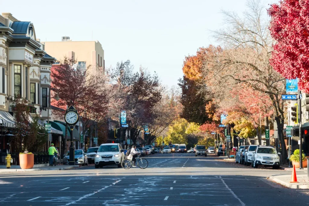
Chico, California
We’re off to northern California, to visit the first city we ever forecast for on Victoria-Weather.com. A little history being made.
At 2pm, PT, Chico was reporting clear skies and a temperature of 64 degrees. If there were any sites in northern California that were reporting any clouds, they were near the coast, and those clouds were tied to the ocean, rather than any overwhelming atmospheric event.
The jet has shifted north and even an expected trough will move ashore in British Columbia and dive into the Continental US through the Northern Rockies over the next couple of days. A weak upper level boundary will move through associated with the trough on Monday, which will introduce some clouds that may linger through Wednesday.
Tomorrow – Fair, High 77, Low 48
Wednesday – Partly cloudy, High 77, 50
TWC: Partly cloudy. High 78, Low 44
Wednesday – Sunshine and clouds mixed. High 79, Low 52
AW: Tomorrow – Partly sunny and comfortable High 77, Low 46
Wednesday – Nice with times of clouds and sun High 77, Low 50
NWS: Tomorrow – Sunny, High 78, Low 44
Wednesday – Mostly sunny, High 80, Low 52
WB: Tomorrow – Mostly sunny, High 78, Low 50
Wednesday – Mostly sunny in the morning, then becoming partly cloudy, High 79, Low 54
WN: Tomorrow – Mostly sunny, High 77, Low 49
Wednesday – Partly cloudy, High 78, Low 53
CLI: Tomorrow – Partly cloudy, High 76, Low 46
Wednesday – Sunny, High 78, Low 50
St. Joseph, Missouri to Victoria, Texas
Could this job be done in one day? Maybe, but it wouldn’t be an entirely safe drive, so we’ll split it into a day and a half, covering 874 miles, at a pace of 67.4mph, meaning we will be done with our Sunday drive about 539 miles from St. Joseph.
DAY ONE (Sunday)
A dry cold front will be sweeping through the central Plains on Sunday morning, which is notable if you intend on driving a high profile vehicle down to Texas, as breezes will likely kick up in northern Kansas. It will still be breezy through Oklahoma, but just normal “Oklahoma breezy” and partly cloudy. Generally, look for pretty decent driving conditions. We’ll cross the Red River and finish the day in Corral City, between Denton and Fort Worth.
DAY TWO (Monday)
So that just leaves us with a 5 hour jaunt through the Lone Star State to Victoria. Low pressure in the High Plains will start spinning, but we shouldn’t notice it at the surface before we get to Victoria. Instead, we will see clouds become more prominent, and maybe a little bit lower as the day progresses, meaning a grayer end to the trip than we began.
We aren’t out of snow season yet!
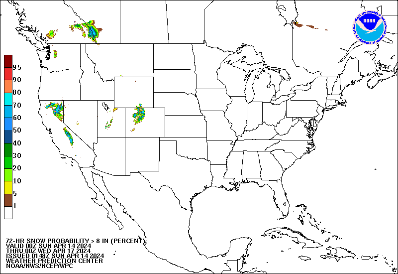
Sure, yes, the forecast snow, in this case showing the chance of 8″ over a three day stretch through Tuesday evening, is confined to the mountains, but it is still snow, and still an ample amount of snow, especially in northern California. That means busy weather, moisture aloft and yes, cold air at some level. This will translate to severe weather when the feature hits the Plains.
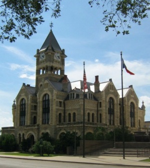
Victoria, Texas
It’s always a special day when we forecast for Victoria, because I get to remind everyone that the site is named this because I am from the version in Minnesota.
At 751PM, CT, Victoria was reporting a temperature of 71 degrees with fair skies and a brisk onshore wind, gusting over 30mph. An upper level ridge is settling into place over the region, which will help temper the wind and allow temperatures to climb through the region.
While there won’t be a significant change to the weather on Monday, there will be a change nevertheless. Low pressure developing in the Colorado Rockies will emerge into the Plains on Monday afternoon, drawing air towards it, including moisture rich air off the Gulf coming through Victoria, making the day a bit cloudier and a bit stickier.
Tomorrow – Partly cloudy, High 84, Low 66
Monday – Cloudier and more humid, High 82, Low 69
TWC: Tomorrow – Sunshine and clouds mixed. High 83, Low 65
Monday – Cloudy with gusty winds developing during the afternoon. High 82, Low 69
AW: Tomorrow – Breezy with times of clouds and sun High 83, Low 65
Monday – Increasingly windy; cloudy in the morning, then intervals of clouds and sunshine in the afternoon High 79, Low 68
NWS: Tomorrow – Partly sunny, High 80, Low 65
Monday – Mostly cloudy High 80, Low 67
WB: Tomorrow – Mostly cloudy in the morning, becoming partly cloudy, High 82, Low 65
Monday – Mostly cloudy, High 79, Low 68
WN: Tomorrow – Partly cloudy, High 80, Low 66
Monday – Mostly cloudy, High 80, Low 68
CLI – Partly cloudy High 82, Low 64
Monday – Light rain showers High 82, Low 68
Clime is the only outlet calling for rain on Monday. I don’t think the moisture will be that rich. Take a look at the clear overhead radar in the area right now.