I wrote last week about the strange forecast coming up for the Twin Cities, where some forecast outlets were calling for a ton of snow, despite so many factors working against a huge accumulation. Well, the storm is nearly over (a recap on that through some updates on the site later) in Minnesota, but the system is still around, and bringing some severe weather concerns in the deep south.

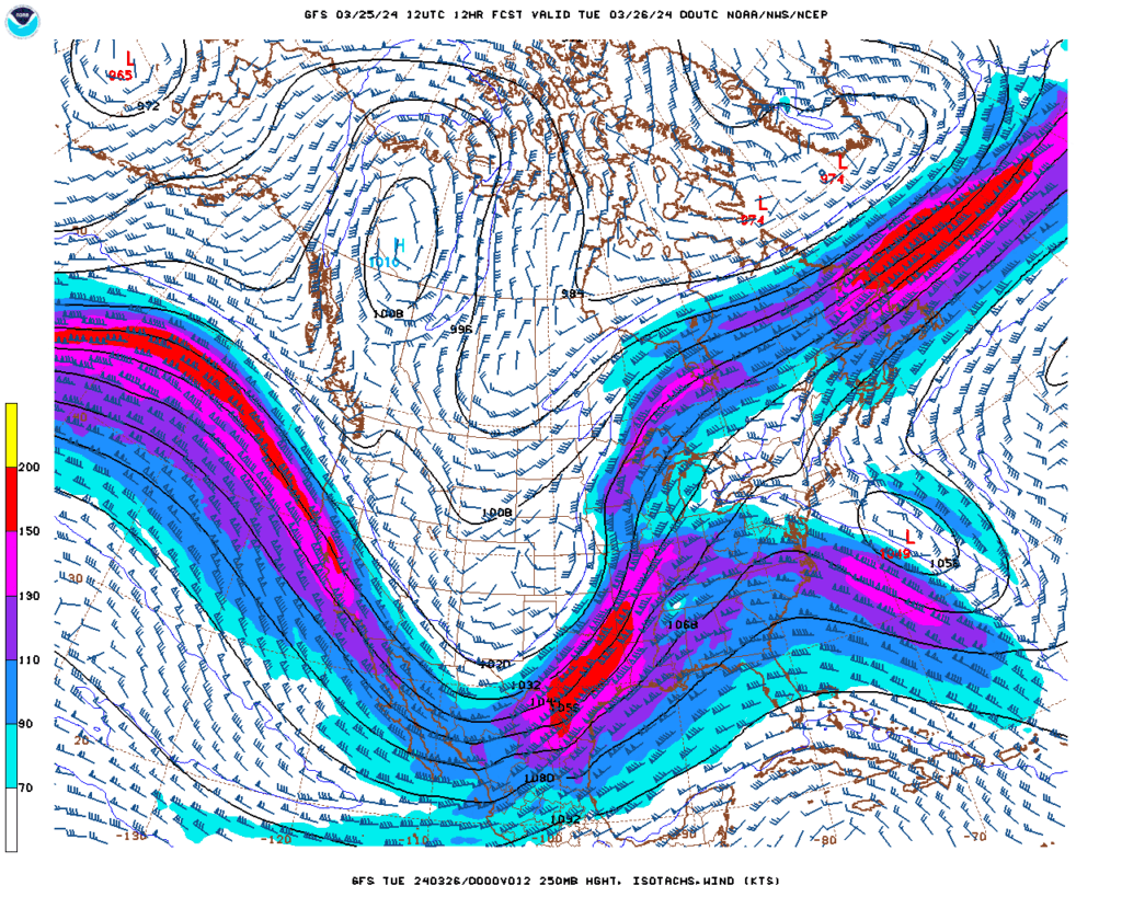
The jet across the country is strong, a common scenario when encountering spring season storm threats, and it is helping the system in the Plains occlude fairly quickly, with an additional area of low pressure developing at the surface northwest of the Mississippi Delta. There is a copious amount of moisture down here, as always, but now also quite a bit of turning in the atmosphere, or vorticity.
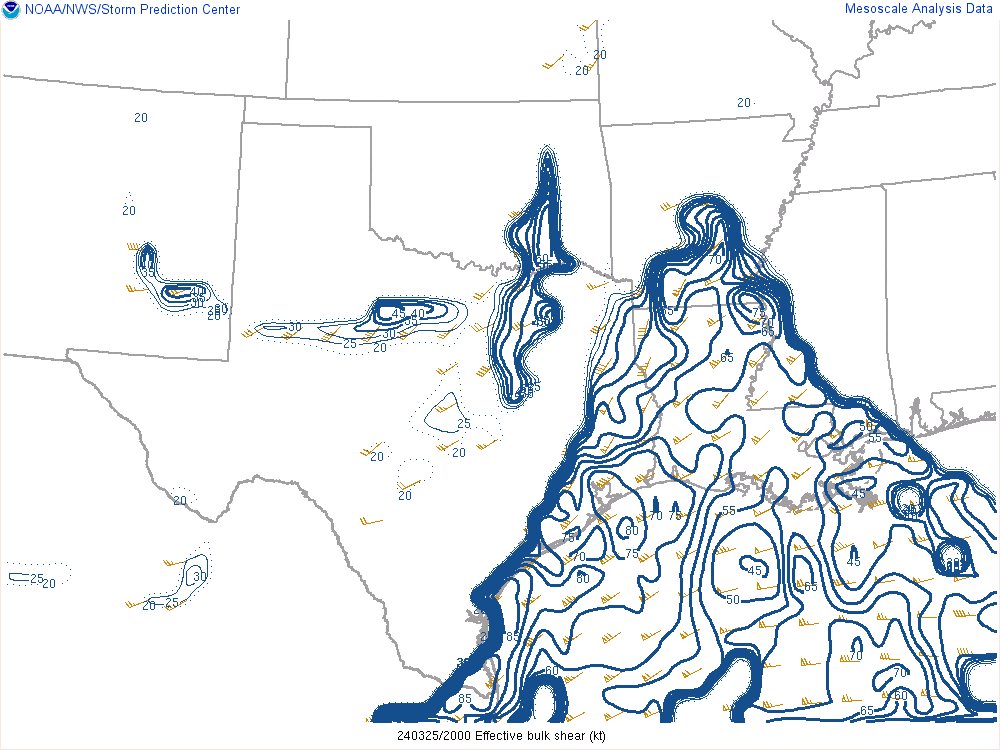
The vorticity is compounded by the fact that the wind is changing directions. While the wind at 250mb, as above, is coming from the southwest, winds at different levels of the atmosphere are angled at different directions. This is called vertical shear, and is something that can help a storm build upwards quickly, and produce twisters at the surface. The area bracketed by the blue has the greatest shear, and will move east into Mississippi overnight, following the storms.

There are already some bands of storms, though none of it yet severe, moving through Louisiana, and it looks like if any storms develop, they will be embedded within a line with rain falling around it. This is a typical mode for “Dixie Alley” where storms make themselves nearly impossible to find, not only by occurring in a tree filled environment, often at night, but also by usually falling in the midst of especially rainy thunderstorm complexes.
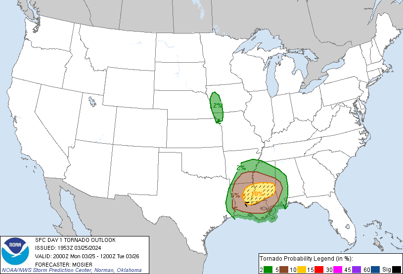
The NWS is calling for a chance for especially large and dangerous tornadoes tonight, potentially in Jackson, Natchez or Meridien, and it is important to stay vigilant as the storms develop and move into the area. There are no basements, generally, in Mississippi, so ensure a spot in a storm shelter if storms loom.

Storms will likely continue deep into the night, but the low across the center of the country will be too stretched to allow for things to continue far into Alabama or Georgia tomorrow. Additionally, there will be a pause in the rough stretch of weather, allowing Delta residents a chance to breath and recover, if necessary. Let’s hope it isn’t.
