Spring is on its way, and we can start to prepare for some warmer weather. To ensure we get good weather for our forecast, we have two scheduled forecasts in the coming days in southern California.
San Luis Obispo, California Road trip from Harrisburg, Pennsylvania to San Luis Obispo
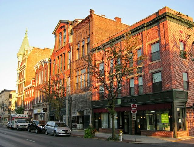
Poughkeepsie, New York Road Trip from Hinesville, Georgia to Poughkeepsie
We’re taking a look at one of the three Columbuses we have in our system, and the only one that I’ve had the pleasure of passing through in person.
At 245PM, ET, Columbus was reporting a temperature of 19 degrees with clear skies and a steady west wind. High pressure was building into the area, however a weak wave riding the forward edge of this ridge brought a few flakes to the region through the overnight, and the accumulated inch or so may be helping keep temperatures a degree or two cooler. High pressure is going to remain in place for the next couple of days, building in from the west. While there is a weak thermal trough embedded in this ridge, it won’t be enough to slow down the warm up coming for Columbus this weekend. Expect a fairly pleasant weekend with sunny skies. Tomorrow – Mostly sunny, High 32, Low 10 Saturday – Mostly sunny, High 34, Low 17
TWC: Tomorrow – Sunshine and clouds mixed. Very cold High 32, Low 10 Saturday – Sunshine and clouds mixed. High 36, Low 14
AW: Tomorrow – Plenty of sunshine, but cold; a warmup is on the way High 33, Low 8 Saturday – Chilly with periods of clouds and sunshine High 38, Low 16
NWS: Tomorrow – Sunny, High 32, Low 9 Saturday – Mostly sunny High 35, Low 15
WB: Tomorrow – Mostly sunny, not as cold, High 26, Low 11 Saturday – Partly cloudy in the morning, then clearing, High 33, Low 16
WN: Tomorrow – Mostly sunny, High 31, Low 8 Saturday – Partly cloudy, High 34, Low 16
CLI: Tomorrow – Sunny, High 30, Low 9 Saturday – Sunny, High 35, Low 11
The Weather Channel says it’s going to be “very cold” tomorrow, while Weatherbug, with a cooler forecast, says “not as cold.” Perspective! Satellite shows some lingering clouds, and some lingering snow on the ground.
The Great Lakes during a cold stretch in February, in the midst of some breezy conditions in the region. I have a pretty good guess on how things are going.
At 1053AM, ET, the Sandusky area was seeing clear skies and a temperature of 16 degrees. There were a few flurries throughout the region, thanks to lingering westerly winds. Another gnarly storm system is bringing heavy rain to the southeastern US. This is adding some moisture to the region, but by tonight, will inhibit flow into a trough moving into the region. The trough is weak, and riding the front edge of a strong ridge in the center of the country. It will bring a few flurries to Sandusky overnight and into the early morning tomorrow. The wind in the area may lead to some lake effect flurries that last into the early afternoon, but high pressure will squash the moisture out of the region by Friday. Expect sunny skies as the weekend rolls in. Tomorrow – A few flurries, perhaps accumulating to an inch, wrapping up in the afternoon. High 24, Low 13 Friday – Clearing and a bit warmer, High 27, Low 15
TWC: Tomorrow – Cloudy with snow showers mainly during the morning High 22, low 14 Friday – Cloudy. Very cold. High 27, Low 15
AW: Tomorrow – Very cold with snow and flurries at times, accumulating a coating to an inch, becoming breezy in the afternoon; roads could be slippery for the morning commute High 21, Low 13 Friday – Quite cold with low clouds; a warmup is on the way High 26, Low 15
NWS: Tomorrow – A chance of snow showers, mainly before 11am. Cloudy, High 22, low 14 Friday – Partly sunny High 27, Low 12
WB: Tomorrow – Cloudy. A chance of snow showers mainly in the morning. Snow accumulation up to 1 inch possible. High 20, Low 15 Friday – Partly sunny, High 24, low 18
WN: Tomorrow – Mostly cloudy with snow showers, High 22, Low 14 Friday – Partly cloudy, High 27, Low 13
CLI: Tomorrow – Heavy snow showers, High 21, Low 13 Friday – Overcast, High 26, Low 14
Given that it was -11 here this morning, the third double digit below zero morning in a row, it’s funny to see multiple outlets refer to the mid 20s as “cold”, needing to call it out like that. The radar shows an impressive amount of coverage, but it won’t add much in terms of accumulation.
1120AM: We are now fully “in the wake of” a particularly nasty February storm, which rendered severe weather across the southeast, with tornados and wind running from the Lower Mississippi Valley east through the Carolinas and Georgia. These storms are often the loudest, of course, but as always, the deadliest storms are the flash floods, which occurred in Kentucky, south of Louisville. It’s a bit further west than the catastrophic storms of a couple of years ago, but the story remains the same: heavy rain in an area with undulating terrain. Appalachian has really been through the ringer in the last few years. Now, behind this storm, a bracing cold has settled in, which is allowing for some flurries in the north, and unpleasant recovery operations in the Tennessee Valley.
12:05AM Persistent precipitation in the western Rockies is expected through the beginning of the week, despite an area of low pressure in the Pacific Northwest with very little juice to it. That’s why the snowfall forecast map in western Montana looks like this, heavy snow in the peaks.
9:48PM: You can tell it’s Valentine’s Day looking at the NWS alerts and warnings map on the side panel. There are a lot of pinks and purples out there! The good news is, those shades aren’t prominently displayed when you get to the Philadelphia and New York City area. Sure, it’s another winter storm, but at least we aren’t going to see busy hubs waylaid too badly. Still, snow is coming, and it is going to be a sluggish weekend in the Great Lakes.
It’s a busy stretch of weather across almost the entire country, so obviously let’s just drive right through it. It’s going to take 3 1/2 days to cover the 1,965 miles between the two cities. Fortunately, we will have a lot of freeway time, which will mean a pace of 67.8mph, or 542 a day for those first three days.
DAY ONE (Friday)
Laredo is the county seat of Webb County, Texas, United States, on the north bank of the Rio Grande in South Texas, across from Nuevo Laredo, Tamaulipas, Mexico.
The most recent storm system to sweep through the country caused some nasty weather in the southeastern US last night, particularly with tornadoes in Alabama and Georgia. The feature is going to be bothering Labrador by the time we are hitting the road from Laredo, though, and we will have the benefit of relatively cool high pressure for the drive through the Lone Star State. Arrival in Louisiana will coincide with a return flow setting up, and the potential for some low level moisture, including mist and light rain from Lake Charles to our destination for Friday night, Cecilia. Don’t be surprise if this turns into some murky fog as we set out on Saturday morning.
DAY TWO (Saturday) That return flow from the Gulf is going to find a ripe environment in the Plains for development. As we get started, precipitation will already have exploded from the Great Lakes, where snow is possible, south through the Tennessee Valley. We will drive through the day in the warm sector of this new feature. By the end of the day, the pivot point for the surface low will be centered around Cincinnati, with a cold front to Shreveport and a warm front stretched towards Washington. With this positioning, Fog will be possible in the morning, through our northerly turn at Slidell, but the clouds may start filtering back in as we hit some terrain in northern Alabama, calling it a night in Hammondville, Alabama, which will come right before we pass into Georgia and then Chattanooga.
DAY THREE (Sunday) That rain, including some embedded thunderstorm activity is going to hit like a freight train overnight in northern Alabama. It will still be pouring as we start packing our things to hit the road on Sunday morning. The bulk of the severe activity will hit to the west and a little south of our stop in Hammondville, but flash flooding is severe weather too. Our drive through steep terrain for most of the day may be plagued by some lingering effects, as heavy precipitation will have moved through every section of our route. If there is good news, it is that precipitation will move too quickly to really add up. Still, bear in mind the slick roadways and embrace how much drier it is by the time we get to the eastern face of the Appalachians, where rain will cut off much sooner. The day will take us to Woodstock in northern Virginia, leaving a half day to Binghamton.
DAY FOUR (Monday) In the wake of the most recent round of significant weather coming this weekend, brisk west wind will trigger an active lake effect regime throughout the Eastern Great Lakes, Mostly clear skies should dominate our drive, with an exception as we approach Binghamton, when some of that Lake snow may filter through.
I have to believe that most football fans in Southeast Pennsylvania were happy with the way the Super Bowl turned out on Sunday. I bet they barely noticed in Lebanon that over a 10th of an inch of ice coated light snow through the region on Friday. Everyone, somehow, pegged the snow and ice, so it came down to the thermometer, where the differentiator was a warm day on Friday. Accuweather and WeatherBug took a share of the win. Actuals: Friday – High 41, Low 31 Saturday – .33 inches of liquid in snow and ice, High 32, Low 24
It’s been a very snowy day nationwide. A quick moving feature starting from the Northern Plains and raced east where there are still winter weather warnings out.
Much is being reported about multiple rounds of storms afflicting the country this coming week, and this first round is informative. You can’t get a bunch of storms unless they are fairly tame and move at lightning speed.
After so many long trips across the country, it’s so nice just to journey within one state. This Keystone State drive will last only a couple of hours and cover just 93 miles of rugged terrain. We are looking at a pace of only 42mph! Let’s roll on, I guess.
Lebanon, Pennsylvania
It’s currently snowing throughout out eastern Pennsylvania, which may lead to some lingering slick roadways, particularly the more lightly traveled and higher elevation roads. The precipitation will be wrapped up as we head out, but chilly wind with the fresh snow will make the drive, short that it may be, fairly challenging. Having a bit of sunshine will help, and the sun has a better chance of peeking out if we leave later in the day.