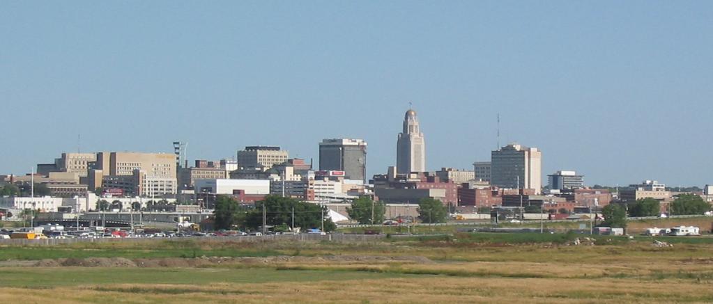
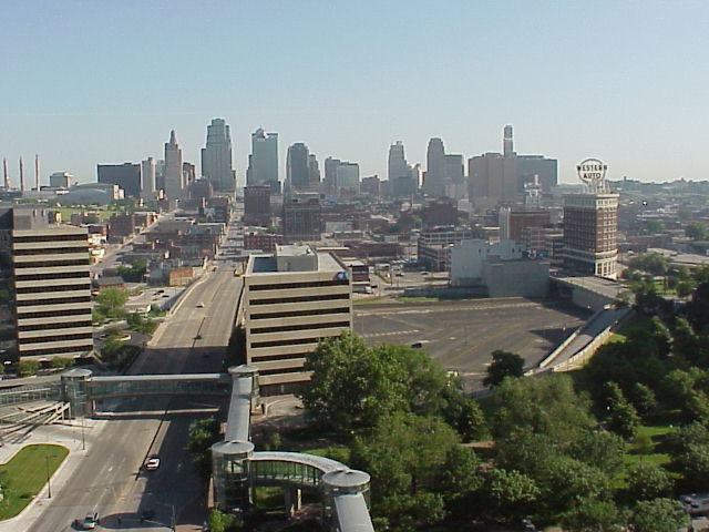
You can’t get much ore “middle of the country” than this, can you? Lincoln and Kansas City are less than 3 1/12 hours apart by car, and 195 miles if you check the odometer. The drive will drill down to a nice, tidy 60mph for a pretty brief Wednesday drive.
Lincoln, Nebraska
The real show in the country is an area of low pressure moving through the southeastern US, but a slow moving inverted trough will dangle north into Missouri through most of Wednesday morning. Guidance universally hangs on to a batch of snow between Nebraska City, Nebraska and St. Joseph, Missouri, which accounts for a sizeable chunk of our route. The day will start clear and will end on a positive note, but the middle of the drive will be slower than I’m sure we would prefer.
An Alberta Clipper has started tracking for the Upper Midwest, with a burst of snow expected in the western Great Lakes region over the weekend. The feature got it’s start in the middle of the week in, of all places, Alberta. This was key for our forecast site in Billings, which enjoyed the infusion of warm air being drawn north towards the low, and didn’t have to put up with any of the consequences, save for a breezy day on Wednesday. The forecasts were pretty similar, and there was a 4 way tie for third, but Victoria-Weather ended up securing a victory for ourselves. Actuals: Tuesday – High 39, Low 23 Wednesday – High 50, Low 26
As I’ve noted before, every forecast outlet pulls their model data from the same source material. The GFS and the NAM are the big models in the US, but the European, UK and Canadian model provide coverage, along with a slew of short range models, and even some created in house for smaller time frames and smaller geographies.
Larger weather companies have created their own methodology for extracting data from the models, and applying formulas to produce forecasts for a broader geographic region without necessarily requiring human involvement at every point in the country. These are called “blends” because they take bits of particular models and create their output.
Recently, the National Weather Service has done away with their former MOS (Model Output Statistics) page, which allowed users to see the raw text output from the GFS and NAM for hundreds of sites across the country, instead replacing it with a page offering the National Blend of Models (NBM) which is all the text forecasts after they have been processed by the National Weather Service using their blending formula (but before they have been processed by local meteorologists and placed on the NWS site).
Since the GFS and NAM are still available for meteorologists, this is really a lift for weather persons without the backing for a company to pay for a whole lot of model data, as it suggests the trends of all the guidance, and not just that which is available for free to the American masses.
It may not lead to better forecasts from everyone, but it definitely sweeps the curtain aside for more curious eyes.
We have spent a lot of time in the western United States lately, so I find it refreshing to return to the east coast. What kind of weather will we see in an entirely different time one than I’ve become accustomed to?
At 155PM, ET, Brunswick was reporting a temperature of 61 degrees with clear skies. Strong winds aloft have produced inland clouds, but they were scoured along the coast, where things are a few degrees cooler. The jet, just to the north of the Brunswick area is helping to facilitate high pressure across the region. The strong jet will merge with a more northerly jet streak, which will set up an upper level convergence point, where showers and isolated embedded rumbles of thunder can develop. That activity will be to the west if Brunswick through most of the period, however increasing clouds will be likely on Thursday, with rain sneaking into the picture by early Friday morning. Tomorrow – Mostly sunny, High 68, Low 41 Thursday – Increasing clouds, High 66, Low 43
TWC: Tomorrow – Plentiful Sunshine, High 66, Low 41 Thursday – Mostly cloudy, High 65, Low 42
AW: Tomorrow – Mostly sunny High 67, Low 42 Thursday – Pleasant with intervals of clouds and sun (PM Showers) High 67, Low 44
NWS: Tomorrow – Sunny, High 65, Low 43 Thursday – Partly sunny, High 64, Low 43
WB: Tomorrow – Partly cloudy in the morning, then clearing. High 67, Low 43 Thursday – Partly cloudy, High 64, Low 42
WN: Tomorrow – Mostly sunny, High 65, Low 43 Thursday – Mostly cloudy, High 65, Low 43
FIO: Tomorrow – Clear throughout the day. High 67, Low 42 Thursday – Partly cloudy throughout the day. High 68, Low 42
The website I have used for model guidance has been taken down. This was a long forecast to write, but not terribly difficult! Here is satellite imagery showing off some clouds resulting from the local jet streak.
Let’s forecast again! We haven’t done that for a while, so let’s head for the High Plains and do that!
At 953PM, MT, Billings was reporting mostly cloudy skies and a temperature of 32 degrees. The northern Rockies were at the eastern crest of an extremely eastward tilted ridge. Mid level clouds were present in the turbid flow aloft, but dry weather was seen at the surface throughout Montana. The ridge will nose in, almost along a west to east axis, cutting a trough over the southwestern US. The northern portion of the trough ridge will become it’s own jet streak, aiding an Alberta Clipper late in the forecast period. While this may make things a bit breezier, Billings will be well south of the feature, and will be in the process of getting warmer thanks to the upper ridge, and flow off the Rockies. Tomorrow – Mostly sunny, High, 40, Low 25 Wednesday – Breezy early, partly cloudy, High 48, Low 30
TWC: Tomorrow – Sunny. Becoming windy late. High 41, Low 24 Wednesday – Sunshine and clouds mixed High 48, Low 32
AW: Tomorrow – Mostly sunny; breezy in the afternoon High 42, Low 25 Wednesday – Strong winds gradually subsiding; periods of clouds and sunshine High 47, Low 31
NWS: Tomorrow – Sunny High 44, Low 24 Wednesday – Mostly sunny, High 48, Low 31
WB: Tomorrow – Sunny, High 41, Low 25 Wednesday- Decreasing clouds, windy, High 46, Low 31
WN: Tomorrow – Mostly sunny, High 44, Low 24 Wednesday – Mostly sunny, High 48, Low 31
FIO: Tomorrow – Clear throughout the day. High 44, Low 27 Wednesday – Mostly cloudy throughout the day. High 47, Low 31
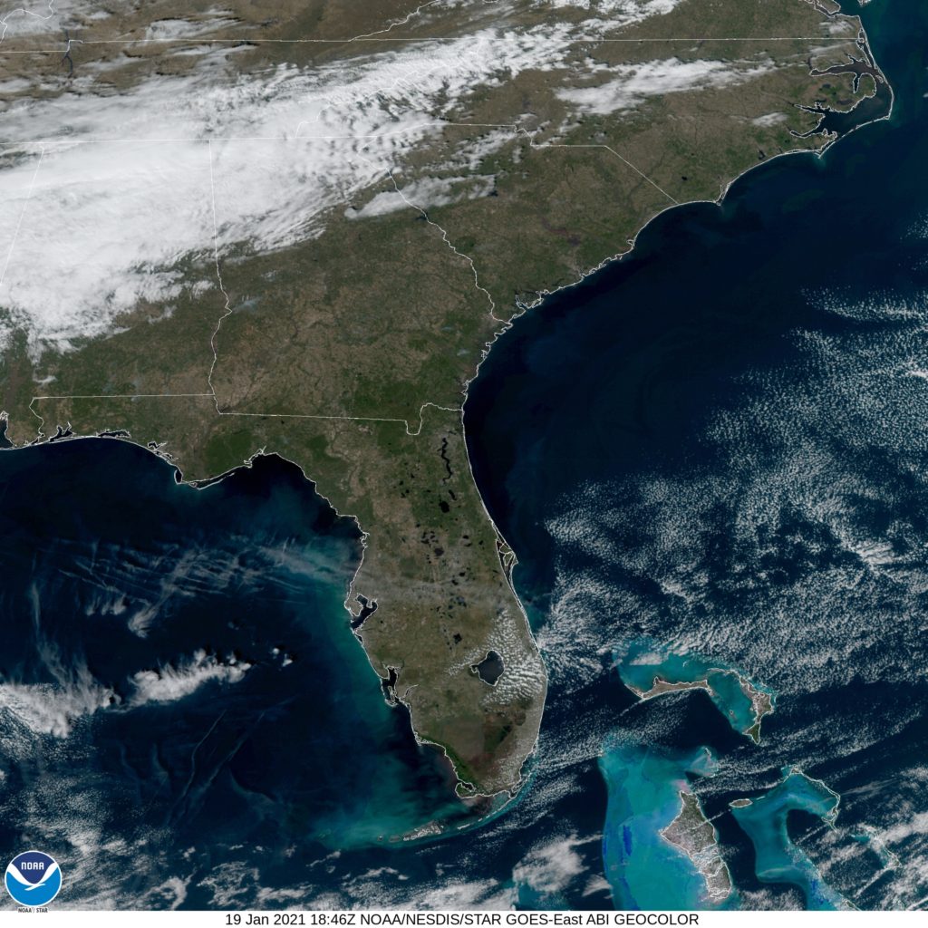
A look at the national satellite shows the sweeping high clouds over the southern US, which is the jet stream forming the base of a severely tilted trough. It’s keeping Billings out of trouble, though!
All eyes will be on the US Capitol on Wednesday, not only in the United States, but across he world. Given the events at the capital on January 6th (and indeed, the tenor of the nation and world politics in recent years) there will be special attention given to an event that usually engenders a lot of headlines in normal times.
If the weather is discussed during those headlines, it will be to discuss the chill in the air during the ceremony. Temperatures in the morning will be hovering at or just below freezing, meaning that anyone around the capital before the ceremony commences better bundle up.
Mostly sunny skies and temperatures in the mid to upper 30s should be in the offing when Kamala Harris, followed by Joe Biden are sworn into their new roles atop the United States government.
There will be a bit of northwest flow thanks to an inverted trough trailing low pressure in the Canadian Maritimes. This may lead to a bit of briskness, but any associated precipitation will remain in the Appalachians west of D.C. Of all the many things that could happen on Wednesday, weather is not something that should raise too many concerns.
The first forecast of the year took us to central California, which was facing the threat of rain, thanks to the continued active pattern over the Gulf of Alaska. A few outlets thought the chance of rain was significant enough to put it in the forecast for Fresno on January 4th, but it never came to pass. In fact, it was clear and dry enough that temperatures climbed into the low 60s, which is exactly where The Weather Channel had them. After earning the most forecast victories in 2020, TWC collected the first crown of 2021. Actuals: January 4th, High 62, Low 48 January 5th, High 60, Low 43
Who could have predicted all that happened in 2020? If anyone could have predicted it, I’m sure a lot of people would have chosen to skip it. A dark December ended brightly, at least in terms of plaudits for The Weather Channel and Accuweather, who tied atop of the leaderboard for forecasters of the month.
It didn’t help put them over the top for forecaster of the year, however. That prize belonged to…. us! Victoria-Weather was he most consistent throughout the year, and ended up with the best scores on aggregate (TWC and AW were 2 and 3, respectively) for the year. Interestingly, The Weather Channel was very good when they were good, but had some stinkers mixed in. They had he most individual forecast wins for 2020, while Accuweather was never at the paramount, but never really had major rough streaks, and are at the bottom of this table.
Outlet
Forecast Wins
The Weather Channel
13
Victoria-Weather
11.41
WeatherNation
7.08
Weatherbug
6.82
Accuweather
5.58
National Weather Service
4.91
Forecast.io
4.16
Victoria-Weather was consistent, and had moments of brilliance as well. Just the way we want it. To 2021, hopefully it goes better than 2020.
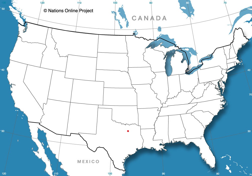
I think the southwestern US is fascinating, geographically. It’s so different than where almost everyone in the country lives, especially when you have to pass from one population hub to another. It will take one long day to cover the 703 miles this drive will take. Our pace will be at 68mph, which is perfect for driving through the desert.
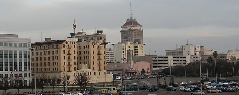
Fresno, California
Almost the entire country is sitting within an upper level trough. One part that isn’t is the west coast, where a sharp ridge is working to keep the Gulf of Alaska low at bay. Skies will be mostly sunny through southern California and western Arizona, but not completely clear. Valley fog will take a while to burn off initially, but should be out of the picture by the time we reach Bakersfield. With northerly jet flow particularly strong in the region, expect Arizona to be seasonably cool, if not a bit chillier, with cloudy skies possible, particularly west of Phoenix. Tucson is going to be a nice place to be this time of year, but may be a bit cooler than expected upon our arrival.