
Today was a particularly active weather day, with low pressure in the Upper Midwest extending a cold front through the Great Lakes and on towards the Mississippi. The front itself has been the origin of severe weather from the Quad Cities south through Missouri and eventually across Big Muddy and through Illinois.
More indicative of what’s coming is the snow that fell in the Upper Midwest. 2-5″ fell in Minnesota as precipitation wrapped into the cold air diving into the country behind this system, merely a couple of hundred miles away from tornado warnings in northern Illinois.
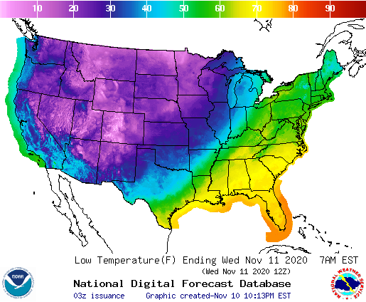
More tangibly, I think these two images spell out the change coming for the end of the week. First, the radar imagery.

And now, take a look at tonight’s lows. There should be some significantly colder air northwest of those bands of thunderstorms.
And there is that sharp drop I promised. High pressure will move in at the surface over the Plains, and prevent much of a warm up for a couple of days. Eta will slow the cold front so all those places that will get copious rain from the tropics will remain warm few days longer.
If you didn’t believe it yet, winter looks like it is here, and will hang on.