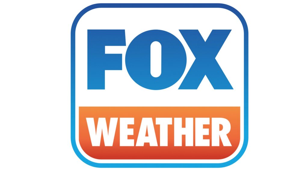
Cold front wasteland

In many summers, I find myself rolling my eyes at other outlets’ analyses of the surface. There is often a stationary boundary, left for days along the Gulf Coast of the US. Perhaps a cold front had descended from the Ohio Valley a week prior, but eventually, you need to call a spade a spade. There is onshore flow, and it causes thunderstorms. Not every boundary is a cold front.

This year, and especially right now, we haven’t been seeing those straggler boundaries populating the coast. Right now, it’s evident that there is an off shore boundary pointing into the Carolinas

One might be inclined to analyze something along the band of thunderstorms through north Florida, or perhaps even further north on the clearing line from southern Kentucky to central Oklahoma. In fact, most outlets are keeping truncated fronts, and there is a very good reason for that.

All of those orange and red shades are heat advisories. It is astonishingly hot throughout the Plains and Mississippi Valley. It’s really hard to say there is a cold front when there is a heat wave immediately behind the boundary. The WPC, proponent of the long ranging front, parlays the cold front into a warm front hugging those advisories to the west.

The jet is still somewhat active, but it remains well north of the domestic US. A cooler start to July in the southeast and a blistering start in the north is also starting to level off, but is making for a challenging environment for cold fronts to survive. If a change occurs, it will have to come from the west, which may happen next week.

Laredo, Texas to Fayetteville, Arkansas

It’s time for another road trip. This route takes us from one state to another that borders another, but we are going to cut through a third to get there. The drive covers about a day and a half, and is 762 miles long. There will be an ample amount of time spent on I-35, which will allow for a pace of 62.9mph. Not as fast as you expected? Well, that’s because of some off – interstate driving through Oklahoma. We’ll work out about 503 miles of driving on Tuesday, with the remainder on Wednesday.

DAY ONE (Wednesday)

Laredo, Texas (via Britannica.comdn

Our day will start from the Mexican border, and take us north through Texas on 35. We will abandon 35 as we head through the Dallas Metroplex and head for the Red River. There is a tail of a weak boundary sagging south through Texas that will trigger an isolated shower or thunderstorm generally north of the Austin area. Nothing severe or long lasting, but just enough to dampen the pavement from time to time. Just before we arrive at the Red River crossing, we will stop for the night in Denison.

DAY TWO (Thursday)
As the tail of that boundary drifts further south, it will clear the air in Oklahoma and western Arkansas. Well, not clear it, so much as bottle up the shower and thunderstorm threat to the south of our route. Be prepared, it’s going to be hot and miserable in Fayetteville when we arrive. Find air conditioning.

Fayetteville, Arkansas

Fayetteville, Arkansas

Arkansas has a surprising number of cities that we can drop forecasts for. The Northwestern Arkansas corridor is definitely more lively than one would normally be lead to believe.

At 953PM, CT, Fayetteville was reporting a temperature of 79 degrees with clear skies and dew points also parked in the upper 70s. It is a surely uncomfortable night which will see some haze across the region by morning. There are heat advisories out across the region, except in the Fayetteville area, where terrain and foliage will help blunt the high temperatures.
Low pressure in the Hudson Bay area is the only particularly well organized system in North America, and it is dangling a generally ineffectual boundary through the heart of the country. It is peeling back dew points a bit, and promoting a moist flow through the Lower Mississippi Valley northward, and will continue to do that through the day Sunday. The weak boundary will arrive in town by evening, and may lead to a more comfortable Monday, with isolated thunderstorms a distinct possibility throughout the day on Monday, but also in the evening on Sunday.
Tomorrow – Partly cloudy, afternoon thunderstorms. Humid. High 92, Low 73
Monday – Mostly cloudy, scattered showers and storms, High 89, Low 70

TWC: Tomorrow – Scattered thunderstorms in the morning, then partly cloudy late High 92, Low 72
Monday – Partly to mostly cloudy. A stray shower or thunderstorm is possible. High 91, Low 71

AW: Tomorrow – Sun and some clouds with a thunderstorm in spots in the afternoon High 92, Low 73
Monday – Humid with more clouds than sun; an afternoon thunderstorm High 91, Low 72

NWS: Tomorrow – A 30 percent chance of showers and thunderstorms, mainly before 1pm. Partly sunny, High 93, Low 73
Monday – A 40 percent chance of showers and thunderstorms. Partly sunny, High 92, Low 72

WB: Tomorrow – Mostly cloudy with chance of showers and thunderstorms in the morning then partly cloudy with slight chance of showers and thunderstorms in the evening. High 90, Low 75
Monday – Partly cloudy with a 50% chance of showers and thunderstorms, High 89, Low 74

WN: Tomorrow – Partly cloudy with a chance of storms, High 93, Low 72
Monday – Partly cloudy with a chance of storms, High 92, Low 71

FIO: Tomorrow – Humid and partly cloudy throughout the day. High 92, Low 73
Monday – Humid and partly cloudy throughout the day. High 89, Low 72

Here is the satellite for the evening, which just shows how clear the skies are to night in the south central US.

Laredo, Texas

We’re heading down to the banks of the Rio Grande for our forecast this evening. Typically this time of the year, we can expect some high heat and a little bit of humidity. Is that the case today as well?

At 656PM, CT, Laredo was reporting a brisk 30mph gust with fair skies and a temperature of 84 degrees. Dew points were near 70, and the moisture rich environment provided an atmosphere that was active with precipitation. A line of thunderstorms ran from north of Victoria to north of Laredo. The storms nearest Laredo on the American side of the border are beginning to diminish, because they are driven less by any synoptic feature, but mostly on the diurnal interaction with onshore flow.
A remnant frontal boundary north of the Gulf Coast is leaching some moisture away from south Texas, but is more importantly allowing the space for high pressure to develop over the western Gulf. Scattered showers and thunderstorms will still be possible in Laredo tomorrow, owing less to the onshore flow, and more to the monsoon flowing through Mexico and north towards the dry line and the Front Range. As high pressure builds, it will interrupt the flow of instability into Laredo, and the end of the week projects to be dry, but much warmer.
Tomorrow – Isolated thunderstorms, High 97, Low 75
Friday – Sunny and hot, High 102, Low 78

TWC: Variable clouds with scattered thunderstorms. High 94, Low 75
Friday – Some clouds in the morning will give way to mainly sunny skies for the afternoon. High 101, Low 78

AW: Tomorrow – Humid with times of clouds and sun High 93, Low 75
Friday – Breezy and less humid with times of sun and clouds High 99, Low 77

NWS: Tomorrow – A 30 percent chance of showers and thunderstorms, mainly after 1pm. Mostly sunny High 96, Low 77
Friday – Sunny and hot, (early AM rain) High 100, Low 78

WB: Tomorrow – Mostly cloudy in the morning then becoming partly cloudy. A 30 percent chance of showers and thunderstorms, High 93, Low 77
Friday – Partly cloudy in the morning, then becoming sunny,, High 100, Low 78

WN: Tomorrow – Partly cloudy with chance of storms, High 95, Low 77
Friday – Mostly sunny, High 100, Low 78

FIO: Tomorrow – Humid and mostly cloudy throughout the day. High 94, Low 75
Friday – Humid and partly cloudy throughout the day. High 98, Low 77

The radar picture below is probably going to be a little less noisy tomorrow, and more so on Friday.

Severe weather batters Europe, Canada

The United States is experiencing it’s own catastrophes this year. Growing wildfires and drought in the west, with flash floods in the southeast, along with heatwaves in the north. A lot of the worst weather in the world seems to afflict the United States in an outsized fashion, but it seems that is not the case in recent weeks.

First is the story of flooding in central Europe. Relentless and heavy rains have been hammering Benelux and western Germany, leading to river flooding on the Rhine in Germany and the Meuse in Belgium in particular, with subsidiaries an other rivers also spilling out of their banks. The intensity of the rains also led to flash flooding in these areas, while the river flooding is continuing to disrupt lives, with the threat of disease adding onto threats to infrastructure and livelihood.

The flooding was the result of a stalled, training pattern of showers and thunderstorms that lasted for the better part of last week. The good news is that the flooding is going to be allowed to abate over the next week, at least. High pressure over the British Isles is going to drift toward the Low Countries and barricade them from additional rainfall for the week. The next real threat for showers and thunderstorms is next weekend, and we can all hope that the feature moves as quickly as the models presently suggest.

A bit closer to home, tornadoes are in the news. The US has had an incredible string of good fortune, in that there were no tornadoes stronger than EF2 in May or June. Unfortunately, in Barrie, Canada, the tornado news was worse. A tornado – measuring at an EF2 – struck residential parts of the community, taking roofs off of houses, but fortunately, doing structural damage and sparing the residents of the houses it hit.

Listen to the tale of Natalie Harris, a City Councilor in Barrie, who saw significant damage to her home during the twister on Thursday.

The greatest damage was to the far southeastern part of town. The damage would surely have been more significant if it had been just a couple miles to the north.

Not enough

As everyone is likely aware, the western US is embroiled in a drought. The seasonal monsoon is helping in some spots, but at the beginning of the monsoon wasn’t able to bring a whole lot of rain to Prescott, among the many locales that is in a deficit right now. If there was any good news, I guess it was that the heat wasn’t as overbearing as it can be in the southwest. The Weather Service and Weathernation conspired to tie for the top forecast.
Actuals: Monday – High 93, Low 66
Tuesday – Rain reported, not measured, High 91, Low 73

Grade: C

Feature Forecast: Pocatello, Idaho, Feature Forecaster: Doug Iverson

Joining us today for the forecast is Doug Iverson, the Chief Meteorologist at KPVI in Pocatello, Idaho. Mr. Iverson likes to go by the moniker Doug I. the Weather Guy, and can be found at Twitter @dougiweatherguy. Mr. Iverson is a native to Idaho, and surely has a little extra insight into the weather of Pocatello. Take it away, Doug!

Yay…the weekend is almost here.  The Snake River Plain will see less of that  wildfire smoke and more of that hot sun.

More heat on the way

Another massive heat wave is in the forecast according to the CPC’s outlook, and this time, the region expected to be baked is the northern Plains and Upper Midwest. Curiously, while the northern US roasts, the southern part of the country looks to be well below normal. In the summer, that’s comfortable, so it’s not the story,

Unlike the blocking ridge that brought the heat in the Pacific Northwest last month, this looks like a more traditional ridge allowing all that heat to build. Temperatures from Montana through the Dakotas and into northern Minnesota could hit triple digits through early next week.

There will be a remnant mid and upper level trough over the southern US, which will lead to several rainy days, and keep temperatures cool. If it weren’t for that trough, given the greater jet pattern, a more significant heat wave could have been in store for a bigger population.

Prescott, Arizona to Bakersfield, California

For whatever reason, we don’t get a lot of trips that are spent entirely out west, like this one. It will last nearly a full, and will cover 481 miles at a pace of 63.2mph, thanks to the lower capacity roads through the desert. Looks like it’s time to get moving.

Prescott, Arizona

The afternoon monsoon looks to be full and robust tomorrow in the Four Corners region. That means very little for us, however. Prescott will have a slim chance for some afternoon showers and storms, but by that time, we will be deep into the Mohave, hoping our tires don’t melt to the road in the heat. Temperatures will easily reach the triple digits tomorrow in Bakersfield, and you have to imagine it will climb even warmer before we reach town in rural California.

Bakersfield, California

Prescott, Arizona

The heat has been extraordinary in the southwest, but Prescott is often in a more favorable weather pattern than their gigantic neighbors to the southeast. How does that translate this time around?

At 753PM, PT, Prescott was reporting a temperature of 80 degrees with clear skies. Some monsoonal rain showers were appearing on radar west of town, and a brisk west wind likely represented outflow, especially given the southeasterly winds of similar magnitude in Kingman. Guidance suggests a stronger ridge tomorrow over the central Rockies, which will stifle the monsoon and lead to a hot dry day in Prescott.
Expect some weakening of the ridge and an amplification of the monsoon. Afternoon and evening thunderstorms will be most common in the higher terrain nearer the New Mexico border, but the coverage is expected to increase on Tuesday. Showers and storms are likely to crop up near Prescott, and it’s tough to leave it out of the forecast for Tuesday.
Tomorrow – Sunny and hot, High 96, Low 68
Tuesday – Isolated thunderstorms, especially after noon, High 89, Low 68

TWC: Tomorrow – Except for a few afternoon clouds, mainly sunny. A stray shower or thunderstorm is possible High 91, Low 70
Tuesday – Some sun in the morning with increasing clouds during the afternoon. A stray shower or thunderstorm is possible. High 89, Low 69

AW: Tomorrow – Partial sunshine with a thundershower in spots in the afternoon High 92, Low 70
Tuesday – Intervals of clouds and sun with a thunderstorm around in the afternoon High 87, Low 70

NWS: Tomorrow – A 20 percent chance of showers and thunderstorms after 11am. Mostly sunny, High 93, Low 69
Tuesday – A 50 percent chance of showers and thunderstorms. Partly sunny, High 89, Low 69

WB: Tomorrow – Partly cloudy with a 20 percent chance of thunderstorms, High 90, Low 71
Tuesday – Mostly cloudy with a 40 percent chance of thunderstorms, High 85, Low 71

WN: Tomorrow – Partly cloudy with chance of storms High 93, Low 69
Tuesday – Partly cloudy with scattered showers, High 89, Low 69

FIO: Tomorrow – Clear throughout the day. High 93, Low 69
Tuesday – Mostly cloudy throughout the day. High 88, Low 67

I should note that it is 20 degrees cooler in Prescott than it was in Phoenix. Some of it is surely the thunderstorm nearby, seen on radar below.