Welcome to hurricane season, everyone! For the first time in quite a while, the Atlantic has managed to avoid having a named storm crop up before the season started, though nevertheless, a busier than normal season is expected this year.
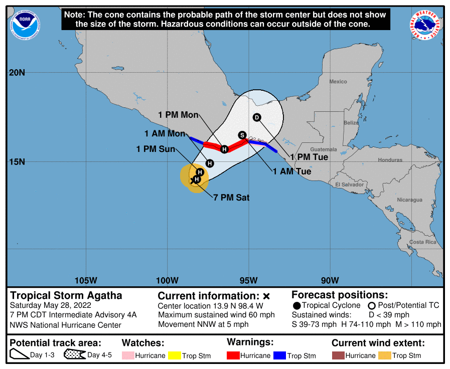
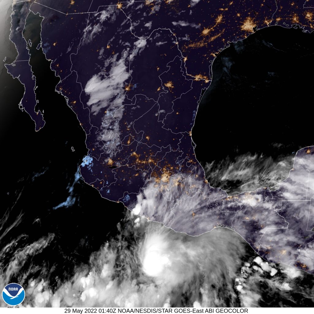
Even as this post is written, the remnants of Tropical Storm Agatha are being monitored for redevelopment in the southern Gulf of Mexico. It would be an interesting way to kick off the season, but the more traditional means of tropical development are, as now, pretty quiet across the Atlantic.
That portends to activity picking up later in the season. Even though this is the beginning of the tropical season, historically the most active period in the Atlantic comes at the end of summer, when the oceans are at there warmest. If the season waits to start and gets busier as it goes on, that will lead to a rough August and September.
Despite Agatha’s emergence in the eastern Pacific, the NHC projects a quieter than average season in the central Pacific. This is particularly important for both Hawai’i and surfers who come looking for big swells around the islands. There aren’t many other land masses that stand to be impacted by tropical features in the middle of the ocean, and even in busy years, Hawai’i isn’t impacted with much frequency.
Of course, with any season, what we remember is the storms that make landfall. Most residents of the Caribbean would agree that the Atlantic can be as busy as it wants to be, just so long as the storms stay out to sea and leave their islands alone. A quiet season in the central Pacific means nothing if one rogue cyclone nails Honolulu.
One last note. The beginning of hurricane season is also the dawning of meteorological summer. We made it, everyone. Happy summer!