
We’re going to the Dakotas this evening. There was a little bit of rough weather in South Dakota last night. Will the start of the work week bring more of the same?
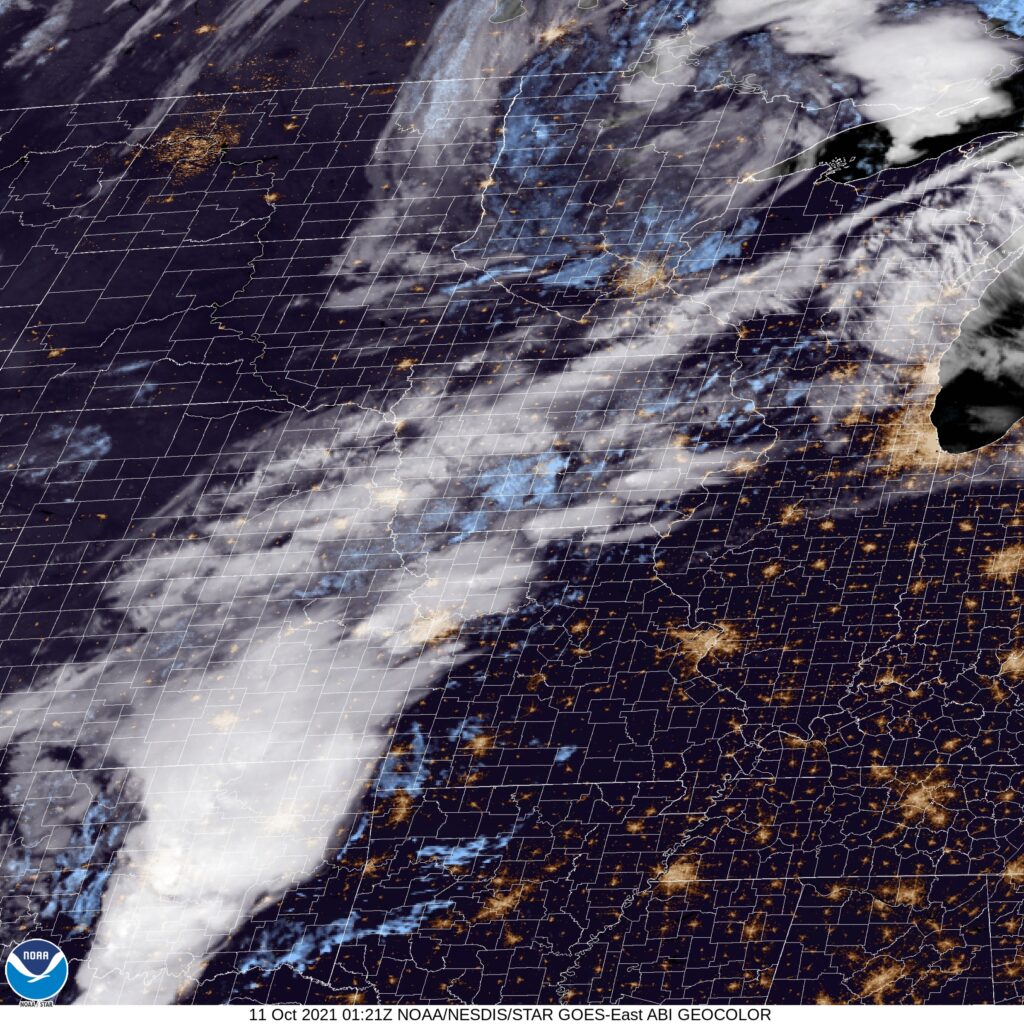
At 756pm, CT, Sioux Falls was reporting a temperature of 55 degrees with clear skies. There was a complex series of of low pressure bringing rain and areas of strong thunderstorms from the Canadian border and further south, particularly in Oklahoma and Texas, but a swath of clear and cool air had built into the Dakotas.
The next trough will rotate into the central Plains after diving out of the Rockies, and is going to bring with it a strong batch of cold air, and quite a bit of vorticity, winding up what will likely be the largest storm of the season. Expect that by late Tuesday, flow will become robustly southerly, with rain starting late in the afternoon and evening. Very windy conditions are expected Tuesday night, with rain heavy in spots.
Tomorrow – Mostly sunny, High 71, Low 42
Tuesday – Sunny early, then rainy with very strong winds, even outside o thunderstorms, High 72, Low 41
TWC: Tomorrow – Sunshine and clouds mixed. High 72, Low 44
Tuesday – Plentiful sunshine High 71, Low 43
AW: Tomorrow – Pleasant and warmer with intervals of clouds and sunshine High 72, Low 45
Tuesday – Partly sunny and comfortable (late rain) High 70, Low 44
NWS: Tomorrow – Sunny High 71, Low 44
Tuesday – Sunny, High 70, Low 45
WB: Tomorrow – Sunny, High 71, Low 46
Tuesday – Sunny, High 70, Low 46
WN: Tomorrow – Mostly sunny, High 71, Low 44
Tuesday – Mostly sunny, High 69, Low 44
FIO: Tomorrow – Clear throughout the day. High 71, Low 45
Tuesday – Clear throughout the day. High 70, Low 45
It’s not a matter of if, but when it will rain in Sioux Falls. At least they aren’t in Wyoming and Montana, where snow is likely. And at least for tonight, it’s pretty OK.
Comment (1)