It’s time for a forecast, dear friends, so lets head on down to the Ohio Valley.
At 756PM, Louisville was reporting mostly clear skies with a temperature of 54 degrees. Parts of the region that saw a little bit of the sun before it set popped to nearly 60, but eastern Kentucky is still socked in, and sits in the upper 40s, with Louisville straddling the line. A deeply occluded low in the Great Lakes was tied to a slow moving low in the Appalachians, and the combination of the two was responsible for the cloud deck slowly departing the Louisville area. The low is wrapping in additional mid level moisture that, within the colder air behind the system, is more inclined to produce some cloud cover. This is the regime that Louisville will find itself within for the remainder of the work week, with passing midlevel clouds passing in front of a seasonably cool sunshine. A perturbation moving through the southern Plains, riding the northern edge of a jet streak will approach late on Friday, but rain will hold off until the weekend. Tomorrow – Partly cloudy, High 60, Low 42 Friday – Partly to mostly cloudy, High 64, Low 42
TWC: Tomorrow – Except for a few afternoon clouds, mainly sunny. High 61, Low 41 Friday – Partly cloudy skies. High 66, Low 39
AW: Tomorrow – Intervals of clouds and sunshine High 61, Low 41 Friday – Sun followed by clouds High 66, Low 39
NWS: Tomorrow – Sun followed by clouds High 60, Low 41 Friday – Mostly sunny High 63, Low 39
WB: Tomorrow – Mostly sunny, High 60, Low 44 Friday – Partly cloudy, High 65, Low 42
WN: Tomorrow – Mostly sunny, High 60, Low 41 Friday – Partly cloudy, High 63, Low 39
FIO: Tomorrow – Partly cloudy throughout the day. High 58, Low 40 Friday – Mostly cloudy throughout the day. High 62, Low 38
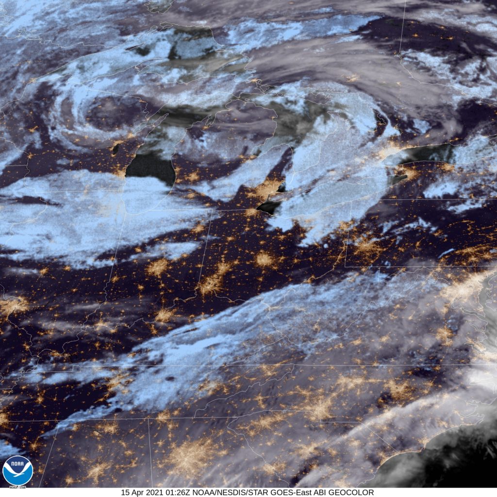
When there are no changes in air mass, and the sun is more or less out for the day, you end up with some pretty similar forecasts. Here is the satellite imagery, showing the last of the significant clouds and snow to Louisville’s southeast, and some less ominous clouds closer to Lake Michigan.
A big blob of rain, with a few thunderstorms embedded within a big swirling low inched towards Decatur late last week. Since late Wednesday night, that rain has made it as far as the Great Lakes. So it rained in Decatur during our forecast period of Thursday and Friday, but the radar was less and less intense as time went on, and temperatures dropped off to become seasonable, and eventually, below normal. If there was a silver lining to all the clouds, it was that forecasts for the region were pretty good. Forecast.io gets top marks. Actuals: Thursday – High .09 inches of rain, High 79, Low 60 Friday – .13 inches of rain, High 63, Low 51
Every ten years, weather averages are reconsidered and updated. Daily high temperatures, low temperatures and precipitation are now based on the most recent 30 years, reflecting the most recent information in our ever changing climate. In addition to the daily changes, monthly and seasonal changes are also instituted.
Hurricane seasonal averages were updated, replacing the 80s with the extremely active 2010s. Now, an average season will see 14 named storms, with 7 hurricanes, up 2 and 1 from the previous averages, according to the National Oceanic and Atmospheric Administration. This is has a lot to do with the active years early in the past decade, and especially the last several years, which were busier than even the new normal years.
There is something to be said about the warming of the north Atlantic, but also, the El Nino pattern, which was more prevalent in recent years. Somewhat surprisingly, the eastern and central Pacific didn’t have any revision to their annual averages. The Atlantic also didn’t see an increase to the major hurricane forecast.
Satellite data and naming conventions really were revolutionized in the 90s. Improved satellite data will, as a result, not be a factor in future changes to averages, but they may have led to some change in this update. Hurricane season, officially, begins on June 1st, and we are coming off the busiest season of all time.
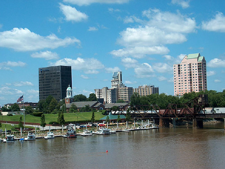
While most of the population of Utah is in a narrow strip of the Salt Lake Basin, right along I-15, there is at least one big outlier: St. George and Cedar City in he southwest corner of the state.
At 156PM, MT, St. George was reporting a temperature of 77 degrees with clear skies. There is a bit of an absence of upper level dynamics, and across the arid inter mountain west, that means sunshine and dry air. Dew points are sitting in the teens, so temperatures this afternoon should warm unabated. The entry region of the nearest jet is centered over the Pacific Northwest, and it will shift towards Wyoming through the day tomorrow. Flow in the wake of the jet will curl cyclonically to join the jet streak, leading to the development of low pressure over Nevada. Southerly flow will emerge in southern Utah later in the day Tuesday. Expect dry conditions to continue over St. George, but some rain and snow to emerge over the southern faces of taller Wasatch Mountains through central Utah by Tuesday night. Tomorrow – Sunny, High 82, Low 51 Tuesday – Partly cloudy and breezy, High 81, Low 51
TWC: Tomorrow – Partly cloudy skies. High 84, Low 50 Tuesday – Partly cloudy early. Mostly sunny skies with gusty winds developing later in the day. High 81, Low 52
AW: Tomorrow – Intervals of clouds and sun High 83, Low 47 Tuesday – Mostly sunny; breezy in the afternoon High 79, Low 53
NWS: Tomorrow – Mostly sunny High 83, Low 51 Tuesday – Sunny, High 79, Low 55
WB: Tomorrow – Sunny, High 81, Low 55 Tuesday – Partly cloudy in the morning, then becoming sunny, High 80, Low 56
WN: Tomorrow – Mostly sunny, High 85, Low 51 Tuesday – Mostly sunny, High 81, Low 55
FIO: Tomorrow – Partly cloudy throughout the day. High 84, Low 50 Tuesday – Partly cloudy throughout the day. High 81, Low 53
This was an interesting forecast to construct, watching low pressure develop on the same map in an area that wasn’t the High Plains. Not something we get to look at every day. It’s pretty sunny today, though.
Our last post of March was actually a forecast that covered the first couple of days of April in Boston. I have to say, it is not weather that I would have enjoyed. After a very rainy start to the month on the 1st, temperatures struggled to even reach 40 on Friday the 2nd. If there was a silver lining, it certainly wasn’t for Bostonians, but rather for Victoria-Weather, who easily won the day. Actuals: Thursday, April 1st, .98″ of rain, High 58, Low 36 Friday, April 2nd, High 40, Low 29
The Masters start tomorrow in Augusta, and if you are a local, I bet it’s not your favorite time of year. So why not get out of town, say, by driving as far as you can in one long day. It will take almost 12 hours to get from Augusta to Decatur, covering about 744 miles at a pace of about 64.5mph. It’s definitely going to be an adventure!
Augusta, Georgia
Low pressure in the mid-Mississippi Valley is rapidly occluding, which means it is slowing down and weakening. As a result, it’s not going to clear the route by the time we get moving, but it’s also not going to provide a lot of heavy weather as we drive on Thursday. There will be some rain and isolated thunder with the tail of the front in the high terrain northwest of Atlanta to about Murfreesboro, Tennessee. At that point, we will get into a dry slot, which will be cloudy and glum, but OK for driving. The dry slot will last for the rest of the day, though the further north, and closer to Decatur we get in while driving in southern Illinois, some light rain becomes more and more likely. So don’t go any further north than Decatur, I guess, is what I’m saying.
Central Illinois is calling our name this evening.
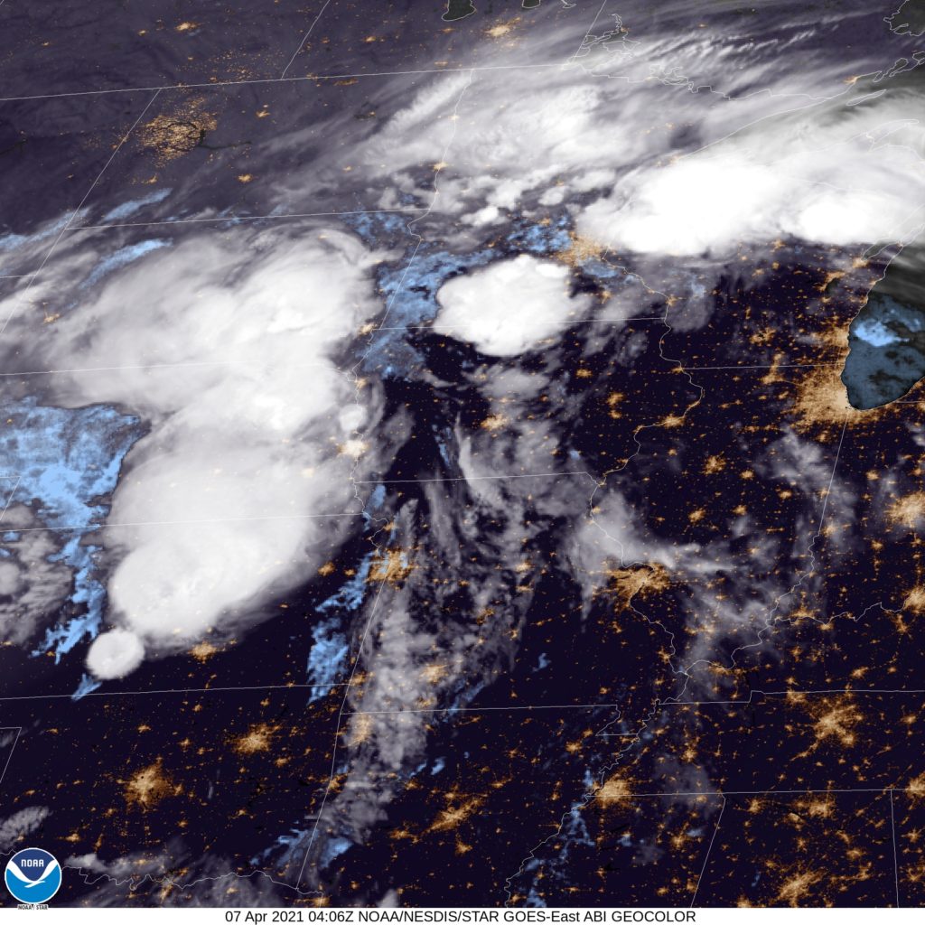
At 1054PM, CT, Decatur was reporting clear skies with a temperature of 66 degrees. An active area of low pressure west of the Mississippi was drawing warm moist air north into Illinois, lending to the stuffy overnight temperatures, but a great deal of rain, with embedded thunderstorms was on it’s way. Fortunately, the warmer weather should continue through most of the day tomorrow. The sharp curl to the upper jet will induce occlusion of the system through tomorrow morning, slowing the system down and taking the teeth out of the precipitation as it moves through Decatur. Severe weather, and even strong thunderstorms are unlikely. Wet weather will arrive in the evening in Decatur on Wednesday, with rain continuing, heavy at times through Thursday morning. Cooler, damp air will linger later in the day on Thursday as low pressure parks itself in central Illinois. With a murky upper level pattern, the lingering moisture over Decatur will help set the stage for shower and thunderstorm activity later this week. Tomorrow – Late rain, some thunderstorms close to midnight, High 77, Low 60 Thursday – Heavy rain, then overcast with spots of drizzle, High 61, Low 52
TWC: Tomorrow – Cloudy in the morning with scattered thunderstorms developing later in the day. High 77, Low 60 Thursday – Cloudy early with showers for the afternoon hours. High 60, Low 53
AW: Tomorrow – Some sun, then increasing clouds and windy; a thunderstorm in spots in the afternoon High 77, Low 61 Thursday – Mainly cloudy, breezy and cooler with a couple of showers High 61, Low 52
NWS: Tomorrow – A 20 percent chance of showers after 2pm. Partly sunny, High 75, Low 60 Thursday – A 40 percent chance of showers after 1pm. Partly sunny High 60, Low 52
WB: Tomorrow – Mostly Sunny, 20% chance of rain showers in the afternoon, High 75, Low 61 Thursday – Cooler. Partly sunny with a 50% chance of rain showers, High 61, Low 55
WN: Tomorrow – Partly cloudy with scattered showers, High 75, Low 60 Thursday – Partly cloudy with scattered showers. High 59, Low 52
FIO: Tomorrow – Rain overnight and in the evening. Hugh 77, Low 5 “Thursday – Rain until morning, starting again in the evening. High 65, Low 51.
Illinois looks nice on satellite, but those poufs of cumulonimbus west of Mississippi bear watching.
March went out like a lion in the mid-Atlantic. A batch of low pressure that emerged from the Smokey Mountains invigorated some moisture in the region, and there was nearly an inch of rain in Washington on the last day of the month. With all those showers, the temperature dispersal was fairly minimal last Wednesday, The top forecast was held by Accuweather, who correctly foresaw the gloomy end to the month. Actuals: Tuesday, High 69, low 46 Wednesday – .92 inches of rain, High 65, Low 56