Norwich is several miles inland, however the official NWS reporting station for the site of our forecast at the beginning of the month is at the Naval base at Groton, which is definitely on the coast. Through some patterns, this doesn’t have a substantial impact. On August 5th and 6th, it was so dramatic it made me take into consideration the typically less reliable observation posts that don’t offer the official NWS read outs. I’m not sure they are fully correct, but I am sure they are closer to a fair representation for Norwich than Groton’s readings, which were a good 10-15 degrees cooler than all of the forecasts. So with that preamble, it stayed sunny, stayed dry and got pretty toasty in Norwich, and The Weather Channel was closest to the readings that I elected to reference. Actuals (?): August 5th – High 89, Low 57 August 6th – High 92, Low 75
We’re not staying in Connecticut long, as we have a forecast back to the west. This trip to Colorado will be shorter than our most recent trip, covering 1934 miles, over the course of 3/12 days. That works out to an average speed of 66.7mph, and a daily mileage of 533.5 miles.
DAY ONE (Saturday)
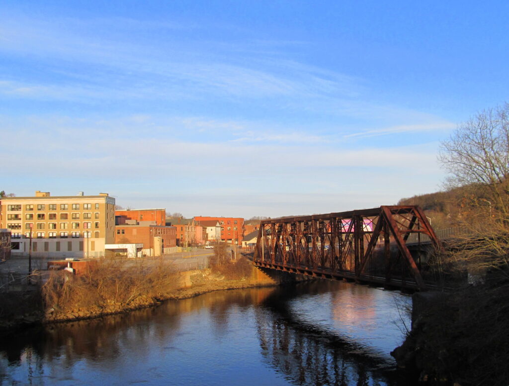
Norwich, Connecticut
There is this band of orphaned moisture riding the back of a broad ridge of high pressure in the Atlantic, and it is leading to chances for showers up and down the coast to about the Appalachians. On the other side of Appalachia, a cold front is meekly trying to move through, further drawing moist air further to the north. This will mean a mostly cloudy day, driving through New York, with some coastal showers in Connecticut at the outset, and then, as that front approaches Appalachia, we could see a few showers for the concluding bit of our driver, between Buffalo and Erie, where we stop for the night.
DAY TWO (Sunday) The cold front will be beyond us by the time we depart Erie on Sunday morning, giving us a fairly unperturbed drive through Ohio and Indiana. The next little vorticity maximum will be rotating through the western Great Lakes by the end of our day on Sunday, which may lead to a few showers and an isolated embedded thunderstorm over northern Illinois. I would call it west of Joliet, which would get us through Chicago, but showers and storms would be possible all the way to Langley, Illinois, which is about 30 miles west of La Salle, and our destination for Sunday night.
DAY THREE (Monday) This time of year, especially after a bit of rain overnight, I wouldn’t be surprised by “corn sweat” in the morning. That would be fog that arises thanks to the latent moisture provided by crops, mostly corn, that are approaching their harvest time. High pressure will be in place, and we should see the sun through western Iowa and into Nebraska. It will be getting warm as we arrive in Kearney for the night, as low pressure in the high Plains is developing a warm front. This may also serve as a guide for some overnight convection, but that should hold off until after we have arrived .
DAY FOUR (Tuesday) Surface high pressure will be all the rage again as we get going on Tuesday morning. The unbroken horizon of Nebraska will lay ahead of us, and it will be a race to see the mountains. We’ll arrive in Fort Collins without much concern, though by afternoon showers and storms will be popping up in along the dry line of eastern Colorado.
This summer has been hot, but the temperatures aren’t as rough as they have been lately, and the storm activity in particular is quiet. It’s a perfect time to take a week and cross the country! We’re going to be driving for 6 days, with the 6 day mercifully shorter than the first 5, at a pace of 67.7mph. This will give us daily goals of 542 miles a day as we cross 3046 miles of America.
DAY ONE (Wednesday)
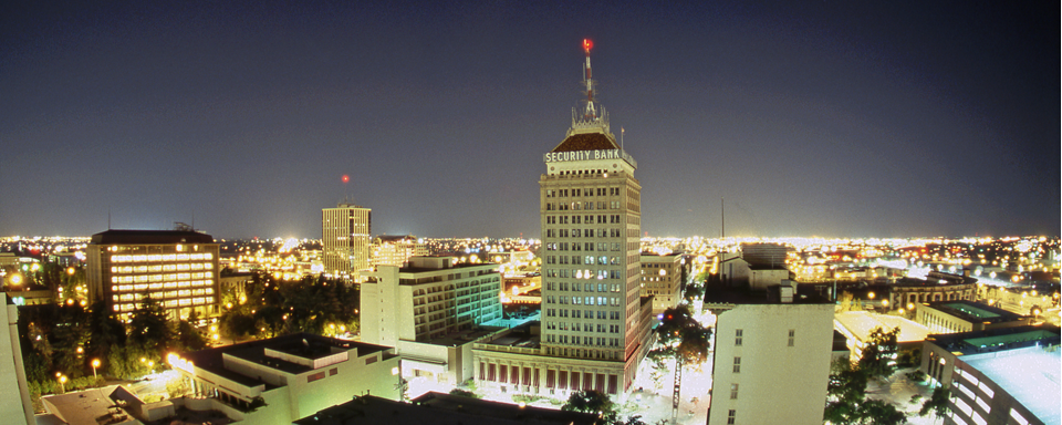
Fresno, California
The story in California and through the Southwest is that it is hot. We will go south to avoid some mountains and drive right through the desert, near Death Valley and past Las Vegas. We won’t find much relief from the heat until we start climbing in Utah, and we won’t do that until near the end of the day. We will stop in southern Utah, in the town of Summit, which lies not far from where we will turn onto I-70.
DAY TWO (Thursday) Moisture is being funneled eastward, which keeping the monsoon stunted. Storms are appearing in Arizona, but I’m not particularly concerned about the mountain passes of the central Rockies. We will make it to the fringes of the mountain community of Golden, west of Denver.
DAY THREE (Friday) It seems like all long road trips end up spending a night in Nebraska. We’re looking into this. Our week will end near Omaha, really on the southwestern outskirts. If there was going to be any rain, this would have been the day, just for the excitement. We’ll still be rain free as we check in to the hotel in Omaha.
DAY FOUR (Saturday) More of the same as we start, with dry skies until Des Moines, for sure. A few scattered showers will emerge as a possibility east of Des Moines, but not one that will ruin our day. Unless they come in Chicago, at which point all bets are off. That would ruin the day. Expect traffic to remain dicey regardless of the weather. Let’s get out of Chicago before the night ends, finishing in LaPorte, Indiana.
DAY FIVE (Sunday) The moisture threat will linger through the weekend, produced by a dissipated area of low pressure and penned by high pressure in the Atlantic. There won’t be much convective activity, and as we reach the hills of Appalachia, the rain will be misty, and more likely the higher we are. The day will end south of Williamsport, in Eastville.
DAY SIX (Monday) In a bit of good news, all that moisture is going to be hemmed to the west of the Appalachians. There may be a bit of low level moisture – fog or light mist – as we set out, but the drive into New England looks to be clear and dry. And significantly cooler than Fresno.
Off to New England as we reach he dog days of summer. I suspect that many residents in the Norwich area would happily be on their way to Martha’s Vineyard or otherwise on vacation this time of year.
At 852PM, ET, Norwich was seeing a temperature of 72 degrees with clear skies. The temperatures over Long Island and near the coast in Connecticut were a shade lower as the sun had less time to shine. Left over mid level moisture along the coast has continued to mean clouds from Long Island southward, and with high pressure parked over the Atlantic will keep it in place for a while. The next feature to keep an eye on is a standing trough in the Great Lakes. While the cold front won’t be moving eastward in any kind of hurry, the little progression there is will draw some of that lingering coastal moisture further north. The mere act of inducing some motion within this moist air mass will lead to some general showers and storms that will eventually reach eastern Connecticut by Thursday evening. Tomorrow – Partly cloudy, High 86, Low 61 Thursday – Late showers and storms, otherwise mostly cloudy, High 87, Low 67
TWC: Tomorrow – Partly cloudy, High 85, Low 59 Thursday – AM Showers, High 88, Low 71
AW: Tomorrow – Humid with intervals of clouds and sunshine High 83, Low 57 Thursday – Uncomfortably humid with intervals of clouds and sun; an afternoon thunderstorm in parts of the area High 86. Low 70
NWS: Tomorrow – Areas of fog before 9am. Otherwise, mostly sunny (late rain), High 84, Low 58 Thursday – A chance of showers before 8am, then a slight chance of showers and thunderstorms after 2pm. Patchy fog between 7am and 8am. Otherwise, mostly cloudy, then gradually becoming sunny, High 87, Low 68
WB: Tomorrow – Patchy fog in the morning. Mostly sunny. (late rain) High 85, Low 64 Thursday – Partly sunny. Patchy fog in the morning. A chance of showers in the morning, then a slight chance of showers and thunderstorms in the afternoon, High 87, Low 70
WN: Tomorrow – Mostly cloudy High 84, Low 58 Thursday – Mostly cloudy with showers and isolated storms, High 87, Low 68
CLI: Tomorrow – Partly cloudy, High 86, Low 59 Thursday – Light rain showers, High 87, Low 70
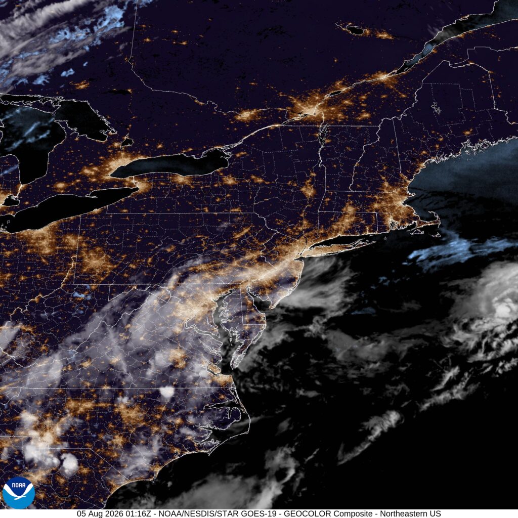
There isn’t enough there, in my opinion, to worry about showers tomorrow. It’s barely concerning on Thursday. Satellite shows those clouds along the Mid-Atantic coast.