At the beginning of the month, we took a look at Ames, Iowa‘s weather. It was a towards the end of the prolonged icy grip on the middle of the country, and temperatures were trying to warm up a bit. The cold wasn’t ready to let go, however, and temperatures never breached the freezing line. The snow remained out of the picture, which was some modicum of relief, and with the benefit of hindsight, we can see that it eventually would get warmer in Ames. The forecast was interesting. The consensus forecast was nearly the best one, but WeatherNation ended up earning their own spot on top of the leaderboard. Actuals: February 2nd, High 27, Low 21 February 3rd High 29, Low 16
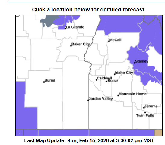
4:37PM: Things are active across the country, including severe weather in the Southeast and the potential for winter weather in the Northwest. I have to say, the current advisory map for Boise is fairly ominous. You’re surrounded!
10:53PM: Happy Valentines Day! Especially if you are in the middle of the country, and are a fan of warm weather. Record highs were reported in Minneapolis today, as a part of that surge of warm air. Heart shaped sunglasses for all.
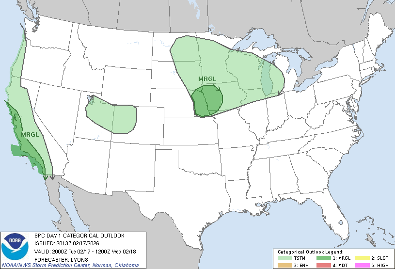
10:28PM: We talked about the change the pattern is going to be experiencing in the very short term. One of the functions of this change is that we will see an active pattern, with low pressure drawing moisture out of the Gulf. Well, here it comes. This is the thunderstorm outlook for Saturday.
It’s been a brutal winter for the eastern part of the US, particularly in the southeast. Temperatures have been colder than normal, and there have been historic ice storms. Parts of the country have endured subzero temperatures for long stretches, while further south, even as far as central Florida, temperatures were, at times, below freezing. No longer!
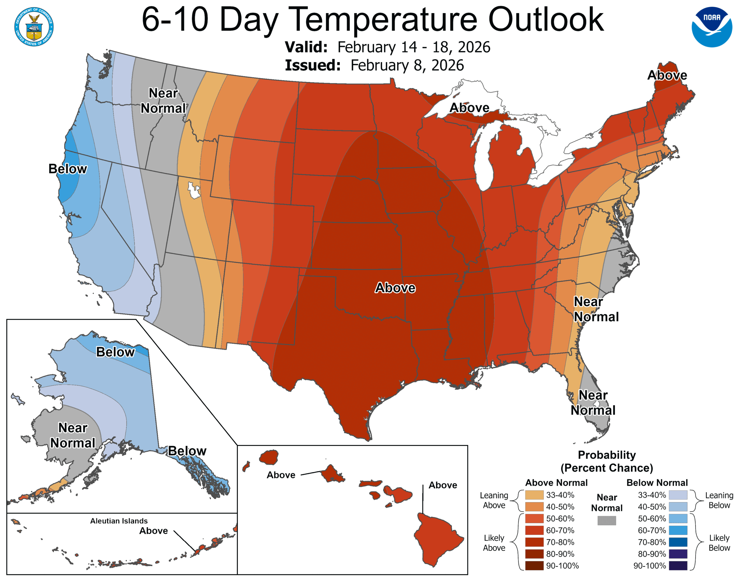
The trough that has been in place over the eastern US, the lobe of the polar vortex that has made everyone so uncomfortable is now back up in the Arctic where it belongs, and a warmer batch of high pressure is moving into the middle of the country. Temperatures are warming up, first in the Plains, but eventually through the Great Lakes, Tennessee Valley and on to the East Coast.
We haven’t talked much about the West Coast, save for more normal conditions and some persistent rain earlier in the winter. The precipitation was intense at times, but more recently it has been dry and warm, just like we have grown to expect along the Pacific for the past few years. The early season rain has tamped down the concerns, and guess what? The early season rain looks like it will be late season rain as well.
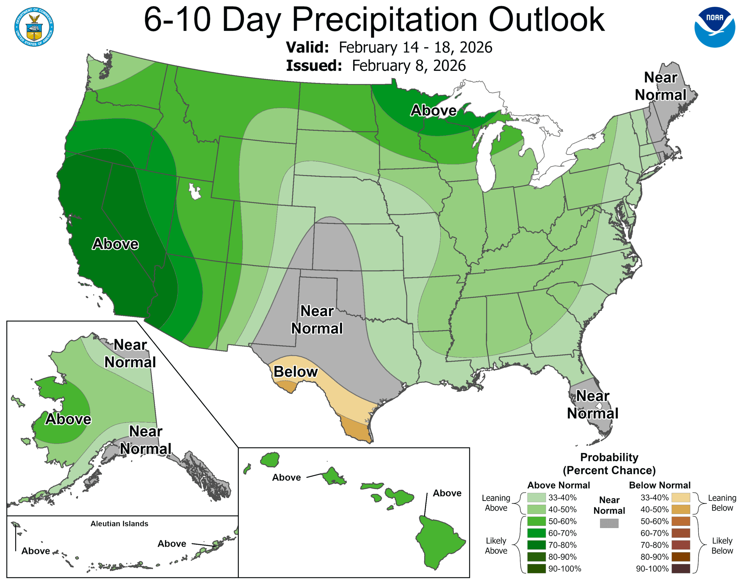
In the very near future, the movement off of the persistent eastern trough is allowing generally more activity through the lower 48. Pattern movement means precipitation, as it will nationwide next week, but also, systems east of the Rockies will draw their energy from the Gulf and points southward. This is early for this sort of pattern, which means above normal temperatures for about 4/5ths of the country.
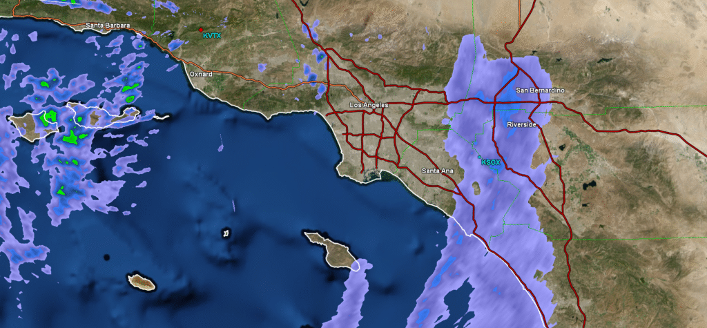
Of course, the active pattern will begin out on the West Coast, with rounds battering California before moving into the Plains, where low pressure will deepen and cause the increasing warm air and action discussed in the previous paragraph. The temperature trends are swapping coasts, and along with it, expect a stormy time ahead.
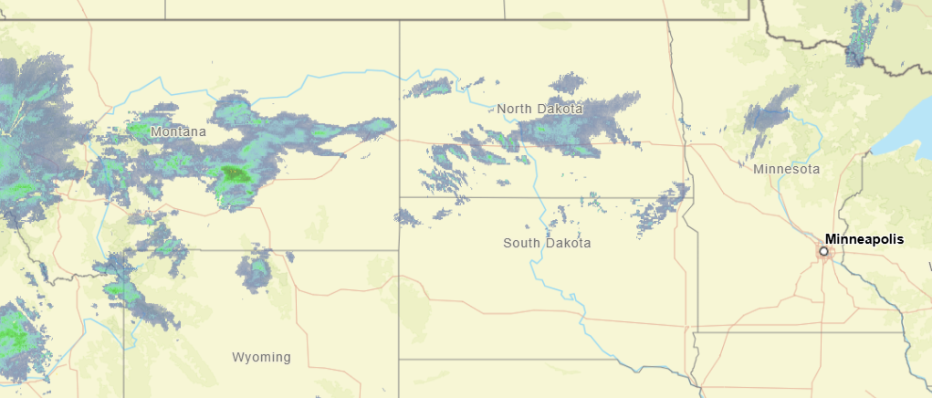
11:33PM: I hope everyone enjoyed the big game! If you are taking a quick gander at the radar before bed, the only thing that stands out to me is that a boundary in the northern Plains is spitting out a bit more snow than I think we expected. Otherwise, a pretty quiet night elsewhere. Except Seattle, I assume.
10:52AM: I can confirm from our forecast for Janesville last night that a weak little band of snow did come through, but there were no accumulations noted. There were light snow showers in the observations for about 3 hours, and now it is 36. It is cloudy, so don’t get ready to go tanning or anything quite yet.
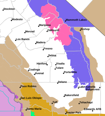
12:57PM: The weather is quiet for a lot of the US right now, but there is one pocket of the nation that is looking ahead to a bit of snow. It is a very narrow pocket, and it isn’t much snow, though. This one is for the handful of people that might actually visit this site!