
8:00PM It’s been storms across a big cross section of the country that have earned a lot of headlines, but one area that hasn’t seen the rain is Florida, and to a degree, the Coastal Plains. Moderately dry conditions are leading to concerns for fires in this area. High winds further west also bring worry about fire and how fast they would spread in the Plains.
Can’t miss everything
The end of the week was a stormy time for a great chunk of the country. And it all started popping off juuuuuuuust to the east of St. Joseph, Missouri, where the early afternoon on Friday brought a little bit of rain and a few gusts to start things off, but that was it. Well, almost. They also got the cold air behind the front. That’s where the real surprise came. St. Joseph reported a trace of snow late on Saturday. That was not on anyone’s bingo board. The National Weather Service had the top forecast for the storm kickoff.
Actuals: Friday -.04 inches of rain, High 79, Low 57
Saturday – .04 inches of liquid in snow, High 59, Low 34
Grade: C
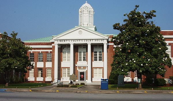
Fort Walton Beach, Florida
Were heading for the Panhandle as spring is beginning to emerge nationwide. A reminder that the Florida Panhandle is more aligned with the American Southeast than it is with Peninsular Florida, where the weather is concerned. Let’s see how that plays into the forecast.
At 1255AM, ET, Fort Walton Beach was reporting a temperature of 64 degrees with clear skies. Temperatures dropped significantly just inland, and the warm air drifting ashore suggested the potential for some fog in the morning, especially with dew points nearly matching the air temperature. Strong low pressure in the Plains is belaboring the pattern, which would otherwise be counterintuitive, given the temperature dynamics.
A strong trough in the Plains is going to allow surface low pressure to intensify and shift to the northeast, all the while pulling in more warm Gulf air to the Panhandle. The day tomorrow will be warm and humid, however a cold front will arrive in Fort Walton Beach early on Thursday, bringing a chance for some light showers and a notably cooler day to follow.
Tomorrow – Warm with some morning haze, High 73, Low 59
Thursday – Morning showers, then clearing and cooler, High 66, Low 50
TWC: Tomorrow – Sunshine and some clouds High 73, Low 58
Thursday – Mostly sunny (Early rain), High 68, Low 52
AW: Tomorrow – Mostly sunny, breezy and pleasant; great day to be outside High 75, Low 57
Thursday – Sunny and windy (Early rain) High 68, Low 54
NWS: Tomorrow – Sunny, High 74, Low 55
Thursday – Partly sunny, then gradually becoming sunny, (Early rain) High 67, Low 50
WB: Tomorrow – Sunny. (Late showers) High 72, Low 62
Thursday – Sunny cooler. Less humid (Early rain) High 67, Low 50
WN: Tomorrow – Mostly sunny (Late rain), High 74, Low 57
Thursday – Mostly sunny (Early rain), High 64, low 51
CLI: Tomorrow – Clear High 74, Low 56
Thursday – Sunny (Early rain) High 67, Low 46
Thursday, after the frontal passage, is expected to be non standard. Surprise! We have a bit of cloud debris collecting on the Mississippi Delta. Will this spread? I suspect it will.

Hanford, California
Our forecast today takes us to the Central Valley of California, where the weather may not provide the reprieve you typically expect.
At 1253PM, Hanford was reporting a clear skies and a temperature of 62 degrees. Northern California, particularly at the higher terrain is under advisories for high wind and snow. At the lower terrain, a trough moving ashore from the Pacific Northwestern coast will carry a significant feature with it. The associated cold front will slide into central California with less fanfare, but will still introduce rain through the afternoon tomorrow.
The moisture will linger through the morning with more drizzle and fog to start Tuesday. A cooler morning, thanks to clouds and a northerly flow will result. Expect snow to persist in the mountains northeast of town for much longer. High pressure builds in by the end of the day across California.
Tomorrow – Rain likely in the afternoon, High 58, Low 45
Tuesday – Rain early, fog and clouds linger, High 60, Low 39
TWC: Tomorrow – Cloudy with periods of rain. High 55, Low 48
Tuesday – Sunny skies (early rain). High 62, Low 41
AW: Tomorrow – Times of clouds and sun with a couple of showers and a thunderstorm; cool; gusty winds and small hail can accompany any downpour High 62, Low 50
Tuesday – Cool with clouds giving way to sun High 63, Low 39
NWS: Tomorrow – Rain before 2pm, then showers and possibly a thunderstorm after 2pm. High 60, Low 49
Tuesday – Sunny High 62, Low 40
WB: Tomorrow – Rain in the morning then rain showers in the afternoon. High 55, Low 48
Tuesday – Sunny (early rain). High 60, Low 43
WN: Tomorrow – Mostly cloudy with rain and isolated storms, High 57, Low 50
Tuesday – Mostly sunny, High 61, Low 42
CLI: Tomorrow – Thunderstorm, High 59, Low 48
Tuesday – Sunny, High 60, Low 39
Some differing opinions on the rain for central California, which opens the possibility of an interesting verification. Some clouds showing up to the north, a precursor to what’s coming.

All hail the NAM
We looked at Poughkeepsie, New York at the beginning of the week. The town was in a clear patch between two systems. The northern system was robbed of moisture by the southern feature, and everyone but the Weather Channel and the GFS believed that Poughkeepsie would see dry skies, and everyone but the Weather Channel and the GFS were correct. It was dry in the atmosphere on Tuesday, which led to a wider temperature delta than was expected. Scores weren’t great, but Accuweather earned a win.
Actuals: Tuesday – High 70, Low 29
Wednesday – High 48, Low 35
Grade: C-D
Coming soon…
Amid a an active storm weekend, we are going to investigate some other locales for next week.

Fort Walton Beach, Florida
Rockford, Illinois
Road Trip from Lake Havasu City, Arizona to Rockford
Pine Bluff, Arkansas
Elmira, New York
St. Joseph, Missouri
St. Joseph is up river along the Missouri from Kansas City, and are eying some potentially significant weather as the weekend approached. Lets join them in eying the weather.
At 1053PM, CT, St. Joseph was reporting clear skies and a temperature of 60 degrees. The unusual warmth was a precursor to a strong area of low pressure developing in the High Plains, and threatening a busy end to the week. The strong surface feature will occlude fairly quickly. Expect it to be warm in St. Joseph tomorrow, however the leading edge of thunderstorms will develop along I-35 – east of St. Joseph – around mid afternoon tomorrow, but the colder air is expected to lag behind.
While strong thunderstorms are a possibility through much of Missouri, it is looking at this time that they will not bother St. Joseph. There is still a slight risk for severe storms, but most of the wet weather will be in the form of scattered showers in the evening. The leading edge of cold air will arrive in St. Joseph overnight, with a clearer and significantly cooler day on Saturday.
Tomorrow – Scattered showers and storms late, windy and starting to cool off in the evening, High 73, Low 57
Saturday – Clearing and colder, High 57, Low 38
TWC: Tomorrow – Windy with periods of thunderstorms later in the day. A few storms may be severe. High 78, Low 54
Saturday – Considerable cloudiness. high 54, Low 38
AW: Tomorrow – Winds becoming strong; very warm with times of clouds and sun, a strong afternoon thunderstorm; storms can bring damaging winds, large hail and even a tornado High 76, Low 55
Saturday – Windy and cooler with times of clouds and sun; strong winds can cause localized power outages; secure loose objects High 55, Low 37
NWS: Tomorrow – A chance of showers after 3pm. Mostly sunny, High 78, Low 58
Saturday – Partly sunny, (Showers before 1) High 58, Low 41
WB: Tomorrow – Mostly sunny. A chance of showers in the afternoon. High 78, Low 57
Saturday – Partly sunny and breezy. High 57, Low 43
WN: Tomorrow – Partly cloudy with scattered showers, High 78, Low 58
Saturday – Partly cloudy with showers, High 58, Low 41
CLI: Tomorrow – Thunderstorm High 78, Low 55
Saturday – Overcast High 55, Low 38
St. Joseph will get none of the noise from tomorrow’s storms, but will get the cold air behind it. The calm before storm, literally, is pretty calm.

February Forecaster of the Month
February started cold, abnormally so, and waited to the end of the month to shake the chill. The Weather Channel, though, stayed hot the whole month, and ended up with a somewhat comfortable victory for the month.
| Outlet | Forecast Wins (year) |
| Accuweather | 2.5 |
| National Weather Service | 2 |
| The Weather Channel | 2 |
| Clime | 1 |
| Victoria-Weather | 1 |
| Weatherbug | 0.5 |
| WeatherNation |

Hinesville, Georgia to Poughkeepsie, New York
Off to the races we go, with a very I-95 dependent journey north along the east coast. It will take two days, the first longer than the second, to cover the 909 miles between our two cities. That will equate to a pace of 64mph, which is probably going to be slowed by traffic. Our goal for night one is 514 miles, which is more than halfway there. Wait…. Does this route go through New Jersey?
DAY ONE (Wednesday)
A rainy area of low pressure that’s been bothering the southeast is finally off shore, and anyone driving the region tomorrow will enjoy pleasant conditions across the coastal Carolinas. We will pass into Virginia, and end the day on the north side of Richmond, in Ashland.
DAY TWO (Thursday)
A weak wave is going to spin out of eastern Canada, into New England. There shouldn’t be enough moisture at the surface to impact the roads, but from about Baltimore onwards, expect an uptick in wind and a bit more overcast. It will be at the gloomiest as we reach Poughkeepsie.

Updates 3/11
1051AM We had a long lead to some severe weather last week, and we are in a similar scenario this week, but unlike last week, the threat is growing ominous the closer we get to the event. Friday and Saturday will offer some strong thunderstorms, starting in the Mississippi Valley on Friday, where there is already a 30% chance of severe weather, which suggests an enhanced or moderate risk is coming in future updates. Pay attention to this one.

130PM I should have noted in the earlier update that the outbreak looks to be multiple days. Saturday has a 30% bullseye over Alabama
