The beginning and middle of the month of December were rough, to say the least. The second major system featuring severe weather started in the northern Plains, and reached the Great Lakes by our December 16th forecast time in Grand Rapids. There was a gust of nearly 60mph, even outside any precipitation on Thursday the 16th. Temperatures, which started in the low 60s on Thursday were ready for a decline, dropping 35 degrees for Friday. Even though the weather was bad, forecasts were generally good. The Weather Channel had the best temperature forecast, but Forecast.io drew level as they were one of only two not to have rain in the forecast. Actuals, Wednesday December 16th, High 63, Low 35 Thursday, December 17th, High 38, Low 28
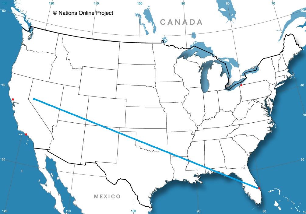
How far are you willing to travel for a holiday? It’s going to take 5 days to make this trip, covering 2914 miles. Sounds like a perfect Christmas gift to me, especially when a pace of 69mph can be sustained. The swift pace will allow 555 miles to be the goal on days 1-4, with a long conclusion to the trek.
DAY ONE (Sunday)
Reno, Nevada
The western US is getting battered by a holiday weather system that is bringing cold weather and snow mostly to the peaks of the Cascades and Sierras, but even to the lower terrain between, at least to a certain level. Seattle and Portland were in line to see some unusual snowfall for Christmas, and white capped peaks are definitely coming to Nevada and Utah. The snow should be done outside of the highest points of northern Nevada, but that won’t necessarily be the case in Utah, where heavy snow could, theoretically, even lead to some road closures. Expect a tougher slog through Utah, especially where the terrain gets a little more hilly east of Salt Lake City We will stop for the day, mercifully, in Wanship, in heart of the Wasatch.
DAY TWO (Monday) The pattern in the western US is just going to be active for the beginning of the week. The low will split in two over the next couple of days, sending the first round of snow and cold air to the Upper Midwest, while leaving quite a bit of moisture in the Pacific Northwest as well. The northern Rockies will be between these two branches of the feature, so while it won’t be stormy, it won’t be great either. Mountain snow with lighter flurries in the valleys will continue through Utah and western Wyoming, but at least the lee side of the Rockies, in Wyoming and western Nebraska will be a bit more favorable, with spots of sun, but mostly cloudy skies. The day will conclude in Big Spring, right at the northeast corner of Colorado, just on the Nebraska side.
DAY THREE (Tuesday) The continued rotation of the low pressure in the west will regenerate again on Tuesday. Expect a generally ok drive through the rest of Nebraska, and the 4 hours that will take, but a cold rain is possible as soon as we hit Nebraska City and the Iowa border. Even more robust precipitation is possible after we make the eastward jaunt at Kansas City, and a cold, steady rain is possible when we stop for the night in Sweet Springs, about an hour east of KC.
DAY FOUR (Wednesday) The rain we see on Tuesday will be the result of a rising warm front, but we won’t really ever be able to get south of the boundary, and our day will begin on a chilly note in Missouri. The lingering boundary will be diffuse and stretched across the mid-Mississippi Valley, an environment rife for redevelopment. Late in the day, a new feature will begin to arise in Mississippi and bring us some cold rain starting around Nashville. Heavier rain will be persistent in the higher terrain of eastern Tennessee throughout the day, so bring an umbrella as we get to our hotel in Manchester, about halfway between Nashville and Chattanooga.
DAY FIVE (Thursday) The front bringing that rain will weaken as it shifts east through the mountains, and at long last, we can expect to be out of any threat for heavy precipitation. Some light showers and overcast will persist from Manchester through the remainder of our time in Tennessee, as well as much of the state of Georgia. We should finally emerge into dry conditions around Tifton, and it will probably even be sunny by the time we alight upon Sebastian.
I spend every other Christmas in Florida, and it definitely feels right to me. So come with me and enjoy the holiday among palm trees and hopefully some sunshine.
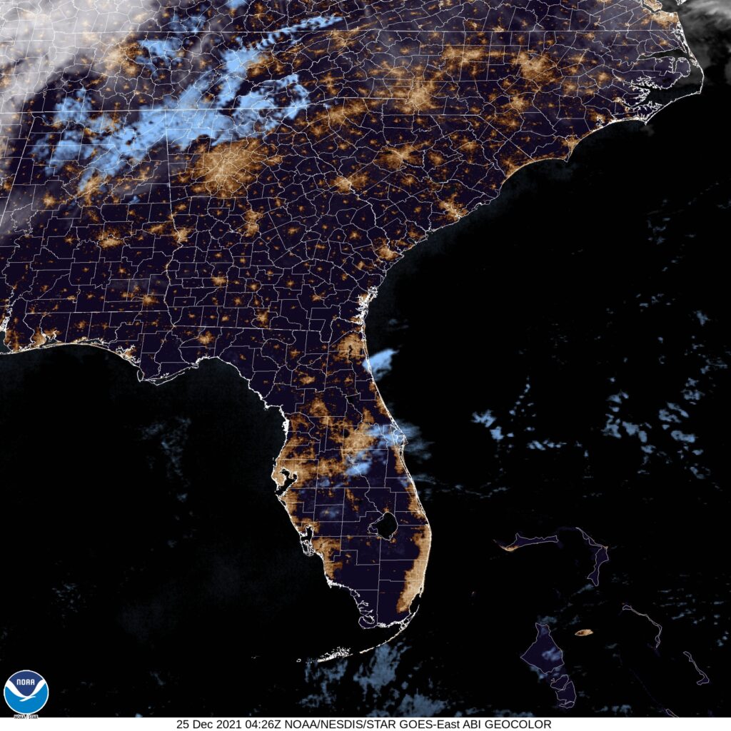
At 1035PM, ET, Sebastian was reporting clear skies and a temperature of 58 degrees. A cold front moved through town earlier in the week, and even dropped an isolated tornado in the Fort Myers, but has left the southeastern US embraced in a pleasant bubble of high pressure. Some stability in the southeastern US will be in order through Christmas and Boxing Day, with a very strong, very linear jet streak running through the Great Lakes is going to continue to tamp down any significant weather. Unseasonable warmth will be in order for Sebastian. Tomorrow – Sunny, High 79, Low 55 Sunday – Sunny, High 79, Low 54
TWC: Tomorrow – Sunny skies. High 81, Low 55 Sunday – Sunny skies. High 80, Low 55
AW: Tomorrow – Plenty of sunshine; beautiful weather for Christmas Day High 80, Low 58 Sunday – Sunny High 78, Low 56
NWS: Tomorrow – Sunny, High 78, Low 57 Sunday – Sunny, High 77, Low 55
WB: Tomorrow – Sunny, High 79, Low 57 Sunday – Sunny, High 76, Low 57
WN: Tomorrow – Mostly sunny, High 77, Low 60 Sunday – Mostly sunny, High 75, Low 58
FIO: Tomorrow – Clear throughout the day. High 77, Low 55 Sunday – Clear throughout the day. High 75, Low 56
With skies as clear as this, you can almost make out Santa and his reindeer. Merry Christmas all!
The same system that brought such devastating weather to the Ohio Valley was also responsible for putting a chill in the mid-Atlantic. When we forecast for Lynchburg almost two weeks ago, nobody anticipated the plummeting temperatures on the evening of December 12th. We all more or less suspected a non-standard day, but not THIS non-standard. It was 27 degrees by the time the 12th turned to the 13th, and forecasts busted across the board. The fast arriving front also prevented record highs on Saturday, which was against the grain for some outlets as well. Forecast.io ended up collecting the wind, mitigating their losses with a cooler forecast. Actuals: Saturday, December 12th: .28 inches of rain in thunderstorms, High 66, Low 49 Sunday, December 13th, High 50, Low 27
It’s hard to remember much about November most of the way through December, especially because December has been such a historic month. The upper level pattern was strong and undulating, reminiscent of an active spring, rather than the middle of December. One of the most devastating and perhaps longest track tornadoes came to the lower Ohio Valley, where there were deaths in Arkansas and Illinois, but particularly in Kentucky, where 76 lost their lives. The tornadoes did the most damage to Mayfield and Dawson Springs in Kentucky, but certainly, other communities are hurting.
That same storm was responsible for dumping up to 20 inches of snow on parts of Minnesota and Wisconsin. Then, a few days later, another strong system tracked into the same area, and serial derechos spread across the High Plains and Upper Midwest. In addition to winds that were approaching 100mph, there were tornadoes recorded in December for the first time in Minnesota and Wisconsin. Fortunately, the human impact was a lot less significant with this storm than the one that struck Mayfield and communities surrounding.
It’s been a very difficult month.
November was a more relaxed month for weather headlines, and it went particularly well for The Weather Channel, who easily won the month, and will be tough to beat for the year’s prize.
The holidays are upon us and travel is going to be much more common this year than it was last year. How will it be, going from one place to another tomorrow, especially along the 712 mile stretch between Lynchburg and Grand Rapids. We’re going to cover it all in one day, at a pace of 63.2mph. It is going to be a long drive, so make sure you hit the restroom before we hit the road.
Lynchburg, Virginia
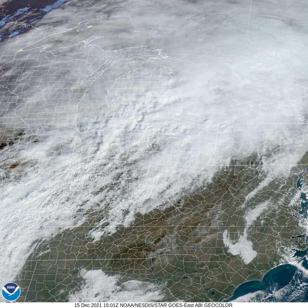
The next system is getting ready to develop in the Ohio Valley, and it’s sure nice to not have to describe it in apocalyptic terms. Still, for a road trip through the region, it’s still going to introduce challenges to our itinerary. The warm front associated with this system will have lifted north of Lynchburg and most of Virginia by the time we set forth on Saturday, but the warm southerly flow will potentially lead to a stray spot of drizzle, and the associated moisture may lead to some fog in the mountains of West Virginia. The reain will begin in earnest after we hit about Athens, Ohio, and will continue across the Buckeye State. It will be overcast when we reach Michigan, but the precipitation will be moving out of the state. Expect some wet flakes to mix in with the rain, maybe as early as Toledo, but the precipitation will wind down around Battle Creek. Given the wind dynamics, chill to the air and the presence of a Great Lake to the west, there could be a fewbands of lake effect snow in western Michigan, of which, one may linger in Grand Rapids for our arrival.
Grand Rapids, Michigan By Rachel Kramer – https://www.flickr.com/photos/rkramer62/3965913452/, CC BY 2.0, https://commons.wikimedia.org/w/index.php?curid=108742650
A large nasty area of low pressure is threatening to create another significant December severe weather outbreak, this time in Minnesota and Iowa. How well will the nasty weather hold together? Does Michigan need to brace itself
At 953AM, ET, Grand Rapids was reporting overcast skies and a temperature of 50 degrees. Low pressure in the Plains was already working to pump warm air into the Great Lakes, leading to near record highs at this early hour. Snow melt was putting a lot of extra moisture in the air and leading to extra fog and clouds across the region. Eventually, there may be some clearing later today, but not much, even with aggressive southerly flow. The rapidly developing, strong system in the Plains is also going to be very fast moving, with the associated cold front arriving in Michigan early tomorrow morning. Fortunately by that point, the dynamics of severe weather will be gone, and even the associated moisture will be drawn north to the center of low pressure. and little to no precipitation will accompany frontal passage. More typical December weather will follow on Thursday afternoon and into Friday, with clearer, colder but less breezy conditions. Tomorrow – Early drizzle and wind, then clearing and colder, High 57, Low 32 Friday – Mostly cloudy, High 36, Low 26
TWC: Tomorrow – Windy with a few clouds from time to time. (early rain) HIgh 60, Low 35 Friday, Partly cloudy skies. High 38, Low 28
AW: Tomorrow – Mostly cloudy and windy (early rain) High 59, Low 34 Friday – Sun and areas of high clouds in the morning; mostly cloudy in the afternoon High 40, Low 28
NWS: Tomorrow – Mostly sunny (Early rain) High 58, Low 36 Friday – A slight chance of rain and snow showers before 2pm, then a slight chance of rain showers between 2pm and 5pm, then a slight chance of rain and snow showers after 5pm. Partly sunny, High 40, Low 29
WB: Tomorrow – Windy, Mostly sunny, High 61, Low 34 Friday – Mostly sunny until midday, then partly sunny with a 20 percent chance of rain and snow showers, High 35, Low 30
WN: Tomorrow – Partly cloudy with light rain showers, High 59, Low 43 Friday – Partly cloudy, High 39, Low 29
FIO: Tomorrow – Dangerously windy until afternoon. High 60, Low 34 Friday – Partly cloudy throughout the day. High 39, Low 28
The map is very cloudy this morning, and may be for the entire day. Fortunately for Grand Rapids, it looks like they are going to duck the worst of the weather, and will instead jump right back to December.
The morning lows in Asheville last week were out of control. After a couple of clearer than expected evenings, the low temperature dropped well beyond expectations, especially on Saturday, where the morning chill was in the mid-30s. Rain never came to the North Carolina town, and Forecast.io, was the only dry forecast in the house, securing victory for the day. Actuals: Sunday, Dec 5th, High 55, Low 37 Monday, Dec 6th, High 63, Low 38
We will certainly reflect on the devastating tornado that afflicted parts of 4 states, most influentially the state of Kentucky in the next several days. We will also take the time to look at the following forecasts.
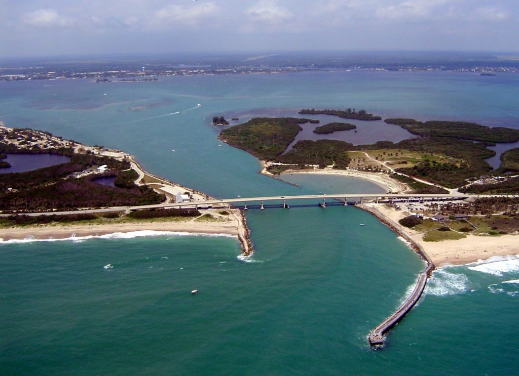
Sebastian, Florida Road Trip from Reno, Nevada to Sebastian
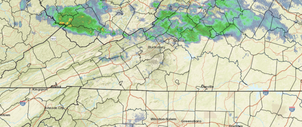
We are headed smack dab into the middle of Virginia for our forecast. There is snow on the ground in this part of the country, but what can be said about Virginia this weekend?
At 1054AM, ET, Lynchburg was reporting a temperature of 47 degrees with mostly cloudy skies. The overcast is ahead of a warm front associated with a vast area of low pressure in the Plains. Moisture will be more plentiful on the western side of the Appalachians, but some light drizzle is still possible this afternoon. When skies clear this afternoon, expect a significant warm up, which will only continue on Saturday. The cold front will arrive with vigor on Saturday evening. While strong and severe weather is anticipated in the mid-Mississippi Valley today and tonight, the teeth will be taken out of the storm. There could be some strong winds, but the continuing elongation of the trough and the disruption caused by the mountains will ensure that the storm won’t have the tornado or heavy rain threat seen today. The front will move through quickly, leading to a cool, dry day on Sunday. The upper trough is going to flatten through the Mid-Atlantic, and in conjunction with post-frontal downsloping, the temperature drop will be blunted, but the dry air will remain. Tomorrow – Showers and thunderstorms in the evening, High 71, Low 47 Sunday – Clearer and cooler, High 54, Low 39
TWC: Tomorrow – Cloudy skies with periods of rain later in the day. Thunder possible. High 70, Low 48 Sunday – A mainly sunny sky. High 53, Low 39
AW: Tomorrow – Mostly cloudy and becoming windier with the temperature near the record of 71 set in 2015; a shower and t-storm in the afternoon High 70, Low 49 Sunday – Mostly sunny and cooler High 53, Low 39
NWS: Tomorrow – A chance of showers before 4pm, then showers and possibly a thunderstorm between 4pm and 5pm, then showers after 5pm. Some of the storms could produce gusty winds. High 69, Low 48 Sunday – Sunny, High 52, Low 36
WB: Tomorrow – Cloudy. Slight chance of a thunderstorm in the afternoon. Some thunderstorms might cause gusty winds in the afternoon. High 66, Low 49 Sunday – Sunny, High 51, Low 39
WN: Tomorrow – Mostly cloudy with light showers and isolated storms, High 68, Low 39 Sunday – Sunny, High 52, Low 36
FIO: Tomorrow – Rain in the evening. High 69, Low 51 Sunday – Clear throughout the day. High 52, Low 32
Looks like that warm frontal rain has reached Lynchburg since this forecast began! The real weather story for the region will be tomorrow afternoon with a cold front, from a system that is causing big problems in the middle of the country right now.