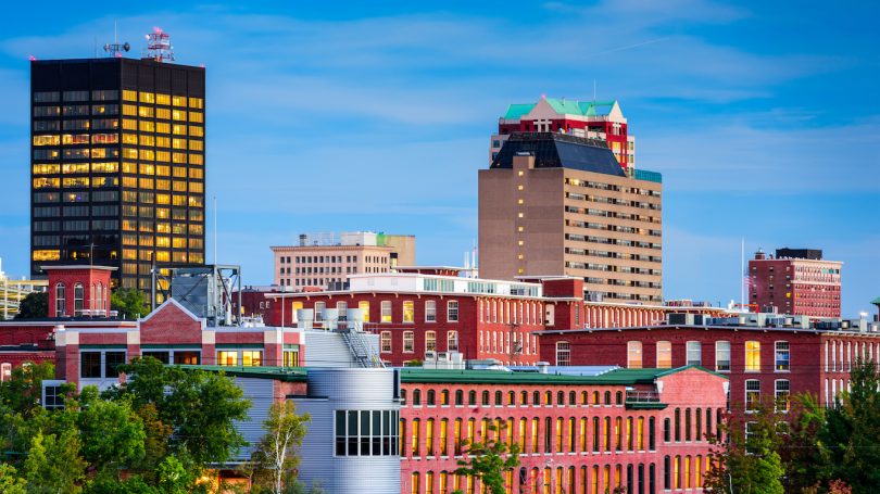
Bend, Oregon

There hasn’t been much news out of the western US this spring and early summer. That’s good news, because typically, that would mean fires. So let’s check in and see what is happening out there.

At 753PM, PT, Bend was reporting clear skies with a temperature of 70 degrees. There was a ridge at the upper levels driving weather for the Western US right now, and the clear skies should persist, especially inland in Bend through Memorial Day.
There is a trough over the Gulf of Alaska, however, and it is going to swing into the Pacific Northwest. This feature does look to introduce a bit of moisture into the region. While there will be some rain in eastern Oregon, it should be dry in the immediate lee of the Cascades
Tomorrow – Mostly sunny, High 81, Low 41
Tuesday – Mostly cloudy, High 71, Low 48

TWC: Tomorrow – Partly cloudy. High 80, Low 41
Tuesday – Partly cloudy skies in the morning will give way to cloudy skies during the afternoon. Slight chance of a rain shower HIgh 69, Low 49

AW: Tomorrow – Partly sunny and nice High 78, Low 41
Tuesday – Mostly cloudy High 70, Low 48

NWS: Tomorrow – Sunny (Late rain), High 78, Low 43
Tuesday – Mostly sunny, High 70, Low 47

WB: Tomorrow – Partly cloudy (Late rain), High 77, Low 44
Tuesday – Mostly cloudy with a 20 percent chance of rain showers, High 69, Low 51

WN: Tomorrow – Partly cloudy with isolated storms, High 78, Low 43
Tuesday – Partly cloudy with light rain showers, High 69, Low 47

CLI: Tomorrow – Partly cloudy, High 81, Low 41
Tuesday – Mostly cloudy, High 77, Low 46

There are a variety of rain forecasts, none of which are heavy, so that will certainly be the variable to watch. Right now, however, there isn’t a cloud across Bend.

Active evening ahead

There are already watches out, covering the entirety of Iowa, some of it in a “Particularly Dangerous Situation” designated tornado watch that butts into parts of Minnesota and Illinois. There are already strong storms appearing on the map, having initiated in eastern Nebraska, with the Omaha Metro seeing more tornado warnings earlier today. The storms will rage through Des Moines though the rush hour, and depart Cedar Rapids and the Twin Cities through about 7 or 8 PM. Cedar Rapids projects to get stronger storms, but Minneapolis and St. Paul will get a whole bunch of rain.

A concern I have is that the storms, already forming a bit of a wavy pattern in western Iowa, will transform into a derecho that continues through the night. If that’s the case, then an overnight squall in Chicago or Milwaukee would be possible. The SPC captured the concern with their enhanced risk extending through Lake Michigan. Be aware of the weather in the Upper Mississippi Valley tonight!

Cleveland, Ohio

Cleveland hosted my Minnesota Twins this weekend, and it didn’t go well for Minnesota. I hope it rains in Cleveland.

At 851PM, ET, Cleveland was reporting a temperature of 79 degrees with mostly cloudy skies. A weak surface trough running through southern Ontario was touching off some storms between Toledo and Fort Wayne, but this activity isn’t expected to continue on to Cleveland. There is a more organized complex of storms in the Plains states, but the upper level pattern is not conducive to sustaining this feature either. Expect some cloudy skies on the horizon throughout most of the day, but rainfall will never reach Cleveland on Monday.
An upper level trough moving through the northern Rockies is going to aid in the development and intensification of the next feature, rising out of the Colorado prairies. This feature is expected to be another severe weather maker for the Plains, and through Tuesday, will encourage a warm front to move northward through the Buckeye State. Some scattered showers and storms will be possible over Lake Erie in the afternoon, with some carry over into Cleveland as well.
Tomorrow – Partly cloudy, High 87, Low 64
Tuesday – Partly cloudy with patchy showers possible, High 87, Low 68

TWC: Tomorrow – Intervals of clouds and sunshine. Slight chance of a rain shower High 85, Low 65
Tuesday – Intervals of clouds and sunshine. A stray shower or thunderstorm is possible High 84, Low 71

AW: Tomorrow – Partly sunny and very warm High 84, Low 67
Tuesday – Very warm with times of clouds and sun high 84, Low 70

NWS: Tomorrow – A slight chance of showers and thunderstorms after 3pm. Mostly sunny, High 85, Low 66
Tuesday – A slight chance of showers between 2pm and 5pm, then a slight chance of showers and thunderstorms after 5pm. Mostly sunny, High 86, Low 69

WB: Tomorrow – Partly cloudy. A chance of showers and thunderstorms in the afternoon. High 84, Low 68
Tuesday – Partly cloudy in the morning, then clearing. High 84, Low 70

WN: Tomorrow – Partly cloudy, High 78, Low 67
Tuesday – Partly cloudy with light rain showers, High 81, Low 71

CLI: Tomorrow – Light rain showers, High 82, Low 68
Tuesday – Partly cloudy, High 82, Low 72

The radar is showing some of the activity northwest of town. The forecasts are showing some widely different opinions.

May starts hot

We forecast for Goldsboro, North Carolina at the beginning of the month, and as soon as the third, we were anticipating a day that reached nearly 90 degrees. It was 89 degrees on the third day of the month, but an upwelling of moisture on the 4th made things stickier, cloudier and a little bit cooler. There had been a forecast for some rain in Goldsboro, and while it has been stormy in the last couple of days in North Carolina, on the 4th, it was not. The Weather Channel had the first top forecast of May,
Actuals: Friday, May 2nd, High 89, Low 64
Saturday, May 3rd, High 84, Low 68

Grade: B-C

Severe weather is back!

There is another enhanced risk for severe weather today, this time ranging from the Texas Panhandle to south central Kansas. Surely, storm chasers are once again going to be out there, probably starting in Amarillo and getting their steak, then tracking east with the storms. For my money, the short term models seems to be favoring development in the late evening in Stillwater and Ponca City, in northern Oklahoma. Were I chaser, that’s where I would go. But I’m not! Good luck if you are.

Coming Soon…

I’m hoping that these coming days will see some regular action around the country, both with posts on the site, and mildly intriguing weather patterns.

Bend, Oregon

Road Trip from Bend to Myrtle Beach, South Carolina

Houston, Texas

Killeen, Texas

Albuquerque, New Mexico
Road Trip from Killeen to Albuquerque

Road Trip from Albuquerque to Anderson, Indiana

Fairbanks, Alaska

State College, Pennsylvania

I hope everyone has been enjoying the Northern Lights where they have been available. Now, we’re going to take a forecast trip to one of the homes of our forecast competitors, Accuweather.

At 853PM, ET, State College was reporting a temperature of 55 degrees with mostly cloudy skies. A shortwave moved through the region last night and through the morning, and scattered showers have now departed the area as the wave attempts to merge with a large feature off shore. This will give State College a bit of dry weather through tomorrow morning.
The next couple of features are coming from the Canadian Prairies, where a weak boundary is sliding through, while a stronger feature in the High Plains is emerging from the south. The cold front will drape north of the Pennsylvania border for most of the day on Monday, which will mean cloudy skies and chances for rain, but the feature rising from the southwest will bring more moisture and instability to the region. It is liable to be rainier with a chance of thunderstorms throughout Tuesday.
Tomorrow – Mostly cloudy with a spot of rain possible, High 74, Low 47
Tuesday – Scattered showers with embedded thunderstorms, High 68, Low 55

TWC: Tomorrow – A few clouds early, otherwise mostly sunny High 73, Low 50
Tuesday – Generally sunny. Slight chance of a rain shower. High 72, Low 46

AW: Tomorrow – Pleasant and warmer with times of clouds and sun High 75, Low 43
Tuesday – Cloudy and not as warm with a couple of showers High 68. Low 53

NWS: Tomorrow – Patchy fog before 10am. Otherwise, mostly sunny High 76, Low 42
Tuesday – A chance of showers, then showers and possibly a thunderstorm after 2pm. high 71, Low 54

WB: Tomorrow – Mostly sunny, High 74, Low 45
Tuesday – Mostly cloudy. A chance of showers in the morning, then showers in the afternoon, High 67, Low 55

WN: Tomorrow – Mostly sunny, High 74, Low 43
Tuesday – Mostly cloudy with light showers and chance of storms, High 71, Low 55

CLI: Tomorrow – Clear, High 75, Low 44
Tuesday – Rain Showers, High 68, Low 54

I’m the only one with rain potentially for Monday. It feels like rain should fall on Mondays, right? Here is the sattelite, showing the field of clouds, drifting away and clearing the way for new rain.

,

Organization harder to come by

After a few particularly miserable weeks, if some models are to be believed (and important people are believing them) we might actually be able to come up for air next week. There isn’t a well put together system to be found in the near future, and beyond what, say, the NAM has to offer, it kind of gets into silly territory anyways. The SPC just has marginal risks the next three days, and after that, not a thing. There will be some sultry air mass type of storms in the southern US, and certainly there could be a strong one in there somewhere, but not the widespread chaos of the last several weeks. Hooray!